Description:
Paris: C.N.R.S., 1959. Livre. Bon. En Feuilles. Grand In-folio. Paris, Centre national de la recherche scientifique (CNRS), Editions géographiques de France, sd [1959]. 50 x 32 cm, grand in-folio, 4 ff. + 80 cartes à doubles page réhaussées de couleurs légendées au recto, en feuilles sous portefeuille vert de l'éditeur. Nouvelle et meilleure édition de ce rare atlas, fruit de 30 années de recherches scientifiques. Déchirures au portefeuille, dont le premier plat est détaché, tampons de la bibliothèque d'un lycée sur la page de titre et au recto de chaque planche, sinon un bon exemplaire..
Atlas universel illustré à l'usage des institutions et des gens du monde, pour suivre les cours de géographie et d'histoire d'après Brué, Balbi, Maltebrun, Lapie, etc., etc. [Le Monde illustré. Atlas universel, 1841-1842 (en couverture) / Atlas géographique portatif (sur les cartes)] by Langlois, Hyacinthe [Louis-Hyacinthe Langlois] - Avril, Charles (ill.) - 1842
by Langlois, Hyacinthe [Louis-Hyacinthe Langlois] - Avril, Charles (ill.)
![Atlas universel illustré à l'usage des institutions et des gens du monde, pour suivre les cours de géographie et d'histoire d'après Brué, Balbi, Maltebrun, Lapie, etc., etc. [Le Monde illustré. Atlas universel, 1841-1842 (en couverture) / Atlas géographique portatif (sur les cartes)] by Langlois, Hyacinthe [Louis-Hyacinthe Langlois] - Avril, Charles (ill.) - 1842](https://d3525k1ryd2155.cloudfront.net/h/513/536/651536513.0.m.jpg)
Atlas universel illustré à l'usage des institutions et des gens du monde, pour suivre les cours de géographie et d'histoire d'après Brué, Balbi, Maltebrun, Lapie, etc., etc. [Le Monde illustré. Atlas universel, 1841-1842 (en couverture) / Atlas géographique portatif (sur les cartes)]
by Langlois, Hyacinthe [Louis-Hyacinthe Langlois] - Avril, Charles (ill.)
- Used
- Hardcover
Paris: H. Langlois, 1842. Atlas. Illus. by Charles Avril. Très bon. Cartonnage Editeur. Ed. originale. Paris, H. Langlois, 1842 (imp. de Simon). 21,5 x 15,5 cm (R), 1 f. bl. - 1 f. (titre et table) - 36 cartes à double page toutes montées sur onglets (chaque planche : 27 x 20,5 cm), cartonnage de l'éditeur de demi-percaline prune portant au premier plat une large pièce de titre sur papier entièrement illustrée en noir. Atlas rare publié par Louis-Hyacinthe Langlois et dessiné par Charles Avril. Toutes les cartes (sauf la première) sont avec rehauts de couleurs à la main et sont enrichies d'une vignette gravée dans la cartouche. Elles portent toutes les mentions "dessiné et gravé par Ch. Avril", "atlas de géographie portatif", "année 1841", "prix 10 centimes en couleur". Liste des cartes : 1. Cosmographie, 2. Mappemonde, 3. Europe, 4. Asie, 5. Afrique, 6. Amérique nord, 7. Amérique sud, 8. Océanie, 9. France, 10. Monde connu des anciens, 11. Iles britanniques, 12. Allemagne, 13. Espagne et Portugal, 14. Italie, 15. Turquie d'Europe et Grèce, 16. Russie d'Europe, 17. Belgique et Hollande, 18. Suède, Norwége [sic] et Danemark, 19. Suisse, 20. Prusse, 21. Autriche, 22. Asie centrale, 23. Indes, 24. Chine et Japon, 25. Russie d'Asie, 26. Afrique septentrionale, 27. Afrique orientale, 28. Afrique occidentale, 29. Afrique méridionale, 30. Etats-Unis, 31. Mexique, 32. Antilles, 33. Colombie, 34. Brésil, 35. Pérou et Bolivia, 36. Plata, Chili et Paraguay. Rousseurs au titre, bel exemplaire..
-
Bookseller
Des livres autour (Julien Mannoni)
 (FR)
(FR)
- Illustrator Charles Avril
- Format/Binding Hardcover
- Book Condition Used - Très bon
- Edition Ed. originale
- Binding Hardcover
- Publisher H. Langlois
- Place of Publication Paris
- Date Published 1842
- Keywords Géographie ; Livres du XIXeme ; Atlas ; Carte ; Cartes ; Carte ancienne ; Cartes anciennes ; Map ; Old maps ; Hyacinthe Langlois ; Cosmographie ; Mappemonde ; Europe ; Asie ; Afrique ; Amérique nord ; Amérique sud ; Océanie ; F

More Photos
Atlas de France (métropole)
by Comité national de géographie ; Margerie, Emmanuel de (préf.) ; Perret, Robert (dir.)
- Used
- Paperback
- Condition
- Used - Bon
- Binding
- Paperback
- Quantity Available
- 1
- Seller
-
Paris, France
- Item Price
-
$161.58
Show Details
Item Price
$161.58

More Photos
Philippi Cluverii Introductio in universam geographiam tam veterem quam novam. Tabulis geographicis XLVI ac notis olim ornata a Johanne Bunone, jam vero locupletata additamentis & annotationibus Joh. Frid. Hekelii & Joh. Reiskii. Cum privilegio ordinum Ho
by Clüver, Philippe [Philipp Cluverius / Cluvier] - Buno, Johann ; Reiske, Johann ; Heckel, Johann Friedrich
- Used
- Hardcover
- first
- Condition
- Used - Bon
- Edition
- First Thus
- Binding
- Hardcover
- Quantity Available
- 1
- Seller
-
Paris, France
- Item Price
-
$2,369.84
Show Details
Description:
Amsterdam: Jean Wolters, 1697. Livre. Bon. Plein Vélin. First Thus. Petit In-4. Amsterdam [Amstelaedami], Jean Wolters [Joannem Wolters], 1697. 24 x 18 cm (R), in-4, 1 f. bl. - titre frontispice entièrement gravé - 11 ff. n. ch. (dont titre, dédicace, adresse au lecteur, epistolae, table et privilège) - 565 pp. - 31 ff. n. ch. d'index - 2 ff. bl. - 2 planches, 3 tableaux et 41 (sur 43) cartes gravées hors texte, dont 40 sont dépliantes ou à double page, reliure hollandaise de l'époque en plein vélin doré, plats estampés à froid de motifs des Pays Bas espagnols dans un double encadrement de filets avec fleurons d'angle, dos estampé de filets et fleurons, titre manuscrit à l'époque, traces de lacets. (sig. *3, **4, ***4, A-Z4, Aa-Zz4, Aaa-Zzz4, Aaaa-Kkkk4) Belle édition de la fin du XVIIeme du célèbre atlas de Clüver, avec les commentaires de Buno,…
Read More Item Price
$2,369.84

More Photos
Plan of the Battle of Waterloo
by Edward Cotton
- Used
- good
- Hardcover
- Condition
- Used - Good
- Binding
- Hardcover
- Quantity Available
- 1
- Seller
-
Boonsboro, Maryland, United States
- Item Price
-
$318.50
Show Details
Description:
1854. Hardcover. Good. Lithograph map with original hand-colored highlights. Approximately 12 1/4 X 12 1/2" on 18 X 18" sheet with extensive printed text at all margins. Title and credit in the map at upper right, good condition with some aging at folds. <br> Original slim 12mo dark green leather-covered board folder with gilt lettering at upper cover. Some scuffing and wear at edges. Additional smaller lithograph map with hand-colored highlights mounted at inside of upper cover. Lengthy 1858 pencil notation of purchase ("on the Field of Waterloo") from Cotton's niece on verso of map.
Item Price
$318.50

More Photos
Die Feldfrüchte Indiens in ihrer geographischen Verbreitung. Zweiter Teil : Atlas von 23 Karten. (Abhandlungen des Hamburgischen kolonialinstituts Band. XIX. Reihe E. Angewandte naturwissenschaften, landwirtschaft und technologie, band 3)
by Engelbrecht, Thiess Hinrich
- Used
- Hardcover
- Condition
- Used - Assez bon
- Edition
- Ed. originale
- Binding
- Hardcover
- Quantity Available
- 1
- Seller
-
Paris, France
- Item Price
-
$99.10
Show Details
Description:
Hamburg: L. Friedrichsen & Co, 1914. Livre. Assez bon. Cartonnage Éditeur. Ed. originale. In-folio. Hamburg, L. Friedrichsen & Co, 1914. 39,5 x 41 cm, in-folio, 3 ff. n. ch. - 23 cartes en couleurs dont l'une dépliante, montées sur onglets, cartonnage imprimé de l'éditeur. Atlas seul. Peu commun. Cotes et tampons de bibliothèque grattés, manques de toile au dos..
Item Price
$99.10
More Photos
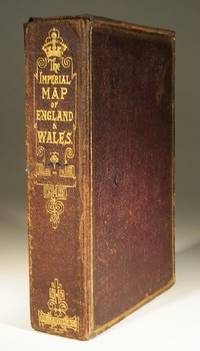
The Imperial Map of England and Wales
- Used
- very good
- Paperback
- Condition
- Used - Very Good
- Binding
- Paperback
- Quantity Available
- 1
- Seller
-
Farningham, Kent, United Kingdom
- Item Price
-
$529.54
Show Details
Description:
London & Edinburgh: A Fullarton & Co The Imperial Map of England and Wales according to the Ordnance Survey, with the latest additions shewing clearly every feature of the country, Railways and their Stations, Roads, Canals, Rivers, Gentlemens Seats etc. on the scale of 4 miles to an inch by John Bartholomew. 19 linen backed sheets numbered 1-15 plus 16 A,B and C. together with a folded index sheet. Flat sheet size, 550x750mm, folded size 275x185mm. All the maps in first class condition with no distress to folds. The folds to the paper index sheet have at some time been rather crudely stregthened. The whole enclosed in the original leathered covered box with an envelope style lid.
Item Price
$529.54
More Photos
Atlas de France (métropole)
by Comité national de géographie ; Margerie, Emmanuel de (préf.) ; Perret, Robert (dir.)
- Used
- Paperback
- Condition
- Used - Bon
- Binding
- Paperback
- Quantity Available
- 1
- Seller
-
Paris, France
- Item Price
-
$161.58
Show Details
Description:
Paris: C.N.R.S., 1959. Livre. Bon. En Feuilles. Grand In-folio. Paris, Centre national de la recherche scientifique (CNRS), Editions géographiques de France, sd [1959]. 50 x 32 cm, grand in-folio, 4 ff. + 80 cartes à doubles page réhaussées de couleurs légendées au recto, en feuilles sous portefeuille vert de l'éditeur. Nouvelle et meilleure édition de ce rare atlas, fruit de 30 années de recherches scientifiques. Déchirures au portefeuille, dont le premier plat est détaché, tampons de la bibliothèque d'un lycée sur la page de titre et au recto de chaque planche, sinon un bon exemplaire..
Item Price
$161.58
More Photos
Philippi Cluverii Introductio in universam geographiam tam veterem quam novam. Tabulis geographicis XLVI ac notis olim ornata a Johanne Bunone, jam vero locupletata additamentis & annotationibus Joh. Frid. Hekelii & Joh. Reiskii. Cum privilegio ordinum Ho
by Clüver, Philippe [Philipp Cluverius / Cluvier] - Buno, Johann ; Reiske, Johann ; Heckel, Johann Friedrich
- Used
- Hardcover
- first
- Condition
- Used - Bon
- Edition
- First Thus
- Binding
- Hardcover
- Quantity Available
- 1
- Seller
-
Paris, France
- Item Price
-
$2,369.84
Show Details
Description:
Amsterdam: Jean Wolters, 1697. Livre. Bon. Plein Vélin. First Thus. Petit In-4. Amsterdam [Amstelaedami], Jean Wolters [Joannem Wolters], 1697. 24 x 18 cm (R), in-4, 1 f. bl. - titre frontispice entièrement gravé - 11 ff. n. ch. (dont titre, dédicace, adresse au lecteur, epistolae, table et privilège) - 565 pp. - 31 ff. n. ch. d'index - 2 ff. bl. - 2 planches, 3 tableaux et 41 (sur 43) cartes gravées hors texte, dont 40 sont dépliantes ou à double page, reliure hollandaise de l'époque en plein vélin doré, plats estampés à froid de motifs des Pays Bas espagnols dans un double encadrement de filets avec fleurons d'angle, dos estampé de filets et fleurons, titre manuscrit à l'époque, traces de lacets. (sig. *3, **4, ***4, A-Z4, Aa-Zz4, Aaa-Zzz4, Aaaa-Kkkk4) Belle édition de la fin du XVIIeme du célèbre atlas de Clüver, avec les commentaires de Buno,…
Read More Item Price
$2,369.84
More Photos
Plan of the Battle of Waterloo
by Edward Cotton
- Used
- good
- Hardcover
- Condition
- Used - Good
- Binding
- Hardcover
- Quantity Available
- 1
- Seller
-
Boonsboro, Maryland, United States
- Item Price
-
$318.50
Show Details
Description:
1854. Hardcover. Good. Lithograph map with original hand-colored highlights. Approximately 12 1/4 X 12 1/2" on 18 X 18" sheet with extensive printed text at all margins. Title and credit in the map at upper right, good condition with some aging at folds. <br> Original slim 12mo dark green leather-covered board folder with gilt lettering at upper cover. Some scuffing and wear at edges. Additional smaller lithograph map with hand-colored highlights mounted at inside of upper cover. Lengthy 1858 pencil notation of purchase ("on the Field of Waterloo") from Cotton's niece on verso of map.
Item Price
$318.50
More Photos
Die Feldfrüchte Indiens in ihrer geographischen Verbreitung. Zweiter Teil : Atlas von 23 Karten. (Abhandlungen des Hamburgischen kolonialinstituts Band. XIX. Reihe E. Angewandte naturwissenschaften, landwirtschaft und technologie, band 3)
by Engelbrecht, Thiess Hinrich
- Used
- Hardcover
- Condition
- Used - Assez bon
- Edition
- Ed. originale
- Binding
- Hardcover
- Quantity Available
- 1
- Seller
-
Paris, France
- Item Price
-
$99.10
Show Details
Description:
Hamburg: L. Friedrichsen & Co, 1914. Livre. Assez bon. Cartonnage Éditeur. Ed. originale. In-folio. Hamburg, L. Friedrichsen & Co, 1914. 39,5 x 41 cm, in-folio, 3 ff. n. ch. - 23 cartes en couleurs dont l'une dépliante, montées sur onglets, cartonnage imprimé de l'éditeur. Atlas seul. Peu commun. Cotes et tampons de bibliothèque grattés, manques de toile au dos..
Item Price
$99.10
More Photos
The Imperial Map of England and Wales
- Used
- very good
- Paperback
- Condition
- Used - Very Good
- Binding
- Paperback
- Quantity Available
- 1
- Seller
-
Farningham, Kent, United Kingdom
- Item Price
-
$529.54
Show Details
Description:
London & Edinburgh: A Fullarton & Co The Imperial Map of England and Wales according to the Ordnance Survey, with the latest additions shewing clearly every feature of the country, Railways and their Stations, Roads, Canals, Rivers, Gentlemens Seats etc. on the scale of 4 miles to an inch by John Bartholomew. 19 linen backed sheets numbered 1-15 plus 16 A,B and C. together with a folded index sheet. Flat sheet size, 550x750mm, folded size 275x185mm. All the maps in first class condition with no distress to folds. The folds to the paper index sheet have at some time been rather crudely stregthened. The whole enclosed in the original leathered covered box with an envelope style lid.
Item Price
$529.54

More Photos
The Sky and the Forest
by Forester, C.S
- Used
- very good
- Hardcover
- first
- Condition
- Used - Very Good
- Jacket Condition
- Very Good
- Edition
- First Edition
- Binding
- Hardcover
- Quantity Available
- 1
- Seller
-
Salem, Oregon, United States
- Item Price
-
$40.00$24.00Save $16.00!
Show Details
Description:
C.S. Forester: The Sky and the Forest. Little, Brown and Company, Boston. Stated First Edition First Printing Thus August, 1948. Cover price $2.75. Used. VG BOOK/VG UNCLIPPED DUST JACKET. A story of a central Africa. By C.S. Forester, author of the Admiral Hornblower series.
Item Price
$40.00$24.00
Save $16.00
!
![Alaska and Klondike Region; [With inset of Klondike Region on the Upper Yukon detail] [From an...](https://d3525k1ryd2155.cloudfront.net/h/062/537/1339537062.0.m.jpg)
Alaska and Klondike Region; [With inset of Klondike Region on the Upper Yukon detail] [From an atlas, "Gazetteer of Alaska and Yukon Region " pp. 105 and 106]
by Miller, J. Martin
- Used
- very good
- Condition
- Used - Very Good
- Edition
- Unknown
- Quantity Available
- 1
- Seller
-
Sebastopol, California, United States
- Item Price
-
$39.00
Show Details
Description:
Chicago: J. Martin Miller, 1899. Unknown. Map. Very Good. [Map copyright 1899, printing date of Atlas later] [19.875x15.125in]; Colored map of Alaska with steamer routes from Portland and Seattle, insets of the Klondike Region on the Upper Yukon and Western portion of Aleutian Islands; On verso index of places and names with two large black and white images; Age toning to all edges, water stain marks on bottom, slight printing offset of colors, small chips and closed tears to lower edge;.
Item Price
$39.00

Zemepis Sveta - Monsunova Asie
by De La Blache, P. Vidal; Gallois, L
- Used
- Hardcover
- Condition
- Used - Very Good Condition
- Jacket Condition
- No Dust Jacket
- Binding
- Hardcover
- Quantity Available
- 1
- Seller
-
Oak Point, Texas, United States
- Item Price
-
$60.00
Show Details
Description:
Aventinum, Prague, Czechoslovakia, 1930. Hardcover. Very Good Condition/No Dust Jacket. Text entirely in Czech. Geography book on Asia with numerous photographs and maps. 1931 edition also available. Size: 4mo - over 9 3/4" - 12" tall. 400 pp. Pages are yellowed, but are tight and clean. Moderate shelfwear along the spine. Corners are lightly bumped. Quantity Available: 1. Shipped Weight: 3-5 pounds. Category: Travel & Places; Non-English Language::Czech; Pictures of this item not already displayed here available upon request. Inventory No: 001227. . Additional shipping charges may apply.
Item Price
$60.00

Zemepis Sveta - Monsunova Asie
by De La Blache, P. Vidal; Gallois, L
- Used
- Hardcover
- Condition
- Used - Very Good Condition
- Jacket Condition
- No Dust Jacket
- Binding
- Hardcover
- Quantity Available
- 1
- Seller
-
Oak Point, Texas, United States
- Item Price
-
$60.00
Show Details
Description:
Aventinum, Prague, Czechoslovakia, 1931. Hardcover. Very Good Condition/No Dust Jacket. Text entirely in Czech. Geography book on Asia with numerous photographs and maps. 1930 edition also available. Size: 4mo - over 9 3/4" - 12" tall. 400 pp. Pages are yellowed, but are tight and clean. Moderate shelfwear along the spine. Corners are lightly bumped. Quantity Available: 1. Shipped Weight: 3-5 pounds. Category: Travel & Places; Non-English Language::Czech; Pictures of this item not already displayed here available upon request. Inventory No: 001228. . Additional shipping charges may apply.
Item Price
$60.00

Asia from the Best Authorities, Russell, ca.1800
by Russell
- Used
- Condition
- Used
- Quantity Available
- 1
- Seller
-
Plymouth, Devon, United Kingdom
- Item Price
-
$25.22
Show Details
Description:
Russell, J. : Asia from the Best Authorities. Nd but ca.1800. From "A New Geographical, Historical and Commercial Grammar and Present State of Several Kingdoms of the World". Copper engraving. Size approx 200 x 230mm. Two neat folds. Some age colouring to edges, otherwise clean and bright. Includes Arabia, India, Borneo, Japan, China and eastern Russia.
Item Price
$25.22

North America from the Best Authorities, Russell, ca.1800
by Russell
- Used
- Condition
- Used
- Quantity Available
- 1
- Seller
-
Plymouth, Devon, United Kingdom
- Item Price
-
$25.22
Show Details
Description:
Russell, J. : A General Map of North America from the Best Authorities. Nd but ca.1800. From "A New Geographical, Historical and Commercial Grammar and Present State of Several Kingdoms of the World." Copper engraving. Size approx 200 x 230mm. Two neat folds. Some age colouring to edges, otherwise very clean and bright.
Item Price
$25.22
![MAP OF UTAH [Territory]](https://d3525k1ryd2155.cloudfront.net/h/836/461/1485461836.0.m.jpg)
More Photos
MAP OF UTAH [Territory]
- Used
- Condition
- Used - Very Good-
- Edition
- Original
- Quantity Available
- 1
- Seller
-
Williamsburg, Virginia, United States
- Item Price
-
$65.00
Show Details
Description:
New York, Richmond, Chicago, & Toledo: H. H. Hardesty, 1885. Original color lithographed map printed by Rand, McNally & Company, Engravers and published in HARDESTY'S HISTORICAL AND GEOGRAPHICAL ENCYCLOPEDIA: SPECIAL VIRGINIA EDITION. 19 3/8 inches by 13 1/4 inches on a 21" X 14 1/2" sheet. The map depicts the Territory of Utah in its final form--large areas had been removed and ceded to Nevada, Colorado, Wyoming, and Nebraska since Utah became a U. S. Territory in 1850. The issue of polygamy prevented statehood until it was finally granted in 1896. This map features railroads and topography and uses color to set off counties from each other. Unlike most atlas maps of the period, this map identifies most small towns. The map is guaranteed to be moe than 135 years old. The map is in about very good condition: generally clean and bright, with slight toning of paper and one faint water stain near the center-left edge of the map.. Original. Single Sheet. Very Good-. Elephant…
Read More Item Price
$65.00

Last Tales
by Dinesen, Isak
- Used
- very good
- Hardcover
- first
- Condition
- Used - Very Good
- Jacket Condition
- Good+
- Edition
- First Edition
- Binding
- Hardcover
- Quantity Available
- 1
- Seller
-
Salem, Oregon, United States
- Item Price
-
$120.00$72.00Save $48.00!
Show Details
Description:
Dinesen, Isak: Last Tales, A Collection of Twelve New Tales of Compelling Beauty 1957, Random House. First Edition. Stated First Printing Thus. Used. Very Good/Good+ original red dust jacket, price-clipped. Jacket states 11/57 on front flap. 5 3/4 X
Item Price
$120.00$72.00
Save $48.00
!

Philips Special Map of the Nile, The Advance on Khartum and the Environs of Omdurman. Cc1900
by George Philips and Son,
- Used
- Condition
- Used
- Quantity Available
- 1
- Seller
-
Plymouth, Devon, United Kingdom
- Item Price
-
$32.78
Show Details
Description:
Philips Special map of the Nile illustrating the Advance on Khartum [Khartoum] with an enlargement of the environs of Omdurman [Omdur]. George Philips and Son, London and Liverpool Ca 1900. 580mm x 900mm folded map. Front title wrapper has come loose, not affecting map area. Three maps are displayed within the sheet. Map1. Map of the Nile Valley 520mm x 300mm showing the approaches of Khartum. Scale 1inch to 100 Geographical miles. Coloured indicating Possessions and Protectorates of European Powers. Map 2. Special map of the Nile from Dongola to Khartum. Scale 16 miles to the inch. Coloured. In set in this map is Map3. Environs of Omdurman, Scale 5 statute miles to the inch. Some small breaks at some folds, not affecting imagery or use of map. Title label is damaged, the map is clean and bright, probably unused. A very interesting record.
Item Price
$32.78

The Adventure of Wrangel Island
by Vilhjalmur Stefansson
- Used
- good
- Hardcover
- first
- Condition
- Used - Good
- Jacket Condition
- No DJ Included
- Edition
- First Edition
- Binding
- Hardcover
- Quantity Available
- 1
- Seller
-
Salem, Oregon, United States
- Item Price
-
$124.89$74.93Save $49.96!
Show Details
Description:
The Adventure of Wrangel Island, Alaska (1925 Macmillan 1st Edition) HISTORY OF ALASKA. EXLIB. Good Condition/ No DJ included. Fold-out map affixed to binding at the back of the book has never been opened. The story of the (unsuccessful) attempted colonization of Wrangel Island Alaska. 413 pages plus appendix, Index. Titling is still bright. A clean, solid copy. Scarce.
Item Price
$124.89$74.93
Save $49.96
!