Description:
N. Israel. Near Fine with no dust jacket. 1968. Hardcover. Original oversized gilt-titled cloth. Firm binding. Several folding maps. Reprint of tne 1937 edition. ; quarto; xii, 543 pages .
THE CARTOGRAPHY OF THE NORTHWEST COAST OF AMERICA TO THE YEAR 1800. by Wagner, Henry R - 1937
by Wagner, Henry R
Similar copies are shown below.
Similar copies are shown to the right.

THE CARTOGRAPHY OF THE NORTHWEST COAST OF AMERICA TO THE YEAR 1800.
by Wagner, Henry R
- Used
- Hardcover
- first
Berkeley, 1937. First edition. 2 vols. Illus., 13 maps. Original 4to cloth in a box with original printed wrappers on each volume. An important piece of cartographical research. Tourville 4723. Inscribed pres. copy from Wagner on front flyleaf of volume one.
-
Bookseller
Michael Ginsberg Books
 (US)
(US)
- Book Condition Used
- Quantity Available 1
- Edition First edition
- Binding Hardcover
- Place of Publication Berkeley
- Date Published 1937
- Keywords PACIFIC NORTHWEST; REFERENCE; WESTERN AMERICANA
We have 9 copies available starting at $74.99.
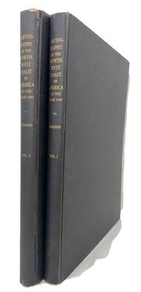
Cartography of the Northwest Coast of America to the Year 1800: Volume 1
by Wagner, Henry R
- Used
- Hardcover
- Condition
- Used - Near Fine with no dust jacket
- Binding
- Hardcover
- Quantity Available
- 1
- Seller
-
Northridge, California, United States
- Item Price
-
$74.99
Show Details
Item Price
$74.99
Cartography of the Northwest Coast of America to the Year 1800: Volume One
by WAGNER, HENRY R
- Used
- Hardcover
- Condition
- Used
- Binding
- Hardcover
- Quantity Available
- 1
- Seller
-
DUNEDIN, New Zealand
- Item Price
-
$72.41
Show Details
Description:
N. Israel 1968. Reprint, quarto, blue cloth boards with gilt lettering to spine & front board, xii + 543pp + folding maps, illus, VG (ligth rubbing & light soiling to boards, ligth foxing to page edges)
Item Price
$72.41
THE CARTOGRAPHY OF THE NORTHWEST COAST OF AMERICA TO THE YEAR 1800.
by Wagner, Henry R
- Used
- Hardcover
- Condition
- Used
- Edition
- Reprint of the 1937 edition.
- Binding
- Hardcover
- Quantity Available
- 1
- Seller
-
Stockton, California, United States
- Item Price
-
$95.00
Show Details
Description:
Pages 543 pp.4to. Clothbound. Reprint of the 1937 edition. Illustrated w/ folding maps. Minor bit of scuffing to covers, else in very good condition.
Item Price
$95.00

CARTOGRAPHY OF THE NORTHWEST COAST OF AMERICA TO THE YEAR 1800: Volume one.
by Wagner, Henry R
- Used
- Hardcover
- Condition
- Used - Near fine.
- Edition
- Reprint
- Binding
- Hardcover
- Quantity Available
- 1
- Seller
-
Santa Barbara, California, United States
- Item Price
-
$150.00
Show Details
Description:
Amsterdam: N. ISRAEL, 1968. Reprint. Hardcover. Near fine.. Reprint. Hardcover. 11 1/4'' X 9 1/2''. `543pp. With Bibliography. Brown cloth.
Item Price
$150.00
Stock Photo: Cover May Be Different
The Cartography of the Northwest Coast of America to the Year 1800 [2 vols. in 1, complete; new, in publisher's shrinkwrap)
by Wagner, Henry R
- New
- Hardcover
- first
- Condition
- New
- Jacket Condition
- in publisher's shrinkwrap
- Edition
- First Martino printing
- Binding
- Hardcover
- ISBN 10 / ISBN 13
- 9781578981649 / 1578981646
- Quantity Available
- 1
- Seller
-
Henderson, Nevada, United States
- Item Price
-
$174.40
Show Details
Description:
Mansfield Centre, Connecticut: Martino Publishing, 1999. 2 volumes bound as 1, complete. BRAND NEW HARDCOVER in perfect condition. STILL SEALED in the publisher's clear plastic SHRINKWRAP. NO rubbing. NO fading. Bright, clean, square and tight. Sharp corners. NOT a library discard. NO owner's name or bookplate. NOT a remainder. Fresh and crisp -- obviously never read. No date (but 1999, First Martino printing "Limited Edition Facsimile"). Reprint of the 1937 two volume set. 2 vols. in 1: xii, pp. 1-270; + (iv), pp. 271-543 + 13 maps not included in the pagination. Well illustrated with 41 map reproductions, including 13 that fold-out. Bound in the original pale yellow cloth, stamped in bright gold over a handsome dark green spine panel. "[A]lthough emphasis is on the Northwest Coast of America, this is a useful reference work for the student of the cartographic history of America. It contains an extensive index, bibliography, and list of place names, as well as a…
Read More Item Price
$174.40

The Cartography of the Northwest Coast of America to the Year 1800 (2 volumes)
by Wagner, Henry R
- Used
- first
- Condition
- Used
- Edition
- First edition
- Quantity Available
- 1
- Seller
-
GIG HARBOR, Washington, United States
- Item Price
-
$275.00
Show Details
Description:
Berkeley: University of California Press, 1937. First edition. 2 vols, 4tos, 270, 271-543pp. 40 maps, 12 folding. Publisher's black cloth, stamped in gilt on spine. Lacking jackets and slipcase, else very good with bumped corners and some edge wear. Few marginal annotations. Howes W7. Streeter VII 4403. Tweney 81. .
Item Price
$275.00
Cartography of the Northwest Coast of America to the Year 1800
by Wagner, Henry R
- Used
- Hardcover
- Condition
- Used - Very Good- in Good dust jacket
- Edition
- Extract
- Binding
- Hardcover
- Quantity Available
- 1
- Seller
-
Decatur, Illinois, United States
- Item Price
-
$450.00
Show Details
Description:
Berkeley CA: University Of California. Very Good- in Good dust jacket. 1937. Extract. Hardcover. 2 Volumes. 543 pp. An extensive cataloguing of the maps with a description of each and explanation of the important advances. Both volumes have minor water damage to the lower page corners -- light staining is confine to the margins extending about 3" up the edge and about 3" along the lower edge -- just a trace of curling. Minor wear to the extremes of the binding. Jackets show considerable wear and tears -- complete but for a few minor chips. Jackets are in Brodart jacket protectors. All dust jackets are in Mylar acid-free protectors.; Folio .
Item Price
$450.00
Cartography of the Northwest Coast of America to the Year 1800
by WAGNER, Henry R
- Used
- Condition
- Used
- Quantity Available
- 1
- Seller
-
Bryn Mawr,, Pennsylvania, United States
- Item Price
-
$450.00
Show Details
Description:
1937. WAGNER, Henry R. The Cartography of the Northwest Coast of America to the Year 1800. 2 vols. Lg. 4tos, in slip case. Berkeley, 1937. 1st ed. Illus. with 40 reproductions of maps(12 of which are folding). Fine set in d/js in publisher's box. Howes W-7. An excellent and extensive account of the evolution of cartography of the Northwest Coast of America.
Item Price
$450.00
More Photos
The Cartography of the Northwest Coast of America to the Year 1800
by Wagner, Henry R
- Used
- very good
- first
- Condition
- Used - Very Good
- Edition
- First Edition, 1st Printing
- Quantity Available
- 1
- Seller
-
Sebastopol, California, United States
- Item Price
-
$448.00
Show Details
Description:
Berkeley, CA: University of California Press, 1937. First Edition, 1st Printing. Very Good. Limited to 750 copies in Two Volumes [12.5x9.25in] Vol 1- xi, [1] map of The Basin of the Northeast Pacific, 270 pp., 40 maps with some folding, 11 charts, 3 tables, index; Vol 2- 271-543 pp., listings of 34 pre-discovery maps and 862 post-discovery maps, index, current and obsolete place names, bibliography; Black cloth covers with gilt titles on spine, all edges trimmed; Minor shelf wear to lower edges and corners, some fraying to top and bottom of spine, age-toning to end papers and edges, small dents to foredge of Vol 1, prior owner handwritten gift letter tipped in to map fold facing p. 97, without dust-jackets or slipcase. [Howes W7, Axe 86]. Henry R. Wagner (1862-1957) was a book collector, cartographer, historian, author and bibliographer. He was a Yale law school graduate and worked for mining interests in North and South America, New York and London. He was a major book collector in later shifted…
Read More Item Price
$448.00