Description:
Washington, D.C.: War Department, Office of the Chief of Engineers [Lithographed by Julius Bien, New York], 1869. First Edition. Prepared under the direction of Bvt. Brig. Gen. N. Michler, Major of Engineers, and Bvt. Lieut. Col. P.S. Michie, Capt. of Engineers. 16 maps on 17 sheets. All but one double-page. Folio (23-5/8 x 18-1/2 inches). Unbound sheets. Light stains at top edges of several maps, title with tape repair. First Edition. Prepared under the direction of Bvt. Brig. Gen. N. Michler, Major of Engineers, and Bvt. Lieut. Col. P.S. Michie, Capt. of Engineers. 16 maps on 17 sheets. All but one double-page. Folio (23-5/8 x 18-1/2 inches). The topographic maps comprise: 1A. Gettsburg to Appomattox Court House (northern) 1B Gettysburg to Appomattox Court House (southern) 2. Fredericksburg 3. Chancellorville, 4. The Wilderness 5. Spottsylvania 6. North Anna (single page) 7. Totopotomoy 8. Cold Harbor 9.. Richmond, 10. Bermuda Hundred 11. Petersburg and Five Forks 12. Jetersville and Sailor's…
Read More Military Maps Illustrating the Operations of the Armies Of The Potomac & James May 4th 1864 to April 9th 1865. by Civil War - United States War Department
by Civil War - United States War Department
Similar copies are shown below.
Similar copies are shown to the right.

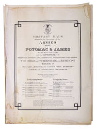
Military Maps Illustrating the Operations of the Armies Of The Potomac & James May 4th 1864 to April 9th 1865.
by Civil War - United States War Department
- Used
- first
Washington, D.C.: War Department, Office of the Chief of Engineers [New York: Julius Bien, 1869]. Folio (23 5/8 x 18 4/8 inches). Lithographed title and 17 lithographed maps, all but one double-page (edges a bit frayed). Contemporary half calf, morocco title label on front cover (worn, hinges weak). Provenance: with the ownership inscription of William Alfred Buckingham (1804-1875), governor of Connecticut and U.S. senator First edition, rare and important Michler-Weyss survey maps that were begun by War Department engineers of the Armies of the Potomac and James during the last year of the American Civil War. From the distinguished library of William A. Butler, who distinguished himself during the American Civil War: "After the Lower South seceded during the early winter of 1860-1861, Buckingham proclaimed a state of emergency in Connecticut. At the same time he ordered his state's quartermaster general to begin purchasing equipment for 5,000 men, subject to approval of the legislature. Hampered by constitutional provisions that gave the legislature sole power over the militia and its pay, rations, and equipment, Buckingham could do little to put the militia in any state of immediate readiness. When the war began with the attack on Fort Sumter, Connecticut's arsenals were virtually empty, and what equipment they contained was obsolete. On his account, Buckingham borrowed funds for the procurement of military supplies. He directed the recruitment, equipment, and organization of three ninety-day regiments to meet Lincoln's call for 75,000 men. Less than a month after Fort Sumter, the First Connecticut Regiment, fully equipped, was en route to Washington. Thereafter, the state enlisted a volunteer force equivalent to more than 48,000 three-year enlistees out of a total population of less than half a million. Primarily concerned with raising and transporting troops, Buckingham's staff, acting under revised militia laws, provided uniforms, muskets, and other related supplies. The federal government would reimburse at a later date a part of the state's outlays. Both the Norwich Bulletin and the New York Times obituaries (6 Feb. 1875) judged Buckingham's wartime administration to be one of the best in the Union" (John Niven for ANDB). Michler had served as head of the topographical department of the Army of the Potomac and was directly involved with the production of many of the wartime campaign and battlefield maps used in the postwar surveys. Under his direction a broader survey was initiated in 1866 to map the major battlefields of the eastern theater. Maj. John E. Weyss headed the fieldwork in Virginia for this endeavor, which was concluded in December 1867. Many of these maps were later rescaled for inclusion in the Atlas to Accompany the Official Records of the Union and Confederate Armies (published in folios 1891-1895). Phillips Atlases 3688 [listing 15 maps only]. .
-
Bookseller
Arader Galleries
 (US)
(US)
- Book Condition Used
- Publisher Washington, D.C.: War Department, Office of the Chief of Engineers [New York: Julius Bien, 1869].
We have 1 copies available starting at $2,500.00.
More Photos
Military Maps Illustrating the Operations of the Armies of the Potomac & James, May 4th, 1864, to April 9th, 1865, Including Battlefields of the Wilderness, Spottsylvania, North Anna, Totopotomoy, Cold Harbor, the Siege of Petersburg and Richmond, Battlefield of Five Forks, Jetersville & Sailor's Creek, Highbridge, Farmville & Appomattox Court-House
by (Civil War) United States, War Department
- Used
- first
- Condition
- Used - Unbound sheets. Light stains at top edges of several maps, title with tape repair
- Edition
- First Edition
- Quantity Available
- 1
- Seller
-
New York, New York, United States
- Item Price
-
$2,500.00
Show Details
Item Price
$2,500.00