Description:
Paris: I'Imprimerie de Bossange, 1808. Very good overall. Eleven fine copper engraved plates from a French mining journal, extracted and bound together. Vol. 23, Plates 1 - 5 & Vol. 24, Plates 7 - 11, from 'Journal Des Mines, ou Recueil De Memoires Sur L'Exploitation Des Mines..' The plates, some folding, include: 6 plates of diagrams of crystalline structures including pyroxene, arragonite, apophyllite, "fer arsenical" and bismuth; geological formations in the valley of Clermont; blacksmith machinery; tools of the metallurgist; and diagram showing refraction of light.
Search Results: MAPS from Antipodean Books, Maps & Prints
You searched for:
- Subject: MAPS from Antipodean Books, Maps & Prints
Results 1 - 20 of 919

11 Engravings: Crystals, mining machinery & geological formations. French Journal des Mines
- Used
- Condition
- Used - Very good overall
- Quantity Available
- 1
- Seller
-
Garrison, New York, United States
- Item Price
-
$45.00$8.00 shipping to USA
Show Details
Item Price
$45.00
$8.00
shipping to USA

11 Section, Putnam and Westchester County with Orange and Rockland across the River
by Beers, F.W.
- Used
- Condition
- Used - Very good condition
- Quantity Available
- 1
- Seller
-
Garrison, New York, United States
- Item Price
-
$350.00$8.00 shipping to USA
Show Details
Description:
New York: Watson & Company, 1891. Very good condition. Large scale map of the area, with land owners and homesteads marked with owner names. Includes a note in the Hudson "southern gate of Highlands"; Peekskill from the Sisters of St. Francis to north of the Highlands Chemical Works (Manitou); Anthony's Nose and surrounding elevations called Manitou Mountains; includes the Hudson Suspension Bridge, New England Railway Company line running from Cortlandtville through the now Bear Mt. Bridge; Camp Smith shown very tiny and noted as "State Camp N.G.S.N.Y"; Bear Mountain named Bear Hill with the lake named Highland Lake; Doodletown to the south; Iona Island with hotel and station (L. H. Mace & Co. named). Original printed color. From the Hudson River Atlas. 29 x 19"
Item Price
$350.00
$8.00
shipping to USA

17 Engravings: Diagrams of crystals & mining machinery. French Journal des Mines
- Used
- Condition
- Used - Very good overall
- Quantity Available
- 1
- Seller
-
Garrison, New York, United States
- Item Price
-
$45.00$8.00 shipping to USA
Show Details
Description:
Paris: I'Imprimerie de Bossange, 1800. Very good overall. Seventeen fine copper engraved plates from a French mining journal, extracted and bound together. Vol. 13, Plate 1 - 11 & Vol. 14, Plates 12 - 17, from 'Journal Des Mines, ou Recueil De Memoires Sur L'Exploitation Des Mines..' The plates, some folding, include: 4 plates of diagrams of crystalline structures including "sahlite", "Tungstate de chaux", and "Formes du Corindon"; diagrams showing apparatus for flame testing; Hydraulic works at Montgolfier; steam machines for extracting minerals from the base of wells; machinery for sorting and processing minerals; machines for making mining pylons; new design for crane; anthracite formations; and design for subterranean graphometer.
Item Price
$45.00
$8.00
shipping to USA

3 Engravings: Crystals and mining machinery. French Journal des Mines
- Used
- Condition
- Used - Very good overall
- Quantity Available
- 1
- Seller
-
Garrison, New York, United States
- Item Price
-
$30.00$8.00 shipping to USA
Show Details
Description:
Paris: I'Imprimerie de Bossange, 1810. Very good overall. Three fine copper engraved plates from a French mining journal, extracted and bound together. Vol. 28, Plates 1 - 3 from 'Journal Des Mines, ou Recueil De Memoires Sur L'Exploitation Des Mines..' The plates, some folding, include: the theory of crystallization; pistons in pumps; and equipment for measuring the electrical capacity of minerals.
Item Price
$30.00
$8.00
shipping to USA

6 Engravings: Crystals, mining machinery & fire ladder. French Journal des Mines
- Used
- Condition
- Used - Very good overall
- Quantity Available
- 1
- Seller
-
Garrison, New York, United States
- Item Price
-
$45.00$8.00 shipping to USA
Show Details
Description:
Paris: I'Imprimerie de Bossange, 1811. Very good overall. Six fine copper engraved plates from a French mining journal, extracted and bound together. Vol. 29, Plates 1 & 2 & Vol. 30, Plates 3 - 6, from 'Journal Des Mines, ou Recueil De Memoires Sur L'Exploitation Des Mines..' The plates, some folding, include: crystal structure of "arsenic sulfure", "fer suflure blanc" and cymophane; hydraulic bellows; mines at Vedrin; and fire ladders for use in small cities by Mr. Regnier.
Item Price
$45.00
$8.00
shipping to USA

7 Engravings: Crystals, mining machinery & geological formations. French Journal des Mines
- Used
- Condition
- Used - Very good overall
- Quantity Available
- 1
- Seller
-
Garrison, New York, United States
- Item Price
-
$45.00$8.00 shipping to USA
Show Details
Description:
Paris: I'Imprimerie de Bossange, 1809. Very good overall. Seven fine copper engraved plates from a French mining journal, extracted and bound together. Vol. 25, Plates 1 - 5 & Vol. 26, Plates 6 & 7, from 'Journal Des Mines, ou Recueil De Memoires Sur L'Exploitation Des Mines..' The plates, some folding, include: 2 plates of diagrams of crystalline structures including arragonite; 2 double plates with diagrams of cylindrical bellows; gypsum strata at the Basse de Montmartre; various forms of rock and earth formations; and new pulley machine (machine de tirage). Faint scattered fox spotting to later plates.
Item Price
$45.00
$8.00
shipping to USA

8 Engravings: Crystals, mining machinery & geological formations. French Journal des Mines
- Used
- Condition
- Used - Very good overall
- Quantity Available
- 1
- Seller
-
Garrison, New York, United States
- Item Price
-
$65.00$8.00 shipping to USA
Show Details
Description:
Paris: I'Imprimerie de Bossange, 1807. Very good overall. Eight fine copper engraved plates from a French mining journal, extracted and bound together. Vol. 21, Plates 1 - 4 & Vol. 22, Plates 5 - 8, from 'Journal Des Mines, ou Recueil De Memoires Sur L'Exploitation Des Mines..' The plates, some folding, include: diagram of hydraulic machine; furnace for refining lead; diagram of disposition of bituminous coal at Durbury; diagram of furnace; diagram of equipment for measuring the flexibility of wire; salt extraction equipment at Moutiers; and equipment for measuring the hauling capacity of horses.
Item Price
$65.00
$8.00
shipping to USA
![Abruzzo et Terra di Lovoro, [Italy]](https://d3525k1ryd2155.cloudfront.net/h/837/666/481666837.0.m.2.jpg)
Abruzzo et Terra di Lovoro, [Italy]
by Mercator, Gerhard
- Used
- Condition
- Used - Very good condition with handsome original color
- Quantity Available
- 1
- Seller
-
Garrison, New York, United States
- Item Price
-
$200.00$8.00 shipping to USA
Show Details
Description:
Amsterdam, 1607. Very good condition with handsome original color. Looking forward to being able to travel again! Copper engraved map with original color from Mercator's "Atlas Minor", published in 1607. Latin text on verso. Image size: 7 wide x 5 1/2". Paper size: 9 x 7". Good impression. Very good.
Item Price
$200.00
$8.00
shipping to USA
Advertisement for Burberry Polar Outfit, The Scottish Geographical Magazine, July 1920
by [Antarctic]
- Used
- Paperback
- Condition
- Used - Very good overall
- Binding
- Paperback
- Quantity Available
- 1
- Seller
-
Garrison, New York, United States
- Item Price
-
$25.00$8.00 shipping to USA
Show Details
Description:
Edinburgh: The Royal Scottish Geographical Society, 1920. Paperback. Very good overall. July 1920, Vol. XXXVI, No. 3. With a full page advertisement for Burberrys of London, Haymarket, with text, below illustration of an explorer dressed in extreme cold weather gear, which reads "In wet and windproof Burberry Gabardine, as supplied to Capt. Scott, Sir Ernest Shackleton, Capt. Amundsen, Sir Douglas Mawson, Dr. Charcot, and Dr. Nansen". Paper wraps, slt toned at edges.
Item Price
$25.00
$8.00
shipping to USA

More Photos
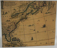
Aestivarum Insulae al Barmudas..
by Morden, Richard
- Used
- Condition
- Used
- Quantity Available
- 1
- Seller
-
Garrison, New York, United States
- Item Price
-
$450.00$8.00 shipping to USA
Show Details
Description:
London: Morden, 1680. Attractive small map of Bermuda, from the 1st edition of Morden's "Geography Rectified". On a page with text below and an 11 item key locating forts and other features, lettered A through L. Map 5.25 x 4.125" on paper 6.25 x 8". Uniformly browned, with some chipping at lower margin. The caption makes reference to "3300 miles from London 500 from Roanoak (sic) in Virginia", the Virginia colony which failed at that point.
Item Price
$450.00
$8.00
shipping to USA

Aethiopia Superior vel Interior; vulgo Abissinorum sive Presbiteri Ioannis Imperium
by Mortier, after Blaeu ?
- Used
- Condition
- Used
- Quantity Available
- 1
- Seller
-
Garrison, New York, United States
- Item Price
-
$850.00$8.00 shipping to USA
Show Details
Description:
1700. 16 1/2 x 21" plus small margins, with repairs. Measures larger than the Blaeu, which is 15 x 19 1/2", and was first published in 1635. Attractive cartouche of a man, woman & 3 children, 2 of which are perched above the others on the cartouche, shielding them from the sun which sits above them in the "Oceanus Orientalis". Another small child on the left with a measuring device. Period outline color, the green strengthened from behind in a couple of places. Goes from just above the Tropic of Cancer to Mozambique. Center fold with slt. split at lower end. Very attractive.
Item Price
$850.00
$8.00
shipping to USA
![Africae Descriptio. [Africa]](https://d3525k1ryd2155.cloudfront.net/h/804/666/481666804.0.m.2.jpg)
More Photos
Africae Descriptio. [Africa]
by Mercator, Gerhard
- Used
- Condition
- Used - Very good condition with handsome original color
- Quantity Available
- 1
- Seller
-
Garrison, New York, United States
- Item Price
-
$450.00$8.00 shipping to USA
Show Details
Description:
Amsterdam, 1607. Very good condition with handsome original color. Looking forward to being able to travel again! Copper engraved map from Mercator's "Atlas Minor", published in 1607. Latin text on verso. Image size: 7 3/4 wide x 6". Paper size: 9 x 7". Good impression. For a ca. 1609 German edition, see Van der Krogt, P. (Atlantes) 8600:351.
Item Price
$450.00
$8.00
shipping to USA
Agricultural Map of New South Wales 1907. New South Wales Australia: The Best of the New Countries
by [Farming; New South Wales]
- Used
- first
- Condition
- Used - Very good condition
- Edition
- First printing
- Quantity Available
- 1
- Seller
-
Garrison, New York, United States
- Item Price
-
$275.00$8.00 shipping to USA
Show Details
Description:
Sydney: New South Wales Intelligence Dept, 1907. First printing. Ephemera. Very good condition. A pamphlet promoting agriculture in New South Wales. The map shows colored zones for dairying and intense cultivation, mixed farming with some dairying, wheat and sheep, artesian areas. Uncolored areas are delineated as "Pastoral with Cultivation within Irrigation Areas." With small inset of Australia and NSW highlighted. On the verso is explanatory text outlining the agricultural potential to sustain primary industries and then promoting increased immigration and tourism, including fares and regulations for assisted passages, climate, cost of living. This pamphlet features a tinted picture of Martin Place "The Soil of New South Wales is rich in Potential Wealth" "Lumps of Gold await the sturdy Settler who brings a fair measure of Application, Pluck, and Perseverance..." 22 1/2 x 17 1/2" folds to 8 3/4 x 3 3/4", Libraries Australia ID 44011705.
Item Price
$275.00
$8.00
shipping to USA
Alexander Smith's Account of the Discovery of East Antarctica, 1841
by Boumphrey, R.
- Used
- Paperback
- Condition
- Used
- Binding
- Paperback
- Quantity Available
- 2
- Seller
-
Garrison, New York, United States
- Item Price
-
$45.00$8.00 shipping to USA
Show Details
Description:
Paperback. Pp 113-115. Lacks map. RGS Journal for March 1964, London. Ills in text. Orig. blue wrps, a bit ruffled and marked o/w g+.
Item Price
$45.00
$8.00
shipping to USA

Alexandria, Vetustissimum Aegypti Emporium, Amplissima Civitas ..
by Braun & Hogenberg
- Used
- Condition
- Used
- Quantity Available
- 1
- Seller
-
Garrison, New York, United States
- Item Price
-
$750.00$8.00 shipping to USA
Show Details
Description:
1575. Maps. Bird's eye view of the walled city of Alexandria, Egypt, with the mosque and Domus Alexandri Magni as the focal point. From Civitates Orbis Terrarum. Uncolored, with vignettes of camels, a column of Pompeii, people in native garb, many sailing ships and triremes on the Mediterranean Sea, and the famous lighthouse (here "Ganophalo") one of the Seven Wonders of the Ancient World. Image size 19 x 14 1/4". Paper size: 20 x 15 3/8". With period ink notation "Alexandrie en Egypte" below the lower left rule, some very light foxing in margins, lightly tipped on to stiffer stock, overall very good. References: Fauser, A. 175; Rumsey 12126.000; OCLC 494376435.
Item Price
$750.00
$8.00
shipping to USA
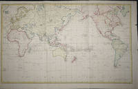
Algemeene Kaart van de Ontdekkingen van Kapit. J. Cook ...
by Cook, James
- Used
- Condition
- Used - Very good condition
- Quantity Available
- 1
- Seller
-
Garrison, New York, United States
- Item Price
-
$1,250.00$8.00 shipping to USA
Show Details
Description:
Amsterdam, 1783. Very good condition. Copper engraved world map showing the routes of the three Cook voyages. Beautiful outline color, with land masses with colored wash. Contemporary folds. Two small light fox spots, otherwise very good condition. 34 x 22"
Item Price
$1,250.00
$8.00
shipping to USA
The Alpine Regions of Alaska (WITH) Prejevalsky's Routes in Tibet in the Proceedings of the Royal Geographical Society and Monthly Record of Geography, May 1887, Complete monthly issue
by Royal Geographical Society; Seton-Karr, Lieut H.W.; General Prejevalsky
- Used
- Paperback
- Condition
- Used - Very good overall
- Binding
- Paperback
- Quantity Available
- 1
- Seller
-
Garrison, New York, United States
- Item Price
-
$85.00$8.00 shipping to USA
Show Details
Description:
London: Royal Geographic Society, 1887. Paperback. Very good overall. 8vo, this group of men were the first mountaineering expedition of its kind in the Alaskan Territory, with good folding map, as well as pp269-284. Great map of Tibet based on Prejevalsky's routes. Original blue printed wrappers.
Item Price
$85.00
$8.00
shipping to USA

America Russa. America Nord Ouest
by Marmocchi. C. Magrini
- Used
- Condition
- Used
- Quantity Available
- 1
- Seller
-
Garrison, New York, United States
- Item Price
-
$250.00$8.00 shipping to USA
Show Details
Description:
Genoa: Paolo Rivera, 1858. Alaska, north west Canada and the north west Coast just including the US border. Includes the top bit of Vancouver Island. From the "Geografia Commerciale". Steel engraving with attractive original outline color, 27 x 34 cm (hxw), printed on thick paper with wide margins. A little light foxing overall o/w very good condition.
Item Price
$250.00
$8.00
shipping to USA

America Septentrionalis Concinnata juxta Observationes Dnn Academae Regalis Scientiarum
by De l'Isle, Guillaume/Lotter, Georg F.
- Used
- Condition
- Used
- Quantity Available
- 1
- Seller
-
Garrison, New York, United States
- Item Price
-
$950.00$8.00 shipping to USA
Show Details
Description:
1770. Ca. 1770. Copper engraved full original color map of North America, showing the boundaries that existed at the time of the Seven Years War, with the western section left blank. The land claimed by the British, French and Spanish is shown here, with the British claim to all of North America east of the Mississippi River. Based on the De L'Isle map of 1700; the first to show California as a peninsula rather than an island (Tooley, 19). With Latin place names and captions and published in Augsburg by Tobias Lotter. The map extends through Central America and includes the islands of the Caribbean and the northern tip of South America. Explorers routes are indicated (Drake, Cortes), as well as settlement locations, the Sargasso Sea (Mer de Sargasse) in the Atlantic, lakes (including the Great Lakes) and Native American territories. Decorative cartouche at the upper right includes Native American to the left and gentleman in European dress to the right side, with ship visible over his shoulder. Image…
Read More Item Price
$950.00
$8.00
shipping to USA
More Photos
America Emergent. An Exhibition of Maps and Atlases in Honor of Alexander O. Vietor
by McCorkle, Barbara B.
- Used
- Paperback
- Condition
- Used - Very good condition
- Binding
- Paperback
- Quantity Available
- 1
- Seller
-
Garrison, New York, United States
- Item Price
-
$30.00$8.00 shipping to USA
Show Details
Description:
Connecticut: Yale University, 1985. Paperback. Very good condition. Oblong 4to, 103pp, paper card covers with map illustration. Internally clean, page edges dusty.
Item Price
$30.00
$8.00
shipping to USA

Didn’t find what you’re looking for?
Try adding this search to your want list. Millions of books are added to our site everyday and when we find one that matches your search, we’ll send you an email. Best of all, it’s free.
Add to Want List

Are you a frequent reader or book collector?
Join the Bibliophile's Club and save 10% on every purchase, every day — up to $20 savings per order!

Social Responsibility
Did you know that since 2004, Biblio has used its profits to build 16 public libraries in rural villages of South America?