Description:
Paperback. Acceptable.

No image available
Landranger Maps (OS Landranger Map Series) Unknown - 1990
by Ordnance Survey
Details
- Title Landranger Maps (OS Landranger Map Series)
- Author Ordnance Survey
- Binding unknown
- Publisher Ordnance Survey
- Date December 1990
- ISBN 9780319220443
More Copies for Sale

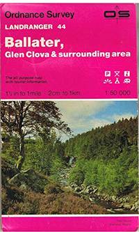
Ballater, Glen Clova and Surrounding Area (Sheet 44) (OS Landranger Map)
by Ordnance Survey
- Used
- Acceptable
- Paperback
- Condition
- Used - Acceptable
- Binding
- Paperback
- ISBN 10 / ISBN 13
- 9780319220443 / 0319220443
- Quantity Available
- 1
- Seller
-
GORING BY SEA, West Sussex, United Kingdom
- Item Price
-
$5.03$10.86 shipping to USA
Show Details
Item Price
$5.03
$10.86
shipping to USA
Ballater, Glen Clova and Surrounding Area (Sheet 44) (OS Landranger Map)
by Ordnance Survey
- Used
- very good
- Paperback
- Condition
- Used - Very Good
- Binding
- Paperback
- ISBN 10 / ISBN 13
- 9780319220443 / 0319220443
- Quantity Available
- 1
- Seller
-
GORING BY SEA, West Sussex, United Kingdom
- Item Price
-
$5.03$10.86 shipping to USA
Show Details
Description:
Paperback. Very Good.
Item Price
$5.03
$10.86
shipping to USA

Ballater, Glen Clova and surrounding area (Ordnance Survey Landranger Map 4 4) 1:50,000 Second Series
- Used
- near fine
- Condition
- Used - Near Fine
- ISBN 10 / ISBN 13
- 9780319220443 / 0319220443
- Quantity Available
- 1
- Seller
-
Arlington, Virginia, United States
- Item Price
-
$15.95FREE shipping to USA
Show Details
Description:
Southampton, England: Ordnance Survey, 1984. Folding map with card covers. Color. 39 x 34.5 inch sheet, folded in 5.25 x 9 inch cover. As New map in a Very Good cover. Not from a library. Unmarked. Relief shown by spot heights. Legend in English, German, and French.
Item Price
$15.95
FREE shipping to USA