
Click for full-size.

A Chart of the West Coast of Sumatra from Old Bencoolen to Buffaloe Point containing the Road of Bencoolen and Poolo Bay
by LAURIE & WHITTLE
- Used
- very good
- Condition
- very good
- Seller
-
New York, New York, United States
Payment Methods Accepted
About This Item
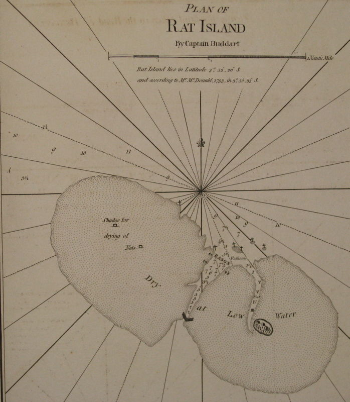
London: Laurie & Whittle, 1799. unbound. very good. Sea chart. Uncolored copper plate engraving. Image measures 20.5" x 24.25".<br/><br/> Beautiful chart of the southwestern coast of Sumatra. Includes rhumb lines, depths, shoals and inland swamps, the paths of previous explorations, a compass rose and two inset maps: "Plan of Rat Island", "Plan of Poolo Bay". The coast lines are further illustrated with with several topographical cross sections and scattered sailing notes and observations. Also shown is Fort Marlborough in what is today Bengkulu, which guarded an important port for the British East India Company. Published in "The East-India Pilot, or Oriental Navigator, on One Hundred and Eighteen Plates: Containing a Complete Collection of Charts and Plans, &c..." (plate 93). Maps are based on the 1745 French "Neptune Oriental" by Jean Baptiste Nicolas Denis d'Apres de Mannevillette. The later English editions include additions by Captain Joseph Huddart, John Price and Mr. McDonald. Minor dampstaining and offsetting with some stains to upper corners. Full original margins.<br/><br/>
Reviews
(Log in or Create an Account first!)
Details
- Bookseller
- Argosy Book Store
 (US)
(US)
- Bookseller's Inventory #
- 220058
- Title
- A Chart of the West Coast of Sumatra from Old Bencoolen to Buffaloe Point containing the Road of Bencoolen and Poolo Bay
- Author
- LAURIE & WHITTLE
- Format/Binding
- Unbound
- Book Condition
- Used - very good
- Quantity Available
- 1
- Publisher
- Laurie & Whittle
- Place of Publication
- London
- Date Published
- 1799
- Keywords
- sea chart, blue back
Terms of Sale
Argosy Book Store
All items are offered net, subject to prior sale. Returns accepted within 7 days of receipt--please contact us first. Payment by Visa , Mastercard & American Express. Appropriate sales tax will be added for all N.Y. State residents
About the Seller
Argosy Book Store
Biblio member since 2004
New York, New York
About Argosy Book Store
We are a large retail store, with 6 floors of out-of-print and rare books, (including, Americana, modern first editions, history of medicine and science), antique maps and prints, autograph manuscripts, letters & signatures.
Glossary
Some terminology that may be used in this description includes:
This Book’s Categories

Collecting and identifying signed letters and holographic documents
Many authors and other famous literary figures wrote and signed letters by hand, and you can find a great collection of them in the Biblio rare book room. See our great collection of handwritten letters and holographic documents

Collecting BiblioMysteries
Want to get meta? Bibliomysteries are mystery stories which deal in some significant way with books and the world associated with books. Browse this fascinating subgenre of mystery novels.