Description:
The Boston Map Store, 1889 IN GOOD CONDITION. Folds out to 32 inches by 22 inches. Hand coloured map of Boston and the Country Adjacent, from actual Surveys. Shows crease tears and stains.
JAPAN AND KOREA by JOHN TALLIS - 1850S
by JOHN TALLIS
Similar copies are shown below.
Similar copies are shown to the right.

JAPAN AND KOREA
by JOHN TALLIS
- Used
8.6 X 10.6 INCHES
-
Seller
abhishek jain
 (IN)
(IN)
- Book Condition Used
- Quantity Available 1
- Publisher JOHN TALLIS AND COMPANY
- Place of Publication LONDON
- Date Published 1850S
We have 1 copies available starting at $126.15.
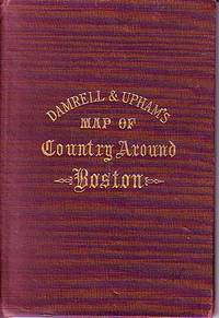
Damrell & Upham's Map of Country Around Boston
- Used
- good
- Hardcover
- Condition
- Used - Good
- Binding
- Hardcover
- Quantity Available
- 1
- Seller
-
Houlton, Maine, United States
- Item Price
-
$125.00
Show Details
Item Price
$125.00

More Photos
Meyers Geographischer Handatlas
by Meyers
- Used
- very good
- Hardcover
- Condition
- Used - Very Good
- Edition
- Revised
- Binding
- Hardcover
- Quantity Available
- 1
- Seller
-
Thessaloniki, Greece
- Item Price
-
$107.73
Show Details
Description:
Hardcover. Very Good. Revised Edition of 1913 on Title Page. Maroon cloth just slightly faded, tight, small shelf wear. Former owners stamp mark, Moskoff famous Greek Jewish tobacco dealer in Thessaloniki.
Item Price
$107.73

More Photos
Africa, Drawn and Engraved from the best Maps and Charts
by Kitchin, T. Sculp (Thomas Kitchen)
- Used
- good
- Condition
- Used - Good
- Binding
- Unknown
- Quantity Available
- 1
- Seller
-
Datil, New Mexico, United States
- Item Price
-
$100.00
Show Details
Description:
London: Harvey's Naval History Original antique map of 18th century Africa. Good condition. Size 34x37cm. Engraved for Harvey's Naval History, published in the early 1780s. This map also had been published in Daniel Fenning's "A New System of Geography" (1770s). The map has moderate foxing, closed tears along some of the folds, and chips & loss in the margins.. Good. Maps.
Item Price
$100.00

More Photos
GUIDE PLAN OF CAIRO: Together with an Index to Streets and Places of Interest
by Egyptian Ministry of Finance
- Used
- Condition
- Used - Good condition; Three of the strips are torn and repaired with archival tape.
- Binding
- Unknown
- Quantity Available
- 1
- Seller
-
Richmond, Texas, United States
- Item Price
-
$104.50
Show Details
Description:
Giza: The Survey of Egypt, 1927. Good condition; Three of the strips are torn and repaired with archival tape.. Appears to be second printing of the 1912 survey; 31 pages with a frontis fold-out Key Map of the Strips and five folding folding strips which make up the Guide Plan stapled into paper covers; Each strip folds out to 39 1/2" long.
Item Price
$104.50

More Photos
Atlas Miniatura de la Republica Mexicana
by NORIEGA, Eduardo
- Used
- Hardcover
- first
- Condition
- Used - Very Good+
- Edition
- First
- Binding
- Hardcover
- Quantity Available
- 1
- Seller
-
Cuernavaca, Mexico
- Item Price
-
$95.00
Show Details
Description:
México, Librería de la Vda de Ch. Bouret, 18998vo menor. [66pp.] Sin numerar. Holandesa con puntas, lomo en piel, tejuelos rojo y azul. Sello de escuela antigua en varias páginas. Contiene páginas por cada Estado y Territorio de México: una página con información y estadísticas, y la otra el mapa. Valle de México con mapa a doble página. Mapas por J.Besson.
Item Price
$95.00

More Photos
Carte de la plaine de Troie levee en 1786 et 1787
by Jean-Denis Barbie - Artist
- Used
- very good
- Condition
- Used - Very Good
- Binding
- Unknown
- Quantity Available
- 1
- Seller
-
DeLand, Florida, United States
- Item Price
-
$125.00
Show Details
Description:
Paris: Blaise. No Binding. Very Good. Louis-Francois Cassas - Cartographer. Antique engraved map on laid paper shown in the corresponding images. This map, "Carte de la plaine de Troie levee en 1786 et 1787," was excised from Marie-Gabriel-Florent-Auguste de Choiseul-Gouffier's "Voyage pittoresque de la Grèce" (1782-1842). This folding plate depicts the topography of the region of Troy, and features Alexandria Troas, Kara Dag (Black Mountain), Tenedos, and the Aegean Sea. The artist is credited as Jean-Denis Barbie, and the cartographer as Louis-Francois Cassas. Condition / Notes: This map, measuring approximately 26 1/2" x 20", displays some age/wear indications, including light foxing, toning concentrated in the margins and at the extremities, minor chipping, and two small closed tears at the foot.. Background: Marie-Gabriel-Florent-Auguste de Choiseul-Gouffier (27 September 1752, Paris - 20 June 1817, Aix-la-Chapelle) was a member of the Académie française and the Choiseul-Gouffier…
Read More Item Price
$125.00
More Photos
Meyers Geographischer Handatlas
by Meyers
- Used
- very good
- Hardcover
- Condition
- Used - Very Good
- Edition
- Revised
- Binding
- Hardcover
- Quantity Available
- 1
- Seller
-
Thessaloniki, Greece
- Item Price
-
$107.73
Show Details
Description:
Hardcover. Very Good. Revised Edition of 1913 on Title Page. Maroon cloth just slightly faded, tight, small shelf wear. Former owners stamp mark, Moskoff famous Greek Jewish tobacco dealer in Thessaloniki.
Item Price
$107.73
More Photos
Africa, Drawn and Engraved from the best Maps and Charts
by Kitchin, T. Sculp (Thomas Kitchen)
- Used
- good
- Condition
- Used - Good
- Binding
- Unknown
- Quantity Available
- 1
- Seller
-
Datil, New Mexico, United States
- Item Price
-
$100.00
Show Details
Description:
London: Harvey's Naval History Original antique map of 18th century Africa. Good condition. Size 34x37cm. Engraved for Harvey's Naval History, published in the early 1780s. This map also had been published in Daniel Fenning's "A New System of Geography" (1770s). The map has moderate foxing, closed tears along some of the folds, and chips & loss in the margins.. Good. Maps.
Item Price
$100.00
More Photos
GUIDE PLAN OF CAIRO: Together with an Index to Streets and Places of Interest
by Egyptian Ministry of Finance
- Used
- Condition
- Used - Good condition; Three of the strips are torn and repaired with archival tape.
- Binding
- Unknown
- Quantity Available
- 1
- Seller
-
Richmond, Texas, United States
- Item Price
-
$104.50
Show Details
Description:
Giza: The Survey of Egypt, 1927. Good condition; Three of the strips are torn and repaired with archival tape.. Appears to be second printing of the 1912 survey; 31 pages with a frontis fold-out Key Map of the Strips and five folding folding strips which make up the Guide Plan stapled into paper covers; Each strip folds out to 39 1/2" long.
Item Price
$104.50

The Cossacks: A Tale of the Caucasus in the Year 1852. UKRAINIA
by Tolstoi, Count Lyof N.
- Used
- Hardcover
- first
- Condition
- Used - Good-
- Jacket Condition
- No DJ Included
- Edition
- First English Edition
- Binding
- Hardcover
- Quantity Available
- 1
- Seller
-
Salem, Oregon, United States
- Item Price
-
$145.00$87.00Save $58.00!
Show Details
Description:
UKRAINIA Tolstoi, Count Lyof N.: The Cossacks: A Tale of the Caucasus in the Year 1852. First English Edition, 1888 Walter Scott, 24 Warwick Lane, Paternoster Row, London. Translated from the Russian by Nathan Haskell Dole. Summary: A novel of the Caucasian War 1817-1864. Used. Good- Condition/ No DJ. Blue Boards gold titling and ornamentation. Imperial Russian crest stamped in gilt at center front. A solid copy. Light foxing to endpapers. Toning. Fabric at top of spine missing. RARE/SCARCE.
Item Price
$145.00$87.00
Save $58.00
!
![Japan and Corea [Korea].](https://d3525k1ryd2155.cloudfront.net/h/490/669/882669490.0.m.jpg)
Japan and Corea [Korea].: Original Antue Map.
by John Tallis & Rapkin
- Used
- good
- Condition
- Used - Good
- Edition
- 1st
- Quantity Available
- 1
- Seller
-
Plymouth, Devon, United Kingdom
- Item Price
-
$126.15
Show Details
Description:
Tallis, John: Japan and Corea [Korea], London. [ca.1851]. From the Montgomery Martin Illustrated Atlas. Map engraved by Rapkin. Size approx 360 x 260mm. Original steel engraved map with original outline hand colouring. 3 vignette views showing Coreans [Koreans], State Barge, and Yedo. Decorative border. Single page unfolded map in excellent, clean condition. Associated text page of the Montgomery Martin Atlas included. A Good Tallis Map.
Item Price
$126.15

More Photos
The Sky and the Forest
by Forester, C.S
- Used
- very good
- Hardcover
- first
- Condition
- Used - Very Good
- Jacket Condition
- Very Good
- Edition
- First Edition
- Binding
- Hardcover
- Quantity Available
- 1
- Seller
-
Salem, Oregon, United States
- Item Price
-
$34.89$20.93Save $13.96!
Show Details
Description:
C.S. Forester: The Sky and the Forest. Little, Brown and Company, Boston. Stated First Edition First Printing Thus August, 1948. Cover price $2.75. Used. VG BOOK/VG UNCLIPPED DUST JACKET. A story of a central Africa. By C.S. Forester, author of the Admiral Hornblower series.
Item Price
$34.89$20.93
Save $13.96
!
![Alaska and Klondike Region; [With inset of Klondike Region on the Upper Yukon detail] [From an...](https://d3525k1ryd2155.cloudfront.net/h/062/537/1339537062.0.m.jpg)
Alaska and Klondike Region; [With inset of Klondike Region on the Upper Yukon detail] [From an atlas, "Gazetteer of Alaska and Yukon Region " pp. 105 and 106]
by Miller, J. Martin
- Used
- very good
- Condition
- Used - Very Good
- Edition
- Unknown
- Quantity Available
- 1
- Seller
-
Sebastopol, California, United States
- Item Price
-
$39.00
Show Details
Description:
Chicago: J. Martin Miller, 1899. Unknown. Map. Very Good. [Map copyright 1899, printing date of Atlas later] [19.875x15.125in]; Colored map of Alaska with steamer routes from Portland and Seattle, insets of the Klondike Region on the Upper Yukon and Western portion of Aleutian Islands; On verso index of places and names with two large black and white images; Age toning to all edges, water stain marks on bottom, slight printing offset of colors, small chips and closed tears to lower edge;.
Item Price
$39.00

Zemepis Sveta - Monsunova Asie
by De La Blache, P. Vidal; Gallois, L
- Used
- Hardcover
- Condition
- Used - Very Good Condition
- Jacket Condition
- No Dust Jacket
- Binding
- Hardcover
- Quantity Available
- 1
- Seller
-
Oak Point, Texas, United States
- Item Price
-
$60.00
Show Details
Description:
Aventinum, Prague, Czechoslovakia, 1930. Hardcover. Very Good Condition/No Dust Jacket. Text entirely in Czech. Geography book on Asia with numerous photographs and maps. 1931 edition also available. Size: 4mo - over 9 3/4" - 12" tall. 400 pp. Pages are yellowed, but are tight and clean. Moderate shelfwear along the spine. Corners are lightly bumped. Quantity Available: 1. Shipped Weight: 3-5 pounds. Category: Travel & Places; Non-English Language::Czech; Pictures of this item not already displayed here available upon request. Inventory No: 001227. . Additional shipping charges may apply.
Item Price
$60.00

Zemepis Sveta - Monsunova Asie
by De La Blache, P. Vidal; Gallois, L
- Used
- Hardcover
- Condition
- Used - Very Good Condition
- Jacket Condition
- No Dust Jacket
- Binding
- Hardcover
- Quantity Available
- 1
- Seller
-
Oak Point, Texas, United States
- Item Price
-
$60.00
Show Details
Description:
Aventinum, Prague, Czechoslovakia, 1931. Hardcover. Very Good Condition/No Dust Jacket. Text entirely in Czech. Geography book on Asia with numerous photographs and maps. 1930 edition also available. Size: 4mo - over 9 3/4" - 12" tall. 400 pp. Pages are yellowed, but are tight and clean. Moderate shelfwear along the spine. Corners are lightly bumped. Quantity Available: 1. Shipped Weight: 3-5 pounds. Category: Travel & Places; Non-English Language::Czech; Pictures of this item not already displayed here available upon request. Inventory No: 001228. . Additional shipping charges may apply.
Item Price
$60.00

Asia from the Best Authorities, Russell, ca.1800
by Russell
- Used
- Condition
- Used
- Quantity Available
- 1
- Seller
-
Plymouth, Devon, United Kingdom
- Item Price
-
$25.23
Show Details
Description:
Russell, J. : Asia from the Best Authorities. Nd but ca.1800. From "A New Geographical, Historical and Commercial Grammar and Present State of Several Kingdoms of the World". Copper engraving. Size approx 200 x 230mm. Two neat folds. Some age colouring to edges, otherwise clean and bright. Includes Arabia, India, Borneo, Japan, China and eastern Russia.
Item Price
$25.23

North America from the Best Authorities, Russell, ca.1800
by Russell
- Used
- Condition
- Used
- Quantity Available
- 1
- Seller
-
Plymouth, Devon, United Kingdom
- Item Price
-
$25.23
Show Details
Description:
Russell, J. : A General Map of North America from the Best Authorities. Nd but ca.1800. From "A New Geographical, Historical and Commercial Grammar and Present State of Several Kingdoms of the World." Copper engraving. Size approx 200 x 230mm. Two neat folds. Some age colouring to edges, otherwise very clean and bright.
Item Price
$25.23
![MAP OF UTAH [Territory]](https://d3525k1ryd2155.cloudfront.net/h/836/461/1485461836.0.m.jpg)
More Photos
MAP OF UTAH [Territory]
- Used
- Condition
- Used - Very Good-
- Edition
- Original
- Quantity Available
- 1
- Seller
-
Williamsburg, Virginia, United States
- Item Price
-
$65.00
Show Details
Description:
New York, Richmond, Chicago, & Toledo: H. H. Hardesty, 1885. Original color lithographed map printed by Rand, McNally & Company, Engravers and published in HARDESTY'S HISTORICAL AND GEOGRAPHICAL ENCYCLOPEDIA: SPECIAL VIRGINIA EDITION. 19 3/8 inches by 13 1/4 inches on a 21" X 14 1/2" sheet. The map depicts the Territory of Utah in its final form--large areas had been removed and ceded to Nevada, Colorado, Wyoming, and Nebraska since Utah became a U. S. Territory in 1850. The issue of polygamy prevented statehood until it was finally granted in 1896. This map features railroads and topography and uses color to set off counties from each other. Unlike most atlas maps of the period, this map identifies most small towns. The map is guaranteed to be moe than 135 years old. The map is in about very good condition: generally clean and bright, with slight toning of paper and one faint water stain near the center-left edge of the map.. Original. Single Sheet. Very Good-. Elephant…
Read More Item Price
$65.00

Last Tales
by Dinesen, Isak
- Used
- very good
- Hardcover
- first
- Condition
- Used - Very Good
- Jacket Condition
- Good+
- Edition
- First Edition
- Binding
- Hardcover
- Quantity Available
- 1
- Seller
-
Salem, Oregon, United States
- Item Price
-
$120.00$72.00Save $48.00!
Show Details
Description:
Dinesen, Isak: Last Tales, A Collection of Twelve New Tales of Compelling Beauty 1957, Random House. First Edition. Stated First Printing Thus. Used. Very Good/Good+ original red dust jacket, price-clipped. Jacket states 11/57 on front flap. 5 3/4 X
Item Price
$120.00$72.00
Save $48.00
!

Philips Special Map of the Nile, The Advance on Khartum and the Environs of Omdurman. Cc1900
by George Philips and Son,
- Used
- Condition
- Used
- Quantity Available
- 1
- Seller
-
Plymouth, Devon, United Kingdom
- Item Price
-
$32.80
Show Details
Description:
Philips Special map of the Nile illustrating the Advance on Khartum [Khartoum] with an enlargement of the environs of Omdurman [Omdur]. George Philips and Son, London and Liverpool Ca 1900. 580mm x 900mm folded map. Front title wrapper has come loose, not affecting map area. Three maps are displayed within the sheet. Map1. Map of the Nile Valley 520mm x 300mm showing the approaches of Khartum. Scale 1inch to 100 Geographical miles. Coloured indicating Possessions and Protectorates of European Powers. Map 2. Special map of the Nile from Dongola to Khartum. Scale 16 miles to the inch. Coloured. In set in this map is Map3. Environs of Omdurman, Scale 5 statute miles to the inch. Some small breaks at some folds, not affecting imagery or use of map. Title label is damaged, the map is clean and bright, probably unused. A very interesting record.
Item Price
$32.80

The Adventure of Wrangel Island
by Vilhjalmur Stefansson
- Used
- good
- Hardcover
- first
- Condition
- Used - Good
- Jacket Condition
- No DJ Included
- Edition
- First Edition
- Binding
- Hardcover
- Quantity Available
- 1
- Seller
-
Salem, Oregon, United States
- Item Price
-
$124.89$74.93Save $49.96!
Show Details
Description:
The Adventure of Wrangel Island, Alaska (1925 Macmillan 1st Edition) HISTORY OF ALASKA. EXLIB. Good Condition/ No DJ included. Fold-out map affixed to binding at the back of the book has never been opened. The story of the (unsuccessful) attempted colonization of Wrangel Island Alaska. 413 pages plus appendix, Index. Titling is still bright. A clean, solid copy. Scarce.
Item Price
$124.89$74.93
Save $49.96
!