Description:
Readex Microprint, 1966. Reprint. Hardcover. Near Fine. small octavo, green leatherette hardback, facsimile reprint of the 1714 ed. (1966), 205 pages + index. Minor soil to textblock edge, otherwise Near Fine.
Journal Historique du Dernier Voyage que fue M. De la Salle sit dans le Golfe de Mexique, pour trouver l'emboucher & le cours de la Riviere de Missicipi, qui traverse la Louisiane by JOUTEL, Henri (ca 1640-1735) - 1713
by JOUTEL, Henri (ca 1640-1735)
Journal Historique du Dernier Voyage que fue M. De la Salle sit dans le Golfe de Mexique, pour trouver l'emboucher & le cours de la Riviere de Missicipi, qui traverse la Louisiane
by JOUTEL, Henri (ca 1640-1735)
- Used
- Hardcover
- first
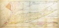
Paris: Estienne Robinot, 1713. 12mo., (6 4/8 x 3 6/8 inches). Large folding engraved map of the eastern seaboard, Caribbean, and Central America "Carta Nouvelle de la Louisiane et de la Riviere de Missisipi. . ." (14 1/4 x 14inches) (short repairs at the mount), woodcut head- and tail-pieces (lightly browned, one or two spots). Contemporary French sprinkled calf, spine in six compartments with five raised bands, morocco gilt lettering-piece in one, the others decorated with small gilt tools (hinges just starting at the head of the spine). First edition. A very attractive copy of the classic account of the ill-fated La Salle expedition, the first attempted European settlement of the area, with the rare and important map which laid the groundwork for the later maps of Texas. Jackson, Flags Along the Coast pp. 123-4: "Before leaving the subject of the influence of Delisle's "Carte Du Mexique", the map which appeared in Hendrix Jute's "Journal Historique" (1713) should be mentioned. This "Carta Nouvelle de la Louisiane" - like Delisle's map - has the Mississippi in mid-continent, emptying into the Gulf just west of the old bay off Espiritu Santo. Jute's map shows the bay quite large, but even larger is his "bay de St. Louis." Moreover, Jute gives a detailed account of French exploration within Texas, keyed to letters on the map. Thus, this map represents a transition to the type of information that Delisle depicted on his 1718 map of Louisiana. Joutel was La Salle's second in command on the ill-fated expedition. In 1682 La Salle had gone down the Mississippi to the Delta and claimed it for France, naming it Louisiana. Two years later he returned to found a colony there, but couldn't find it this time around, and ended up landing at Matagorda Bay, on the Texas coast. The colony was doomed from the start. La Salle was murdered by his own men. Joutel and some other survivors made their way across Texas and up the Mississippi to Fort. St. Louis on the Illinois, and then then to Quebec. An early and important book for the cartography of Texas and the history of the French in the region. Howes J266; Church 855; Graff 2251; Jenkins Basic Texas Books 114; Wagner Spanish Southwest 79; Sabin 36760. Alden & Landis 713/103. Catalogued by Kate Hunter.
-
Bookseller
Arader Galleries
 (US)
(US)
- Book Condition Used
- Binding Hardcover
- Publisher Estienne Robinot
- Place of Publication Paris
- Date Published 1713

THE LAST VOYAGE PERFORM'D BY DE LA SALE
by Joutel, Henri
- Used
- near fine
- Hardcover
- Condition
- Used - Near Fine
- Edition
- Reprint
- Binding
- Hardcover
- Quantity Available
- 1
- Seller
-
Rougemont, North Carolina, United States
- Item Price
-
$10.00
Show Details
Item Price
$10.00

The Last Voyage Perform'd by de la Sale
by Joutel, Henri
- Used
- near fine
- Hardcover
- Condition
- Used - Near Fine
- Jacket Condition
- No Jacket
- Binding
- Hardcover
- Quantity Available
- 1
- Seller
-
Austin, Minnesota, United States
- Item Price
-
$11.00
Show Details
Description:
Readex Microprint Corporation, 1966. Book. Near Fine. Hardcover.
Item Price
$11.00
The Last Voyage Perform'd by de la Sale [Great Americana]
by Joutel, Henri
- Used
- Fine
- Hardcover
- Condition
- Used - Fine
- Jacket Condition
- Not Issued
- Edition
- Facsimile Reprint Edition
- Binding
- Hardcover
- Quantity Available
- 1
- Seller
-
Kutztown, Pennsylvania, United States
- Item Price
-
$9.95
Show Details
Description:
Readex Microprint Corp., 1966. Book. Fine. Hardcover. Facsimile Reprint Edition. 12mo - over 6¾" - 7¾" tall. Olive leatherette, lettered in gilt. As issued. [vi],xxi,[ix],205,[5] pp. Facsimile reprint of original 1714 edition..
Item Price
$9.95
Joutel's Journal of La Salle's Last Voyage
by Joutel, Henri / introduction by Darrett B. Rutman
- Used
- Paperback
- Condition
- Used
- Binding
- Paperback
- Quantity Available
- 1
- Seller
-
West Brattleboro, Vermont, United States
- Item Price
-
$10.00
Show Details
Description:
The American Experience Series / Corinth, 1962. Day by day account of the Mississippi exploration. Near fine stiff wraps with strong spine and clean text
Item Price
$10.00
A Journal of the Last Voyage Perform'd by Monsr. de la Sale, to the Gulph of Mexico, to find out the Mouth of the Miissisipi River
by Henri Joutel
- Used
- near fine
- Hardcover
- Condition
- Used - Near Fine
- Binding
- Hardcover
- Quantity Available
- 1
- Seller
-
Saint Louis, Missouri, United States
- Item Price
-
$15.00
Show Details
Description:
Readex Microprint, 1966. Hardcover. Near Fine. Small 8vo pebbled leatherette. Facsimile of the work originally published in English in 1714
Item Price
$15.00
The Last Voyage Perform'd by de la Sale
by Joutel, Henri
- Used
- good
- Hardcover
- Condition
- Used - Good
- Binding
- Hardcover
- Quantity Available
- 1
- Seller
-
Vancouver, Washington, United States
- Item Price
-
$14.25
Show Details
Description:
Readex Microprint, 1966. Hardback in good condition. Inside of book is in near fine condition but outside covering of spine has cracked along front hinge edge. Otherwise near fine. Blind stamp (embossed) on title page.. Hardcover. Good.
Item Price
$14.25

Stock Photo: Cover May Be Different
Journal historique du dernier voyage que feu M. de LaSale fit dans le golfe de Mexique, pour trouver l'embouchure, & le cours de la riviere de ... la Louisiane: Où l'on voit l'histoire tragi
by Joutel, Henri
- New
- Hardcover
- Condition
- New
- Binding
- Hardcover
- ISBN 10 / ISBN 13
- 9780274850334 / 0274850338
- Quantity Available
- 1
- Seller
-
Exeter, Devon, United Kingdom
- Item Price
-
$8.93
Show Details
Description:
Wentworth Press, 2018. Hardcover. New. 436 pages. French language. 9.49x6.38x1.22 inches.
Item Price
$8.93
THE LAST VOYAGE PERFORM'D BY DE LA SALE : March of America Fascimile Series, Number 31
by Joutel, Henri; (Translated from the French to English)
- Used
- near fine
- Hardcover
- Condition
- Used - Near Fine
- Jacket Condition
- None as Issued
- Edition
- Fascimile Reprint
- Binding
- Hardcover
- Quantity Available
- 1
- Seller
-
Berkeley, California, United States
- Item Price
-
$16.50
Show Details
Description:
Ann Arbor, MI: Univ Microfilms/Xerox Company, 1966. Fascimile Reprint . Half-Leather. Near Fine/None as Issued. EX-LIB/UNCIRCULATED Copy. Text/BRAND NEW & Bright. Blue boards/NF. DJ/None as Issued. First published in French, 1713; translated & published in English, 1714. Journal of the last voyage of de la sale to the Gulf of Mexico to fin the mouth of the Mississippi. This a facsimile reproduction of Joutel's Journal, an abridgement of the orginal by the Sieur de Mitchel; Mitchel's preface, with map and a copy of Louis XIV's instructions of 1712 for the government of Louisiana are included.
Item Price
$16.50
Journal of La Salle's Last Voyage, 1684-7; With a Frontispiece of Gudebrod's Statue of La Salle, and the Map of the Original French Edition, Paris 1713, in Facsimile;
by Henri Joutel (Creator)
- Used
- good
- Paperback
- Condition
- Used - Good
- Binding
- Paperback
- ISBN 10 / ISBN 13
- 9781290457132 / 1290457131
- Quantity Available
- 1
- Seller
-
HOUSTON, Texas, United States
- Item Price
-
$31.72
Show Details
Description:
HardPress Publishing, 2012-08-01. Paperback. Good.
Item Price
$31.72

Stock Photo: Cover May Be Different
The La Salle Expedition to Texas: The Journal of Henri Joutel, 1684-1687.
by JOUTEL, Henri
- Used
- Hardcover
- first
- Condition
- As New in As New dust jacket
- Binding
- Hardcover
- ISBN 10 / ISBN 13
- 9780876111659 / 0876111657
- Quantity Available
- 1
- Seller
-
Springfield, Massachusetts, United States
- Item Price
-
$25.00
Show Details
Description:
Austin:: Texas State Historical Association,. As New in As New dust jacket. 1998. Hardcover. 0876111657 . Edited and with an introduction by William C. Foster. Translated from the French by Johanna S. Warren. Black and white photographs. First edition. As new in like dust jacket. Still in original shrinkwrap. .
Item Price
$25.00