Description:
UsedGood. The item shows wear from consistent use, but it remains in good condition and works perfectly. All pages and cover are intact (including the dust cover, if applicable). Spine may show signs of wear. Pages may include limited notes and highlighting. May NOT include discs, access code or other supplemental materials.
MID-DOWN. Sheet 10. One-Inch popular series by ORDNANCE SURVEY OF NORTHERN IRELAND
by ORDNANCE SURVEY OF NORTHERN IRELAND

MID-DOWN. Sheet 10. One-Inch popular series
by ORDNANCE SURVEY OF NORTHERN IRELAND
- Used
Ordnance Survey of Northern Ireland , 1938 000000000000000. Brown Card covers with original price 3/6. Back cover has some annotation the map itself is near fine. .
-
Bookseller
Independent bookstores
 (GB)
(GB)
- Book Condition Used
- Publisher Ordnance Survey of Northern Ireland , 1938 000000000000000
- Keywords Maps Maps
Stock Photo: Cover May Be Different
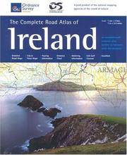
The Complete Road Atlas Of Ireland (Irish Maps, Atlases & Guides)
by Ordnance Survey of Northern Ireland
- Used
- Condition
- UsedGood
- ISBN 10 / ISBN 13
- 9781903974704 / 1903974704
- Quantity Available
- 1
- Seller
-
Interlochen, Michigan, United States
- Item Price
-
$6.15
Show Details
Item Price
$6.15

Loch Linnhe Sheet 46 (Ordnance Survey One-inch Map of Great Britain)
by Ordnance Survey One-inch Map of great Britain
- Used
- good
- Paperback
- Condition
- Used - Good
- Binding
- Paperback
- Quantity Available
- 1
- Seller
-
Goring-by-Sea, West Sussex, United Kingdom
- Item Price
-
$4.32
Show Details
Description:
Ordnance Survey, 1956. Paperback. Good. 1956. Revised. Unpaginated. Pictorial paper covers. Coloured map printed on map. Binding remains firm.Pages & illustrations remain bright with minimal tanning. Paper cover has mild edge-wear with light rubbing and creasing.
Item Price
$4.32

Larne (Irish Discoverer Maps): Sheet 9 (Irish Discoverer Series)
by Ordnance Survey of Northern Ireland
- Used
- very good
- Paperback
- Condition
- Used - Very Good
- Binding
- Paperback
- ISBN 10 / ISBN 13
- 9781905306015 / 1905306016
- Quantity Available
- 1
- Seller
-
GORING BY SEA, West Sussex, United Kingdom
- Item Price
-
$2.60
Show Details
Description:
Paperback. Very Good.
Item Price
$2.60
Craigavon
by Ordnance Survey of Northern Ireland Staff
- Used
- Condition
- Used - Good
- ISBN 10 / ISBN 13
- 9781873819609 / 1873819609
- Quantity Available
- 1
- Seller
-
Reno, Nevada, United States
- Item Price
-
$13.45
Show Details
Description:
Used - Good. Used book that is in clean, average condition without any missing pages.
Item Price
$13.45

1991 Ordnance Survey Motoring Atlas of Great Britain
by Great Britain. Ordnance Survey
- Used
- very good
- Paperback
- Condition
- Used - Very Good
- Edition
- Eighth edition
- Binding
- Paperback
- ISBN 10 / ISBN 13
- 9780600570738 / 0600570738
- Quantity Available
- 1
- Seller
-
Arlington, Virginia, United States
- Item Price
-
$14.95
Show Details
Description:
Southampton, England: Ordnance Survey and London: Hamlyn Publishing, 1990. Paperback. Very Good. Unmarked. Spine straight and tight. Covers clean with significant wrinkling. Not from a library. 140 pages. 15.6 x 11.25 x 0.25 inches.
Item Price
$14.95

Newry and Mourne Street Map | Enlarged City Centre Map | Ordnance Survey Northern Ireland | OSNI Newry Street Map | Newry | City Centre | Street Map | Maps | Adventure (Irish Street Maps)
by Ordnance Survey of Northern Ireland
- Used
- very good
- Paperback
- Condition
- Used - Very Good
- Binding
- Paperback
- ISBN 10 / ISBN 13
- 9781905306282 / 1905306288
- Quantity Available
- 2
- Seller
-
GORING BY SEA, West Sussex, United Kingdom
- Item Price
-
$4.22
Show Details
Description:
Paperback. Very Good.
Item Price
$4.22

Strabane (Irish Discoverer Maps): Sheet 12 (Irish Discoverer Series)
by Ordnance Survey of Northern Ireland
- Used
- very good
- Paperback
- Condition
- Used - Very Good
- Binding
- Paperback
- ISBN 10 / ISBN 13
- 9781873819982 / 1873819986
- Quantity Available
- 1
- Seller
-
GORING BY SEA, West Sussex, United Kingdom
- Item Price
-
$4.90
Show Details
Description:
Paperback. Very Good.
Item Price
$4.90

Discoverer Map 014: Lough Neagh (Discoverer Map Series)
by Ordnance Survey of Northern Ireland
- Used
- very good
- Paperback
- Condition
- Used - Very Good
- Binding
- Paperback
- ISBN 10 / ISBN 13
- 9781873819784 / 1873819781
- Quantity Available
- 1
- Seller
-
GORING BY SEA, West Sussex, United Kingdom
- Item Price
-
$4.91
Show Details
Description:
Paperback. Very Good.
Item Price
$4.91

Ballycastle: Sheet 5 (Irish Discoverer Series)
by Ordnance Survey of Northern Ireland
- Used
- very good
- Paperback
- Condition
- Used - Very Good
- Binding
- Paperback
- ISBN 10 / ISBN 13
- 9781873819722 / 1873819722
- Quantity Available
- 1
- Seller
-
GORING BY SEA, West Sussex, United Kingdom
- Item Price
-
$4.91
Show Details
Description:
Paperback. Very Good.
Item Price
$4.91
Ballymoney: Sheet 8 (Irish Discoverer Series)
by Ordnance Survey of Northern Ireland
- Used
- very good
- Paperback
- Condition
- Used - Very Good
- Binding
- Paperback
- ISBN 10 / ISBN 13
- 9781873819517 / 187381951X
- Quantity Available
- 3
- Seller
-
GORING BY SEA, West Sussex, United Kingdom
- Item Price
-
$5.01
Show Details
Description:
Paperback. Very Good.
Item Price
$5.01