Description:
Scandinavia Publishing, 5/1/2012 12:00:01 AM. hardcover. Very Good. 0.4000 in x 9.5000 in x 6.7000 in.
Motoring Map - Karte fur Kraftfahrer - Carte Routiere (Nordisk Turisttrafikkomite, Danmark, Finland, Norge, Sverige). by SCANDINAVIA) - Ca. 1930s.
by SCANDINAVIA)

Motoring Map - Karte fur Kraftfahrer - Carte Routiere (Nordisk Turisttrafikkomite, Danmark, Finland, Norge, Sverige).
by SCANDINAVIA)
- Used
Ca. 1930s.. Color map, 28 x 20 inches (71 x 91 cm), folding to 7 1/2 x 5 1/2 inches, black and white photo illustrations on verso. A few tiny holes at intersections of folds, a few travel service stamps on verso, otherwise very good condition with some light creasing near intersections of folds. Map is clean and bright. Road map for Denmark, Sweden, Norway and Finland. Lists "Important Direct Steamship Lines" in lower right corner. Text in English, German, and French. Shows "Motor car ferries and other routes (steamer and rail) for conveyance of motor-cars". .
-
Bookseller
Independent bookstores
 (US)
(US)
- Book Condition Used
- Date Published Ca. 1930s.
- Keywords Denmark, Europe, Finland, French, German, map, Norway, Steam Ships, Sweden, Transportation, zz_22_WS_40_off, zzephem

Stock Photo: Cover May Be Different
Jesus is Risen (Contemporary Bible)
by Scandinavia Publishing
- Used
- very good
- Hardcover
- Condition
- Used - Very Good
- Binding
- Hardcover
- ISBN 10 / ISBN 13
- 9788772475820 / 877247582x
- Quantity Available
- 1
- Seller
-
HILLSIDE, New Jersey, United States
- Item Price
-
$2.02
Show Details
Item Price
$2.02

Stock Photo: Cover May Be Different
Preschoolers Best Story and Activity Bible
by Newton, Andrew; Scandinavia Publishing House [Creator]; L’Amour, Sandrine [Illustrator]; Fiorin, Fabiano [Illustrator];
- Used
- good
- Paperback
- Condition
- Used - Good
- Binding
- Paperback
- ISBN 10 / ISBN 13
- 9781496460073 / 1496460073
- Quantity Available
- 1
- Seller
-
Kingwood, Texas, United States
- Item Price
-
$5.58
Show Details
Description:
Tyndale Kids, 2022-03-08. Paperback. Good. 10x8x0.
Item Price
$5.58

Jesus Is Risen
by Scandinavia Publishing House Staff
- Used
- good
- Hardcover
- Condition
- Used - Good
- Binding
- Hardcover
- ISBN 10 / ISBN 13
- 9788772475820 / 877247582X
- Quantity Available
- 1
- Seller
-
Seattle, Washington, United States
- Item Price
-
$5.99
Show Details
Description:
Scandinavia Publishing House, 2012. Hardcover. Good. Pages can have notes/highlighting. Spine may show signs of wear. ~ ThriftBooks: Read More, Spend Less.Dust jacket quality is not guaranteed.
Item Price
$5.99

The EDA Handbook for Middle Eastern Dance
by DaVid of Scandinavia
- Used
- Paperback
- Condition
- Used:Good
- Binding
- Paperback
- ISBN 10 / ISBN 13
- 9780615166810 / 0615166814
- Quantity Available
- 1
- Seller
-
HOUSTON, Texas, United States
- Item Price
-
$6.70
Show Details
Description:
The EDA / Patrisha Productions, 2007-11-05. Paperback. Used:Good.
Item Price
$6.70
The EDA Handbook for Middle Eastern Dance
by DaVid of Scandinavia
- Used
- good
- Paperback
- Condition
- Used - Good
- Binding
- Paperback
- ISBN 10 / ISBN 13
- 9780615166810 / 0615166814
- Quantity Available
- 1
- Seller
-
HOUSTON, Texas, United States
- Item Price
-
$6.70
Show Details
Description:
The EDA / Patrisha Productions, 2007-11-05. Paperback. Good.
Item Price
$6.70
Stock Photo: Cover May Be Different
Jesus Is Risen
by Scandinavia Publishing House Staff
- Used
- Condition
- Used - Very Good
- ISBN 10 / ISBN 13
- 9788772475820 / 877247582x
- Quantity Available
- 1
- Seller
-
Mishawaka, Indiana, United States
- Item Price
-
$6.92
Show Details
Description:
Used - Very Good. Former library book; may include library markings. Used book that is in excellent condition. May show signs of wear or have minor defects.
Item Price
$6.92

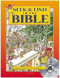
Seek and Find in the Bible
by Scandinavia Publishing House Staff
- Used
- very good
- Hardcover
- Condition
- Used - Very Good
- Binding
- Hardcover
- ISBN 10 / ISBN 13
- 9788772477541 / 8772477547
- Quantity Available
- 1
- Seller
-
Seattle, Washington, United States
- Item Price
-
$7.12
Show Details
Description:
Scandinavia Publishing House, 2012. Hardcover. Very Good. May have limited writing in cover pages. Pages are unmarked. ~ ThriftBooks: Read More, Spend Less.Dust jacket quality is not guaranteed.
Item Price
$7.12
Seek & Find in the Bible
by Scandinavia Publishing
- Used
- good
- Hardcover
- Condition
- Used - Good
- Binding
- Hardcover
- ISBN 10 / ISBN 13
- 9788772477541 / 8772477547
- Quantity Available
- 1
- Seller
-
Seattle, Washington, United States
- Item Price
-
$7.12
Show Details
Description:
Scandinavia Publishing House, 2012. Hardcover. Good. Pages can have notes/highlighting. Spine may show signs of wear. ~ ThriftBooks: Read More, Spend Less.Dust jacket quality is not guaranteed.
Item Price
$7.12

Seek & Find in the Bible
by Scandinavia Publishing
- Used
- good
- Hardcover
- Condition
- Used - Good
- Binding
- Hardcover
- ISBN 10 / ISBN 13
- 9788772477541 / 8772477547
- Quantity Available
- 1
- Seller
-
Seattle, Washington, United States
- Item Price
-
$7.12
Show Details
Description:
Scandinavia Publishing House, 2012. Hardcover. Good. Missing dust jacket; Pages can have notes/highlighting. Spine may show signs of wear. ~ ThriftBooks: Read More, Spend Less.Dust jacket quality is not guaranteed.
Item Price
$7.12

Stock Photo: Cover May Be Different
Joseph and the Hebrews in Egypt
by Scandinavia Publishing House Staff
- Used
- Condition
- Used - Very Good
- ISBN 10 / ISBN 13
- 9788772474533 / 877247453x
- Quantity Available
- 1
- Seller
-
Mishawaka, Indiana, United States
- Item Price
-
$7.62
Show Details
Description:
Used - Very Good. Former library book; may include library markings. Used book that is in excellent condition. May show signs of wear or have minor defects.
Item Price
$7.62