Description:
Bern [Switzerland]: Hans Körber [Koerber] (Huber & Comp.), 1861. Very Good condition. SEE PHOTOS. Karten etwas fleckig (maps somewhat spotted). This is Blatt VIII, Aarau - Luzern Zug - Zürich [Zurich]. The map is dated 1861 and has 21 sections. It is printed on paper, then mounted on cloth (i.e. backed with linen). When folded the map measures 19 cm tall x 11 cm wide. When unfolded, 57 cm tall x 79 cm wide. SEE PHOTOS. Linen-backed, steel-engraved folding map in 21 segments. Scale 1:100,000.. 1861 edition. Hardcover. Very Good (somewhat spotted).
"A New Map of England, Scotland and Ireland" by Tindal, Nicholas - 0
by Tindal, Nicholas

"A New Map of England, Scotland and Ireland"
by Tindal, Nicholas
- Used
- very good
London Map/Print. Illus. by Tindal, Nicholas . Very Good. No Binding. 18th Century Map of the United Kingdom. London c1745. Nicholas Tindal from "The Continuation of Mr. Rapin's History of England: From the Revolution to the Present Times" by Nicholas Tindal (a translation of Rapin-Thoyras's "Histoire d'Angleterre"). ----- The map offers a view of the England, Wales, Ireland and most of Scotland and is entitled "A New Map of England, Scotland and Ireland," with the caption "Rapin Folio Vol. I p. 162" in the lower right corner. ----Fold not prominently noticeable. Wear to bottom edge of map. [was edge of book] Unnoticeable small closed tear upper right corner. Light toning. Rear of map blank. Title cartouche with ornamental borders. Measures approximately 20 inches tall by 15,5 inches. .
-
Bookseller
Independent bookstores
 (US)
(US)
- Illustrator Tindal, Nicholas
- Book Condition Used - Very Good
- Jacket Condition None Issued
- Place of Publication London
![Blatt 8 (VIII) : Aarau - Luzern Zug - Zürich [Zurich] : Topographische Karte der Schweiz :...](https://d3525k1ryd2155.cloudfront.net/h/777/796/330796777.0.m.jpg)
More Photos
Blatt 8 (VIII) : Aarau - Luzern Zug - Zürich [Zurich] : Topographische Karte der Schweiz : Massstab 1 : 100,000, Vermessen und herausgegeben unter Aufsicht von General G. H. Dufour
by Dufour, General G. H. [Guillaume-Henri]
- Used
- Hardcover
- Condition
- Used - Very Good (somewhat spotted)
- Edition
- 1861 edition
- Binding
- Hardcover
- Quantity Available
- 1
- Seller
-
Henderson, Nevada, United States
- Item Price
-
$175.00
Show Details
Item Price
$175.00

More Photos
SMITH'S MAP OF PHILADELPHIA AND VICINITY
by Gannett, Henry; Chief Topographer, U. S. Geological Survey
- Used
- Hardcover
- first
- Condition
- Used - Good+
- Edition
- First Edition Thus; Second Printing
- Binding
- Hardcover
- Quantity Available
- 1
- Seller
-
Fairfield, New Jersey, United States
- Item Price
-
$175.00
Show Details
Description:
Philadelphia: J. L. Smith. Good+. 1904. First Edition Thus; Second Printing. Hardcover. U. S. Geological Survey, surveyed in 1894, edition of 1902, printed in 1904. This is a 30 1/2" x 38 1/2" USGS map that J. L. Smith of Philadelphia, sometime after issue, sectioned (4 sections x 6 sections) and mounted on linen to create a folding pocket map. It is mounted in a 10 x 5.5 inch dark brown embossed and gilded hardcover folder that bears the title "Smith's Map of Philadelphia and Vicinity". The map covers the area north and west well past Norristown and south into Delaware, as well as a good part of New Jersey beyond Camden. It shows the local road network and was made for local travel. The inside cover has original owner's signature. Cover graded G+ due to rubbing along the spine edges & corners. The map is in VG condition. ; Fold out cloth Map; Small 4to 9" - 11" tall .
Item Price
$175.00

More Photos
Africa, Drawn and Engraved from the best Maps and Charts
by Kitchin, T. Sculp (Thomas Kitchen)
- Used
- good
- Condition
- Used - Good
- Binding
- Unknown
- Quantity Available
- 1
- Seller
-
Datil, New Mexico, United States
- Item Price
-
$100.00
Show Details
Description:
London: Harvey's Naval History Original antique map of 18th century Africa. Good condition. Size 34x37cm. Engraved for Harvey's Naval History, published in the early 1780s. This map also had been published in Daniel Fenning's "A New System of Geography" (1770s). The map has moderate foxing, closed tears along some of the folds, and chips & loss in the margins.. Good. Maps.
Item Price
$100.00

GEZICHT VAN DEN BERG ARARAT VAN DEN KANT DER DREI KERKEN (Ansicht des Berges Ararat mit den drei Kirchen - View of Mount Ararat with the Three Churches)
by MOUNT ARARAT - Kupferstich - Original Antique Etching
- Used
- very good
- Condition
- Used - Very Good
- Binding
- Unknown
- Quantity Available
- 1
- Seller
-
Tel-Aviv, Israel
- Item Price
-
$150.00
Show Details
Description:
1727. No Binding. Very Good. ORIGINAL-KUPFERSTICH ( holländische Ausgabe) von 1727 . Ansicht nach der Beschreibung von de Tournefort. 44 x 27,5. Gesamtansicht beider Gipfel. Frisches festes Papier. - ORIGINAL COPPER ETCHING , depicting MOUNT ARARAT - view following the description of Tournefort. Strong and fresh paper quality. -
Item Price
$150.00

More Photos
Britannicae Insulae: Antique map of Great Britain
by Robert de Vaugondy
- Used
- very good
- Condition
- Used - Very Good
- Quantity Available
- 1
- Seller
-
Providence, Seychelles
- Item Price
-
$175.00
Show Details
Description:
FULL TITLE: Britannicae, Insulae in quibus Albion Seu Britannia Major, et Ivernia seu Britannia Minor juxta Ptolemaei mentem divisae tùm in suas majores partes, tùm in populos exhibentur, à Nicolao sanson Christ, Regis Geographo, Revisae, et ad observationes astronomicas redactae, accurante Robert de Vaugondy filio, gum Privilegio Regis'DATE PRINTED: 1750 IMAGE SIZE: Approx 50.0 x 55.0cm, 19.5 x 21.5 inches (Large); Please note that this is a folding map.TYPE: Large antique 18th-century atlas map, printed on thick, good quality paper. partially hand-colored.CONDITION: Good; suitable for framing. Please check the scan for any blemishes prior to making your purchase. Virtually all antiquarian maps and prints are subject to some normal aging due to use and time which is not obtrusive unless otherwise stated. We offer a no-questions-asked return policy.AUTHENTICITY: This is an authentic historic map, published at the date stated above. It is not a modern copy.VERSO: Short map title printed on the…
Read More Item Price
$175.00

Maps and Mapmakers of the Aegean
by Sphyroeras, Vasilis Avramea, Anna Ashdrahas, Spyros
- Used
- as new
- Hardcover
- first
- Condition
- As New
- Jacket Condition
- as new
- Edition
- First English language edition
- Binding
- Hardcover
- Quantity Available
- 1
- Seller
-
Thessaloniki, Greece
- Item Price
-
$108.56
Show Details
Description:
Athens: Olkos, 1985. First English language edition. Hardcover. As New/as new. As new hardcover with DJ. 1st english ed. 263pages, 29X21,8cm.Translated by G. Cox, J. Solman. The charting of the Aegean Sea, or the Greek Archipelago, from the 15th up to the 19th century. Map Index; General Index. 166 color and black & white maps.
Item Price
$108.56
More Photos
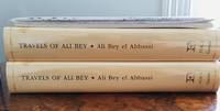
Travels of Ali Bey In Morocco, Tripoli, Cyprus, Egypt, Arabia, Syria, and Turkey. Volume One: Between the Years 1803 and 1807
by Ali Bey
- Used
- Fine
- Hardcover
- first
- Condition
- Used - Fine
- Jacket Condition
- Fine
- Edition
- 1st Edition (Folios Archive Library)
- Binding
- Hardcover
- ISBN 10 / ISBN 13
- 9781873938393 / 187393839X
- Quantity Available
- 1
- Seller
-
Port Fairy, Victoria, Australia
- Item Price
-
$99.21
Show Details
Description:
Part of a Two volumes set. See Volume Two. Numerous B/W pictures, drawings, maps in separate folders. Introduction by Robin Bidwell.
Item Price
$99.21
![Southern Regions; [Published in Colton's General Atlas, 1861 as No. XIII]](https://d3525k1ryd2155.cloudfront.net/h/589/126/1453126589.0.m.jpg)
More Photos
Southern Regions; [Published in Colton's General Atlas, 1861 as No. XIII]
by Colton, George
- Used
- very good
- first
- Condition
- Used - Very Good
- Edition
- First State, later printing
- Binding
- Unknown
- Quantity Available
- 1
- Seller
-
Sebastopol, California, United States
- Item Price
-
$168.00
Show Details
Description:
New York: J. H. Colton & Co, 1855. First State, later printing. Very Good. [14x11in Neatline, 17.5x14.25in Sheet]; Map with distinctive Colton borders of discovered Antarctic features of few land features and the ice covered coast line as of 1855 from reports of explorers; Some age-toning and light stains along edges [Rumsey Collection 2441.009]. The Southern Regions map was initially drawn and engraved for publication in Colton's General Atlas of 1855. Colton reissued atlases in different formats, pagination and collation over the years. This map was from the 1861 issue and distinctive in the roman numerals format and number placement. The map has not been altered since 1855. The details on the map are from six explorations over a 70 year period from 1773 to 1843. The continent of Antarctica was completely unknown prior to James Cook's second voyage of the Resolution and Adventure 1772-1775. Others followed fifty years later Bellinghausen, 1820, Briscoe 1831-32, Kemp 1833, Wilkes 1940, and Ross…
Read More Item Price
$168.00

More Photos
Mediterranean, the Dardanelles (ancient Hellespont): Nautical map of the Dardanelles
by Hydrographic Office of Great Britain
- Used
- Condition
- Used - Good-
- Edition
- Large corrections Sept. 1880. Small corrections to 1914.
- Quantity Available
- 1
- Seller
-
Providence, Seychelles
- Item Price
-
$175.00
Show Details
Description:
Hydrographic chart of the Dardanelles Strait region, Turkey. Relief is shown by spot heights and hachures. Depths are shown by bathymetric isolines and soundings.The chart is damaged along the edges with some tears in the middle. Wrinkles and some pencil inscriptions, signs of aging and wear. Please see the photos. Free Shipping included. The map will be shipped in a strong cardboard tube.If you have any questions or inquiries, please don't hesitate to contact us!
Item Price
$175.00

More Photos
A Bird’s-Eye View of Narragansett Bay.
by J.A. & R.A. Reid
- Used
- Condition
- Used
- Quantity Available
- 1
- Seller
-
Houston, Texas, United States
- Item Price
-
$175.00
Show Details
Description:
A Bird's-Eye View of Narragansett Bay. [Providence, R.I.]: J.A. & R.A. Reid. 1888. Black and white bird's eye map. 50 x 72 cm. Has been folded. Very good. OCLC shows no holdings. Probably produced for Reid's Illustrated Sea Side Souvenir, which is itself very scarce, with only two holdings for any years (Brown Univ. & RI Hist. Soc.). A nice display piece. Inset of light house and sailboat. Index of places.
Item Price
$175.00
Stock Photo: Cover May Be Different
THE HISTORY OF THE GROWTH AND DECAY OF THE OTHMAN EMPIRE
by Dimitrie Cantemir, Voivode of Moldavia, 1673-1723 [author]; Tindal, N. (Nicholas), 1687-1774 [translator]
- Used
- Condition
- Used
- ISBN 10 / ISBN 13
- 9781170998502 / 117099850x
- Quantity Available
- 1
- Seller
-
Rockville, Maryland, United States
- Item Price
-
$21.00
Show Details
Description:
Eighteenth Century Collection Online Print Editions. Softcover. Octavo; Reprint of edition published by A. Millar, London, 1756; VG-; Paperback; Spine, tan with black print; Cover has light edgewear, clean and bright; Text block clean and tight; xv, 460 pages, illustrated (b&w). 1363887. FP New Rockville Stock.
Item Price
$21.00

Stock Photo: Cover May Be Different
Report of The Trial of The Action, Bogle versus Lawson, for A Libel Publshed in "The Times" London-Newspaper, Tried at The Summer Assizes for The County of Surrey, Held at Croydon
by Tindal, Nicholas Conyngham
- Used
- good
- Paperback
- Condition
- Used - Good
- Binding
- Paperback
- ISBN 10 / ISBN 13
- 9781275114715 / 1275114717
- Quantity Available
- 1
- Seller
-
HOUSTON, Texas, United States
- Item Price
-
$29.57
Show Details
Description:
Gale, Making of Modern Law, 2012-02-16. Paperback. Good.
Item Price
$29.57

Engraved Portrait of Tindal, Half Length, books behind, in oval frame, on pedestal with coat of arms, after George Knapton [1698-1778] by Bernard Picart.
by NICHOLAS TINDAL [1687-1774] Historical Writer and Translator
- Used
- Condition
- Used
- Quantity Available
- 1
- Seller
-
Ilminster, Somerset, United Kingdom
- Item Price
-
$25.34
Show Details
Description:
Engraving, good margins, some creasing,
Item Price
$25.34
Stock Photo: Cover May Be Different
Report of the Trial of the Action, Bogle Versus Lawson, for a Libel Publshed in the Times London-Newspaper, Tried at the Summer Assizes for the County of Surrey, Held at Croydon
by Nicholas Conyngham Tindal
- New
- Paperback
- Condition
- New
- Binding
- Paperback
- ISBN 10 / ISBN 13
- 9781275114715 / 1275114717
- Quantity Available
- 10
- Seller
-
Southport, Merseyside, United Kingdom
- Item Price
-
$30.28
Show Details
Description:
Paperback / softback. New.
Item Price
$30.28

More Photos
Spence's polymetis abridged or A guide to classical learning....With an introduction by Nicholas Tindall, sixth edition corrected.
by Spence. Joseph/Tindal. Nicholas
- Used
- very good
- Hardcover
- Condition
- Used - Very Good
- Jacket Condition
- No Jacket
- Edition
- 5th or later Edition
- Binding
- Hardcover
- Quantity Available
- 1
- Seller
-
Carmarthenshire, United Kingdom
- Item Price
-
$57.01
Show Details
Description:
London: J. Johnson et al, 1802. 5th or later Edition . Hardcover. Very Good/No Jacket. 8vo - over 7¾" - 9¾" tall. original full leather hardcover, 12 of 13 engraved plates ( lacks plate 3, Venus of Medici) xxiv, 1-166pp plus index pages, covers rubbed and chipped otherwise a very good clean copy. We are a real bookshop with real books situated in and shipping from the United Kingdom. Shelf B/A
Item Price
$57.01
Spence's polymetis abridged or A guide to classical learning
by Tindal, Nicholas:
- Used
- Hardcover
- Condition
- Used
- Binding
- Hardcover
- Quantity Available
- 1
- Seller
-
The Basin, Victoria, Australia
- Item Price
-
$66.14
Show Details
Description:
London; J Johnson, 1802 leather bound hardcover. 166p, plus index. front cover detached.
Item Price
$66.14

More Photos
A GUIDE TO CLASSICAL LEARNING; or Polymetis abridged.
by Tindal, N[icholas] (1687-1774) (Joseph Spence 1699-1768)
- Used
- very good
- Hardcover
- Condition
- Used - Very Good
- Binding
- Hardcover
- Quantity Available
- 1
- Seller
-
Blockley, Gloucestershire, United Kingdom
- Item Price
-
$311.68
Show Details
Description:
London: R.Horsfield & J.Dofdley 2nd edition corrected and inlarged, 1765. Hardcover. Very Good. copperplates [12 including one folding of star constellations by P.Fourdrinier] with from one to six images] these probably used previously in Spence's Polymetis as page numbering is entirely incorrect.. 12mo marbled tan leather on 5 raised bands with extra gilt floral decoration and red title label to spine.Gilt dentelles. Spine slightly worn, coverpage slightly loose[tiny bit bleached to one corner]. Plate 1 as frontis +Title-page in red and black +[6p-Introduction] +279pp +[6p=index] +1 leaf over publisher's booklist. 1 Pullout illustration on p173. Except for endpapers's browning/foxing to edges a lovely clean copy in a charming binding in overall very nice condition. *Deals with the Ancient Greek and Roman deities, heroes, poets, and other classical figures and the statuary and artwork produced. This book is an abridgment by Tindal of Joseph Spence's 'Polymetis', Printed on Ludgate Srt.
Item Price
$311.68

More Photos
The History of England, Vol. I
by de Rapin, Paul, [Thoyras], translated by Rev. Nicholas Tindal
- Used
- Hardcover
- Condition
- Used - , boards scuffed, lacks frontispiece, hinges cracked thus covers loosely held, creasing and edge tears to some plates, occasiona
- Edition
- Third Edition
- Binding
- Hardcover
- Quantity Available
- 1
- Seller
-
Skipton, North Yorkshire, United Kingdom
- Item Price
-
$443.45
Show Details
Description:
, 798 pages, with all 4 folding maps, 8 genealogical tables and 44 other plates, (Books I-XV), pages 691-800 of later edition [1817] at the rear with 7 plates, continues from vol I (Books XVI-XVII), English translation from the French
Item Price
$443.45

The continuation of M. Rapin de Thoyras's History of England : from the revolution to the accession of King George II: in three volumes
by Tindal, Nicholas (1687-1774). Rapin de Thoyras M. Paul (1661-1725)
- Used
- Hardcover
- Condition
- Used
- Edition
- Second Edition
- Binding
- Hardcover
- Quantity Available
- 1
- Seller
-
Galway, Ireland
- Item Price
-
$510.00
Show Details
Description:
London: printed for James, John, and Paul Knapton, at the Crown in Ludgate-street, near the West-End of St. Paul's, 1733. Second Edition. Hardcover. Poor set in the original full worn aniline calf; wear and tear as with age. Text remains in fine condition and without blemish. Provenance; from the library of James Whatman with the owner's bookplate. Physical description; 3 vols. ( vol. II, vol. IV and vol. IV: part II) : ill. ; 41 cm. Subjects; Great Britain History ; Early works to 1800. Genre; Illustrated.
Item Price
$510.00

A Correct Chart of the Mediterranean Sea
by RAPIN DE THOYRAS, Paul and TINDAL, Nicholas
- Used
- Condition
- Used
- Quantity Available
- 1
- Seller
-
New York, New York, United States
- Item Price
-
$750.00
Show Details
Description:
1751. Map. Engraving with hand coloring. Image 13 1/2" x 28 1/4"<br/> <br/> Striking sea chart of the Mediterranean Sea with coastlines extensively labeled. Extends from the straits of Gibraltar to the Levant. Inset for the Road of Leghorn in the upper right corner, depicting the city of Livorno and surroundings. This map is in excellent condition, with no chips or tears. Minor toning to original centerfold, crease to upper left corner, and minimal scattered foxing.<br> <Br> Richard William Seale (1732--1775) was a British engraver and cartographer in the Rococo tradition. While known best for his maps of England, he also contributed to many books, atlases, and magazines. Published in the English edition of Rapin's "History of England" (1724-27), translated from the French by Tindal.<br/> <br/>
Item Price
$750.00

More Photos
The Sky and the Forest
by Forester, C.S
- Used
- very good
- Hardcover
- first
- Condition
- Used - Very Good
- Jacket Condition
- Very Good
- Edition
- First Edition
- Binding
- Hardcover
- Quantity Available
- 1
- Seller
-
Salem, Oregon, United States
- Item Price
-
$34.89$20.93Save $13.96!
Show Details
Description:
C.S. Forester: The Sky and the Forest. Little, Brown and Company, Boston. Stated First Edition First Printing Thus August, 1948. Cover price $2.75. Used. VG BOOK/VG UNCLIPPED DUST JACKET. A story of a central Africa. By C.S. Forester, author of the Admiral Hornblower series.
Item Price
$34.89$20.93
Save $13.96
!
![Alaska and Klondike Region; [With inset of Klondike Region on the Upper Yukon detail] [From an...](https://d3525k1ryd2155.cloudfront.net/h/062/537/1339537062.0.m.jpg)
Alaska and Klondike Region; [With inset of Klondike Region on the Upper Yukon detail] [From an atlas, "Gazetteer of Alaska and Yukon Region " pp. 105 and 106]
by Miller, J. Martin
- Used
- very good
- Condition
- Used - Very Good
- Edition
- Unknown
- Quantity Available
- 1
- Seller
-
Sebastopol, California, United States
- Item Price
-
$39.00
Show Details
Description:
Chicago: J. Martin Miller, 1899. Unknown. Map. Very Good. [Map copyright 1899, printing date of Atlas later] [19.875x15.125in]; Colored map of Alaska with steamer routes from Portland and Seattle, insets of the Klondike Region on the Upper Yukon and Western portion of Aleutian Islands; On verso index of places and names with two large black and white images; Age toning to all edges, water stain marks on bottom, slight printing offset of colors, small chips and closed tears to lower edge;.
Item Price
$39.00

Zemepis Sveta - Monsunova Asie
by De La Blache, P. Vidal; Gallois, L
- Used
- Hardcover
- Condition
- Used - Very Good Condition
- Jacket Condition
- No Dust Jacket
- Binding
- Hardcover
- Quantity Available
- 1
- Seller
-
Oak Point, Texas, United States
- Item Price
-
$60.00
Show Details
Description:
Aventinum, Prague, Czechoslovakia, 1930. Hardcover. Very Good Condition/No Dust Jacket. Text entirely in Czech. Geography book on Asia with numerous photographs and maps. 1931 edition also available. Size: 4mo - over 9 3/4" - 12" tall. 400 pp. Pages are yellowed, but are tight and clean. Moderate shelfwear along the spine. Corners are lightly bumped. Quantity Available: 1. Shipped Weight: 3-5 pounds. Category: Travel & Places; Non-English Language::Czech; Pictures of this item not already displayed here available upon request. Inventory No: 001227. . Additional shipping charges may apply.
Item Price
$60.00

Zemepis Sveta - Monsunova Asie
by De La Blache, P. Vidal; Gallois, L
- Used
- Hardcover
- Condition
- Used - Very Good Condition
- Jacket Condition
- No Dust Jacket
- Binding
- Hardcover
- Quantity Available
- 1
- Seller
-
Oak Point, Texas, United States
- Item Price
-
$60.00
Show Details
Description:
Aventinum, Prague, Czechoslovakia, 1931. Hardcover. Very Good Condition/No Dust Jacket. Text entirely in Czech. Geography book on Asia with numerous photographs and maps. 1930 edition also available. Size: 4mo - over 9 3/4" - 12" tall. 400 pp. Pages are yellowed, but are tight and clean. Moderate shelfwear along the spine. Corners are lightly bumped. Quantity Available: 1. Shipped Weight: 3-5 pounds. Category: Travel & Places; Non-English Language::Czech; Pictures of this item not already displayed here available upon request. Inventory No: 001228. . Additional shipping charges may apply.
Item Price
$60.00

Asia from the Best Authorities, Russell, ca.1800
by Russell
- Used
- Condition
- Used
- Quantity Available
- 1
- Seller
-
Plymouth, Devon, United Kingdom
- Item Price
-
$25.34
Show Details
Description:
Russell, J. : Asia from the Best Authorities. Nd but ca.1800. From "A New Geographical, Historical and Commercial Grammar and Present State of Several Kingdoms of the World". Copper engraving. Size approx 200 x 230mm. Two neat folds. Some age colouring to edges, otherwise clean and bright. Includes Arabia, India, Borneo, Japan, China and eastern Russia.
Item Price
$25.34

North America from the Best Authorities, Russell, ca.1800
by Russell
- Used
- Condition
- Used
- Quantity Available
- 1
- Seller
-
Plymouth, Devon, United Kingdom
- Item Price
-
$25.34
Show Details
Description:
Russell, J. : A General Map of North America from the Best Authorities. Nd but ca.1800. From "A New Geographical, Historical and Commercial Grammar and Present State of Several Kingdoms of the World." Copper engraving. Size approx 200 x 230mm. Two neat folds. Some age colouring to edges, otherwise very clean and bright.
Item Price
$25.34
![MAP OF UTAH [Territory]](https://d3525k1ryd2155.cloudfront.net/h/836/461/1485461836.0.m.jpg)
More Photos
MAP OF UTAH [Territory]
- Used
- Condition
- Used - Very Good-
- Edition
- Original
- Quantity Available
- 1
- Seller
-
Williamsburg, Virginia, United States
- Item Price
-
$65.00
Show Details
Description:
New York, Richmond, Chicago, & Toledo: H. H. Hardesty, 1885. Original color lithographed map printed by Rand, McNally & Company, Engravers and published in HARDESTY'S HISTORICAL AND GEOGRAPHICAL ENCYCLOPEDIA: SPECIAL VIRGINIA EDITION. 19 3/8 inches by 13 1/4 inches on a 21" X 14 1/2" sheet. The map depicts the Territory of Utah in its final form--large areas had been removed and ceded to Nevada, Colorado, Wyoming, and Nebraska since Utah became a U. S. Territory in 1850. The issue of polygamy prevented statehood until it was finally granted in 1896. This map features railroads and topography and uses color to set off counties from each other. Unlike most atlas maps of the period, this map identifies most small towns. The map is guaranteed to be moe than 135 years old. The map is in about very good condition: generally clean and bright, with slight toning of paper and one faint water stain near the center-left edge of the map.. Original. Single Sheet. Very Good-. Elephant…
Read More Item Price
$65.00

Philips Special Map of the Nile, The Advance on Khartum and the Environs of Omdurman. Cc1900
by George Philips and Son,
- Used
- Condition
- Used
- Quantity Available
- 1
- Seller
-
Plymouth, Devon, United Kingdom
- Item Price
-
$32.94
Show Details
Description:
Philips Special map of the Nile illustrating the Advance on Khartum [Khartoum] with an enlargement of the environs of Omdurman [Omdur]. George Philips and Son, London and Liverpool Ca 1900. 580mm x 900mm folded map. Front title wrapper has come loose, not affecting map area. Three maps are displayed within the sheet. Map1. Map of the Nile Valley 520mm x 300mm showing the approaches of Khartum. Scale 1inch to 100 Geographical miles. Coloured indicating Possessions and Protectorates of European Powers. Map 2. Special map of the Nile from Dongola to Khartum. Scale 16 miles to the inch. Coloured. In set in this map is Map3. Environs of Omdurman, Scale 5 statute miles to the inch. Some small breaks at some folds, not affecting imagery or use of map. Title label is damaged, the map is clean and bright, probably unused. A very interesting record.
Item Price
$32.94

Last Tales
by Dinesen, Isak
- Used
- very good
- Hardcover
- first
- Condition
- Used - Very Good
- Jacket Condition
- Good+
- Edition
- First Edition
- Binding
- Hardcover
- Quantity Available
- 1
- Seller
-
Salem, Oregon, United States
- Item Price
-
$120.00$72.00Save $48.00!
Show Details
Description:
Dinesen, Isak: Last Tales, A Collection of Twelve New Tales of Compelling Beauty 1957, Random House. First Edition. Stated First Printing Thus. Used. Very Good/Good+ original red dust jacket, price-clipped. Jacket states 11/57 on front flap. 5 3/4 X
Item Price
$120.00$72.00
Save $48.00
!

The Adventure of Wrangel Island
by Vilhjalmur Stefansson
- Used
- good
- Hardcover
- first
- Condition
- Used - Good
- Jacket Condition
- No DJ Included
- Edition
- First Edition
- Binding
- Hardcover
- Quantity Available
- 1
- Seller
-
Salem, Oregon, United States
- Item Price
-
$124.89$74.93Save $49.96!
Show Details
Description:
The Adventure of Wrangel Island, Alaska (1925 Macmillan 1st Edition) HISTORY OF ALASKA. EXLIB. Good Condition/ No DJ included. Fold-out map affixed to binding at the back of the book has never been opened. The story of the (unsuccessful) attempted colonization of Wrangel Island Alaska. 413 pages plus appendix, Index. Titling is still bright. A clean, solid copy. Scarce.
Item Price
$124.89$74.93
Save $49.96
!