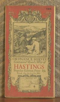
ORDNANCE SURVEY CONTOURED ROAD MAP OF HASTINGS Popular edition Scale 1 inch to 1 mile- Sheet # 135
by Ordnance Survey
- Used
- very good
- Condition
- Very Good
- Seller
-
Blue Hill, Maine, United States
Payment Methods Accepted
About This Item
Southampton: Ordnance Survey Office/ Charles Close Dir., 1921. Third revised edition. Map. Very Good. 4 X 7 in. high. unfolds to 30 X 21 inches. Condition of the book is VERY GOOD; Map is very clean, lightly rubbed at folds, but no splits or tears. Geography Ephemera
Reviews
(Log in or Create an Account first!)
Details
- Seller
- Andre Strong Bookseller
 (US)
(US)
- Seller's Inventory #
- 6465
- Title
- ORDNANCE SURVEY CONTOURED ROAD MAP OF HASTINGS Popular edition Scale 1 inch to 1 mile- Sheet # 135
- Author
- Ordnance Survey
- Format/Binding
- Map
- Book Condition
- Used - Very Good
- Quantity Available
- 1
- Edition
- Third revised edition
- Publisher
- Ordnance Survey Office/ Charles Close Dir.
- Place of Publication
- Southampton
- Date Published
- 1921
- Bookseller catalogs
- Geography;
Terms of Sale
Andre Strong Bookseller
30 day return guarantee, with full refund including shipping costs for up to 30 days after delivery if an item arrives misdescribed or damaged.
About the Seller
Andre Strong Bookseller
Biblio member since 2008
Blue Hill, Maine
About Andre Strong Bookseller
Andre Strong Bookseller is located in Blue Hill, on the coast of Maine. We offer 22,000 books for sale online, and work from an office and rare book room, with a warehouse adjacent. We carry a wide selection of fine books on every subject, with specialization in art, architecture, photography, nautical, Maine and fiction. We do not have an open shop - if you'd like to visit, please arrange an appointment.
Glossary
Some terminology that may be used in this description includes:
This Book’s Categories

The American Eclipse of 2017
The path of the total eclipse of August 2017 had our offices at 99% totality - we closed the office to go watch the spectacle, but first we put together this gallery inspired by eclipses to celebrate.

Collecting Children’s Literature
Children’s books are among some of the most popular themes to build a book collection on. Learn a bit more in our Brief History of Children’s Literature.