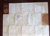
Description:
Ordnance Survey, 1947. Paperback. Good. 1947. Unpaginated. Orange and white pictorial paperback. Sheet 131. Map is bright and clear with some light foxing and tanning. Slight creases to corners.
Ordnance Survey Map [Scotland] Rothesay Sheet 26 Scale 2 Miles to 1 Inch [Price Two Shillings] by Ordnance Survey: - 1908
by Ordnance Survey:
Similar copies are shown below.
Similar copies are shown to the right.

Ordnance Survey Map [Scotland] Rothesay Sheet 26 Scale 2 Miles to 1 Inch [Price Two Shillings]
by Ordnance Survey:
- Used
- very good
- Paperback
Southampton: Ordnance Survey. Very Good. 1908. Paperback. White covers, mounted on linen, coloured map. Covers clean and sound. The map has light foxing in a few places but generally very good. Map # 2014; 8vo 8" - 9" tall .
-
Seller
Independent bookstores
 (GB)
(GB)
- Format/Binding Paperback
- Book Condition Used - Very Good
- Binding Paperback
- Publisher Ordnance Survey
- Place of Publication Southampton
- Date Published 1908
We have 4 copies available starting at $6.67.

Ordnance Survey Map : Birmingham Sheet 131 ( On Cloth ) : New Popular Edition One Inch Map Of England & Wales (1947)
by Ordnance Survey
- Used
- good
- Paperback
- Condition
- Used - Good
- Binding
- Paperback
- Quantity Available
- 1
- Seller
-
Goring-by-Sea, West Sussex, United Kingdom
- Item Price
-
$6.67
Show Details
Item Price
$6.67
ORDNANCE SURVEY MAP - 1923 - N0 47- LINCOLN
by Ordnance Survey
- Used
- Paperback
- Condition
- Used - read description
- Binding
- Paperback
- Quantity Available
- 1
- Seller
-
South Kelsey, Lincolnshire, United Kingdom
- Item Price
-
$3.77
Show Details
Description:
United Kingdom: Ordnance Survey. Front cover has a 3 cm slit/tear and small section of bottom outer corner of rear cover is missing. Cover has general wear and has been reinforced with old sellotape around edge of rear cover. The map itself show signs of having been but has no tears. See image from Winghale Books. ORDNANCE SURVEY MAP - 1923 - N0 47- LINCOLN. one inch to one mile . read description. Soft cover. 1923.
Item Price
$3.77

Ordnance Survey Map : Winchester Sheet 168 New Popular Edition One Inch Map Of England & Wales (1945)
by Ordnance Survey
- Used
- good
- Paperback
- Condition
- Used - Good
- Binding
- Paperback
- Quantity Available
- 1
- Seller
-
Southampton, Hampshire, United Kingdom
- Item Price
-
$13.82
Show Details
Description:
Ordnance Survey, 1945. Paperback. Good. GC,Ordnance Survey Map of Winchester, sheet 168. Ordnance Survey Office,1945.One-Inch Map.Scale 1:63,360.The map is in GC but the front and back cover are separated from the map ( small tears,chipped and mark on the edges of the cover) but still included, two small tears on the edges of the map.The map is in GC for its age with some shelf wear.
Item Price
$13.82

Ordnance Survey Map: Ancient Britain: South Sheet Second Edition
by Ordnance Survey
- Used
- good
- Paperback
- Condition
- Used - Good
- Binding
- Paperback
- Quantity Available
- 1
- Seller
-
Devizes, Wiltshire, United Kingdom
- Item Price
-
$33.79
Show Details
Description:
Ordnance Survey, 1964-01-01. Paperback. Good. 19 to 25 cm tall, Octavo, (8vo). Posted within 1 working day. 1st class tracked post to the UK, Airmail tracked worldwide. Robust recyclable packaging.
Item Price
$33.79