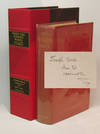
Plan of Boston comprising a part of Charlestown and Cambridge
by SMITH, George G. (1795-1878)
- Used
- Condition
- See description
- Seller
-
New York, New York, United States
Payment Methods Accepted
About This Item
Boston: George G. Smith ... Also by Ide and Dutton, 1855. Engraved folding pocket map, period hand-colouring in outline. Inset maps of South Boston and East Boston. Street index along the left margin. Folds into publisher's blindstamped cloth covers, title stamped in gilt on the upper cover, Ide & Dutton advertisement on the front pastedown. A noted mid-19th century map of Boston: among the earliest to show the proposed filling of Back Bay.
This decorative map of Boston shows the city divided into wards and fire districts, with the city's streets and wharves named. The map further identifies many of the public buildings, schools and churches located in the city. The most notable feature on this map, however, is its depiction of the proposed filling of Back Bay. "The tide mills had not been successful and, cut off by the Mill Dam and with the flow of water further impeded by the railroad embankments, the Back Bay, into which all the sewers from surrounding areas drained, had become a stinking cesspool. By the early 1850s it was determined that the only solution was to fill the bay, and in 1854 the state and the Boston Water Power Company, the two major owners of the Back Bay flats, made an agreement for filling them. This agreement included the street grid plan shown on the 1855 map. This street grid had been laid out without regard for the railroad tracks, and eventually only the streets east of Dartmouth, which is just west of the point where the tracks crossed, were constructed..." (Mapping Boston, plate 39, page 205). The filling of Back Bay would begin in 1857 and take nearly twenty-five years to complete. This copy an unusual variant, with a large reservoir appearing just below the Mill Dam, with the explanation "Plan of improvement proposed by Hon. David Sears." This reservoir was removed in subsequent issues of the map, suggesting this to be an early state.
Mapping of Boston, p. 205.
Reviews
(Log in or Create an Account first!)
Details
- Seller
- Donald Heald Rare Books
(US)
- Seller's Inventory #
- 25831
- Title
- Plan of Boston comprising a part of Charlestown and Cambridge
- Author
- SMITH, George G. (1795-1878)
- Book Condition
- Used
- Quantity Available
- 1
- Publisher
- George G. Smith ... Also by Ide and Dutton
- Place of Publication
- Boston
- Date Published
- 1855
- Bookseller catalogs
- Pocket Maps;
Terms of Sale
Donald Heald Rare Books
All items are guaranteed as described. Any purchase may be returned for a full refund within 10 working days as long as it is returned in the same condition and is packed and shipped correctly.
About the Seller
Donald Heald Rare Books
Biblio member since 2006
New York, New York
About Donald Heald Rare Books
Donald Heald Rare Books, Prints, and Maps offers the finest examples of antiquarian books and prints in the areas of botany, ornithology, natural history, Americana and Canadiana, Native American, voyage and travel, maps and atlases, photography, and more. We are open by appointment only.
Glossary
Some terminology that may be used in this description includes:
- G
- Good describes the average used and worn book that has all pages or leaves present. Any defects must be noted. (as defined by AB...
- Cloth
- "Cloth-bound" generally refers to a hardcover book with cloth covering the outside of the book covers. The cloth is stretched...
- Gilt
- The decorative application of gold or gold coloring to a portion of a book on the spine, edges of the text block, or an inlay in...
- Plate
- Full page illustration or photograph. Plates are printed separately from the text of the book, and bound in at production. I.e.,...


