Description:
Tallis, John: South Australia. London. [ca.1851]. From the Montgomery Martin Illustrated Atlas. Map engraved by Rapkin. Size approx 360 x 260mm. Original steel engraved map with original outline hand colouring and decorative border. 5 vignettes include Australian Dog, Natives on a Catamaran and Adelaide. Single page unfolded map in excellent, clean condition. Associated text page of the Montgomery Martin Atlas included. A good Tallis Map.
Reproduction Map) Plan Of The Harbour, Town & Forts Of Porto Bello -
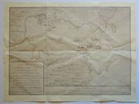
Reproduction Map) Plan of the Harbour, Town & Forts of Porto Bello
- Used
- near fine
- Paperback
No Place: No Publisher Bottom right states " By permission of the British Library", Map Number 83670, (2), Plan of the Harbour, Town & Forts of Porto Bello. Near Fine, folded once horizontally, twice vertically. The greatest British success in the War of Jenkin's Ear, fought against the Spanish. Nicely suited for framing, will be mailed folded. . Reprint. Map. Near Fine. 24 3/4" w x 18 3/4" h.
-
Bookseller
Independent bookstores
 (US)
(US)
- Format/Binding Paperback
- Book Condition Used - Near Fine
- Edition Reprint
- Binding Paperback
- Publisher No Publisher
- Place of Publication No Place
- Size 24 3/4" w x 18 3/4" h
- Size 24 3/4" w x 18 3/4" h

South Australia.: Original Antique Map
by John Tallis & Rapkin
- Used
- first
- Condition
- Used
- Edition
- 1st Edition
- Quantity Available
- 1
- Seller
-
Plymouth, Devon, United Kingdom
- Item Price
-
$101.36
Show Details
Item Price
$101.36

More Photos
Africa, Drawn and Engraved from the best Maps and Charts
by Kitchin, T. Sculp (Thomas Kitchen)
- Used
- good
- Condition
- Used - Good
- Binding
- Unknown
- Quantity Available
- 1
- Seller
-
Datil, New Mexico, United States
- Item Price
-
$100.00
Show Details
Description:
London: Harvey's Naval History Original antique map of 18th century Africa. Good condition. Size 34x37cm. Engraved for Harvey's Naval History, published in the early 1780s. This map also had been published in Daniel Fenning's "A New System of Geography" (1770s). The map has moderate foxing, closed tears along some of the folds, and chips & loss in the margins.. Good. Maps.
Item Price
$100.00

The Sea on Paper: The story of the Van Keulens and their Sea-torch
by C Koeman
- Used
- Hardcover
- Condition
- Used
- Edition
- Facsimile
- Binding
- Hardcover
- ISBN 10 / ISBN 13
- 9789022112489 / 9022112489
- Quantity Available
- 1
- Seller
-
Canmore, Alberta, Canada
- Item Price
-
$99.98
Show Details
Description:
This is imitation leather brown boards with gilt title and crest on the front, gilt also on spine.Inscription on page 14th Sept 1972. Introduction to the facsimile edition of the Nieuwe Groote Lichtende Zee-fakkel 1728. Advertisement of sea atlases 1695 on page 58 - black and white illustration of the House Van Keulen 1647 on page 61, then various maps from 5501 70 5587
Item Price
$99.98

More Photos
A List of Geographical Atlases in the Library of Congress. Four Volumes. (1909-1920)
by Phillip Lee Phillips; Library of Congress
- Used
- Hardcover
- first
- Condition
- Used - Very Good-
- Edition
- First
- Binding
- Hardcover
- Quantity Available
- 1
- Seller
-
Tucson, Arizona, United States
- Item Price
-
$100.00
Show Details
Description:
First edition, four volumes, 1909-1920, Washington. Overall very good condition in original bindings. Notable for the complete absence of library or ownership markings. The only marking I can find is an old pencil note on the front blank of volume 3. Includes bound in errata slips and a promotional leaf for the series laid in. The boards have some dings to the corners. Volume 3 has the most condition issues: shows the most outer wear with some stains on the edges and wear on spine and boards (see scans). Bindings are all sound, which I expect can be an issue with this heavy set. A quite decent usable set. Please see scans of the books you will receive.
Item Price
$100.00
Freetown, Sierra Leone, Special Sheet map 1:50,000 (DOS, 419; 1968)
by United Kingdom. Directorate of Overseas Surveys
- Used
- very good
- first
- Condition
- Used - Very Good
- Edition
- First Edition
- Quantity Available
- 1
- Seller
-
Arlington, Virginia, United States
- Item Price
-
$142.50$85.50Save $57.00!
Show Details
Description:
RARE! Tolworth, Surrey, England: Great Britain. Directorate of Overseas Surveys, 419. First Edition. 1968. D.O.S. 419. Printed on one side. Color. 45.5" x 31" (116 x 79 cm) heavy paper sheet, folded after purchase. Condition: Very Good: Map is unmarked. Small tears, chips, and tape scars to the margins. Creases from post-purchase folding. Suitable for mounting/framing. Contents: Freetown Peninsula (Western Area) 1:50,000; Inset: Freetown (city center) 1:10,000; Inset: Banana Islands 1:50,000.
Item Price
$142.50$85.50
Save $57.00
!
South Australia.: Original Antique Map
by John Tallis & Rapkin
- Used
- first
- Condition
- Used
- Edition
- 1st Edition
- Quantity Available
- 1
- Seller
-
Plymouth, Devon, United Kingdom
- Item Price
-
$101.36
Show Details
Description:
Tallis, John: South Australia. London. [ca.1851]. From the Montgomery Martin Illustrated Atlas. Map engraved by Rapkin. Size approx 360 x 260mm. Original steel engraved map with original outline hand colouring and decorative border. 5 vignettes include Australian Dog, Natives on a Catamaran and Adelaide. Single page unfolded map in excellent, clean condition. Associated text page of the Montgomery Martin Atlas included. A good Tallis Map.
Item Price
$101.36
More Photos
Africa, Drawn and Engraved from the best Maps and Charts
by Kitchin, T. Sculp (Thomas Kitchen)
- Used
- good
- Condition
- Used - Good
- Binding
- Unknown
- Quantity Available
- 1
- Seller
-
Datil, New Mexico, United States
- Item Price
-
$100.00
Show Details
Description:
London: Harvey's Naval History Original antique map of 18th century Africa. Good condition. Size 34x37cm. Engraved for Harvey's Naval History, published in the early 1780s. This map also had been published in Daniel Fenning's "A New System of Geography" (1770s). The map has moderate foxing, closed tears along some of the folds, and chips & loss in the margins.. Good. Maps.
Item Price
$100.00
The Sea on Paper: The story of the Van Keulens and their Sea-torch
by C Koeman
- Used
- Hardcover
- Condition
- Used
- Edition
- Facsimile
- Binding
- Hardcover
- ISBN 10 / ISBN 13
- 9789022112489 / 9022112489
- Quantity Available
- 1
- Seller
-
Canmore, Alberta, Canada
- Item Price
-
$99.98
Show Details
Description:
This is imitation leather brown boards with gilt title and crest on the front, gilt also on spine.Inscription on page 14th Sept 1972. Introduction to the facsimile edition of the Nieuwe Groote Lichtende Zee-fakkel 1728. Advertisement of sea atlases 1695 on page 58 - black and white illustration of the House Van Keulen 1647 on page 61, then various maps from 5501 70 5587
Item Price
$99.98
More Photos
A List of Geographical Atlases in the Library of Congress. Four Volumes. (1909-1920)
by Phillip Lee Phillips; Library of Congress
- Used
- Hardcover
- first
- Condition
- Used - Very Good-
- Edition
- First
- Binding
- Hardcover
- Quantity Available
- 1
- Seller
-
Tucson, Arizona, United States
- Item Price
-
$100.00
Show Details
Description:
First edition, four volumes, 1909-1920, Washington. Overall very good condition in original bindings. Notable for the complete absence of library or ownership markings. The only marking I can find is an old pencil note on the front blank of volume 3. Includes bound in errata slips and a promotional leaf for the series laid in. The boards have some dings to the corners. Volume 3 has the most condition issues: shows the most outer wear with some stains on the edges and wear on spine and boards (see scans). Bindings are all sound, which I expect can be an issue with this heavy set. A quite decent usable set. Please see scans of the books you will receive.
Item Price
$100.00
Freetown, Sierra Leone, Special Sheet map 1:50,000 (DOS, 419; 1968)
by United Kingdom. Directorate of Overseas Surveys
- Used
- very good
- first
- Condition
- Used - Very Good
- Edition
- First Edition
- Quantity Available
- 1
- Seller
-
Arlington, Virginia, United States
- Item Price
-
$142.50$85.50Save $57.00!
Show Details
Description:
RARE! Tolworth, Surrey, England: Great Britain. Directorate of Overseas Surveys, 419. First Edition. 1968. D.O.S. 419. Printed on one side. Color. 45.5" x 31" (116 x 79 cm) heavy paper sheet, folded after purchase. Condition: Very Good: Map is unmarked. Small tears, chips, and tape scars to the margins. Creases from post-purchase folding. Suitable for mounting/framing. Contents: Freetown Peninsula (Western Area) 1:50,000; Inset: Freetown (city center) 1:10,000; Inset: Banana Islands 1:50,000.
Item Price
$142.50$85.50
Save $57.00
!

More Photos
The Sky and the Forest
by Forester, C.S
- Used
- very good
- Hardcover
- first
- Condition
- Used - Very Good
- Jacket Condition
- Very Good
- Edition
- First Edition
- Binding
- Hardcover
- Quantity Available
- 1
- Seller
-
Salem, Oregon, United States
- Item Price
-
$34.89$20.93Save $13.96!
Show Details
Description:
C.S. Forester: The Sky and the Forest. Little, Brown and Company, Boston. Stated First Edition First Printing Thus August, 1948. Cover price $2.75. Used. VG BOOK/VG UNCLIPPED DUST JACKET. A story of a central Africa. By C.S. Forester, author of the Admiral Hornblower series.
Item Price
$34.89$20.93
Save $13.96
!
![Alaska and Klondike Region; [With inset of Klondike Region on the Upper Yukon detail] [From an...](https://d3525k1ryd2155.cloudfront.net/h/062/537/1339537062.0.m.jpg)
Alaska and Klondike Region; [With inset of Klondike Region on the Upper Yukon detail] [From an atlas, "Gazetteer of Alaska and Yukon Region " pp. 105 and 106]
by Miller, J. Martin
- Used
- very good
- Condition
- Used - Very Good
- Edition
- Unknown
- Quantity Available
- 1
- Seller
-
Sebastopol, California, United States
- Item Price
-
$39.00
Show Details
Description:
Chicago: J. Martin Miller, 1899. Unknown. Map. Very Good. [Map copyright 1899, printing date of Atlas later] [19.875x15.125in]; Colored map of Alaska with steamer routes from Portland and Seattle, insets of the Klondike Region on the Upper Yukon and Western portion of Aleutian Islands; On verso index of places and names with two large black and white images; Age toning to all edges, water stain marks on bottom, slight printing offset of colors, small chips and closed tears to lower edge;.
Item Price
$39.00

Zemepis Sveta - Monsunova Asie
by De La Blache, P. Vidal; Gallois, L
- Used
- Hardcover
- Condition
- Used - Very Good Condition
- Jacket Condition
- No Dust Jacket
- Binding
- Hardcover
- Quantity Available
- 1
- Seller
-
Oak Point, Texas, United States
- Item Price
-
$60.00
Show Details
Description:
Aventinum, Prague, Czechoslovakia, 1931. Hardcover. Very Good Condition/No Dust Jacket. Text entirely in Czech. Geography book on Asia with numerous photographs and maps. 1930 edition also available. Size: 4mo - over 9 3/4" - 12" tall. 400 pp. Pages are yellowed, but are tight and clean. Moderate shelfwear along the spine. Corners are lightly bumped. Quantity Available: 1. Shipped Weight: 3-5 pounds. Category: Travel & Places; Non-English Language::Czech; Pictures of this item not already displayed here available upon request. Inventory No: 001228. . Additional shipping charges may apply.
Item Price
$60.00

Zemepis Sveta - Monsunova Asie
by De La Blache, P. Vidal; Gallois, L
- Used
- Hardcover
- Condition
- Used - Very Good Condition
- Jacket Condition
- No Dust Jacket
- Binding
- Hardcover
- Quantity Available
- 1
- Seller
-
Oak Point, Texas, United States
- Item Price
-
$60.00
Show Details
Description:
Aventinum, Prague, Czechoslovakia, 1930. Hardcover. Very Good Condition/No Dust Jacket. Text entirely in Czech. Geography book on Asia with numerous photographs and maps. 1931 edition also available. Size: 4mo - over 9 3/4" - 12" tall. 400 pp. Pages are yellowed, but are tight and clean. Moderate shelfwear along the spine. Corners are lightly bumped. Quantity Available: 1. Shipped Weight: 3-5 pounds. Category: Travel & Places; Non-English Language::Czech; Pictures of this item not already displayed here available upon request. Inventory No: 001227. . Additional shipping charges may apply.
Item Price
$60.00

North America from the Best Authorities, Russell, ca.1800
by Russell
- Used
- Condition
- Used
- Quantity Available
- 1
- Seller
-
Plymouth, Devon, United Kingdom
- Item Price
-
$25.34
Show Details
Description:
Russell, J. : A General Map of North America from the Best Authorities. Nd but ca.1800. From "A New Geographical, Historical and Commercial Grammar and Present State of Several Kingdoms of the World." Copper engraving. Size approx 200 x 230mm. Two neat folds. Some age colouring to edges, otherwise very clean and bright.
Item Price
$25.34

Asia from the Best Authorities, Russell, ca.1800
by Russell
- Used
- Condition
- Used
- Quantity Available
- 1
- Seller
-
Plymouth, Devon, United Kingdom
- Item Price
-
$25.34
Show Details
Description:
Russell, J. : Asia from the Best Authorities. Nd but ca.1800. From "A New Geographical, Historical and Commercial Grammar and Present State of Several Kingdoms of the World". Copper engraving. Size approx 200 x 230mm. Two neat folds. Some age colouring to edges, otherwise clean and bright. Includes Arabia, India, Borneo, Japan, China and eastern Russia.
Item Price
$25.34
![MAP OF UTAH [Territory]](https://d3525k1ryd2155.cloudfront.net/h/836/461/1485461836.0.m.jpg)
More Photos
MAP OF UTAH [Territory]
- Used
- Condition
- Used - Very Good-
- Edition
- Original
- Quantity Available
- 1
- Seller
-
Williamsburg, Virginia, United States
- Item Price
-
$65.00
Show Details
Description:
New York, Richmond, Chicago, & Toledo: H. H. Hardesty, 1885. Original color lithographed map printed by Rand, McNally & Company, Engravers and published in HARDESTY'S HISTORICAL AND GEOGRAPHICAL ENCYCLOPEDIA: SPECIAL VIRGINIA EDITION. 19 3/8 inches by 13 1/4 inches on a 21" X 14 1/2" sheet. The map depicts the Territory of Utah in its final form--large areas had been removed and ceded to Nevada, Colorado, Wyoming, and Nebraska since Utah became a U. S. Territory in 1850. The issue of polygamy prevented statehood until it was finally granted in 1896. This map features railroads and topography and uses color to set off counties from each other. Unlike most atlas maps of the period, this map identifies most small towns. The map is guaranteed to be moe than 135 years old. The map is in about very good condition: generally clean and bright, with slight toning of paper and one faint water stain near the center-left edge of the map.. Original. Single Sheet. Very Good-. Elephant…
Read More Item Price
$65.00

Philips Special Map of the Nile, The Advance on Khartum and the Environs of Omdurman. Cc1900
by George Philips and Son,
- Used
- Condition
- Used
- Quantity Available
- 1
- Seller
-
Plymouth, Devon, United Kingdom
- Item Price
-
$32.94
Show Details
Description:
Philips Special map of the Nile illustrating the Advance on Khartum [Khartoum] with an enlargement of the environs of Omdurman [Omdur]. George Philips and Son, London and Liverpool Ca 1900. 580mm x 900mm folded map. Front title wrapper has come loose, not affecting map area. Three maps are displayed within the sheet. Map1. Map of the Nile Valley 520mm x 300mm showing the approaches of Khartum. Scale 1inch to 100 Geographical miles. Coloured indicating Possessions and Protectorates of European Powers. Map 2. Special map of the Nile from Dongola to Khartum. Scale 16 miles to the inch. Coloured. In set in this map is Map3. Environs of Omdurman, Scale 5 statute miles to the inch. Some small breaks at some folds, not affecting imagery or use of map. Title label is damaged, the map is clean and bright, probably unused. A very interesting record.
Item Price
$32.94

Last Tales
by Dinesen, Isak
- Used
- very good
- Hardcover
- first
- Condition
- Used - Very Good
- Jacket Condition
- Good+
- Edition
- First Edition
- Binding
- Hardcover
- Quantity Available
- 1
- Seller
-
Salem, Oregon, United States
- Item Price
-
$120.00$72.00Save $48.00!
Show Details
Description:
Dinesen, Isak: Last Tales, A Collection of Twelve New Tales of Compelling Beauty 1957, Random House. First Edition. Stated First Printing Thus. Used. Very Good/Good+ original red dust jacket, price-clipped. Jacket states 11/57 on front flap. 5 3/4 X
Item Price
$120.00$72.00
Save $48.00
!

The Adventure of Wrangel Island
by Vilhjalmur Stefansson
- Used
- good
- Hardcover
- first
- Condition
- Used - Good
- Jacket Condition
- No DJ Included
- Edition
- First Edition
- Binding
- Hardcover
- Quantity Available
- 1
- Seller
-
Salem, Oregon, United States
- Item Price
-
$124.89$74.93Save $49.96!
Show Details
Description:
The Adventure of Wrangel Island, Alaska (1925 Macmillan 1st Edition) HISTORY OF ALASKA. EXLIB. Good Condition/ No DJ included. Fold-out map affixed to binding at the back of the book has never been opened. The story of the (unsuccessful) attempted colonization of Wrangel Island Alaska. 413 pages plus appendix, Index. Titling is still bright. A clean, solid copy. Scarce.
Item Price
$124.89$74.93
Save $49.96
!