Description:
A.W. Webster, London, 1835. First Edition. Hardcover (Half Leather). Very Good/No Dust Jacket. NARRATIVE OF A SECOND VOYAGE IN SEARCH OF A NORTH-WEST PASSAGE, and of a Residence in the Arctic Regions During the Years 1829, 1830, 1831, 1832, 1833. Including the Reports of Commander, now Captain James Clark Ross and The Discovery of the Northern Magnetic Pole. 1st Edition. xxxiii, (1), 740pp, illustrated with 31 plates, including 6 maps and charts, some outlined in colour and 2 folding, 24 views, some hand coloured. Appendix: xii, 120pp, cxliv, ciii. Half cream leather with dark brown leather boards, spine ruled with black leather spine labels, titled in gilt. After the embarrassment of Ross's first voyage in which he claimed to see the mountains in Lancaster Sound, it took him a decade to source private backing (he had lost the confidence of the British Admiralty) for a second trip. Ross travelled through Lancaster Sound into Prince Regent inlet and onto Boothia Peninsula, while on the way…
Read More [Russia - Dwarfs] - Oude en Nieuwe Staat van 't Russische of Moskovische Keizerryk (...) Met nodige kaerten en fraeje prentverbeeldingen, door ... J.C. Philips gesneden, vercierd. - 4 Parts in 2 vols. (Complete). by Reitz, Joh. Fred. (ed.) - 1744
by Reitz, Joh. Fred. (ed.)
![[Russia - Dwarfs] - Oude en Nieuwe Staat van 't Russische of Moskovische Keizerryk (...) Met nodige kaerten en fraeje prentverbeeldingen, door ... J.C. Philips gesneden, vercierd. - 4 Parts in 2 vols. (Complete). by Reitz, Joh. Fred. (ed.) - 1744](https://d3525k1ryd2155.cloudfront.net/h/573/831/1466831573.0.m.jpg)
[Russia - Dwarfs] - Oude en Nieuwe Staat van 't Russische of Moskovische Keizerryk (...) Met nodige kaerten en fraeje prentverbeeldingen, door ... J.C. Philips gesneden, vercierd. - 4 Parts in 2 vols. (Complete).
by Reitz, Joh. Fred. (ed.)
- Used
- very good
- first
[Russia - Dwarfs] - Reitz, Joh. Fred. (ed.). Oude en Nieuwe Staat van 't Russische of Moskovische Keizerryk (...) Met nodige kaerten en fraeje prentverbeeldingen, door ... J.C. Philips gesneden, vercierd. Utrecht, Joh. Broedelet, 1744. 4 Parts in 2 vols. 4to. ca. 25.5 x 20 cm. (16), 200; 96; 830 pp. With large folding engraved map of the Russian Empire, including the new discoveries of Captain Spanberg, engr. fold. map of the Caspian Sea by G. de Lisle, fold. engr. plan of the Russian Turkish war of 1736-1737, incl. information by Captain Carl von Frauendorf, all maps dated dated 1743, engr. fold. plan of St. Petersburg, founded by Czar Peter the Great in 1703, large fold. table of the Russian customs tariff on numerous goods, and 3 fold. engr. plates by J.C. Philips, showing the long dress of the Russian cut in the street by order of Peter the Great, a Russian baptism, and a wedding party of dwarfs organized by Czar Peter the Great. Fine contemp. h.calf, spines gilt decorated in 6 compartments with red title-label, and with crowned monogram in the lower compartment.
Very good copy on large paper of the rare first & only edition of an extensive work on Russia. Based on the latest geographical knowledge, the work was compiled by Johan Frederik Reitz (1695-1778), professor in Utrecht, tutor to Prince Friedrich Wilhelm II, and later Rector-Magnificus of the University of Utrecht. It is partly based on the unpublished papers of Jacob Broedelet, who started the work in 1728 but died before it was finished. The first volume gives the description of the country and its people, geographical and cultural, and the other volumes, offer the history of Russia and its rulers from the beginning to the present day. Of special interest are the new maps of Russia and the new plan of Saint Petersburg, a city designed and founded by Czar Peter the Great (1672-1725), after Dutch model. The large map of the Russian Empire was drawn up by the geographer Johannus Matthias Hasius (1674-1743), using the latest discoveries by Captain Spanberg, a famous Russian clockmaker and geographer, measuring ca. 55 x 65 cm. incl. margins. And the map of the war of Russia against the Turcs and Tartars of 1737-1738, partly based on a map of the Tartar Crimea drawn up by Captain Carl von Frauendorf for the St. Petersburg Academy, with an extensive legenda.
Fine set. - Tiele 1032 (erroneously dated 1774; Cat. Russica 2-78; Cartographica, vol. 12, no. 2, 1775, Monograph 14 (on Russian Cartography, incl. chapter 5, "Sources for the Hist. of the Geogr. Dept." on Captain Spanberg's voyages of discovery). Spanberg).
-
Bookseller
Independent bookstores
 (NL)
(NL)
- Illustrator With maps, plans, tables and plates
- Format/Binding Fine contemp. h.calf, spines gilt decorated in 6 compartments.
- Book Condition Used - Very Good
- Quantity Available 1
- Edition First & only edition.
- Publisher Joh. Broedelet
- Place of Publication Utrecht
- Date Published 1744
- Pages 16), 200; 96; 830 pp.
- Size 4to. ca. 25.5 x 20 cm.
- Keywords Russia, Czar Peter the Great, St. Petersburg, Hasius, Spanberg, von Frauendorf, G. de Lisle, Caspian Sea, Russian Turkish war, dwarfs, dwarf
- Size 4to. ca. 25.5 x 20 cm.

More Photos
NARRATIVE OF A SECOND VOYAGE IN SEARCH OF A NORTH-WEST PASSAGE, and of a Residence in the Arctic Regions During the Years 1829...1833. Inc the Reports of ..Capt. James Clark Ross TOGETHER with Appendix (2 Volumes)
by Sir John Ross
- Used
- very good
- Hardcover
- first
- Condition
- Used - Very Good
- Jacket Condition
- No Dust Jacket
- Edition
- First Edition
- Binding
- Hardcover
- Quantity Available
- 1
- Seller
-
Llandudno, Conwy, United Kingdom
- Item Price
-
$2,244.96
Show Details
Item Price
$2,244.96

More Photos
Voyage fait par ordre de L'Impératrice de Russie Catherine II, dans le nord de la Russie Asiatique, dans la Mer Glaciale, dans la mer d'Anadyr, et sur les Côtes de L'Amérique, depuis 1785 jusq'wn 1794, Par le Commodore Billings
by Martin Sauer (1785-1806)
- Used
- very good
- Hardcover
- first
- Condition
- Used - Very Good
- Edition
- First
- Binding
- Hardcover
- Quantity Available
- 1
- Seller
-
Fort Worth, Texas, United States
- Item Price
-
$2,500.00
Show Details
Description:
2 volumes with Atlas. [4]+xxiv+385 pages with xxii-xxiv lists books of voyages available from the publisher; [4]+418 pages with appendix containing vocabularies of the languages of Yukagir, Yakut, Tungoose, Kamchatka, the Aleutian Islands and Kadiak and inex. Atlas with title, list of plates, 14 engraved plates & large folding engraved map. Text volumes are small octavo (7¾" x 4½"), 19th century quarter calf & boards, spines tooled in gilt, morocco lettering pieces; atlas is quarto (11" x 7½") in period tree calf, spine tooled in gilt. Translated by J Castéra. (Howes S-117) First French Edition.Martin Sauer was an English civil servant who knew Russian, French and German. He became acquainted with Joseph Billings in St Petersburg in the 1780s. He agreed to join Billings expedition as his secretary and interpreter. It was agreed that he would write the official account, but there is some controversy about his actives when he returned to St Petersburg in 1794. It has been suggested that he left…
Read More Item Price
$2,500.00
More Photos
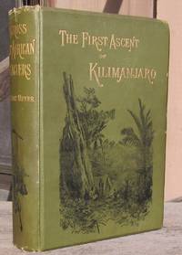
Across East African Glaciers An Account Of The First Ascent Of Kilimanjaro
by Meyer, Hans
- Used
- very good
- Hardcover
- first
- Condition
- Used - Very Good
- Jacket Condition
- No Jacket
- Edition
- 1st Edition
- Binding
- Hardcover
- Quantity Available
- 1
- Seller
-
Portland, Oregon, United States
- Item Price
-
$3,500.00
Show Details
Description:
London: George Philip & Son, 1891. 1st Edition . Hardcover. Very Good/No Jacket. First UK Edition translated from the German edition. Original green cloth binding with decorated front cover & spine, gilt lettering front & spine, original green coated end pages. The book has tissue-repaired inside hinges, strong binding and stable, former owner bookplate on the front pastedown, a bookstore stamp on upper edge of the verso of the FFEP along with seller's mark in pencil in the same area, no other marks or writing on any pages, a little fore-edge foxing but no foxing on page faces, light cover wear with some surface rubbing at the corners, generally clean. Complete with all maps and illustrations. The plates with the original photos are clean with no darkening/browning of the margins that is sometimes found with this book. The book measures 26cm tall x 18cm and has 404pp, 3 colored folding maps, colored frontispiece, 8 mounted b/w photos, 12 illustrated plates, 19 text illustrations, 11…
Read More Item Price
$3,500.00

More Photos
Le nouveau et curieux Atlas Geographique et historique...
by Chiquet (Jacques) [Antoine Menard].
- Used
- Hardcover
- Condition
- Used
- Binding
- Hardcover
- Quantity Available
- 1
- Seller
-
Sidney, British Columbia, Canada
- Item Price
-
$2,250.00
Show Details
Description:
Paris: chez Chereanau, [1719].. Oblong small 4to. Full vellum with ties. Wear at edges, chip from fore-edge of lower front cover,blank end leaves are heavily annotated and written-upon in 18th & 19th century hands. Old stains to margins and a few maps, old paper-tape repairs to the verso of the Asia map, but generally very good. Engraved allegorical title page, 3 plates (two of globes), and 24 maps opposite explanatory text in French. 23 maps have contemporary hand-colouring in outline; a couple have attractively coloured cartouches. The Globe Terrestre map, of two hemispheres, is holed, slightly affecting the title. The map of North America shows California as an island. This is the second or third edition of this atlas, originally by Antoine Menard, first published by Chiquet in [1711 & 1713], with most of the maps dated 1709-1711. In this 1719 edition Chiquet has removed Menard's name entirely; on many of the maps (such as L'Amerique Septentrionale) he has changed it to his own name and altered…
Read More Item Price
$2,250.00

More Photos
Memory About Service, Friendship and You. Red Banner Pacific Ocean Fleet, Soviet Navy Photo Album ( Black Sea,) with 15 SIGNED Pen and Ink Tracings of Warships
by Unknown Soviet Navy Sailor
- Used
- very good
- Hardcover
- Signed
- Condition
- Used - Very Good
- Binding
- Hardcover
- Quantity Available
- 1
- Seller
-
Bloomington, Indiana, United States
- Item Price
-
$2,250.00
Show Details
Description:
Soviet Union , 1979. Dated 1979-1982, a unique and RARE Soviet sailor's photo album, 13 1/2" w x 9" h, in string-tied brown velvet over heavy cardboard. Containing 40 pp. of thick cardboard, with 140 black and white and 4 color photographs pasted in, and 4 B & W photos and 1 negative laid in. The album rendered unique and amazing by the addition of 15 exquisitely detailed SIGNED pen and ink tracings of warships, 11 modern Soviet Navy warships and 4 tall ships, on rice paper, with each tracing interspersed between the photography pages. Very Good, small tears to the edges of some of the rice paper sheets. RARE Soviet Navy photographs from the height of the Cold War taken by an incredibly talented sailor/ artist. . Photograph Album. Very Good. 13 1/2" w x 9" h.
Item Price
$2,250.00
More Photos
NARRATIVE OF A SECOND VOYAGE IN SEARCH OF A NORTH-WEST PASSAGE, and of a Residence in the Arctic Regions During the Years 1829...1833. Inc the Reports of ..Capt. James Clark Ross TOGETHER with Appendix (2 Volumes)
by Sir John Ross
- Used
- very good
- Hardcover
- first
- Condition
- Used - Very Good
- Jacket Condition
- No Dust Jacket
- Edition
- First Edition
- Binding
- Hardcover
- Quantity Available
- 1
- Seller
-
Llandudno, Conwy, United Kingdom
- Item Price
-
$2,244.96
Show Details
Description:
A.W. Webster, London, 1835. First Edition. Hardcover (Half Leather). Very Good/No Dust Jacket. NARRATIVE OF A SECOND VOYAGE IN SEARCH OF A NORTH-WEST PASSAGE, and of a Residence in the Arctic Regions During the Years 1829, 1830, 1831, 1832, 1833. Including the Reports of Commander, now Captain James Clark Ross and The Discovery of the Northern Magnetic Pole. 1st Edition. xxxiii, (1), 740pp, illustrated with 31 plates, including 6 maps and charts, some outlined in colour and 2 folding, 24 views, some hand coloured. Appendix: xii, 120pp, cxliv, ciii. Half cream leather with dark brown leather boards, spine ruled with black leather spine labels, titled in gilt. After the embarrassment of Ross's first voyage in which he claimed to see the mountains in Lancaster Sound, it took him a decade to source private backing (he had lost the confidence of the British Admiralty) for a second trip. Ross travelled through Lancaster Sound into Prince Regent inlet and onto Boothia Peninsula, while on the way…
Read More Item Price
$2,244.96
More Photos
Voyage fait par ordre de L'Impératrice de Russie Catherine II, dans le nord de la Russie Asiatique, dans la Mer Glaciale, dans la mer d'Anadyr, et sur les Côtes de L'Amérique, depuis 1785 jusq'wn 1794, Par le Commodore Billings
by Martin Sauer (1785-1806)
- Used
- very good
- Hardcover
- first
- Condition
- Used - Very Good
- Edition
- First
- Binding
- Hardcover
- Quantity Available
- 1
- Seller
-
Fort Worth, Texas, United States
- Item Price
-
$2,500.00
Show Details
Description:
2 volumes with Atlas. [4]+xxiv+385 pages with xxii-xxiv lists books of voyages available from the publisher; [4]+418 pages with appendix containing vocabularies of the languages of Yukagir, Yakut, Tungoose, Kamchatka, the Aleutian Islands and Kadiak and inex. Atlas with title, list of plates, 14 engraved plates & large folding engraved map. Text volumes are small octavo (7¾" x 4½"), 19th century quarter calf & boards, spines tooled in gilt, morocco lettering pieces; atlas is quarto (11" x 7½") in period tree calf, spine tooled in gilt. Translated by J Castéra. (Howes S-117) First French Edition.Martin Sauer was an English civil servant who knew Russian, French and German. He became acquainted with Joseph Billings in St Petersburg in the 1780s. He agreed to join Billings expedition as his secretary and interpreter. It was agreed that he would write the official account, but there is some controversy about his actives when he returned to St Petersburg in 1794. It has been suggested that he left…
Read More Item Price
$2,500.00
More Photos
Across East African Glaciers An Account Of The First Ascent Of Kilimanjaro
by Meyer, Hans
- Used
- very good
- Hardcover
- first
- Condition
- Used - Very Good
- Jacket Condition
- No Jacket
- Edition
- 1st Edition
- Binding
- Hardcover
- Quantity Available
- 1
- Seller
-
Portland, Oregon, United States
- Item Price
-
$3,500.00
Show Details
Description:
London: George Philip & Son, 1891. 1st Edition . Hardcover. Very Good/No Jacket. First UK Edition translated from the German edition. Original green cloth binding with decorated front cover & spine, gilt lettering front & spine, original green coated end pages. The book has tissue-repaired inside hinges, strong binding and stable, former owner bookplate on the front pastedown, a bookstore stamp on upper edge of the verso of the FFEP along with seller's mark in pencil in the same area, no other marks or writing on any pages, a little fore-edge foxing but no foxing on page faces, light cover wear with some surface rubbing at the corners, generally clean. Complete with all maps and illustrations. The plates with the original photos are clean with no darkening/browning of the margins that is sometimes found with this book. The book measures 26cm tall x 18cm and has 404pp, 3 colored folding maps, colored frontispiece, 8 mounted b/w photos, 12 illustrated plates, 19 text illustrations, 11…
Read More Item Price
$3,500.00
More Photos
Le nouveau et curieux Atlas Geographique et historique...
by Chiquet (Jacques) [Antoine Menard].
- Used
- Hardcover
- Condition
- Used
- Binding
- Hardcover
- Quantity Available
- 1
- Seller
-
Sidney, British Columbia, Canada
- Item Price
-
$2,250.00
Show Details
Description:
Paris: chez Chereanau, [1719].. Oblong small 4to. Full vellum with ties. Wear at edges, chip from fore-edge of lower front cover,blank end leaves are heavily annotated and written-upon in 18th & 19th century hands. Old stains to margins and a few maps, old paper-tape repairs to the verso of the Asia map, but generally very good. Engraved allegorical title page, 3 plates (two of globes), and 24 maps opposite explanatory text in French. 23 maps have contemporary hand-colouring in outline; a couple have attractively coloured cartouches. The Globe Terrestre map, of two hemispheres, is holed, slightly affecting the title. The map of North America shows California as an island. This is the second or third edition of this atlas, originally by Antoine Menard, first published by Chiquet in [1711 & 1713], with most of the maps dated 1709-1711. In this 1719 edition Chiquet has removed Menard's name entirely; on many of the maps (such as L'Amerique Septentrionale) he has changed it to his own name and altered…
Read More Item Price
$2,250.00
More Photos
Memory About Service, Friendship and You. Red Banner Pacific Ocean Fleet, Soviet Navy Photo Album ( Black Sea,) with 15 SIGNED Pen and Ink Tracings of Warships
by Unknown Soviet Navy Sailor
- Used
- very good
- Hardcover
- Signed
- Condition
- Used - Very Good
- Binding
- Hardcover
- Quantity Available
- 1
- Seller
-
Bloomington, Indiana, United States
- Item Price
-
$2,250.00
Show Details
Description:
Soviet Union , 1979. Dated 1979-1982, a unique and RARE Soviet sailor's photo album, 13 1/2" w x 9" h, in string-tied brown velvet over heavy cardboard. Containing 40 pp. of thick cardboard, with 140 black and white and 4 color photographs pasted in, and 4 B & W photos and 1 negative laid in. The album rendered unique and amazing by the addition of 15 exquisitely detailed SIGNED pen and ink tracings of warships, 11 modern Soviet Navy warships and 4 tall ships, on rice paper, with each tracing interspersed between the photography pages. Very Good, small tears to the edges of some of the rice paper sheets. RARE Soviet Navy photographs from the height of the Cold War taken by an incredibly talented sailor/ artist. . Photograph Album. Very Good. 13 1/2" w x 9" h.
Item Price
$2,250.00

More Photos
The Sky and the Forest
by Forester, C.S
- Used
- very good
- Hardcover
- first
- Condition
- Used - Very Good
- Jacket Condition
- Very Good
- Edition
- First Edition
- Binding
- Hardcover
- Quantity Available
- 1
- Seller
-
Salem, Oregon, United States
- Item Price
-
$34.89$20.93Save $13.96!
Show Details
Description:
C.S. Forester: The Sky and the Forest. Little, Brown and Company, Boston. Stated First Edition First Printing Thus August, 1948. Cover price $2.75. Used. VG BOOK/VG UNCLIPPED DUST JACKET. A story of a central Africa. By C.S. Forester, author of the Admiral Hornblower series.
Item Price
$34.89$20.93
Save $13.96
!
![Alaska and Klondike Region; [With inset of Klondike Region on the Upper Yukon detail] [From an...](https://d3525k1ryd2155.cloudfront.net/h/062/537/1339537062.0.m.jpg)
Alaska and Klondike Region; [With inset of Klondike Region on the Upper Yukon detail] [From an atlas, "Gazetteer of Alaska and Yukon Region " pp. 105 and 106]
by Miller, J. Martin
- Used
- very good
- Condition
- Used - Very Good
- Edition
- Unknown
- Quantity Available
- 1
- Seller
-
Sebastopol, California, United States
- Item Price
-
$39.00
Show Details
Description:
Chicago: J. Martin Miller, 1899. Unknown. Map. Very Good. [Map copyright 1899, printing date of Atlas later] [19.875x15.125in]; Colored map of Alaska with steamer routes from Portland and Seattle, insets of the Klondike Region on the Upper Yukon and Western portion of Aleutian Islands; On verso index of places and names with two large black and white images; Age toning to all edges, water stain marks on bottom, slight printing offset of colors, small chips and closed tears to lower edge;.
Item Price
$39.00

Zemepis Sveta - Monsunova Asie
by De La Blache, P. Vidal; Gallois, L
- Used
- Hardcover
- Condition
- Used - Very Good Condition
- Jacket Condition
- No Dust Jacket
- Binding
- Hardcover
- Quantity Available
- 1
- Seller
-
Oak Point, Texas, United States
- Item Price
-
$60.00
Show Details
Description:
Aventinum, Prague, Czechoslovakia, 1930. Hardcover. Very Good Condition/No Dust Jacket. Text entirely in Czech. Geography book on Asia with numerous photographs and maps. 1931 edition also available. Size: 4mo - over 9 3/4" - 12" tall. 400 pp. Pages are yellowed, but are tight and clean. Moderate shelfwear along the spine. Corners are lightly bumped. Quantity Available: 1. Shipped Weight: 3-5 pounds. Category: Travel & Places; Non-English Language::Czech; Pictures of this item not already displayed here available upon request. Inventory No: 001227. . Additional shipping charges may apply.
Item Price
$60.00

Zemepis Sveta - Monsunova Asie
by De La Blache, P. Vidal; Gallois, L
- Used
- Hardcover
- Condition
- Used - Very Good Condition
- Jacket Condition
- No Dust Jacket
- Binding
- Hardcover
- Quantity Available
- 1
- Seller
-
Oak Point, Texas, United States
- Item Price
-
$60.00
Show Details
Description:
Aventinum, Prague, Czechoslovakia, 1931. Hardcover. Very Good Condition/No Dust Jacket. Text entirely in Czech. Geography book on Asia with numerous photographs and maps. 1930 edition also available. Size: 4mo - over 9 3/4" - 12" tall. 400 pp. Pages are yellowed, but are tight and clean. Moderate shelfwear along the spine. Corners are lightly bumped. Quantity Available: 1. Shipped Weight: 3-5 pounds. Category: Travel & Places; Non-English Language::Czech; Pictures of this item not already displayed here available upon request. Inventory No: 001228. . Additional shipping charges may apply.
Item Price
$60.00

Asia from the Best Authorities, Russell, ca.1800
by Russell
- Used
- Condition
- Used
- Quantity Available
- 1
- Seller
-
Plymouth, Devon, United Kingdom
- Item Price
-
$24.94
Show Details
Description:
Russell, J. : Asia from the Best Authorities. Nd but ca.1800. From "A New Geographical, Historical and Commercial Grammar and Present State of Several Kingdoms of the World". Copper engraving. Size approx 200 x 230mm. Two neat folds. Some age colouring to edges, otherwise clean and bright. Includes Arabia, India, Borneo, Japan, China and eastern Russia.
Item Price
$24.94

North America from the Best Authorities, Russell, ca.1800
by Russell
- Used
- Condition
- Used
- Quantity Available
- 1
- Seller
-
Plymouth, Devon, United Kingdom
- Item Price
-
$24.94
Show Details
Description:
Russell, J. : A General Map of North America from the Best Authorities. Nd but ca.1800. From "A New Geographical, Historical and Commercial Grammar and Present State of Several Kingdoms of the World." Copper engraving. Size approx 200 x 230mm. Two neat folds. Some age colouring to edges, otherwise very clean and bright.
Item Price
$24.94
![MAP OF UTAH [Territory]](https://d3525k1ryd2155.cloudfront.net/h/836/461/1485461836.0.m.jpg)
More Photos
MAP OF UTAH [Territory]
- Used
- Condition
- Used - Very Good-
- Edition
- Original
- Quantity Available
- 1
- Seller
-
Williamsburg, Virginia, United States
- Item Price
-
$65.00
Show Details
Description:
New York, Richmond, Chicago, & Toledo: H. H. Hardesty, 1885. Original color lithographed map printed by Rand, McNally & Company, Engravers and published in HARDESTY'S HISTORICAL AND GEOGRAPHICAL ENCYCLOPEDIA: SPECIAL VIRGINIA EDITION. 19 3/8 inches by 13 1/4 inches on a 21" X 14 1/2" sheet. The map depicts the Territory of Utah in its final form--large areas had been removed and ceded to Nevada, Colorado, Wyoming, and Nebraska since Utah became a U. S. Territory in 1850. The issue of polygamy prevented statehood until it was finally granted in 1896. This map features railroads and topography and uses color to set off counties from each other. Unlike most atlas maps of the period, this map identifies most small towns. The map is guaranteed to be moe than 135 years old. The map is in about very good condition: generally clean and bright, with slight toning of paper and one faint water stain near the center-left edge of the map.. Original. Single Sheet. Very Good-. Elephant…
Read More Item Price
$65.00

Philips Special Map of the Nile, The Advance on Khartum and the Environs of Omdurman. Cc1900
by George Philips and Son,
- Used
- Condition
- Used
- Quantity Available
- 1
- Seller
-
Plymouth, Devon, United Kingdom
- Item Price
-
$32.43
Show Details
Description:
Philips Special map of the Nile illustrating the Advance on Khartum [Khartoum] with an enlargement of the environs of Omdurman [Omdur]. George Philips and Son, London and Liverpool Ca 1900. 580mm x 900mm folded map. Front title wrapper has come loose, not affecting map area. Three maps are displayed within the sheet. Map1. Map of the Nile Valley 520mm x 300mm showing the approaches of Khartum. Scale 1inch to 100 Geographical miles. Coloured indicating Possessions and Protectorates of European Powers. Map 2. Special map of the Nile from Dongola to Khartum. Scale 16 miles to the inch. Coloured. In set in this map is Map3. Environs of Omdurman, Scale 5 statute miles to the inch. Some small breaks at some folds, not affecting imagery or use of map. Title label is damaged, the map is clean and bright, probably unused. A very interesting record.
Item Price
$32.43

Last Tales
by Dinesen, Isak
- Used
- very good
- Hardcover
- first
- Condition
- Used - Very Good
- Jacket Condition
- Good+
- Edition
- First Edition
- Binding
- Hardcover
- Quantity Available
- 1
- Seller
-
Salem, Oregon, United States
- Item Price
-
$120.00$72.00Save $48.00!
Show Details
Description:
Dinesen, Isak: Last Tales, A Collection of Twelve New Tales of Compelling Beauty 1957, Random House. First Edition. Stated First Printing Thus. Used. Very Good/Good+ original red dust jacket, price-clipped. Jacket states 11/57 on front flap. 5 3/4 X
Item Price
$120.00$72.00
Save $48.00
!

The Adventure of Wrangel Island
by Vilhjalmur Stefansson
- Used
- good
- Hardcover
- first
- Condition
- Used - Good
- Jacket Condition
- No DJ Included
- Edition
- First Edition
- Binding
- Hardcover
- Quantity Available
- 1
- Seller
-
Salem, Oregon, United States
- Item Price
-
$124.89$74.93Save $49.96!
Show Details
Description:
The Adventure of Wrangel Island, Alaska (1925 Macmillan 1st Edition) HISTORY OF ALASKA. EXLIB. Good Condition/ No DJ included. Fold-out map affixed to binding at the back of the book has never been opened. The story of the (unsuccessful) attempted colonization of Wrangel Island Alaska. 413 pages plus appendix, Index. Titling is still bright. A clean, solid copy. Scarce.
Item Price
$124.89$74.93
Save $49.96
!