Description:
Philadelphia: Mitchell & Hinman, 1836. First Edition. Hardcover. Lacks, as usual, the scarce accompanying map. Very Good. Contemporary half calf and marbled boards; 342 pages. Population and census data by county. Early bookplate on front pastedown and signature on front endpaper of John F. Fager of Harrisburg. Samuel Augustus Mitchell and his sons were the leading publishers of maps in the United States during most of the nineteenth century. Mitchell had come to Philadelphia around 1830 with the intention of improving the standard of geography textbooks. A New American Atlas, published in 1831, was his first work. Then, in 1845 he acquired the rights to Tanner's New Universal Atlas, and in 1846 he published his first edition of the present work. Mitchell continued to publish the atlas until 1850, when he sold the copyright to Cowperthwaite & Co. of Philadelphia, who continued to publish it until the mid-1850s, when It was purchased by Charles DeSilver.
Search Results: Maps from Charles Agvent
You searched for:
- Subject: Maps from Charles Agvent
Results 1 - 12 of 12
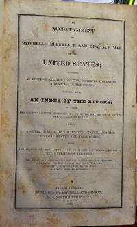
AN ACCOMPANIMENT TO MITCHELL'S REFERENCE AND DISTANCE MAP OF THE UNITED STATES; CONTAINING AN INDEX OF ALL THE COUNTIES, DISTRICTS, TOWNSHIPS, TOWNS, &C IN THE UNION; TOGETHER WITH AN INDEX OF THE RIVERS...
by (MITCHELL, Samuel A.)
- Used
- Hardcover
- first
- Condition
- Used - Lacks, as usual, the scarce accompanying map. Very Good
- Edition
- First Edition
- Binding
- Hardcover
- Quantity Available
- 1
- Seller
-
Fleetwood, Pennsylvania, United States
- Item Price
-
$62.50$8.00 shipping to USA
Show Details
Item Price
$62.50
$8.00
shipping to USA
ALGEMEINE GESCHICHTE DER LANDER UND VOLKER VON AMERICA
by [SCHROTER, Johann Friedrich; CHARLEVOIX, Pierre-Francois-Xavier de; LAFITAU, Joseph-Francois] BAUMGARTEN, Siegmund Jakob
- Used
- Hardcover
- first
- Condition
- Used - Text and plates very clean. Tasteful early twentieth century bookplate on front pastedowns. Near Fine
- Edition
- First Edition
- Binding
- Hardcover
- Quantity Available
- 1
- Seller
-
Fleetwood, Pennsylvania, United States
- Item Price
-
$5,000.00$8.00 shipping to USA
Show Details
Description:
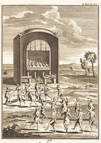
Halle: Johann Justinus Gebauer, 1752 - 1753. First Edition. Hardcover. Text and plates very clean. Tasteful early twentieth century bookplate on front pastedowns. Near Fine. Two quarto (7-3/4" x 10") volumes bound in early full vellum with gilt lettering and rules on the spine. Illustrated with 8 maps (5 folding) and 59 full-page engravings (6 folding), many of which depict early Native Americans. Most of the first volume contains German translations of Lafiteau's MOEURS DES SAUVAGES AMERICAINS COMPARES AUX MOEURS DES PREMIERS TEMPS (Paris, 1723). The second volume is compiled from various sources and includes German translations of passages from Charlevoix's HISTOIRE ET DESCRIPTION GENERALE DE LA NOUVELLE FRANCE (Paris, 1744). Baumgarten's "Vorrede" contains a bibliography of the New World. The social life and customs of Native Americans of both North and South America are described and illustrated in detail, with chapters on individual areas including Florida, New England, Virginia, Peru, Brazil,…
Read More Item Price
$5,000.00
$8.00
shipping to USA
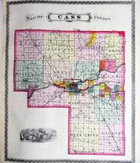
COMBINATION ATLAS MAP OF CASS COUNTY INDIANA
by [INDIANA]
- Used
- Hardcover
- first
- Condition
- Used - An uncommon county atlas, here in an excellent state of preservation. A few minor tears and stains but generally clean and brigh
- Edition
- First Edition
- Binding
- Hardcover
- Quantity Available
- 1
- Seller
-
Fleetwood, Pennsylvania, United States
- Item Price
-
$937.50$8.00 shipping to USA
Show Details
Description:
Chicago: Kingman Brothers, 1878. First Edition. Hardcover. An uncommon county atlas, here in an excellent state of preservation. A few minor tears and stains but generally clean and bright. Covers with light scuffing and edgewear but tight. Very Good. Large folio (15" x 17-1/2") bound in publisher's leather-backed cloth; 100 pages. Compiled, drawn, and published from personal examinations and surveys. Illustrated with hand-colored maps of the United States, the state of Indiana, and Cass County as well as its individual townships. Lacking, as usual, the special folding map of Logansport. There are also many lithographed portraits and views of private residences and businesses, including interior views. The text includes histories, local advertisements, and a detailed business directory.
Item Price
$937.50
$8.00
shipping to USA
DE ZEDEN DER WILDEN VAN AMERIKA
by LAFITAU, Joseph-Francois
- Used
- Hardcover
- first
- Condition
- Used - Some light toning throughout; upper joint split, covers bowed and soiled. Very Good
- Edition
- First Edition
- Binding
- Hardcover
- Quantity Available
- 1
- Seller
-
Fleetwood, Pennsylvania, United States
- Item Price
-
$3,125.00$8.00 shipping to USA
Show Details
Description:
The Hague: Gerard Vander Poel, 1731. First Edition. Hardcover. Some light toning throughout; upper joint split, covers bowed and soiled. Very Good. Two folio (7-3/4" x 12") volumes bound in one in contemporary full Dutch vellum, covers tooled in blind with large central blocked arabesque, spine in eight compartments with raised bands, early manuscript titling to the second compartment. Titles in red and black with engraved vignettes. Illustrated with an engraved frontispiece, a map, and 41 plates. First Dutch Edition of a key work on Native American peoples. Lafitau was assigned as a Jesuit missionary to Canada from 1711-1718 and was based for much of that period among the Iroquois at Sault Saint-Louis. His work, written in an attempt to prove that the native American peoples were descended from Tartar stock, provides a wealth of information on the customs, religious beliefs, and social organization of the Iroquois and the other northern tribes. Field 851: "a grand cyclopaedia of Indian history, and…
Read More Item Price
$3,125.00
$8.00
shipping to USA

AN HISTORICAL, TOPOGRAPHICAL, AND DESCRIPTIVE VIEW OF THE UNITED STATES OF AMERICA, AND OF UPPER AND LOWER CANADA. With An Appendix, Containing a brief and comprehensive Sketch of The Present State of Mexico and South America, and also of the Native Tribes of the New World
by MACKENZIE, Eneas
- Used
- Hardcover
- first
- Condition
- Used - Long tear to map with no loss; text and plates generally clean. Backstrip slightly lifted with minor split to front hinge and co
- Edition
- First Edition
- Binding
- Hardcover
- Quantity Available
- 1
- Seller
-
Fleetwood, Pennsylvania, United States
- Item Price
-
$1,875.00$8.00 shipping to USA
Show Details
Description:
Newcastle upon Tyne: MacKenzie and Dent, [1819]. First Edition. Hardcover. Long tear to map with no loss; text and plates generally clean. Backstrip slightly lifted with minor split to front hinge and cover just a tad loose; small gouge to leather on spine. Very Good. Octavo (5-1/4" x 8-1/2") in 19th-century black calf-backed marbled boards; xv, (1), (9)-712 pages. Illustrated with a large folding engraved map, 2 engraved plans of the City of Washington and the Country round Pittsburg, and 6 engraved views: the Capitol, Falls of Niagara, Natural Bridge, Mount Vernon, an American Stage Waggon,and the Bank of the United States. HOWES M-137. Quite scarce when the large map is present.
Item Price
$1,875.00
$8.00
shipping to USA
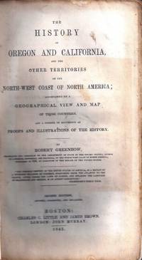
THE HISTORY OF OREGON AND CALIFORNIA, AND THE OTHER TERRITORIES ON THE NORTH-WEST COAST OF NORTH AMERICA...
by GREENHOW, Robert
- Used
- Paperback
- Condition
- Used - Text block in three sections; map Very Good despite the long tear. Rare in original binding
- Edition
- Second Edition
- Binding
- Paperback
- Quantity Available
- 1
- Seller
-
Fleetwood, Pennsylvania, United States
- Item Price
-
$437.50$8.00 shipping to USA
Show Details
Description:
Boston: Little & Brown, 1845. Second Edition. Wraps. Text block in three sections; map Very Good despite the long tear. Rare in original binding. Blue wraps, complete with half-title page; [20] 492 pages. Graff 1652; Howes G-389; New Howes G-386 "b": "Leading contemporary authority, well documented"; Sabin 28362. The important edition with Greenhow's answer to Falconer's Strictures. The large (22-3/4" x 25-1/2" plus margins) folding map has a light stain in the upper right corner, two small cuts in the ocean off Alaska, and a 13" closed tear through the Pacific Ocean stopping off the coast of San Francisco.
Item Price
$437.50
$8.00
shipping to USA

IL GAZZETTIERE AMERICANO CONTENENTE UN DISTINTO RAGGUAGLIO DI TUTTE LE PARTI DEL NUOVO MONDO DELLA LORO SITUAZIONE, CLIMA, TERRENO, PRODOTTI, STATO ANTICO E MODERNO, MERCI, MANIFATTURE, E COMMERCIO CON UNA ESATTA DESCRIZIONE DELLE CITTÀ, PIAZZE, PORTI, BAJE, FIUMI, LAGHI, MONTAGNE, PASSI, E FORTIFICAZIONI IL TUTTO DESTINATO AD ESPORRE LO STATO PRESENTE DELLE COSE IN QUELLA PARTE DI GLOBO, E LE MIRE, E INTERESSI DELLE DIVERSE POTENZE, CHE HANNO DEGLI STABILIMENTI IN AMERICA
- Used
- Hardcover
- first
- Condition
- Used - Half-title with marginal repair, one leaf (Ll1) with a small repaired hole affecting text, first folding map with repair to vers
- Edition
- First Edition
- Binding
- Hardcover
- Quantity Available
- 1
- Seller
-
Fleetwood, Pennsylvania, United States
- Item Price
-
$9,375.00$8.00 shipping to USA
Show Details
Description:
Livorno: Marco Coltellini, 1763. First Edition. Hardcover. Half-title with marginal repair, one leaf (Ll1) with a small repaired hole affecting text, first folding map with repair to verso, some light staining, mostly marginal; binding close to Fine with a little spotting to the leather. Overall Near Fine. Three folio (9-1/2" x 12") volumes bound in twentieth century half green morocco leather with marbled boards and endpapers and matching morocco corners. First Italian Edition of THE AMERICAN GAZETTEER, published in London in three duodecimo volumes by J. Millar in 1762, which Sabin 26814 refers to as "A meritorious work." Illustrated with engraved title vignettes and 78 engraved plates and maps (including engraved frontispiece, 20 folding maps, 19 maps, 35 plates, 3 folding views). This work covers parts of South America, Cuba, New England, and up to Newfoundland. The natural history plates include bison, penguins, and many others. A handsome presentation. Borba, page 347: "This translation of…
Read More Item Price
$9,375.00
$8.00
shipping to USA
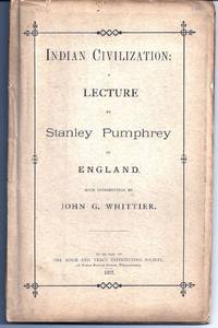
INDIAN CIVILIZATION: A LECTURE
by [WHITTIER] PUMPHREY, Stanley
- Used
- Paperback
- first
- Condition
- Used - Slight loss of paper to spine with front cover partly detached toward the bottom. Still Near Fine for this fragile, uncommon ite
- Edition
- First Edition
- Binding
- Paperback
- Quantity Available
- 1
- Seller
-
Fleetwood, Pennsylvania, United States
- Item Price
-
$625.00$8.00 shipping to USA
Show Details
Description:
Philadelphia: Bible & Tract Dist. Society, 1877. First Edition. Wraps. Slight loss of paper to spine with front cover partly detached toward the bottom. Still Near Fine for this fragile, uncommon item. Original printed wraps; 52 pages. BAL 21950. Introduction by the poet John Greenleaf Whittier. Illustrated with a large color folding map. Written right after the Custer Massacre in an attempt to show how gentle and peaceful the Arapahoes, Cheyenne, and Sioux really were.
Item Price
$625.00
$8.00
shipping to USA
![LE COLONIE UNITE DELL'AMERICA SETTENTR[IONA]LE. DI NUOVO PROJEZIONE](https://d3525k1ryd2155.cloudfront.net/h/413/551/1223551413.0.m.jpg)
LE COLONIE UNITE DELL'AMERICA SETTENTR[IONA]LE. DI NUOVO PROJEZIONE
by [ATLAS] ZATTA, Antonio
- Used
- Paperback
- first
- Condition
- Used - Some minor worming to inner marginal folds of maps, occasional spotting. Complete with vibrant coloring. Close to Fine
- Edition
- First Edition
- Binding
- Paperback
- Quantity Available
- 1
- Seller
-
Fleetwood, Pennsylvania, United States
- Item Price
-
$10,625.00$8.00 shipping to USA
Show Details
Description:
Venice: Antonio Zatta, 1778. First Edition. Softcover. Some minor worming to inner marginal folds of maps, occasional spotting. Complete with vibrant coloring. Close to Fine. Oblong folio (16 1/4" x 12") bound in contemporary limp decorated paper covers. Containing 15 double-page engraved maps (including the double-page title), each beautifully hand-colored, depicting Bermuda; the east coast of North America from Nova Scotia to Florida, west to the Great Lakes and south to "Luigiana" and "Messico"; Lake Superior and its coast, with an inset of eastern Florida, including the Keys and Bahamas; Canada, between the Ottawa River and Hudson Bay; Labrador; Lake Michigan, including parts of Michigan, Illinois, Indiana, Wisconsin, Minnesota, and Iowa; Lake Huron, Ontario, Erie, Ohio, Pennsylvania, New York, the Hudson River, Long Island, and western New England; the Canadian and New England coast from Acadia and the Bay of Fundy, down the coast to the Long Island Sound; Virginia, the Mississippi and Missouri…
Read More Item Price
$10,625.00
$8.00
shipping to USA
MODERN AND AUTHENTIC SYSTEM OF UNIVERSAL GEOGRAPHY
by COOKE, George Alexander
- Used
- Hardcover
- first
- Condition
- Used - Some foxing, mostly to the text, the maps largely clean and fresh. Some wear to the binding, the covers strong. Near Fine
- Edition
- First Edition
- Binding
- Hardcover
- Quantity Available
- 1
- Seller
-
Fleetwood, Pennsylvania, United States
- Item Price
-
$2,187.50$8.00 shipping to USA
Show Details
Description:
London: Evans & Bourne, 1817 & 1822. First Edition. Hardcover. Some foxing, mostly to the text, the maps largely clean and fresh. Some wear to the binding, the covers strong. Near Fine. Two folio (8-1/2" x 10-1/4") volumes bound in contemporary tree calf leather with contrasting maroon and black morocco spine labels. Illustrated with 2 engraved frontispieces, 52 full-page engraved plates, and 24 folding hand-colored maps, including a fine world map and 3 related to the United States.
Item Price
$2,187.50
$8.00
shipping to USA
REIS-BESCHRYVING DOOR DE ZUID-ZEE, LANGS DE KUSTEN VAN CHILI, PERU EN BRAZIL OPGESTELT OP EENE REISTOCHT GEDAAN IN DE JAREN 1712, 1713, EN 1714. NEVENS EENE BESCHRYVINGE VAN DE REGERINGE DER YNCAS, KONINGEN VAN PERU
by FREZIER, M
- Used
- Hardcover
- first
- Condition
- Pale marginal dampstain affecting some pages but generally very clean and bright, the binding Fine housed in a Very Good marbled
- Edition
- First Dutch Edition
- Binding
- Hardcover
- Quantity Available
- 1
- Seller
-
Fleetwood, Pennsylvania, United States
- Item Price
-
$3,125.00$8.00 shipping to USA
Show Details
Description:
Amsterdam: R & G Wetstein, 1718. First Dutch Edition. Hardcover. Pale marginal dampstain affecting some pages but generally very clean and bright, the binding Fine housed in a Very Good marbled paper slipcase. Small quarto (6" x 7-5/8") bound in modern half green morocco leather and paper patterned boards with matching morocco corners and a heavily gilt-decorated spine with four raised bands and a gilt-lettered blue morocco label, top edge gilt; (16), 406, (9) pages. First published in French in 1716, this edition includes information about the Jesuit activities in Paraguay not published previously. Illustrated with 37 maps, city plans, plates of natives, and natural history specimens, many folding, including Plate 9 which depicts the Chilean game of La Sueca and which is widely regarded as one of the earliest printed depictions of a form of golf. Borba de Moraes p. 329; Hill, page 115 (1716 edition); Sabin 25927; Tiele 361.
Item Price
$3,125.00
$8.00
shipping to USA

AN UNIVERSAL HISTORY FROM THE EARLIEST ACCOUNT OF TIME TO THE PRESENT: COMPILED FROM ORIGINAL AUTHORS
- Used
- Hardcover
- first
- Condition
- Used - Sporadic light foxing, but generally clean, the maps and plates fresh, one with a long closed tear. The binding dry and worn, al
- Edition
- First Edition
- Binding
- Hardcover
- Quantity Available
- 1
- Seller
-
Fleetwood, Pennsylvania, United States
- Item Price
-
$437.50$8.00 shipping to USA
Show Details
Description:
London: J. Batley, E. Symon, T. Osborne, & J. Crokatt, 1736 - 1738. First Edition. Hardcover. Sporadic light foxing, but generally clean, the maps and plates fresh, one with a long closed tear. The binding dry and worn, all covers neatly detached. Good or better. Three folio (8-1/2" x 13-1/2") volumes (of 7) bound in contemporary calf-backed marbled boards with gilt-lettered morocco spine labels. Illustrated with 5 full-page engraved plates, 6 folding plates, 2 folding plans, and 18 folding maps. The first 3 volumes of the set. Included are several maps of the Holy Land, Egypt, Syria, Sicily, Armenia, etc. as well as folding plans of Jerusalem, and plates depicting the pyramids and Sphinx, the Camp of the Israelites, Babylon, Persepolis, Noah's Ark, etc.
Item Price
$437.50
$8.00
shipping to USA

Didn’t find what you’re looking for?
Try adding this search to your want list. Millions of books are added to our site everyday and when we find one that matches your search, we’ll send you an email. Best of all, it’s free.
Add to Want List

Are you a frequent reader or book collector?
Join the Bibliophile's Club and save 10% on every purchase, every day — up to $20 savings per order!

Social Responsibility
Did you know that since 2004, Biblio has used its profits to build 16 public libraries in rural villages of South America?