Description:
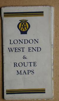
London.: Automobile Association. Undated, circa 1950/60s. Printed folding map. Slight wear on folds.. Good+.
Search Results: Maps from N. G. Lawrie Books.
You searched for:
- Subject: Maps from N. G. Lawrie Books.
Results 1 - 20 of 378

AA London West End & Route Maps.
by Folding Map.
- Used
- Condition
- Used - Good+
- Quantity Available
- 1
- Seller
-
Sheffield, United Kingdom
- Item Price
-
$3.77$11.93 shipping to USA
Show Details
Item Price
$3.77
$11.93
shipping to USA

Abergavenny and The Black Mountains. Sheet 161.
by Folding Map.
- Used
- Condition
- Used - Good+
- Quantity Available
- 1
- Seller
-
Sheffield, United Kingdom
- Item Price
-
$2.51$11.93 shipping to USA
Show Details
Description:
Ordnance Survey., 1974. Scale 1:50000 First Series. Covers have some edge creases.. Good+.
Item Price
$2.51
$11.93
shipping to USA

Admont und Hieflau.
by (Folding Map).
- Used
- very good
- Condition
- Used - Very Good
- Quantity Available
- 1
- Seller
-
Sheffield, United Kingdom
- Item Price
-
$6.28$11.93 shipping to USA
Show Details
Description:
Wien.: k. k. Militär-Geografisches Instiut Folding map, printed on paper. 1:75.000. Zone 15 Col XI. Undated but circa 1890s.. Very Good.
Item Price
$6.28
$11.93
shipping to USA

Africa - North East, with Egypt.
by Map.
- Used
- very good
- Condition
- Used - Very Good
- Quantity Available
- 1
- Seller
-
Sheffield, United Kingdom
- Item Price
-
$6.28$11.93 shipping to USA
Show Details
Description:
London.: George Philip and Son Limited., 1940. Colour Map from Philips' International Atlas. Measures approx 15 3/4 x 20 1/2 inches. Centre fold.. Very Good.
Item Price
$6.28
$11.93
shipping to USA

Africa - Political.
by Map.
- Used
- very good
- Condition
- Used - Very Good
- Quantity Available
- 1
- Seller
-
Sheffield, United Kingdom
- Item Price
-
$6.28$11.93 shipping to USA
Show Details
Description:
London.: The Times., 1922. Colour Map from The Times Survey Atlas Of The World. Measures approx 17 1/2 x 22 3/4 inches. Centre fold. With inset maps of Races, Density of Population, Mean Annual Rainfall & Prevailing Vegetation.. Very Good.
Item Price
$6.28
$11.93
shipping to USA

Africa - Political.
by Map.
- Used
- very good
- Condition
- Used - Very Good
- Quantity Available
- 1
- Seller
-
Sheffield, United Kingdom
- Item Price
-
$6.28$11.93 shipping to USA
Show Details
Description:
London.: George Philip and Son Limited., 1940. Colour Map from Philips' International Atlas. Measures approx 20 1/2 x 15 3/4 inches. Centre fold. With inset maps of Guinea, Madagascar, Canary Islands, Mauritius and Reunion.. Very Good.
Item Price
$6.28
$11.93
shipping to USA

Africa Septentrionalis.
by (Map).
- Used
- Condition
- Used - Very Good+
- Quantity Available
- 1
- Seller
-
Sheffield, United Kingdom
- Item Price
-
$6.28$11.93 shipping to USA
Show Details
Description:
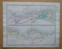
London.: Longman & Co., 1853. Engraved map with original colour from an Atlas of Ancient Geography, engraved by S. Hall. Measures approx 9 x 11 inches (including margins). Centre fold.. Very Good+.
Item Price
$6.28
$11.93
shipping to USA

Africa, South of the Equator.
by Map.
- Used
- very good
- Condition
- Used - Very Good
- Quantity Available
- 1
- Seller
-
Sheffield, United Kingdom
- Item Price
-
$6.28$11.93 shipping to USA
Show Details
Description:
London.: The Office Of The Times., 1900. Colour Map from The Times Atlas. Measures approx 16 x 22 inches. Centre fold.. Very Good.
Item Price
$6.28
$11.93
shipping to USA

Alberta & Saskatchewan.
by (Map).
- Used
- Condition
- Used - Very Good+
- Quantity Available
- 1
- Seller
-
Sheffield, United Kingdom
- Item Price
-
$6.28$11.93 shipping to USA
Show Details
Description:
London.: The Times., 1922. Colour map measures approx 22 3/4 x 17 3/4 inches (including margins). Centre fold. From The Times Survey Atlas of The World. Prepared under the direction of J. G. Bartholomew.. Very Good+.
Item Price
$6.28
$11.93
shipping to USA

Argentina & Chile, Etc
by Map.
- Used
- very good
- Condition
- Used - Very Good
- Quantity Available
- 1
- Seller
-
Sheffield, United Kingdom
- Item Price
-
$6.28$11.93 shipping to USA
Show Details
Description:
London.: The Times., 1922. Colour Map from The Times Survey Atlas Of The World. Measures approx 17 1/2 x 22 3/4 inches. Centre fold.. Very Good.
Item Price
$6.28
$11.93
shipping to USA

Argentina, Chile.
by (Map).
- Used
- Condition
- Used - Very Good+
- Quantity Available
- 1
- Seller
-
Sheffield, United Kingdom
- Item Price
-
$6.28$11.93 shipping to USA
Show Details
Description:
London.: The Times., 1922. Colour map measures approx 22 3/4 x 17 3/4 inches (including margins). Centre fold. From The Times Survey Atlas of The World. Prepared under the direction of J. G. Bartholomew.. Very Good+.
Item Price
$6.28
$11.93
shipping to USA

Arkansas, Oklahoma, Louisiana, Texas.
by Folding Map.
- Used
- Condition
- Used - Very Good+
- Quantity Available
- 1
- Seller
-
Sheffield, United Kingdom
- Item Price
-
$2.51$11.93 shipping to USA
Show Details
Description:
The National Geographic Magazine., 1974. Colour folding map.. Very Good+.
Item Price
$2.51
$11.93
shipping to USA

Arkansas.
by (Map).
- Used
- very good
- Condition
- Used - Very Good
- Quantity Available
- 1
- Seller
-
Sheffield, United Kingdom
- Item Price
-
$5.02$11.93 shipping to USA
Show Details
Description:
New York.: The Century Co., 1897. Colour Map from The Century Atlas. Measures 11 3/4 x 16 inches, centre fold reinforced on the back.. Very Good.
Item Price
$5.02
$11.93
shipping to USA

Asia - Political.
by Map.
- Used
- very good
- Condition
- Used - Very Good
- Quantity Available
- 1
- Seller
-
Sheffield, United Kingdom
- Item Price
-
$6.28$11.93 shipping to USA
Show Details
Description:
London.: George Philip and Son Limited., 1940. Colour Map from Philips' International Atlas. Measures approx 15 3/4 x 20 1/2 inches. Centre fold.. Very Good.
Item Price
$6.28
$11.93
shipping to USA

Asia Minor.
by Map.
- Used
- Condition
- Used - Very Good+
- Quantity Available
- 1
- Seller
-
Sheffield, United Kingdom
- Item Price
-
$6.28$11.93 shipping to USA
Show Details
Description:
London.: Longman & Co., 1853. Engraved map with original colour from an Atlas of Ancient Geography, engraved by S. Hall. Measures approx 9 x 11 inches (including margins). Centre fold.. Very Good+.
Item Price
$6.28
$11.93
shipping to USA

Asia Minor.
by Map.
- Used
- very good
- Condition
- Used - Very Good
- Quantity Available
- 1
- Seller
-
Sheffield, United Kingdom
- Item Price
-
$6.28$11.93 shipping to USA
Show Details
Description:
London.: The Amalgamated Press Ltd. Colour Map from Harmsworth's New Atlas. Undated, circa 1920s. With an inset map of Smyrna, & printed information & illustrations on the back. Measures approx 9 3/4 x 14 1/2 inches. With small pin holes on one edge, otherwise clean & bright.. Very Good.
Item Price
$6.28
$11.93
shipping to USA

More Photos
Atlas De Columbia.
- Used
- Hardcover
- Condition
- Used - Very Good+
- Edition
- Second Edition
- Binding
- Hardcover
- Quantity Available
- 1
- Seller
-
Sheffield, United Kingdom
- Item Price
-
$188.42$11.93 shipping to USA
Show Details
Description:
Bogota.: Instituto Geografico "Agustin Codazzi", 1969. 216pp, with colour maps, photographs & illustrations. Firm & tight binding. DW is frayed with a little loss. Internally, clean & unmarked.. Second Edition. Hardcover. Very Good+/Good. Elephant Folio - over 15" - 23" tall.
Item Price
$188.42
$11.93
shipping to USA

Aulus-Les Bains, Mont Valier.
by Instiut Geographique National.
- Used
- very good
- Condition
- Used - Very Good
- Quantity Available
- 1
- Seller
-
Sheffield, United Kingdom
- Item Price
-
$6.28$11.93 shipping to USA
Show Details
Description:
Paris.: Instiut Geographique National., 2000. Sheet Map. Scale 1 : 25 000. . Very Good.
Item Price
$6.28
$11.93
shipping to USA

Australia - Eastern Queensland
by (Map).
- Used
- Condition
- Used - Very Good+
- Quantity Available
- 1
- Seller
-
Sheffield, United Kingdom
- Item Price
-
$6.28$11.93 shipping to USA
Show Details
Description:
London.: The Times., 1922. Colour map measures approx 22 3/4 x 17 3/4 inches (including margins). Centre fold. With inset map of Brisbane. From The Times Survey Atlas of The World. Prepared under the direction of J. G. Bartholomew.. Very Good+.
Item Price
$6.28
$11.93
shipping to USA

Australia - Eastern Section.
by (Map).
- Used
- Condition
- Used - Very Good+
- Quantity Available
- 1
- Seller
-
Sheffield, United Kingdom
- Item Price
-
$6.28$11.93 shipping to USA
Show Details
Description:
London.: The Times., 1922. Colour map measures approx 22 3/4 x 17 3/4 inches (including margins). Centre fold. With inset map of Tasmania. From The Times Survey Atlas of The World. Prepared under the direction of J. G. Bartholomew.. Very Good+.
Item Price
$6.28
$11.93
shipping to USA


