Description:
Knightstown, Indiana: The Bookmark, 1979. 127 pages. Full-size facsimile reprint of the 1874 atlas, with added material that is useful for genealogists. The book is clean and tight, with some extremely light tanning at edges of covers.. First Edition Thus. Paperback. Very Good. Elephant Folio - over 15" - 23" tall. Map.
Search Results: Cartography, Maps and Atlases from Tennyson Williams, Books and Fine Art
You searched for:
- Subject: Cartography, Maps and Atlases from Tennyson Williams, Books and Fine Art
Results 1 - 12 of 12

CENTURY LANDOWNER ATLAS OF TIPTON COUNTY, INDIANA, Including 1874 Landowner Wall-Map, 1927-8 O'Banion Atlas, 1975 Plat Book, and Historical Appendix
- Used
- very good
- Paperback
- first
- Condition
- Used - Very Good
- Edition
- First Edition Thus
- Binding
- Paperback
- Quantity Available
- 1
- Seller
-
Williamsburg, Virginia, United States
- Item Price
-
$100.00$6.50 shipping to USA
Show Details
Item Price
$100.00
$6.50
shipping to USA

COLTON'S INDIANA
by Colton, J. H.
- Used
- very good
- first
- Condition
- Used - Very Good
- Edition
- First Edition
- Quantity Available
- 1
- Seller
-
Williamsburg, Virginia, United States
- Item Price
-
$150.00$6.50 shipping to USA
Show Details
Description:
New York: J. H. Colton, 1855. The image is 15 3/4 inches by 12 3/4 inches on a sheet measuring 17 1/2 inches by 14 3/8 inches. This map is from the 1855 first edition of Colton's Atlas of the World, Illustrating Physical and Political Geography. It was the first atlas published by the Colton family, who had been in the map business since the 1830s. The atlas is considered to be among the most accurate of the time, and it was so successful that new editions continued to be published well into the 1880s. In addition to their accuracy, the maps are distinguished by their clarity, their attention to detail such as railway lines, fine hand-coloring to set counties off from each oyher, and attractive decorative borders. These are among the most sought-after mid-nineteenth century American maps. The map offered here is in very good condition: clean and bright image that is free from foxing; lightly toned paper and minimal edgewear.. First Edition. Single Sheet. Very Good. Folio - over 12" -…
Read More Item Price
$150.00
$6.50
shipping to USA
CRAM'S TOWNSHIP AND RAIL ROAD MAP OF ALABAMA
by Cram, George F.
- Used
- Paperback
- first
- Condition
- Used - Very Good+
- Edition
- First Edition
- Binding
- Paperback
- Quantity Available
- 1
- Seller
-
Williamsburg, Virginia, United States
- Item Price
-
$250.00$6.50 shipping to USA
Show Details
Description:
Chicago, Illinois: George F. Cram, 1889. Very scarce pocket folding map (20 1/2" X 17 7/8") accompanied by 24 pages of text; bound in the original blue stiff card covers. The map is in fine condition, with no damage at the folds. The covers are clean and tight, with some color flaking along the spine; someone has written "#3" in one corner of the front cover.. First Edition. Paperback. Very Good+. 16mo - over 5¾" - 6¾" tall. Map.
Item Price
$250.00
$6.50
shipping to USA
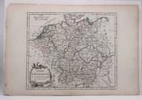
EMPIRE d'ALLEMAGNE
by Vaugondy, Dirier Robert De
- Used
- first
- Condition
- Used - Very Good-
- Edition
- First Edition Thus
- Quantity Available
- 1
- Seller
-
Williamsburg, Virginia, United States
- Item Price
-
$100.00$6.50 shipping to USA
Show Details
Description:
Paris: Vaugondy, 1778. The image is 9 3/8 inches by 11 inches on a folded sheet measuring 11 1/4 inches by 16 3/8 inches. Original hand-colored in outline map of the German Empire by Didier Robert de Vaugondy (circa 1723-1786). He and his father Gilles Robert de Vaugondy were the premier French cartographers of the 18th century. This map was published circa 1778 in Vaugondy's Atlas Portatif. The map is guaranteed to be more than 240 years old. It is in about very good condition: clean and bright, withjust s few small spots of foxing; edges of paper are tanning well away from the image; binding edge is rough.. First Edition Thus. Single Sheet. Very Good-. 9 3/8 inches by 11 Inches. Map.
Item Price
$100.00
$6.50
shipping to USA
![HISPANIAE VETERIS DESCRIPTIO [Original Hand-colored Copper-engraved Map of Ancient Spain]](https://d3525k1ryd2155.cloudfront.net/h/835/461/1485461835.0.m.jpg)
HISPANIAE VETERIS DESCRIPTIO [Original Hand-colored Copper-engraved Map of Ancient Spain]
by Ortelius, Abraham
- Used
- very good
- Condition
- Used - Very Good
- Edition
- Original
- Quantity Available
- 1
- Seller
-
Williamsburg, Virginia, United States
- Item Price
-
$900.00$6.50 shipping to USA
Show Details
Description:
Antwerp, Belgium: Jan Baptiste Vrients, 1603. 14 3/4 inches by 19 3/8 inches on a 16 5/8" by 21 3/4" sheet of laid paper. Latin text on the verso. van den Broecke 193. Abraham Ortelius was a Flemish scholar who moved to Antwerp to become a bookseller and cartographer. This map of ancient Spain is from his PARERGON, published as an appendix to the THEATRUM ORBIS TERRARUM, the world's first true atlas as well as the most authoritative and commercially successful atlas of the late 16th and early 17th centuries. Although it is dated 1586 in one cartouche, this map actually is a second state (printed between 1601 and 1612) as indicated by the stipple engraving in the ocean & seas and by the line through the word "Cinniana" in line 8 of the descriptive text within the cartouche in the lower right corner. The map is in very good condition: generally clean and bright, with barely a hint of toning and minor soiling limited to the blank margins. Madrid bookseller's stamp…
Read More Item Price
$900.00
$6.50
shipping to USA
![KINGDOM OF SARDINIA [Original Hand-colored Lithographed Map]](https://d3525k1ryd2155.cloudfront.net/h/831/461/1485461831.0.m.jpg)
KINGDOM OF SARDINIA [Original Hand-colored Lithographed Map]
by Mitchell, Samuel Augustus
- Used
- very good
- Condition
- Used - Very Good
- Edition
- Original
- Quantity Available
- 1
- Seller
-
Williamsburg, Virginia, United States
- Item Price
-
$125.00$6.50 shipping to USA
Show Details
Description:
Philadelphia: Thomas, Cowperthwaite & Co., 1848. This map is from the 1848 edition of A NEW UNIVERSAL ATLAS CONTAINING MAPS OF THE VARIOUS EMPIRES. The atlas was based primarily on the H. S. Tanner UNIVERSAL ATLAS, the rights to which were purchased by Mitchell from Carey & Hart. The early Mitchell maps are distinguished by their vivid hand-coloring and attractive decorated borders. They are among the most sought after ante-bellum maps published in the United States. This map is guaranteed to be authentic and more than 170 years old. It is in very good condition: clean and bright, with some toning; There are two 1/4 inch closed tears in the margin on one edge--far away fron the image.. Original. Single Sheet. Very Good. Folio - over 12" - 15" tall. Map.
Item Price
$125.00
$6.50
shipping to USA
![RUSSIA IN EUROPE [Original Hand-colored Lithographed Map]](https://d3525k1ryd2155.cloudfront.net/h/838/461/1485461838.0.m.jpg)
More Photos
RUSSIA IN EUROPE [Original Hand-colored Lithographed Map]
by Mitchell, Samuel Augustus
- Used
- very good
- Condition
- Used - Very Good
- Edition
- Original
- Quantity Available
- 1
- Seller
-
Williamsburg, Virginia, United States
- Item Price
-
$120.00$6.50 shipping to USA
Show Details
Description:
Philadelphia: Thomas, Cowperthwaite & Co., 1848. This map is from the 1848 edition of A NEW UNIVERSAL ATLAS CONTAINING MAPS OF THE VARIOUS EMPIRES. The atlas was based primarily on the H. S. Tanner UNIVERSAL ATLAS, the rights to which were purchased by Mitchell from Carey & Hart. The early Mitchell maps are distinguished by their vivid hand-coloring and attractive decorated borders. They are among the most sought-after ante-bellum maps published in the United States. This map is guaranteed to be authentic and more than 170 years old. It is in very good condition: clean and bright, with some toning. There is one tiny chip out of one corner of the sheet--far away from the image.. Original. Single Sheet. Very Good. Folio - over 12" - 15" tall. Map.
Item Price
$120.00
$6.50
shipping to USA
More Photos
SOIL SURVEY OF CRAIG COUNTY, OKLAHOMA (Series 1931, Number 24))
by Anderson, A. C., A. W. Goke, O. H. Brensing, R. E. Penn, and C. B. Boatright
- Used
- very good
- Paperback
- Condition
- Used - Very Good
- Edition
- Early Printing
- Binding
- Paperback
- Quantity Available
- 1
- Seller
-
Williamsburg, Virginia, United States
- Item Price
-
$24.50$6.50 shipping to USA
Show Details
Description:
Washington, D. C.: USDA Bureau of Chemistry and Soils, 1936. 35 pages + one huge color folding map of the county. Internally the book is clean and tight, with light soiling of the covers.. Early Printing. Paperback. Very Good. 8vo - over 7¾" - 9¾" tall. Book.
Item Price
$24.50
$6.50
shipping to USA
More Photos
SOIL SURVEY OF ANNE ARUNDEL COUNTY, MARYLAND (Series 1928, Number 18)
by Phillips, S. W., S. O. Perkins, and H. B. Winant
- Used
- Paperback
- first
- Condition
- Used - Good-
- Edition
- First Printing
- Binding
- Paperback
- Quantity Available
- 1
- Seller
-
Williamsburg, Virginia, United States
- Item Price
-
$24.50$6.50 shipping to USA
Show Details
Description:
Washington, D. C.: USDA Bureau of Chemistry and Soils, 1928. 29 pages + one huge color folding map of the county. Internally the book is clean and tight, with light soiling of the covers; some splitting of the covers along the spine fold.. First Printing. Paperback. Good-. 8vo - over 7¾" - 9¾" tall. Book.
Item Price
$24.50
$6.50
shipping to USA

More Photos
SOIL SURVEY OF CALDWELL COUNTY, NORTH CAROLINA
by Cobb, W. B., And S. F. Davidson
- Used
- Paperback
- first
- Condition
- Used - Good-
- Edition
- First Printing
- Binding
- Paperback
- Quantity Available
- 1
- Seller
-
Williamsburg, Virginia, United States
- Item Price
-
$24.50$6.50 shipping to USA
Show Details
Description:
Washington, D. C.: USDA Bureau of Chemistry and Soils, 1919. 29 pages + one huge color folding map of the county. Internally the book is clean and tight, with a short tear in the fore-edge margin of most pages; light soiling of the covers; some minor splitting of the covers along the spine fold; one tiny chip out of one corner edge.. First Printing. Paperback. Good-. 8vo - over 7¾" - 9¾" tall. Book.
Item Price
$24.50
$6.50
shipping to USA

More Photos
SOIL SURVEY OF LIVINGSTON PARISH, LOUISIANA (Series 1931)
by Anderson, A. C., E. B. Deeter, S. Rankin Bacon, W. H. Buckhannan, C. S. Simmons, R. R. Finley, K. V. Goodman, and B. H. Hendrickson
- Used
- very good
- Paperback
- Condition
- Used - Very Good
- Edition
- Early Printing
- Binding
- Paperback
- Quantity Available
- 1
- Seller
-
Williamsburg, Virginia, United States
- Item Price
-
$35.00$6.50 shipping to USA
Show Details
Description:
Washington, D. C.: USDA Bureau of Chemistry and Soils, 1936. 35 pages + one huge color folding map of the county. This 1931 soil survey is out of print and unavailable in any form from the USDA's Natural Resources Conservation Service. Internally the book is clean and tight, with light soiling of the covers.. Early Printing. Paperback. Very Good. 8vo - over 7¾" - 9¾" tall. Book.
Item Price
$35.00
$6.50
shipping to USA
![TURKEY IN EUROPE [Original Hand-colored Lithographed Map]](https://d3525k1ryd2155.cloudfront.net/h/839/461/1485461839.0.m.jpg)
TURKEY IN EUROPE [Original Hand-colored Lithographed Map]
by Mitchell, Samuel Augustus
- Used
- very good
- Condition
- Used - Very Good
- Edition
- Original
- Quantity Available
- 1
- Seller
-
Williamsburg, Virginia, United States
- Item Price
-
$110.00$6.50 shipping to USA
Show Details
Description:
Philadelphia: Thomas, Cowperthwaite & Co., 1848. This map is from the 1848 edition of A NEW UNIVERSAL ATLAS CONTAINING MAPS OF THE VARIOUS EMPIRES. The atlas was based primarily on the H. S. Tanner UNIVERSAL ATLAS, the rights to which were purchased by Mitchell from Carey & Hart. The early Mitchell maps are distinguished by their vivid hand-coloring and attractive decorated borders. They are among the most sought after ante-bellum maps published in the United States. This map is guaranteed to be authentic and more than 170 years old. It is in very good condition: clean and bright, with some toning. There is one tiny chip out of one corner of the sheet--far away from the image.. Original. Single Sheet. Very Good. Folio - over 12" - 15" tall. Map.
Item Price
$110.00
$6.50
shipping to USA

Didn’t find what you’re looking for?
Try adding this search to your want list. Millions of books are added to our site everyday and when we find one that matches your search, we’ll send you an email. Best of all, it’s free.
Add to Want List

Are you a frequent reader or book collector?
Join the Bibliophile's Club and save 10% on every purchase, every day — up to $20 savings per order!

Social Responsibility
Did you know that since 2004, Biblio has used its profits to build 16 public libraries in rural villages of South America?