Description:
London (Amen-Corner, Paternoster-Row): Wm. S. Orr and Co., 1853. Complete 3 volume set (viii, 1-308; iv, 309-608; iv, 609-912) , with all 165 engraved plates (b&w as issued) and added engraved tail-pieces intact. Hinges starting (front board to volume 3 is present, but off), half leather with marbled boards and fore-edges. Small book-plate of Sarah Cross in each volume. This set was republished as a replica of the original SDUK publication, thought to be too expensive for wide distribution. Some chipping to edges. Decorative gilt-lettered, stamped spines, legible with some scuffing. Minimal browning and foxing. The preface that "the Society apologises for the incompleteness of their publication" due to the lack of some original portraiture. They also indicate a lack of representation for metaphysics, "in consequence of the highly controversial natue of the subject". This is a very nice and uncommon set. . 4to - over 9¾" - 12" tall.
Search Results: E. Books--Atlases from The Prime Meridian: Antique Maps & Books
You searched for:
- Subject: E. Books--Atlases from The Prime Meridian: Antique Maps & Books
Results 1 - 20 of 57

(165 Engraved Plates- 3 volumes): The Portrait Gallery of Distinguished Poets, Philosophers, Statesmen, Divines, Painters, Architects, Physicians, and Lawyers, Since the Revival of Art; with Their Biographies Arranged in Chronological Order
by SDUK (Society for the Diffusion of Useful Knowledge)
- Used
- Hardcover
- Condition
- Used
- Binding
- Hardcover
- Quantity Available
- 1
- Seller
-
Crozet, Virginia, United States
- Item Price
-
$795.00$8.50 shipping to USA
Show Details
Item Price
$795.00
$8.50
shipping to USA
(2 Volume Set- Prussian Military History, with 6 Articles and Complete 25 Map Case with Explanatory Volume): Prussian Manuals for Military Fortifications, with Complete Atlas Case
by Lennox (General Sir Wilbraham Oates)
- Used
- very good
- Hardcover
- Condition
- Used - Very Good
- Binding
- Hardcover
- Quantity Available
- 1
- Seller
-
Crozet, Virginia, United States
- Item Price
-
$1,250.00$8.50 shipping to USA
Show Details
Description:
Royal Engineers , 1880. Virtually unique as presented here, apparently intended as a private publication for the Royal Corps of Engineers, with all 6 articles (Proposed Prussian Organization for the Duties of Troops at Sieges translated by HE Rawson, 26; Prussian Sapping Regulation translated by HA Gun, 40pp; Prussian Etappen Regulations, translated by D O'Brien, 72pp; Elements of Fortress Warfare, translated by CM Watson, 72pp; Principles of Fortification, translated by H Schaw & H Pilkington, 210pp; Prussian Pontoon Regulations, translated by HA Gun, 76pp). All 6 of these are bound together in half red calf with pebbled boards and marbled fore-edges, issued over a period of years ending in 1880. Numerous folding plates are present within this first volume, with some of original paper wraps present (these were apparently issued singly in original form). The covers on this initial volume are very good, with hinges a bit tender, and gilt-lettered banded spine. The second volume is a cloth map…
Read More Item Price
$1,250.00
$8.50
shipping to USA
(21 Map Atlas Intact at Rear of Volume): A Complete and Universal Dictionary of the English Language...An Epitome of the History of England...A Description of...Great Britain...the Kingdoms, States, Provinces in the Known World
by Barclay, The Revd. James
- Used
- very good
- Hardcover
- Condition
- Used - Very Good
- Binding
- Hardcover
- Quantity Available
- 1
- Seller
-
Crozet, Virginia, United States
- Item Price
-
$800.00$8.50 shipping to USA
Show Details
Description:
Bungay (Suffolk): Brightly & Childs, 1813. Rebacked, new endpapers, with attractive quarter leather boards. Thick (928 pp, including the time table of ancient and modern history, plus the full "An Atlas of the Principal Places in the World."Text clean with some browning and foxing (overall VG). The 28 b&w copperplate engravings (various locations, details of natural history) are present, but many are diffusely browned. The full 21 map atlas is present at the rear of the volume, with all hand colored (early) maps in VG or better condition, including several folding plates (world double hemisphere, Russia, West Indies) and many single page maps (N. America, Africa, Netherlands and more). The attractive frontispiece engraving is dated Nov. 14, 1813 (although the title page itself still lists 1812- this is stated to be a new and enlarged edition). The is a very nice example of this early dictionary with the full complement of maps. The coloured plate of British maps is present (name of…
Read More Item Price
$800.00
$8.50
shipping to USA
More Photos
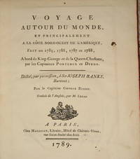
(22 maps & plates- Canada, Northwest American Coast Exploration): Voyage Autour Du Monde..A La Cote Nord-Ouest De L'Amerique..1785, 1786, 1787, 1788..Par Le Capitaines Portlock et Dixon
by Dixon, Capitaines George (dedicated to Sir Joseph Banks)
- Used
- very good
- Hardcover
- first
- Condition
- Used - Very Good
- Edition
- First Edition Thus
- Binding
- Hardcover
- Quantity Available
- 1
- Seller
-
Crozet, Virginia, United States
- Item Price
-
$1,875.00$8.50 shipping to USA
Show Details
Description:
Paris: Maradan, 1789. Small 4to (10 inches); first French edition (there was a smaller and later 8vo. edition in 2 volumes). Contemporary vellum spine separated at front edge (boards attached and binding sound), with somewhat later boards and endpapers, with red gilt-lettered label intact though a bit scuffed and slightly chipped at the right lower edge. Boards a bit scuffed at edges; binding tight, interior very good or better with all 22 engraved plates (numbered 1-21, plus the large folding frontis map (color coded for voyage routes and titled "Carte des Voyages du King George et de la Reine Charlotte...). This is 499 pp, including appendix I, plus appendix II of 46pp, followed by the 2 pp Approbation. One of the plates is of a Native American, plus there are several maps and views, along with the later engravings of several birds (very attractive). This is an increasingly uncommon and very nice copy of this detailed explorations of the Pacific Northwest and Queen Charlotte Islands, with all…
Read More Item Price
$1,875.00
$8.50
shipping to USA
(3 Volume Historical / Thematic Atlas): Atlas Historique et Pittoresque Du Histoire Universelle...Tome I- Antiquite...Tome II- Moyen-Age...Tome III- Temps Moderne
by Baquol, J. (revised with Maps By J.-H. Schnitzler)
- Used
- very good
- Hardcover
- Condition
- Used - Very Good
- Binding
- Hardcover
- Quantity Available
- 1
- Seller
-
Crozet, Virginia, United States
- Item Price
-
$350.00$8.50 shipping to USA
Show Details
Description:
Strasbourg: E. Simon, Rue Du Dome, 14., 1864. The above date refers to the earliest of the 3 volumes (all small elephant folios), the last being published with a date of 1868. These are very decorative, with all maps as issued, which appear at the end of each volume with original color on heavy paper. They are representative of the times applicable to the volumes (ancient, middle and modern). The extensive historical text is in French, and the volumes also have extensive b&w lithographed images of famous persons and places, all quite decorative. The bindings are a bit scuffed and rubbed, especially at the edges; they are in their original red cloth (the original owners name is bound-in to a small slip in volume 1, seeming to indicate the volume was prepared to order), with gilt lettered leather spines and raised bands. The new edition of Tooley's "Dictionary of Mapmakers" only reports a 2 volume set from 1860, and does not deal with the enlarged later edition. Phillips (entry 101)…
Read More Item Price
$350.00
$8.50
shipping to USA
(34 Etchings, City & Waterway Views): The Doge & The Dolphin. Impressions of Venice
by Crabtree, Chris N
- Used
- as new
- Hardcover
- Signed
- Condition
- As New
- Edition
- Limited/Numbered
- Binding
- Hardcover
- Quantity Available
- 1
- Seller
-
Crozet, Virginia, United States
- Item Price
-
$975.00$8.50 shipping to USA
Show Details
Description:
Goolwa, South Australia : Dolphin Studios , 1990. An artistically striking, 22 inch oblong elephant folio, unusued and as new, in original dark red decorative slipcase. Full brown and tan leather, with decorative endpapers, copy number 20 of a limited edition of 50. The introduction gives the explanation for the choice of title: the head of the old oligarchy (The Doge), and the forests and lagoon (The Dolphin) that captured the interests of the aerial cartographers. The first etching is a waterside view of the Doge's palace. All 34 etchings have the original tissue guards, along with their individual explanations. The artist was trained as an architect; his wife was the intaglio printer in charge of the etching production. The paper is heavy, acid-free stock. There is a full list of specifications, some bibliographical references, and a glossary. In addition to the palace, there are numerous views of various buildings, waterways, gondolas, etc. . Signed by Author. Limited/Numbered. Full-Leather. As New.
Item Price
$975.00
$8.50
shipping to USA
(39 Maps / City Plans): An Illustrated Atlas, Geographical Statistical, and Historical, of the United States, and the adjacent Countries
by Bradford, T.G. (Thomas Gamaliel)
- Used
- Hardcover
- first
- Condition
- Used
- Edition
- First Thus
- Binding
- Hardcover
- Quantity Available
- 1
- Seller
-
Crozet, Virginia, United States
- Item Price
-
$8,275.00$8.50 shipping to USA
Show Details
Description:
Boston & New York: Weeks, Jordan & Co., and Wiley & Putnam, 1838. Twenty inch elephant folio, expertly re-backed with original half-leather boards, with original spine laid down on a new Harmatan goatskin spine, some restoration to corners of covers. Front endpapers creased (original), with two title pages (first in full color). Few maps expertly repaired verso (minor tears at margins; none major). An owner's inscription indicating a gift to a son, dated 1860, is on the verso of the Philadelphia frontis plan. This was an enlarged edition (including a larger map format) of Bradford's eariler atlas. Wiley & Putnam were the New York publishers; Weeks, Jordan and C. were of Boston. The atlas was stereotyped and printed by Fulsom, Wells & Thurston of Cambridge, Mass. Ristow (p. 271 "American Maps and Mapmakers") indicates that the title page was engraved by James Archer of Boston, also repsonsible for most of the plates in Hinton's "History and Topography of…
Read More Item Price
$8,275.00
$8.50
shipping to USA
(60 maps / plates): A New General Atlas, Comprising a Complete Set of Maps, representing the Grand Divisions of the Globe, Together with the several Empires, Kingdoms and States in the World: Compiled from the Best Authorities
by Finley, Anthony (written and engraved by Jos. Perkins)
- Used
- very good
- Hardcover
- first
- Condition
- Used - Very Good
- Edition
- First Edition
- Binding
- Hardcover
- Quantity Available
- 1
- Seller
-
Crozet, Virginia, United States
- Item Price
-
$6,375.00$8.50 shipping to USA
Show Details
Description:
Philadelphia: Anthony Finley, 1824. Small folio, 13.75 inches, very good condition, half leather with some resoration to spine. Front endpaper detached but present. Very little foxing, few tiny stains, to the 58 hand colored maps and two charts (mountains, rivers). Sixty plates in all, as called for (Phillips 4314). The maps were engraved by Young and Delleker, who did many of the maps for many other period atlases, including those of the Carey and Lee atlases, also of Philadelphia. This is the first edition, second issue (Western Hemisphere is first map) of this well-known atlas. The individual states of America are all here, along with other world areas, with each individual engraving measuring approximately 11.5 x 8.5 inches. There is a small owners signature (Mary G. Chow ?) penned at the left lower title page. This is a nice atlas from the early USA, at a time when most of the production centered in Philadelphia. A rather scarce atlas in this early state. LC Control Number: unk82073490 . . First…
Read More Item Price
$6,375.00
$8.50
shipping to USA
Atlas America Latina. The World's Markets
by R. G. Dunn (The Mercantile Agency)
- Used
- very good
- Hardcover
- first
- Condition
- Used - Very Good
- Edition
- First Edition
- Binding
- Hardcover
- Quantity Available
- 1
- Seller
-
Crozet, Virginia, United States
- Item Price
-
$225.00$8.50 shipping to USA
Show Details
Description:
New York: Genral Drafting Co., Inc., 1919. Interior generally VG+ but for insect damage to the first 19 pages at the lower margin of the Spanish text (also in English and Portuguese, which are not affected). Very little interference with legibility, and all of maps/charts are intact. This was an unusual atlas, preparted with a specific eye to world trade expansion post World War I. This atlas deals with Mexico, Central and SOuth America. There are 35 printed color maps, the initial one being an index map with all existing trade routes. There are commercial graphic charts of trade details for each country, with an elaborate introduction, text and index. There is an article by William C. Wells (Chief Statistician of the Pan American Union) on "Trading with Latin America". There are details of geography, topography, climate, population/language, religion, education, mmigration, ports/harbors, transportation, monetary systems and more. The 29 plates constituting a comprehensive map of Latin…
Read More Item Price
$225.00
$8.50
shipping to USA
Atlas Historique, Genealogique Chronologique et Geographique
by Le Sage (Lesage), A. (Comte De Las Casas
- Used
- very good
- Hardcover
- Condition
- Used - Very Good
- Binding
- Hardcover
- Quantity Available
- 1
- Seller
-
Crozet, Virginia, United States
- Item Price
-
$875.00$8.50 shipping to USA
Show Details
Description:
Paris: Leclere, Librarie, Boulevard Saint-Martin, No. 11, 1829. VG+ interior on handmade paper. Original hand coloring. 35 plates/charts/maps as called for. The 1829 date is pencilled in at bottom of title page, but is printed into the beginning of the introduction. These were popular atlases, forerunners to the familiar Carey & Lea/ Buchon atlases. According to Jeremy Black (in MAPS AND HISTORY, his dissertation on historical atlases), the Le Sage atlases, first appearing very early in the 19th century, were among the most important of their time. This item has its original marbeled boards with a tight binding, and is the 'Nouvelle Edition ou Reimpression', with many more plates than the earlier versions. This is a nice historical (thematic) atlas, with attractive copperplate engraved maps, hand colored (as issued) on heavy paper.. Very Good. Elephant Folio - over 15" - 23" tall. Private Press.
Item Price
$875.00
$8.50
shipping to USA

(Atlas, Military Forts- 89 plans): Recueil Des Fortifications Forts et Ports De Mer De France lave Au Pinceau
by Le Rouge, George Louis
- Used
- Hardcover
- Condition
- Used
- Binding
- Hardcover
- Quantity Available
- 1
- Seller
-
Crozet, Virginia, United States
- Item Price
-
$1,200.00$8.50 shipping to USA
Show Details
Description:
Paris (Rue des Augustins): le Rouge , 1760. Contemporary marbled cloth boards, rebacked with banded leather spine and gilt-lettering. All 89 plates, including American ports (Quebec, Louisbourg, Nouvelle orleans, Fort Dauphin, Cayenne, Ville Marie), plus Table (index) at rear. These are b&w (as issued) copperplate engravings, on laid paper, all in very good or better condition. Le Rouge was trained as a military engineer, but did quite a number of cartographic works, often with a military slant, between 1740-1780 (see Moreland & Bannister, ANTIQUE MAPS). Listed as Phillips' entry 2975. A rather uncommon small atlas. Neat owners signatures.. 8vo - over 7¾" - 9¾" tall.
Item Price
$1,200.00
$8.50
shipping to USA
(Atlas Volume Only- 60 Maps / Plans; Military History, Napoleonic Campaigns): Life of Napoleon By Baron Jomini, General-in-Chief and Aid-de-Camp to the Emperor of Russia
by Jomini, (Antoine) Henri (Baron de); Translated By Major General H. W. (Henry Wager) Halleck
- Used
- Hardcover
- Condition
- Used
- Binding
- Hardcover
- Quantity Available
- 1
- Seller
-
Crozet, Virginia, United States
- Item Price
-
$750.00$8.50 shipping to USA
Show Details
Description:
New York: D. Van Nostrand, 192 Broadway, 1864. Small oblong (9.8 inch) 4to, half calf, contemporary marbelled boards, gilt lettered spine. Compared to other copies, based on the boards and the index pages, this seems to be something of a deluxe edition, though the maps are the same. There is some chipping to the edges of the spine , with some scuffing and a few small scratches to the cover, but the binding is sound. There is a full list of maps, indexed to the text volumes (those are not present here). Complete with all 60 steel-lpate engravings, color coded for troop positions. These are all in very good or better condition. This atlas covers campaigns from the Valley of the Po i 1796, to the Battle of Wavre in 1815. Jomini was originally in the French army, but later was a General in Russian service, after a falling-out with the French command. This is a very nice small atlas of significance for students of military cartography. With respect to General Halleck, who translated this set of…
Read More Item Price
$750.00
$8.50
shipping to USA
(Atlas Volume Only- 60 Maps / Plans; Military History, Napoleonic Campaigns): Life of Napoleon By Baron Jomini, General-in-Chief and Aid-de-Camp to the Emperor of Russia
by Jomini, (Antoine) Henri (Baron de); Translated By Major General H. W. (Henry Wager) Halleck
- Used
- Hardcover
- Condition
- Used
- Binding
- Hardcover
- Quantity Available
- 1
- Seller
-
Crozet, Virginia, United States
- Item Price
-
$625.00$8.50 shipping to USA
Show Details
Description:
New York: D. Van Nostrand, 192 Broadway, 1864. Small oblong (9.8 inch) 4to, red contemporary cloth boards, hinges starting, but binding sound. Some chipping to board edges. There is a full list of maps, indexed to the text volumes (those are not present here). Complete with all 60 steel-lpate engravings, color coded for troop positions. These are all in very good or better condition. This atlas covers campaigns from the Valley of the Po i 1796, to the Battle of Wavre in 1815. Jomini was originally in the French army, but later was a General in Russian service, after a falling-out with the French command. This is a very nice small atlas of significance for students of military cartography. With respect to General Halleck, who translated this set of Jomini's works: "He commanded the Department of the Missouri and then the Department of the Mississippi. He led the Union forces during the Corinth campaign before he became the commanding general of the Army on 13 July 1862. He served as…
Read More Item Price
$625.00
$8.50
shipping to USA
Atlas of Israel, Cartography Physical and Human Geography
by The Survey of Israel (multiauthored atlas)
- Used
- as new
- Hardcover
- Condition
- As New
- Edition
- 3rd
- Binding
- Hardcover
- Quantity Available
- 1
- Seller
-
Crozet, Virginia, United States
- Item Price
-
$150.00$8.50 shipping to USA
Show Details
Description:
New York: MacMillan Publishing Company, 1985. As new. This is the third edition (the most recent), with 40 printed color plates (numbered), in collaboration with The Survey of Israel (Tel Aviv). The first edition, published c. 1964, dealt with Israel within the 1949 armistice lines. The second edition (1970) covered the post-cease fire lines from 1967. This edition, beautifully produced, includes the territory as of 1985, but also include the Sinai (returned to Egypt 1982). . 3rd. Cloth. As New/No Jacket. Elephant Folio - over 15" - 23" tall.
Item Price
$150.00
$8.50
shipping to USA
Atlas of Iraqi War Crimes in the State of Kuwait
by Al-Hammadi, Dr. Abdullah M., M.D. And Al-Abdalrazaq, Mr. Abdulateef A
- Used
- very good
- Hardcover
- Signed
- Condition
- Used - Very Good
- Binding
- Hardcover
- Quantity Available
- 1
- Seller
-
Crozet, Virginia, United States
- Item Price
-
$160.00$8.50 shipping to USA
Show Details
Description:
Kuwait: Atlas Est., 1995. Nearly unusued, 2nd printing, probable deluxe edition with red cloth covers and gilt lettering. Lavish production with many color maps, divided into 4 sections: War Crimes, Brief Statistics of the Invasion, Maps of Mass Destruction, Maps of Different Areas of Kuwait Showing the Locality Where War Crimes Were Committed. Text in English, Arabic and French. Map endpapers. This copy has a HAND SIGNED LETTER FROM DR. AL-HAMMADI, dated 15/8/1998 to the Voice of Reason (newsletter of the Americans for Religious Liberty) dedicating this particular copy to the library of said publication. There is also a bound (satin tie) laminated key card/bookmark. A very impressive modern atlas of the invasion and its aftermath. . Cloth. Very Good/Very Good. Folio - over 12" - 15" tall.
Item Price
$160.00
$8.50
shipping to USA
An Atlas of Ancient Geography
by Butler, Samuel
- Used
- Condition
- Used
- Quantity Available
- 1
- Seller
-
Crozet, Virginia, United States
- Item Price
-
$150.00$8.50 shipping to USA
Show Details
Description:
Longman, Rees, Orme, Brown, Green & Longman; London, C.1830. 8vo, cover worn and rubbed/bumped/frayed edges w/ soiled margins. Hinges starting, but contents intact. Most of maps at least good, w/all but onel in hand outline color. Some writing on verso several maps, only one or two w/ annotations recto. Index, title page and contents intact.22 maps/plans. There is soiling and some foxing of several image areas. Most of maps (opened) 19x24cm..
Item Price
$150.00
$8.50
shipping to USA
Britannica Atlas
by Encyclopedia Britannica, Inc
- Used
- Condition
- Used
- Quantity Available
- 1
- Seller
-
Crozet, Virginia, United States
- Item Price
-
$45.00$8.50 shipping to USA
Show Details
Description:
Encyclopedia Britannica Inc., Chicago, 1977. Nice 4vo world atlas. No Dj, cover G due to soiling and some wear. Most of maps VG+. 312pp maps; 222pp index. Some soiling edges..
Item Price
$45.00
$8.50
shipping to USA
(Civil War Atlas- 22 Battle & Campaign Maps): History of the Army of the Cumberland...Atlas (Atlas Only)
by Ruger, Edward (by the request of Major-General George Thomas)
- Used
- Hardcover
- Condition
- Used
- Binding
- Hardcover
- Quantity Available
- 1
- Seller
-
Crozet, Virginia, United States
- Item Price
-
$495.00$8.50 shipping to USA
Show Details
Description:
Cincinnati: Robert Clarke & Co., 1875. Large 8vo. with very few markings; tiny bookseller sticker at lower end of rear paste-down; some scuffing to spine, but text legible and binding tight. Exterior very good, internally about fine. All 22 maps (many folding out too much larger size) present, and color coded for troop positions: Map...Operations...Armies...Cumberland and Ohio...Generals Anderson, Sherman, and Buell; Map...Logan's Cross-Roads...; Map...Shiloh; Map...lines of Intrenchment...Routes...General Halleck; Map...Perryville, Kentucky; Map...Campaigns...Under...General Rosecrans; Map...Stone River; Map...Chickamauga: Map...Chattanooga...Campaigns...; Map...Batle-Field of Chattanooga; Map...First Epoch...Atlanta Campaign; Map...Second Epoch...; Map...Third Epoch...; Map... Fourth Epoch...; Map...Fifth Epoch...; Map...Operations...General George H. Thomas...; Map...Franklin, Tennessee; Map...Nashville; Map...Selma, Alabama...Defenses; Map...Marches...General Sherman...Georgia and the…
Read More Item Price
$495.00
$8.50
shipping to USA
Civil War Atlas to Accompany Steele's American Campaigns
by Stamps, TD (editor)
- Used
- Paperback
- first
- Condition
- Used
- Edition
- First Edition
- Binding
- Paperback
- Quantity Available
- 1
- Seller
-
Crozet, Virginia, United States
- Item Price
-
$90.00$8.50 shipping to USA
Show Details
Description:
West Point : US Military Academy (Dept. Of Military Art and Engineering), 1941. Oblong atlas elephant folio (13x19 inches). All 136 maps in near fine condition, with original outline color. THis atlas was prepared by the US Military Academy for its course in military history. The only flaw is that the previous owner stored this folded, so there is a center crease in the volume. The gilt lettered soft cover, pebbled covers are in VG+ condition. Among the contributors to this volume is one Maj. VT Espisoto, who published extensively in this arena over the years, including the sell-known (and later) 'West Point Atlas of American Wars'. . First Edition.
Item Price
$90.00
$8.50
shipping to USA
De la Grandeur et de la Figure de la Terre
by Cassini, Jacques (Cassini De Thury)
- Used
- Hardcover
- Condition
- Used
- Binding
- Hardcover
- Quantity Available
- 1
- Seller
-
Crozet, Virginia, United States
- Item Price
-
$1,200.00$8.50 shipping to USA
Show Details
Description:
Paris, 1720. Ex-Lib (Univ. of Chicago, Berlin), with usual interior markings. Leather boards chipped and separating, with spine chipped (could be rebound; binding tight), with engraved frontis. 306pp, 15 plates, 5 folding maps (mostly France). Interior VG+, with maps and plates in similar condition. This volume was produced as part of a series in the memoirs of the Royal Academy of Sciences for the year 1718. Cassni was a member of the Royal Society and Academy of Sciences, and also a director of the Paris Observatory, where he succeeded his father (Jean-Dominique). This is a scarce volume..
Item Price
$1,200.00
$8.50
shipping to USA

Didn’t find what you’re looking for?
Try adding this search to your want list. Millions of books are added to our site everyday and when we find one that matches your search, we’ll send you an email. Best of all, it’s free.
Add to Want List

Are you a frequent reader or book collector?
Join the Bibliophile's Club and save 10% on every purchase, every day — up to $20 savings per order!

Social Responsibility
Did you know that since 2004, Biblio has used its profits to build 16 public libraries in rural villages of South America?