Atlases
From The Mapmakers to Atlas Maior, from The Mapmakers to Hammond's Family Reference World Atlas, we can help you find the atlases books you are looking for. As the world's largest independent marketplace for new, used and rare books, you always get the best in service and value when you buy from Biblio.com, and all of your purchases are backed by our return guarantee.
Top Sellers in Atlases

The Mapmakers
by John Noble Wilford
John Noble Wilford is a science correspondent for The New York Times. He lives in New York.


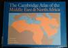
The Cambridge Atlas Of the Middle East and North Africa
by Gerald, Dewdney, John, Mitchell, Jonathan Blake


Atlases Books & Ephemera
The Mapmakers
by Wilford, John Noble
John Noble Wilford is a science correspondent for The New York Times. He lives in New York.


ODHAMS ROAD ATLAS OF GREAT BRITAIN
by Odhams
London: Oldhams Press. Very Good+ with no Dust Jacket. 1953. 1st Edition. Hardcover. 8vo 8" - 9" tall; 112 pages; Blue cloth hard covers with gold lettering on spine. There is a bumped area on spine. Very light rubbing to the edges and turn corners. Spine is straight, binding tight. Pages are clean with light vanilla patina. .
Item Price
$15.00
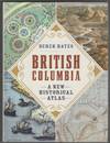
British Columbia A New Historical Atlas
by Hayes, Derek
Vancouver BC: Douglas & McIntyre. Very Good in Very Good dust jacket. 2012. Second Printing. Hardcover. 1926812573 . Short tear bottom of DJ and book spine ; Dust jacket in Mylar jacket protector. ; 13.5 X 10.2 X 1.5 inches; 368 pages; "British Columbia was among the last temperate places on Earth to appear on the map of the world, a function of its position-remote from Europe. When gold was finally discovered in quantity in 1858, leading to the gold rush that created British Columbia as...
Read more about this item
Item Price
$89.95

Catalogo Cartografico De La Republica Argentina
by Greco Carlos A. Turco
Universitaria De Buenos Aires, 1967. Book. Good +. Hardcover. Blue Notebook binding w/ two metal brads. Thick compilation of maps and text. Department imprint stamp to bottom text page, otherwise all of pages clean. Mild edgewear. One brad edge chipped off but binding sturdy and solid. Fold-outs..
Item Price
$55.00$49.50

Knaurs Welt-Atlas
by Pahl, Günter und Knaur:
1952.. München, Droemersche Verlagsanstalt, 119 farbige und schwarze Haupt- und Nebenkarten, ca 580 Seiten, Register gebundene Ausgabe, Leinen, Hardcover/Pappeinband Neubearbeitung 1951/1952, ohne Schutzumschlag, Ecken/Kanten bestossen, Einband berieben, vergilbt und fleckig, Buchschnitt mit Lagerspuren und Flecken, Seiten gebräunt, Ecken verknickt, eher mittlerer Zustand für das Alter Bücher
Item Price
$9.70

Vol. 9 of 29 Atlases of Insurance Maps for Brooklyn. East Williamsburg & Bushwick
by SANBORN MAP COMPANY
New York: Sanborn Map Company, 1933. hardcover. very good. Atlas. Lithograph with original hand coloring. Massive elephant folio. Decorative calligraphic titles, indices, and key maps. Contains a set of 73 detailed maps of East Williamsburg and Bushwick along with changes recorded on paste-on correction slips through 1973. Quarter leather binding with gilt title on front and spine. Slight wear and small tear to spine of original protective canvas cover.<br/><br/> This volume includes the...
Read more about this item
Item Price
$750.00

Atlas to Accompany Monograph XXVIII on the Marquette Iron-Bearing District of Michigan
by BIEN, Julius; U.S. GEOLOGICAL SURVEY; VAN HISE, Richard; BAYLEY, William Shirley
Washington: U.S. Geological Survey, 1896. First. hardcover. very good. 36 color maps, some folding. Atlas folio, cloth covered boards, spine ends slightly worn, front cover soiled. First edition. Washington: U.S. Geological Survey, 1896. In very good condition.<br/><br/> Atlas to Accompany Monograph XXVIII on the Marquette Iron-Bearing District of Michigan by Richard Van Hise and William Shirley Bayley, with a chapter on the Republic Through by Henry Lloyd Smyth. <br><br>...
Read more about this item
Item Price
$500.00

Gazetteer of Great Britain
by Ordnance Survey
Ordnance Survey of Great Britain, 1972. Paper covers. Good/No Jacket. Ex-library copy with bookplate and stamps.
Item Price
$15.14

Vol. 10A of 29 Atlases of Insurance Maps for Brooklyn. Kensington, South Prospect Park & Borough Park
by SANBORN MAP COMPANY
New York: Sanborn Map Company, 1929. hardcover. very good. Atlas. Lithograph with original hand coloring. Massive elephant folio. Decorative calligraphic titles, indices, and key maps. Contains a set of 76 detailed maps of southern Brooklyn along with changes recorded on paste-on correction slips through 1973. Quarter leather binding with gilt title on front and spine. Tear to spine and lower right corner of original protective canvas cover.<br/><br/> This volume includes the terminus of...
Read more about this item
Item Price
$750.00

Pathfinder sheet 735: Red Wharf Bay (Anglesey)
by Ordnance Survey
Ordnance Survey, 1978. Scale 1:25,000. Folded map. Fine/No Jacket. Sheet number inscribed on cover.
Item Price
$15.14

Atlas of South Australia
by Griffin, T. & McCaskill, M. (eds.)
South Australian Government / Wakefield Press, 1986. 1st edition. Hard covers, no dust jacket. Good/No Jacket. Damp staining to one corner of front cover, also affecting first few pages. Ex-library copy with label, security sticker etc.
Item Price
$25.23

The island of lost maps: a true story of cartographic crime
by Harvey, M
Weidenfeld & Nicolson, 2001. 1st UK edition. Hard covers, dust jacket. Fine/Fine. Scarcely used.
Item Price
$7.57

A school atlas of English history
by Gardiner, S.R
Longmans, Green, 1904. New impression. Hard covers. Good/No Jacket. Binding a little loose. Obliterated signatures of previous owners. Wear to tips of spine.
Item Price
$15.14

Strassen-Taschenatlas Maßstab 1:500 000 Deutschland, Nordostschweiz, Westösterreich
by Kremling, Dr. Ernst:
1970.. München, JRO-Verlag, 114 fünffarbige Kartenseiten, 70 mehrfarbige Städtedurchfahrtspläne, Entfernungstabelle, Ortsregister Hardcover/Pappeinband 4. Auflage um 1970/keine Jahresangabe, Ecken/Kanten bestossen, Einband berieben, vergilbt und fleckig, Buchschnitt mit Lagerspuren, Seiten gebräunt, wellig, Leserillen, schiefgelesen, kein Schutzumschlag, mittlerer Zustand Bücher
Item Price
$10.34

Mercator. The man who mapped the planet
by Crane, Nicholas
London: Weidenfeld & Nicolson. 2002. Large octavo size [16x24cm approx]. Near Fine copy in Very Good dustjacket. Dustjacket is now protected in our purpose-made plastic sleeve. A nice copy. Colour and black & white illustrations. Robust, professional packaging and tracking provided for all parcels. 348 pages. . 2nd Impression. Hardback.
Item Price
$19.52

Pathfinder sheet 891 (SJ80/90)
by Ordnance Survey
Ordnance Survey, 1989. Scale 1:25,000. Folded map. V.g.. Little used.
Item Price
$15.14

Vol. 6 of 29 Atlases of Insurance Maps for Queens. Downtown Jamaica & Morris Park
by SANBORN MAP COMPANY
New York: Sanborn Map Company, 1925. hardcover. very good. Atlas. Lithograph with original hand coloring. Massive elephant folio. Decorative calligraphic titles, indices, and key maps. Contains a set of 79 maps along with changes recorded on paste-on correction slips through 1970. Quarter leather binding with gilt title on front and spine. Tear to spine of original protective canvas cover.<br/><br/> This volume includes part of Richmond Hill and the Van Wyck Expressway, and the original...
Read more about this item
Item Price
$750.00
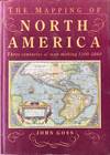
The mapping of North America: three centuries of map-making 1500-1860
by Goss, J
The Wellfleet Press, Secaucus N.J., 1990. 1st edition. Hard covers, dust jacket. V.g./V.g.. Scarcely used. No inscriptions.
Item Price
$35.32

Vol. 18 of 29 Atlases of Insurance Maps for Brooklyn.Coney Island and Brighton Beach
by SANBORN MAP COMPANY
New York: Sanborn Map Company, 1930. hardcover. very good. Atlas. Lithograph with original hand coloring. Massive elephant folio. Decorative calligraphic titles, indices, and key maps. Contains a set of 86 detailed maps of southern Brooklyn along with changes recorded on paste-on correction slips through 1974. Quarter leather binding with gilt title on front and spine. Minor wear to spine of original protective canvas cover.<br/><br/> This volume includes Sheepshead Bay, Shore Parkway,...
Read more about this item
Item Price
$750.00

Dolgellau (first series 1:25,000)
by Ordnance Survey
Ordnance Survey, 1961. Sheet SH71. Folded map. Good. Unconventionally folded.Title has been added by hand, the front cover being largely blank!
Item Price
$6.31

Vol. 8 of 29 Atlases of Insurance Maps for Brooklyn. East New York
by SANBORN MAP COMPANY
New York: Sanborn Map Company, 1928. hardcover. very good. Atlas. Lithograph with original hand coloring. Massive elephant folio. Decorative calligraphic titles, indices, and key maps. Contains a set of 76 detailed maps of East New York along with changes recorded on paste-on correction slips through 1973. Quarter leather binding with gilt title on front and spine. Original protective canvas cover in very good condition.<br/><br/> This volume includes an inset "Map of Islands of...
Read more about this item
Item Price
$650.00

Sheet 15 ( N.W. Donegal, the area around Gweebarra Bay)
by Geological Survey of Ireland
Geological Survey of Ireland, n.d.. Covers the area of One-inch sheet 15 (Dunglow) of the Irish Ordnance Survey. Linen-backed map with 8 segments, legend etc. mounted at rear.. V.g./No Jacket. Sheet 15, one-inch geological survey map. Handwritten label, unusual marbled covers resembling a conglomerate.
Item Price
$30.28


WARRANTEE ATLAS OF LAWRENCE COUNTY, PENNSYLVANIA 1909
by Henry Houck
Department of Internal Affairs. Near Fine with no dust jacket. 1909. Hardcover. Warrantee Atlas of Lawrence County, Pennsylvania. Constructed From the Records on File in the Department of Internal Affairs and Surveys Made on the Ground during the Year 1908, under the Direction of Honorable Henry Houck, Secretary of Internal Affairs, in Pursuance of an Act of the General Assembly of Pennsylvania . Pebble grain cloth boards backed witha morocco leather black spine. 24" x 24.5" 10 pounds...
Read more about this item
Item Price
$441.00

Imagined Corners : Exploring the World's First Atlas
by Binding, Paul
Headline Review, 2003. Book. Very Good. hardback. 1st Edition. hardback, slight forward lean else a very good tightly bound copy in a lightly rubbed pictorial dust wrapper, the text is clean and is unmarked, colour illustrations, 314pp.
Item Price
$8.83

Hansa Welt-Atlas
1933.. berlin, Neufeld & Henius Verlag, 168 Seiten, 63 Karten, 50 Diagramme, Spezialkarten, Tabellen, Zeichnungen, Text, Statistiken gebunden, Ecken/Kanten bestossen, Einband abgerieben und sehr fleckig, Buchrücken fehlt, Buchkörper sehr fleckig, Seiten vergilbt und stark fleckig, schlechter Zustand Bücher
Item Price
$8.89
