Rare and Antiquarian Books
Rare books from Original Antique Maps
Results 1 - 15 of 40
More Photos
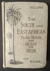
The South and East African Year Book Guide. With Atlas and Diagrams. 34th Issue owned by A. Jessop: Union-Castle Atlas pp. 2-64 with color maps, single and double page, George Philips & Son, Geographical Institute, London
by Edited Annually By A. Samler Brown, F.R.M.S. & G. Gordon Brown, F.R.G.S.
- Used
- Hardcover
- Signed
- Condition
- Used
- Edition
- 34th
- Binding
- Hardcover
- Seller
-
FRAMINGHAM, Massachusetts
- Item Price
-
$275.00$11.00 shipping to USA
Show Details
Item Price
$275.00
$11.00
shipping to USA
More Photos
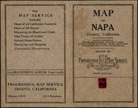
Napa County California. 1914
by Copyright 1914 by Punnett Brothers
- Used
- Condition
- Used
- Seller
-
FRAMINGHAM, Massachusetts
- Item Price
-
$950.00$11.00 shipping to USA
Show Details
Item Price
$950.00
$11.00
shipping to USA

Published by the Milwaukee Sentinel Commemorating Its One Hundredth Anniversary June 27, 1937: Approved by the Wisconsin Conservation Commission, Checked and Approved by Dr. Joseph Schafer, Superintendent of the Historical Society of Wisconsin and Dr. Louise Phelps Kellogg, Senior Research Associate Endorsed by the Wisconsin State Chamber of Commer
by Copyright 1932 by Erwin F. Bahlmann and Artist Nina S. Bahlman
- Used
- Condition
- Used
- Seller
-
FRAMINGHAM, Massachusetts
- Item Price
-
$650.00$11.00 shipping to USA
Show Details
Item Price
$650.00
$11.00
shipping to USA
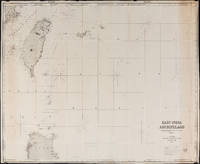
East India Archipelago Chart No. 7 (1878): Formosa
by James Imray and Son
- Used
- Condition
- Used
- Seller
-
FRAMINGHAM, Massachusetts
- Item Price
-
$900.00$11.00 shipping to USA
Show Details
Item Price
$900.00
$11.00
shipping to USA
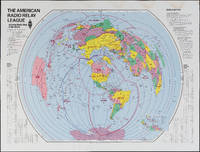
The Amateur Radio Relay League: Amateur Radio Map of the World
by American Radio Relay League
- Used
- Condition
- Used
- Seller
-
FRAMINGHAM, Massachusetts
- Item Price
-
$325.00$11.00 shipping to USA
Show Details
Item Price
$325.00
$11.00
shipping to USA

Map of Mining Claims Butte and Vicinity Montana (1907)
by Harper, Macdonald & Co., J.H. Harper, A.B. Hobart, R.H. Lindsay, Jr., Mineral & Land Attorneys & U.S. Mineral Land Surveyors
- Used
- Signed
- Condition
- Used
- Seller
-
FRAMINGHAM, Massachusetts
- Item Price
-
$800.00$11.00 shipping to USA
Show Details
Item Price
$800.00
$11.00
shipping to USA

More Photos
Mitchell's Reference and Distance Map of the United States, 1845
by J.H.Young
- Used
- Condition
- Used
- Seller
-
FRAMINGHAM, Massachusetts
- Item Price
-
$5,200.00$11.00 shipping to USA
Show Details
Item Price
$5,200.00
$11.00
shipping to USA

More Photos
New and Correct Map of the Lines of the Northern Pacific Railroad and Oregon Railway & Naviagation Co. Fall, 1883, November
by Northern Pacific Railroad and Oregon Railway & Naviagation Co.
- Used
- Condition
- Used
- Edition
- Fall, 1883, November
- Seller
-
FRAMINGHAM, Massachusetts
- Item Price
-
$3,600.00$11.00 shipping to USA
Show Details
Item Price
$3,600.00
$11.00
shipping to USA

Vue du Centre de Paris a vol d'oiseau, Grand Marnier Liquor, 1951
by G. Peltier
- Used
- Condition
- Used
- Seller
-
FRAMINGHAM, Massachusetts
- Item Price
-
$500.00$11.00 shipping to USA
Show Details
Item Price
$500.00
$11.00
shipping to USA

U.S. Harbor & River Monitor, Tippe Canoe Class, (1864) with manuscript dedication: [Presented to William Macpherson Horner by his friend Capt. Fox Asst.Sec.Navy 1864]
- Used
- Condition
- Used
- Seller
-
FRAMINGHAM, Massachusetts
- Item Price
-
$2,500.00$11.00 shipping to USA
Show Details
Item Price
$2,500.00
$11.00
shipping to USA

A Beautiful and Accurate Elevation of the Temple of Solomon Taken From the Celebrated Model Erected by Counsellor Schott at Hamburgh. Ornamented with the most interesting Passages in the Lives of King David and Solomon his Son. (c. 1860's)
- Used
- Condition
- Used
- Seller
-
FRAMINGHAM, Massachusetts
- Item Price
-
$1,400.00$11.00 shipping to USA
Show Details
Item Price
$1,400.00
$11.00
shipping to USA

More Photos
Boston, 1857 (manuscript proof approval verso): Framed period engraving examined out of frame
by after J.W.Hill, artist
- Used
- Condition
- Used
- Seller
-
FRAMINGHAM, Massachusetts
- Item Price
-
$2,500.00$11.00 shipping to USA
Show Details
Item Price
$2,500.00
$11.00
shipping to USA
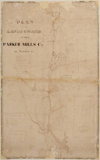
PLAN OF THE LANDS & WATER OF THE PARKER MILLS CO. in Wareham, Mass. - Manuscript (nd) (c. 1834?)
by Sylvanus Bourne
- Used
- Condition
- Used
- Seller
-
FRAMINGHAM, Massachusetts
- Item Price
-
$1,300.00$11.00 shipping to USA
Show Details
Item Price
$1,300.00
$11.00
shipping to USA

A Correct Map of the Seat of War In Mexico. 1847: Being a Copy of Genl Arista's Map, taken at Resaca de la Palma, with additions and Corrections; Embellished with Diagrams of the Battles of 8th & 9th May, and Capture of Monterey, with a memorandum of forces engaged, results &c. and Plan of Vera Cruz and
- Used
- Condition
- Used
- Seller
-
FRAMINGHAM, Massachusetts
- Item Price
-
$3,900.00$11.00 shipping to USA
Show Details
Item Price
$3,900.00
$11.00
shipping to USA

More Photos
Complete bound Set of 73 Hawaiian Fish Chromolithographs, manuscript ink on blue book spine " Baldwin, A.H. 1904 Fish Paintings U.S. Bureau Fishes " and ink manuscript "A.H.Baldwin Feb 24, 1904" with hand drawn tropical fish sketch on front free endpaper.
- Used
- Condition
- Used
- Seller
-
FRAMINGHAM, Massachusetts
- Item Price
-
$9,500.00$11.00 shipping to USA
Show Details
Item Price
$9,500.00
$11.00
shipping to USA
