Description:
Paperback. Very Good.
Abergavenny (Y Fenni). 1:25000 Map Sheet SO 21/31 (Pathfinder 1086) by Ordnance Survey - 1980
by Ordnance Survey
Similar copies are shown below.
Similar copies are shown to the right.
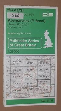
Abergavenny (Y Fenni). 1:25000 Map Sheet SO 21/31 (Pathfinder 1086)
by Ordnance Survey
- Used
- very good
- Paperback
Ordnance Survey, 1980. Book. Very Good. Map. Map in very good condition, sticker on front cover. Edition A. Surveyed 1960-70, revised for significant changes 1978, major roads 1980..
-
Bookseller
Nigel Smith Books
 (GB)
(GB)
- Format/Binding Paperback
- Book Condition Used - Very Good
- Binding Paperback
- ISBN 10 0319210863
- ISBN 13 9780319210864
- Publisher Ordnance Survey
- Date Published 1980
- Keywords wales, monmouthshire, breconshire, map, crickhowell, crucywell, llangattock, llangatwg, clydach, gilwern, glangrwyney, llangenny, llangenau, govilon, abergavenny, y fenni, llanellen, llanddewi rhydderch, llanfable, llanwytherin, monmouthshire and brecon c
We have 1 copies available starting at $5.05.

Abergavenny (Sheet 1086 (SO21/31)) (Pathfinder maps)
by Ordnance Survey
- Used
- very good
- Paperback
- Condition
- Used - Very Good
- Binding
- Paperback
- ISBN 10 / ISBN 13
- 9780319210864 / 0319210863
- Quantity Available
- 1
- Seller
-
GORING BY SEA, West Sussex, United Kingdom
- Item Price
-
$5.05$8.57 shipping to
Show Details
Item Price
$5.05
$8.57
shipping to