Click for full-size.
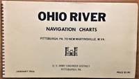
Ohio River Navigation Charts, Pittsburgh, Pa. to New Martinsville, W. Va (Revised: 1 January 1966)
by U.S. Army Engineer District, Pittsburgh, Pa
- Used
- very good
- Condition
- Very Good
- Seller
-
Alplaus, New York, United States
Payment Methods Accepted
About This Item
U.S. Army Engineer District, Pittsburgh, Pa, 1966-01-01. Spiral-bound. Very Good. 14x8x0. January 1966 edition. Oblong-shaped book of maps with wire coil binding. No text markings noted, mild wear.
Reviews
(Log in or Create an Account first!)
Details
- Bookseller
- Alplaus Books
 (US)
(US)
- Bookseller's Inventory #
- 69689spb
- Title
- Ohio River Navigation Charts, Pittsburgh, Pa. to New Martinsville, W. Va (Revised: 1 January 1966)
- Author
- U.S. Army Engineer District, Pittsburgh, Pa
- Format/Binding
- Spiral-bound
- Book Condition
- Used - Very Good
- Quantity Available
- 1
- Publisher
- U.S. Army Engineer District, Pittsburgh, Pa
- Date Published
- 1966-01-01
- Size
- 14x8x0
- Weight
- 2.00 lbs
Terms of Sale
Alplaus Books
Items are generally shipped within 24 hours of order. Returns accepted within one month of original sale.
About the Seller
Alplaus Books
Biblio member since 2006
Alplaus, New York
About Alplaus Books
Alplaus Books offers books for online purchase.

Collecting Classic Supernatural Fiction
Classic supernatural fiction is distinct from contemporary horror because it is more literate and often relies upon poetic subtlety rather than unpleasant gratuity to create an atmosphere. Enter if you dare!

Storing books - laying down or standing up?
Don’t unwittingly damage your growing book collection! Learn about when to store books laying down vs standing up. Read About Safe Book Storage