Description:
Clarkson Potter. Used - Good. . . Your purchase supports More Than Words, a nonprofit job training program for youth, empowering youth to take charge of their lives by taking charge of a business. All orders guaranteed and ship within 24 hours.
Rand, McNally & Co.'s Unrivaled Atlas of the World Containing Colored Maps of Every Country and Civil Divisions Upon the Face of the Globe by ATLAS) - 1901.
by ATLAS)

Rand, McNally & Co.'s Unrivaled Atlas of the World Containing Colored Maps of Every Country and Civil Divisions Upon the Face of the Globe
by ATLAS)
- Used
- Hardcover
Chicago.: Rand McNally.. 1901.. Numerous full page and double page printed color maps, black and white illustrations, color diagrams, decorative endpapers, 320pp., 14 1/4 x 11 1/2 inches, gilt lettered green cloth covered boards (hardbound). Full-color maps copyright 1895. The volume has been glued at the hinges and along the spine which was split; wear to cover extremities. Wear along fore-edge of front free endpaper, soiling to first couple of pages, a few short tears to illustrated pages (outside image and text area). Map pages, which run from 1 - 160, are clean and bright. The double page maps are NOT tipped in. The title continues "With Marginal Index Together With Historical, Descriptive, and Statistical Matter Pertaining to Each Colored Statistical Diagram, and City Maps." Full-page maps of the states in addition to major American cities and foreign countries. Includes illustrated section on The World's Peoples. A thorough view of the world at the dawn of the twentieth century. .
-
Bookseller
Independent bookstores
 (US)
(US)
- Book Condition Used
- Binding Hardcover
- Publisher Rand McNally.
- Place of Publication Chicago.
- Date Published 1901.
- Keywords Atlas, Book, geography, Illustrated, map, zzbookg

Stock Photo: Cover May Be Different
The Vegetarian 5-Ingredient Gourmet: 250 Simple Recipes and Dozens of Healthy Menus for Eating Well Every Day
by Atlas, Nava
- Used
- Condition
- Used - Good
- ISBN 10 / ISBN 13
- 9780767906906 / 076790690x
- Quantity Available
- 1
- Seller
-
Waltham, Massachusetts, United States
- Item Price
-
$1.00
Show Details
Item Price
$1.00

Stock Photo: Cover May Be Different
Fitness Book: Fatness to Fitness - Former Fat Kid Reveals His Most Powerful Personal Strategies and Techniques to Help You Quickly and Safely Achieve Permanent Fitness Success
by Joey Atlas
- Used
- Condition
- UsedGood
- ISBN 10 / ISBN 13
- 9781605305158 / 1605305154
- Quantity Available
- 1
- Seller
-
Imperial, Missouri, United States
- Item Price
-
$4.41
Show Details
Description:
UsedGood. The item shows wear from consistent use, but it remains in good condition and works perfectly. All pages and cover are intact (including the dust cover, if applicable). Spine may show signs of wear. Pages may include limited notes and highlighting. May NOT include discs, access code or other supplemental materials.
Item Price
$4.41

Stock Photo: Cover May Be Different
Sweet Designs: Bake It, Craft It, Style It
by Atlas, Amy
- Used
- good
- Hardcover
- Condition
- Used - Good
- Binding
- Hardcover
- ISBN 10 / ISBN 13
- 9781401324407 / 1401324401
- Quantity Available
- 1
- Seller
-
Chicago, Illinois, United States
- Item Price
-
$1.49
Show Details
Description:
Hyperion, 2012-04-24. Hardcover. Good. 1.5000 in x 9.8000 in x 7.5000 in.
Item Price
$1.49

Stock Photo: Cover May Be Different
The Vegetarian Family Cookbook: Featuring More than 275 Recipes for Quick Breakfasts, Healthy Snacks and Lunches , Classic Comfort Foods, Hearty Main Dishes, Wholesome Baked Goods, and More
by Atlas, Nava
- Used
- Condition
- UsedGood
- ISBN 10 / ISBN 13
- 9780767913966 / 0767913965
- Quantity Available
- 1
- Seller
-
Lynden, Washington, United States
- Item Price
-
$4.61
Show Details
Description:
UsedGood. Book is in good condition and may contain underlining or highlighting and minimal wear. The book can also include library labels. May not contain miscellaneous items (toys, dvds, etc). We offer 100% money back guarantee and fast customer support.
Item Price
$4.61

Axel, Angels, Faith, and SpaceTime
by Driver, Cora; Atlas, Oliver [Translator]
- Used
- Paperback
- Condition
- Used:Good
- Binding
- Paperback
- Quantity Available
- 1
- Seller
-
HOUSTON, Texas, United States
- Item Price
-
$4.65
Show Details
Description:
Independently published, 2020-07-28. Paperback. Used:Good.
Item Price
$4.65
Axel, Angels, Faith, and SpaceTime
by Driver, Cora; Atlas, Oliver [Translator]
- Used
- Paperback
- Condition
- Used: Good
- Binding
- Paperback
- Quantity Available
- 1
- Seller
-
HOUSTON, Texas, United States
- Item Price
-
$4.65
Show Details
Description:
Independently published, 2020-07-28. Paperback. Used: Good.
Item Price
$4.65

Stock Photo: Cover May Be Different
Bellow: A Biography
by Atlas, James
- Used
- good
- Hardcover
- Condition
- Used - Good
- Binding
- Hardcover
- ISBN 10 / ISBN 13
- 9780394585017 / 0394585011
- Quantity Available
- 1
- Seller
-
HILLSIDE, New Jersey, United States
- Item Price
-
$1.68
Show Details
Description:
Random House, 10/17/2000 12:00:01. hardcover. Good. 1.6000 in x 9.7000 in x 6.7000 in. Ex-library book*
Item Price
$1.68
Stock Photo: Cover May Be Different
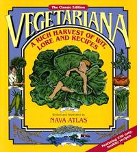
Vegetariana: A Rich Harvest of Wit, Lore, and Recipes
by Atlas, Nava
- Used
- Condition
- UsedGood
- ISBN 10 / ISBN 13
- 9780963024350 / 0963024353
- Quantity Available
- 1
- Seller
-
Imperial, Missouri, United States
- Item Price
-
$4.74
Show Details
Description:
UsedGood. The item shows wear from consistent use, but it remains in good condition and works perfectly. All pages and cover are intact (including the dust cover, if applicable). Spine may show signs of wear. Pages may include limited notes and highlighting. May NOT include discs, access code or other supplemental materials.
Item Price
$4.74
The Healthy Cook's Kitchen Companion: An Organizer for Your Favorite Recipes
by Atlas, Nava
- Used
- Condition
- UsedGood
- ISBN 10 / ISBN 13
- 9780963024343 / 0963024345
- Quantity Available
- 1
- Seller
-
Brooklyn Park, Minnesota, United States
- Item Price
-
$1.86
Show Details
Description:
UsedGood. Cover has some rubbing and edgewear. Access codes, CD's, and other accessories may not be included.
Item Price
$1.86
Stock Photo: Cover May Be Different
The Vegetarian 5-Ingredient Gourmet: 250 Simple Recipes and Dozens of Healthy Menus for Eating Well Every Day : A Cookbook
by Atlas, Nava
- Used
- Condition
- UsedGood
- ISBN 10 / ISBN 13
- 9780767906906 / 076790690X
- Quantity Available
- 1
- Seller
-
Imperial, Missouri, United States
- Item Price
-
$4.97
Show Details
Description:
UsedGood. The item shows wear from consistent use, but it remains in good condition and works perfectly. All pages and cover are intact (including the dust cover, if applicable). Spine may show signs of wear. Pages may include limited notes and highlighting. May NOT include discs, access code or other supplemental materials.
Item Price
$4.97