
Topographical Description of the Western Territory of North America
by IMLAY, Gilbert
- Used
- Condition
- See description
- Seller
-
Bryn Mawr,, Pennsylvania, United States
Payment Methods Accepted
About This Item
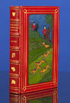
1797. IMLAY, Gilbert. A Topographical Description of the Western Territory of North America: Containing a Succinct Account of Its Soil, Climate, Natural History, Population, Agriculture, Manners, and Customs...The third Edition, With Great Additions. London. 1797. xii,598,[28]pp. plus 3 folding maps and folding plan. A very good copy bound in contemporary 1/2 leather and marbled boards. Internally very fresh. $4,500.00[a] Streeter Sale 1525. HOWES I-12,"b." Field 747. Thomson 632. Sabin 34358. Vail 1130. Buck 43. Clark II:41. Graff 2091. "The most complete version of this work, in which form it was the most informative compilation on the West at the end of the 18th century" -Streeter. "The most complete information on the trans-Allegany frontier..."-Howes. The third edition of Imlay's work adds so much material to the earlier editions as to make it a completely different work, embellished with important maps. Here he gives the complete texts of Filson's famous work on Kentucky, and Hutchins on Florida, Louisiana and Virginia, as well as an account of Indians, Indian corn, ancient earthworks, the soil in the Genesee country, Patrick Kennedy's journal up the Illinois River, a reprint of A Short Description of the State of Tennassee [sic] which first appeared in Philadelphia the previous year, the act creating Knoxville, the 1796 treaty with Spain, and the plan of association of the North American Land Company. All of this is illuminated by "A Map of the Western Territories of the United States," "A Map of the State of Kentucky from Actual Survey by Elihu Barker of Philadelphia" and "A Map of the Tennassee [sic] Government..." The folding plan shows the falls of the Ohio. One of the most important pieces of Americana of the late 18th century.
Reviews
(Log in or Create an Account first!)
Details
- Bookseller
- George S. MacManus Company
(US)
- Bookseller's Inventory #
- 70778
- Title
- Topographical Description of the Western Territory of North America
- Author
- IMLAY, Gilbert
- Book Condition
- Used
- Quantity Available
- 1
- Date Published
- 1797
- Keywords
- HOWESX, TRAVEL & EXP, INDIANS, FINE/GEN AM
Terms of Sale
George S. MacManus Company
We accept VS or MC or we will hold for a check. Books may be returned with the original packing slip within 7 days. Domestic Shipping via UPS is $5.00 for 1st volume, $2.50 for each additional volume. International rates given upon request.
About the Seller
George S. MacManus Company
Biblio member since 2005
Bryn Mawr,, Pennsylvania
About George S. MacManus Company
Our inventory of over 45,000 catalogued titles focuses primarily on 18th and 19th century Americana with specialities such as Voyages and Travels, Local Histories, Indians and the West and the Civil War. Also included in our collection are English and American literary first editions, Limited Edition Club selections and Books about Books.
Glossary
Some terminology that may be used in this description includes:
- Reprint
- Any printing of a book which follows the original edition. By definition, a reprint is not a first edition.
- Marbled boards
- ...

