Click for full-size.
Underground Water Map - Utah - Salt Lake Sheet
by Gardner, Frank D. & John Stewart
- Used
- Condition
- See description
- Seller
-
Salt Lake City, Utah, United States
Payment Methods Accepted
About This Item
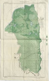
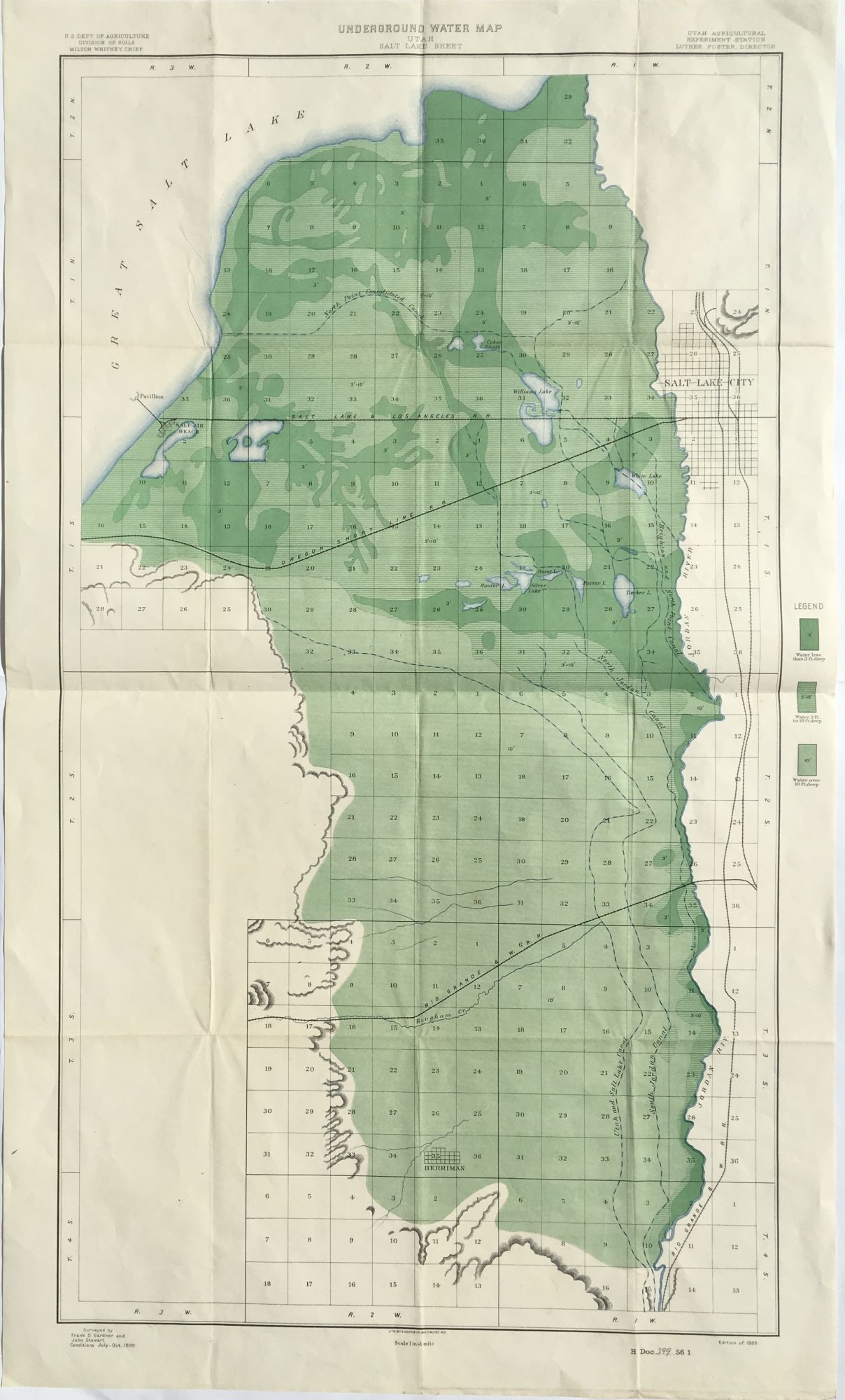
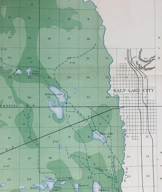
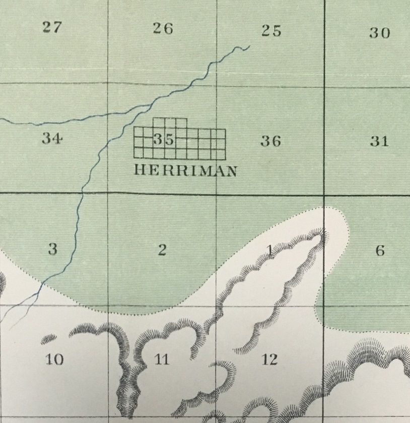
Baltimore, MD: Hoen & Co. Map [76 cm x 43 cm] printed in black, light blue, light green and green. Fold across the center. The legend identifies the water depth along with the underground water of the Salt Lake Valley, this map also locates canals, shallow surface lakes, the Jordan River; the towns of Salt Lake City and Herriman. the Saltair pavilion and beach and the lines for the Rio Grande & Western, the Oregon Short Line and the Salt Lake & Los Angeles. Produced by the Utah Agricultural Experiment Station. Surveyed by Frank D. Gardner and John Stewart between July and October of 1899. Uncommon. We locate six institutional holdings. Moffat 298.
Reviews
(Log in or Create an Account first!)
Details
- Seller
- Tschanz Rare Books
 (US)
(US)
- Seller's Inventory #
- 1257
- Title
- Underground Water Map - Utah - Salt Lake Sheet
- Author
- Gardner, Frank D. & John Stewart
- Book Condition
- Used
- Quantity Available
- 1
- Publisher
- Hoen & Co
- Place of Publication
- Baltimore, MD
- Keywords
- Herriman Salt Lake Saltair Jordan River Utah Water
Terms of Sale
Tschanz Rare Books
All items subject to prior sale. All items are guaranteed authentic and as described. Items may be returned for a full refund within fourteen days with prior notification. Regular customers may expect their usual billing terms. Institutions will be accomodated according to their needs.
About the Seller
Tschanz Rare Books
Biblio member since 2019
Salt Lake City, Utah
About Tschanz Rare Books
We actively buy and sell books, photographs, ephemera, maps, and objects in our specialties: Utah and the Mormons, Interior West, Western National Parks, Western Indians, Railroads and Western Americana generally.
This Book’s Categories

Collecting the 1939 New York World’s Fair
Born in the midst of the Great Depression, the theme of the 1939 World’s Fair was “The World of Tomorrow” - a theme that captured the hearts of a generation. Check out the maps, souvenirs, and other ephemera on Biblio!

Vertigo Comics
Vertigo Comics, an imprint of DC Comics, is being retired in 2020 after a 27 year run of groundbreaking comics. The imprint was DC’s home for mature tales that were often horror-themed or otherwise dark in nature. Learn more about Vertigo, home of V for Vendetta, Sandman, and Fables.