Description:
Ordnance Survey, 1965. Paperback. Good. 1965. Revised Edition. Unpaginated. Large folded map in colour with red paper cover. Printed on paper. Sheet number 107. Map is bright and clear with light tanning to edges. Some wear marks to folds. Minimal tears to edges. Paper cover is moderately tanned. Notable tears and creasing to edges. Thumb-marking present.
Search Results: ordnance survey one inch map
You searched for:
- Title: ordnance survey one inch map
Results 1 - 20 of 578

Ordnance Survey One Inch Map Snowdon Sheet 107 Seventh Series
by Various
- Used
- Good
- Paperback
- Condition
- Used - Good
- Binding
- Paperback
- Quantity Available
- 1
- Seller
-
Goring-by-Sea, West Sussex, United Kingdom
- Item Price
-
$3.23$7.78 shipping to USA
Show Details
Item Price
$3.23
$7.78
shipping to USA

Ordnance Survey New Popular Edition One-Inch Map of England & Wales Fishguard Sheet 138
by Unstated
- Used
- Acceptable
- Paperback
- Condition
- Used - Acceptable
- Binding
- Paperback
- Quantity Available
- 1
- Seller
-
Goring-by-Sea, West Sussex, United Kingdom
- Item Price
-
$3.32$7.78 shipping to USA
Show Details
Description:
Ordnance Survey, 1952. Paperback. Acceptable. 1952. No Edition Remarks. Unpaginated. Orange and white paper covers. Colour illustrated map of Fishguard. Light tanning to panels with visible creasing to fold lines. Binding remains firm. Paper covers have moderate edge-wear and corner curling with visible splitting, tanning and scuffing overall.
Item Price
$3.32
$7.78
shipping to USA

Ordnance Survey New Popular Edition One-Inch Map of England & Wales Sheet 179 Bournemouth
by Ordnance Survey
- Used
- Acceptable
- Paperback
- Condition
- Used - Acceptable
- Binding
- Paperback
- Quantity Available
- 1
- Seller
-
Goring-by-Sea, West Sussex, United Kingdom
- Item Price
-
$3.53$7.78 shipping to USA
Show Details
Description:
Ordnance Survey, 1947. Paperback. Acceptable. 1947. New Edition. Unpaginated. Colour paper map with pictorial paper covers. Full title: Ordnance Survey New Popular Edition One-Inch Map of England & Wales Sheet 179 Bournemouth. Map remains bright and clear. Paper cover has moderate edgewear with small tears and creasing. Pencil inscription to front cover. Wear marks overall.
Item Price
$3.53
$7.78
shipping to USA

Ordnance Survey One-Inch Map of Great Britain Cheltenham and Evesham Sheet 144
by Unstated
- Used
- Acceptable
- Paperback
- Condition
- Used - Acceptable
- Binding
- Paperback
- Quantity Available
- 1
- Seller
-
Goring-by-Sea, West Sussex, United Kingdom
- Item Price
-
$3.58$7.78 shipping to USA
Show Details
Description:
Ordnance Survey, 1946. Paperback. Acceptable. 1946. New Popular Edition. Unpaginated. Colour cloth bound map with pictorial paper covers. Map has light tanning overall with foxing to edges. Pencil inscriptions to reverse covers. Paper cover has moderate edgewear with small tears and creasing. Slight curling to corners. Pen and pencil inscriptions to both covers. Wear marks overall.
Item Price
$3.58
$7.78
shipping to USA

Ordnance Survey Wensleydale Sheet 90 One-Inch Map
by none stated
- Used
- Good
- Paperback
- Condition
- Used - Good
- Binding
- Paperback
- Quantity Available
- 1
- Seller
-
Goring-by-Sea, West Sussex, United Kingdom
- Item Price
-
$3.71$7.78 shipping to USA
Show Details
Description:
Ordnance Survey, 1955. Paperback. Good. 1955. No Edition Remarks. 1 pages. Red and brown paper cover with black lettering to front. Pages and binding are presentable with no major defects. Minor issues present such as mild tanning. Paper cover has mild edge wear with light rubbing and creasing. Some light marking and sunning. Small tears to edges.
Item Price
$3.71
$7.78
shipping to USA

Ordnance Survey: Hexham Sheet 77 One-Inch Map
by None Stated
- Used
- Good
- Paperback
- Condition
- Used - Good
- Binding
- Paperback
- Quantity Available
- 1
- Seller
-
Goring-by-Sea, West Sussex, United Kingdom
- Item Price
-
$3.71$7.78 shipping to USA
Show Details
Description:
Ordnance Survey, 1964. Paperback. Good. 1964. No Edition Remarks. Unpaginated. Red paper cover with large map inside. Pages and binding are presentable with no major defects. Minor issues present such as mild cracking, inscriptions, inserts, light foxing, tanning and thumb marking. Overall a good condition item. Paper cover has mild edge wear with light rubbing and creasing. Some light marking and sunning.
Item Price
$3.71
$7.78
shipping to USA

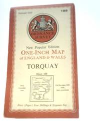
Ordnance Survey One-inch Map of England and Wales. Torquay. New Popular Edition. Sheet 188 (Ordnance Survey One-inch Map of England and Wales)
by Ordnance Survey
- Used
- Good
- Paperback
- Condition
- Used - Good
- Binding
- Paperback
- Quantity Available
- 1
- Seller
-
Goring-by-Sea, West Sussex, United Kingdom
- Item Price
-
$3.71$7.78 shipping to USA
Show Details
Description:
Ordnance Survey, Chessington, Surrey, 1946. Paperback. Good. 1946. Unpaginated. Orange and white pictorial paper cover. Sheet 188. Map is bright and clear with some light foxing and tanning. Slight creases to corners. Paper cover is lightly rub worn and thumbed with light shelf wear to edges and corners. Light creases to corners and spine. Tanning to spine and edges.
Item Price
$3.71
$7.78
shipping to USA

Ordnance Survey Wensleydale Sheet 90 One-Inch Map
by Ordnance Survey
- Used
- Good
- Paperback
- Condition
- Used - Good
- Binding
- Paperback
- Quantity Available
- 1
- Seller
-
Goring-by-Sea, West Sussex, United Kingdom
- Item Price
-
$3.71$7.78 shipping to USA
Show Details
Description:
Ordnance survey, 1966. Paperback. Good. 1966. Unpaginated. Orange and white pictorial paper cover. Sheet 90. Map is bright and clear with some light foxing and tanning. Slight creases to corners. Paper cover has mild edge wear with light rubbing and creasing. Some light marking and sunning.
Item Price
$3.71
$7.78
shipping to USA

Ordnance Survey One-Inch Map of Great Britain Cheltenham and Evesham Sheet 144 - english
by Ordnance Survey
- Used
- Good
- Paperback
- Condition
- Used - Good
- Binding
- Paperback
- Quantity Available
- 1
- Seller
-
Goring-by-Sea, West Sussex, United Kingdom
- Item Price
-
$3.71$7.78 shipping to USA
Show Details
Description:
Ordnance Survey, 1946. Paperback. Good. 1946. Unpaginated. Orange and white pictorial paper cover. Cloth backed map is bright and clear, with light foxing and tanning. Slight creases to corners. Paper cover is moderately rub worn and thumbed with noticeable shelf wear to edges and corners, creases to corners and spine. Tanning to spine and edges.
Item Price
$3.71
$7.78
shipping to USA
Ordnance Survey One-inch Map of England and Wales. Torquay. New Popular Edition. Sheet 188 (Ordnance Survey One-inch Map of England and Wales)
by Ordnance Survey
- Used
- Good
- Paperback
- Condition
- Used - Good
- Binding
- Paperback
- Quantity Available
- 1
- Seller
-
Goring-by-Sea, West Sussex, United Kingdom
- Item Price
-
$3.81$7.78 shipping to USA
Show Details
Description:
Ordnance Survey, 1946. Paperback. Good. 1946. First Published. Unpaginated. Colour paper map with pictorial paper covers. Full title: Ordnance Survey One-inch Map of England and Wales Torquay. New Popular Edition. Sheet 188 (Ordnance Survey One-inch Map of England and Wales). Map is lightly tanned with marking to some panels. Paper cover has moderate edgewear with small tears and creasing. Wear marks overall.
Item Price
$3.81
$7.78
shipping to USA

Ordnance Survey New Popular Edition One-Inch Map of England & Wales Kidderminster Sheet 130
by Ordnance Survey:
- Used
- Good
- Paperback
- Condition
- Used - Good
- Binding
- Paperback
- Quantity Available
- 1
- Seller
-
Goring-by-Sea, West Sussex, United Kingdom
- Item Price
-
$4.03$7.78 shipping to USA
Show Details
Description:
Ordnance Survey Office, 1947. Paperback. Good. 1947. Unpaginated. Orange and white pictorial paperback. Sheet 130. Cloth backed map is bright and clear, with light foxing and tanning. Slight creases to corners. Paper cover has mild edge wear with light rubbing.
Item Price
$4.03
$7.78
shipping to USA

Ordnance Survey New Popular Edition One-Inch Map of England & Wales Exeter Sheet 176
by Ordnance Survey
- Used
- Good
- Paperback
- Condition
- Used - Good
- Binding
- Paperback
- Quantity Available
- 1
- Seller
-
Goring-by-Sea, West Sussex, United Kingdom
- Item Price
-
$4.05$7.78 shipping to USA
Show Details
Description:
Ordnance Survey Office, 1946. Paperback. Good. 1946. Unpaginated. Orange and white pictorial paper cover. Sheet 176. Map is bright and clear with some light foxing and tanning. Slight creases to corners. Paper cover is lightly rub worn and thumbed with light shelf wear to edges and corners. Light creases to corners and spine. Tanning to spine and edges.
Item Price
$4.05
$7.78
shipping to USA

Ordnance Survey One-Inch Map of Great Britain - Minehead (Sheet 164)
by Ordnance Survey
- Used
- Good
- Paperback
- Condition
- Used - Good
- Binding
- Paperback
- Quantity Available
- 1
- Seller
-
Goring-by-Sea, West Sussex, United Kingdom
- Item Price
-
$4.38$7.78 shipping to USA
Show Details
Description:
Ordnance Survey, 1111. Paperback. Good. Unpaginated. Orange and white pictorial paper cover. Map is bright and clear with some light foxing and tanning. Slight creases to corners. Paper cover is lightly rub worn and thumbed with light shelf wear to edges and corners. Light creases to corners and spine.
Item Price
$4.38
$7.78
shipping to USA

Ordnance Survey National Grid Seventh Series One-inch map of Great Britain Ipswich Sheet 150
by Ordnance Survey
- Used
- Good
- Paperback
- Condition
- Used - Good
- Binding
- Paperback
- Quantity Available
- 1
- Seller
-
Goring-by-Sea, West Sussex, United Kingdom
- Item Price
-
$4.38$7.78 shipping to USA
Show Details
Description:
Ordnance Survey, 1963. Paperback. Good. 1963. Unpaginated. Orange and white pictorial paper cover. Sheet 150. Map is bright and clear with some light foxing and tanning. Slight creases to corners. Paper cover is lightly rub worn and thumbed with light shelf wear to edges and corners. Light creases to corners and spine. Book has been laminated.
Item Price
$4.38
$7.78
shipping to USA

Ordnance Survey One Inch Map of Bournemouth: 7th series, sheet 179
by Ordnance Survey
- Used
- Acceptable
- Paperback
- Condition
- Used - Acceptable
- Binding
- Paperback
- Quantity Available
- 1
- Seller
-
Goring-by-Sea, West Sussex, United Kingdom
- Item Price
-
$4.38$7.78 shipping to USA
Show Details
Description:
The Ordnance Survey, 1966. Paperback. Acceptable. 1966. Major roads revised. Unpaginated. Ordnance survey map in colour. Paperback covers. Map remains bright and clear. Moderate creasing present. Water marking present. Covers have moderate tanning with creasing and reading lines. Water marking present.
Item Price
$4.38
$7.78
shipping to USA

Ordnance Survey One Inch Map: Gainsborough, Sheet 104
by Ordnance Survey
- Used
- Good
- Paperback
- Condition
- Used - Good
- Binding
- Paperback
- Quantity Available
- 1
- Seller
-
Goring-by-Sea, West Sussex, United Kingdom
- Item Price
-
$4.38$7.78 shipping to USA
Show Details
Description:
Ordnance Survey, 1969. Paperback. Good. 1969. No Edition Remarks. Unpaginated. Red pictorial paper cover with colour illustrated One Inch Map of Gainsborough, Sheet 104. Map is in good condition with minimal thumb-marking or tanning to edges. Paper cover has light edge-wear with minor creasing and curled corners. Light rubbing overall.
Item Price
$4.38
$7.78
shipping to USA

Ordnance Survey One-Inch Map Of Great Britain: Market Weighton, Sheet 98
by Ordnance Survey
- Used
- Good
- Paperback
- Condition
- Used - Good
- Binding
- Paperback
- Quantity Available
- 1
- Seller
-
Goring-by-Sea, West Sussex, United Kingdom
- Item Price
-
$4.38$7.78 shipping to USA
Show Details
Description:
Ordnance Survey, 1967. Paperback. Good. 1967. Reprint. Unpaginated. Ordnance survey map in colour. Paperback covers. Map remains bright and clear. Minor creasing present. Covers remain in good condition with minimal tanning and little creasing.
Item Price
$4.38
$7.78
shipping to USA

Ordnance Survey One Inch Map Of Great Britain: Ripon Sheet 91
by Ordnance Survey
- Used
- Good
- Paperback
- Condition
- Used - Good
- Binding
- Paperback
- Quantity Available
- 1
- Seller
-
Goring-by-Sea, West Sussex, United Kingdom
- Item Price
-
$4.38$7.78 shipping to USA
Show Details
Description:
Ordnance Survey, 1972. Paperback. Good. 1972. Reprint with major roads. Unpaginated. Ordnance survey map in colour. Paperback covers. Map has moderate tanning. Moderate creasing present. Pen inscription to inside covers and map reverse. Covers have moderate tanning with creasing and reading lines. Pen marking present.
Item Price
$4.38
$7.78
shipping to USA

Loch Linnhe Sheet 46 (Ordnance Survey One-inch Map of Great Britain)
by Ordnance Survey One-inch Map of great Britain
- Used
- Good
- Paperback
- Condition
- Used - Good
- Binding
- Paperback
- Quantity Available
- 1
- Seller
-
Goring-by-Sea, West Sussex, United Kingdom
- Item Price
-
$4.46$7.78 shipping to USA
Show Details
Description:
Ordnance Survey, 1956. Paperback. Good. 1956. Revised. Unpaginated. Pictorial paper covers. Coloured map printed on map. Binding remains firm.Pages & illustrations remain bright with minimal tanning. Paper cover has mild edge-wear with light rubbing and creasing.
Item Price
$4.46
$7.78
shipping to USA

Exeter (Sheet 176) Ordnance Survey One-Inch Map of England & Wales
by No Author Stated
- Used
- Good
- Paperback
- Condition
- Used - Good
- Binding
- Paperback
- Quantity Available
- 1
- Seller
-
Goring-by-Sea, West Sussex, United Kingdom
- Item Price
-
$4.60$7.78 shipping to USA
Show Details
Description:
Ordnance Survey, 1946. Paperback. Good. 1946. New Popular Edition. Unpaginated. Pictorial paper cover. Map is bright and clear, with light tanning to edges and slight foxing to joints. Cover has moderate shelf-wear to edges and surfaces, with curling to corners. Mild crushing to ends, with a pencil inscription to rear cover. Lightly tanned overall.
Item Price
$4.60
$7.78
shipping to USA

Didn’t find what you’re looking for?
Try adding this search to your want list. Millions of books are added to our site everyday and when we find one that matches your search, we’ll send you an email. Best of all, it’s free.
Add to Want List

Are you a frequent reader or book collector?
Join the Bibliophile's Club and save 10% on every purchase, every day — up to $20 savings per order!

Social Responsibility
Did you know that since 2004, Biblio has used its profits to build 16 public libraries in rural villages of South America?