Description:
Edinburgh: Adam and Charles Black, 1871. xxi., 168 pages, + 72 pages of ads., maps illustrations. Covers, bumped, soiled, worn, bookseller's blind stamp to front endpaper, previous owner's stamp & name to prelims., binding sl. loose but holding, some plates loose, some loss to some advert pages. This edition uncommon. [682] . New Edition.. Green Cloth. Very Good. 175mm. x 120mm.. Book.
Search Results: Maps & Guides from William Glynn
You searched for:
- Subject: Maps & Guides from William Glynn
Results 1 - 9 of 9

More Photos
Black's Guide to Sussex and Its Watering-Places
by A & C Black
- Used
- very good
- Hardcover
- Condition
- Used - Very Good
- Edition
- New Edition.
- Binding
- Hardcover
- Quantity Available
- 1
- Seller
-
Reydon, Suffolk, United Kingdom
- Item Price
-
$25.34$31.67 shipping to USA
Show Details
Item Price
$25.34
$31.67
shipping to USA
More Photos
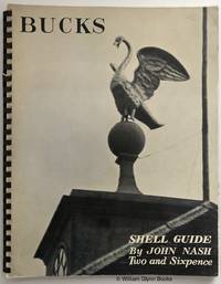
Bucks - Shell Guide
by Nash, John
- Used
- very good
- Paperback
- first
- Condition
- Used - Very Good
- Edition
- First Edition.
- Binding
- Paperback
- Quantity Available
- 1
- Seller
-
Reydon, Suffolk, United Kingdom
- Item Price
-
$190.05$31.67 shipping to USA
Show Details
Description:
London: B T Batsford, 1936. 46 pages, b/w illustrations + 8 pink photo plates, 2 coloured maps. Shell advertisement illustrated by Edward Bawden to rear. Title to black plastic comb binding. With notes on monuments by Katherine A Esdaile. Illustrators/Photographers include Maurice Beck, Humphrey Jennings, A E Newcombe, Will F Taylor, John Nash, Gilbert Spencer, Herbert Felton, W C Sayle, Paul Nash, J Hassell, Stanley Spencer, Anthony Brown. Minor wear to covers, small split to binding, contents fine, unmarked. [15915/729] . First Edition.. Comb Binding. Very Good. 230mm. x 185mm.. Book.
Item Price
$190.05
$31.67
shipping to USA

More Photos
By Loch and Land. The Circular Route of the Caledonian Railway, By Crieff Etc.
by [Watson, Jean L]
- Used
- good
- Paperback
- first
- Condition
- Used - Good
- Edition
- First Edition.
- Binding
- Paperback
- Quantity Available
- 1
- Seller
-
Reydon, Suffolk, United Kingdom
- Item Price
-
$31.67$31.67 shipping to USA
Show Details
Description:
Edinburgh: Andrew Elliot, 1875. 111, [6] pages, fold-out coloured map, 3 engraved plates. Some soiling, wear to covers, front cover part detached, small bookseller label inside front cover, minor spotting internally. Uncommon. [763] . First Edition.. Card Covers. Good. 170mm. x 120mm.. Book.
Item Price
$31.67
$31.67
shipping to USA

Devon - A Shell Guide
by Watson, Brian
- Used
- very good
- Hardcover
- Condition
- Used - Very Good
- Edition
- New , Revised Edition.
- Binding
- Hardcover
- Quantity Available
- 1
- Seller
-
Reydon, Suffolk, United Kingdom
- Item Price
-
$38.01$31.67 shipping to USA
Show Details
Description:
London: Faber & Faber Limited, 1955. 112 pages, b/w illustrations, 4 coloured maps to rear. Advertisement illustrated by Edward Bawden to rear. Based on the 1935 edition. Minor shelfwear to covers, some offsetting to prelims., first state unclipped dustjacket has some age toning, small tear to head of spine, now in protective sleeve. [729] . New , Revised Edition.. Red Cloth. Very Good/Very Good. 230mm. x 185mm.. Book.
Item Price
$38.01
$31.67
shipping to USA

More Photos
The Eastern Alps, Including the Bavarian Highlands, the Tyrol, Salzkammergut, Styria, and Carinthia
by Baedeker, Karl
- Used
- very good
- Hardcover
- Condition
- Used - Very Good
- Edition
- Fourth Edition
- Binding
- Hardcover
- Quantity Available
- 1
- Seller
-
Reydon, Suffolk, United Kingdom
- Item Price
-
$88.69$31.67 shipping to USA
Show Details
Description:
Leipsic: Karl Baedeker, 1879. xxix, 406 pages, 20 maps, 10 plans and 7 panoramas, all as called for. Red cloth, gilt titling, marbled edges. Includes plans of Gratz, Innsbruck, Salzburg, and Trieste. Some wear, bumping to covers, extremities, spine faded, with split to head age toning to page edges, small tear to fold-out map. Size - 160mm. x 115mm. A very nice copy. [758] . Fourth Edition, Remodelled and Augmented. . Fourth Edition. Red Cloth, Gilt. Very Good. 160mm. x 115mm.. Book.
Item Price
$88.69
$31.67
shipping to USA

Northumberland - A Shell Guide
by Sharp, Thomas
- Used
- very good
- Hardcover
- Condition
- Used - Very Good
- Edition
- New , Revised Edition.
- Binding
- Hardcover
- Quantity Available
- 1
- Seller
-
Reydon, Suffolk, United Kingdom
- Item Price
-
$31.67$31.67 shipping to USA
Show Details
Description:
London: Faber & Faber Limited, 1954. 52 pages, b/w illustrations, 3 coloured maps to rear. Based on the 1937 edition, 'almost entirely rewritten'. Minor shelfwear to covers, some marginalia and ticks to gazetteer section, first state unclipped dustjacket has some age toning, now in protective sleeve. [729]. New , Revised Edition.. Blue Cloth. Very Good/Very Good. 230mm. x 185mm.. Book.
Item Price
$31.67
$31.67
shipping to USA

The Printed Maps in the Atlases of Great Britain and Ireland. A Bibliography, 1579-1870
by Chubb, Thomas; Sprent, F P (intro.)
- Used
- very good
- Hardcover
- first
- Condition
- Used - Very Good
- Edition
- First Edition.
- Binding
- Hardcover
- Quantity Available
- 1
- Seller
-
Reydon, Suffolk, United Kingdom
- Item Price
-
$76.02$31.67 shipping to USA
Show Details
Description:
London: The Homeland Association, 1927. xvii., 479 pages, frontis. & 31 plates, biographical notes, list of subscribers. Some bumping, soiling, wear to covers, soiling to fore edges, mild age toning internally. [786] . First Edition.. Green Cloth. Very Good. 290mm. x 235mm.. Book.
Item Price
$76.02
$31.67
shipping to USA
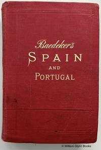
Spain and Portugal
by Baedeker, Karl
- Used
- very good
- Hardcover
- Condition
- Used - Very Good
- Edition
- Second Edition
- Binding
- Hardcover
- Quantity Available
- 1
- Seller
-
Reydon, Suffolk, United Kingdom
- Item Price
-
$82.35$31.67 shipping to USA
Show Details
Description:
Leipsic: Karl Baedeker, 1901. lxxxviii, 608 pages, 7 maps, 47 plans as called for. Red cloth, gilt titling, marbled edges. Some wear, bumping to covers, extremities, spine faded, previous owner's name to half title, which has top section removed, fold-out map torn, repaired, repairs to 2 leaves. [779]. Second Edition. Red Cloth, Gilt. Very Good. 160mm. x 115mm.. Book.
Item Price
$82.35
$31.67
shipping to USA
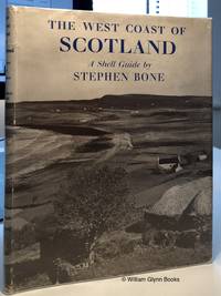
The West Coast of Scotland. Skye to Oban - A Shell Guide
by Bone, Stephen
- Used
- very good
- Hardcover
- first
- Condition
- Used - Very Good
- Edition
- First Edition.
- Binding
- Hardcover
- Quantity Available
- 1
- Seller
-
Reydon, Suffolk, United Kingdom
- Item Price
-
$88.69$31.67 shipping to USA
Show Details
Description:
London: Faber & Faber Limited, 1952. 64 pages, b/w illustrations, 8 coloured maps to rear. Minor shelfwear to covers, contents unmarked., first state clipped dustjacket has some age toning, edgewear , now in protective sleeve. [729] . First Edition.. Green Cloth. Very Good/Very Good. 230mm. x 185mm.. Book.
Item Price
$88.69
$31.67
shipping to USA

Didn’t find what you’re looking for?
Try adding this search to your want list. Millions of books are added to our site everyday and when we find one that matches your search, we’ll send you an email. Best of all, it’s free.
Add to Want List

Are you a frequent reader or book collector?
Join the Bibliophile's Club and save 10% on every purchase, every day — up to $20 savings per order!

Social Responsibility
Did you know that since 2004, Biblio has used its profits to build 16 public libraries in rural villages of South America?