Atlases
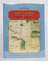
From The Mapmakers to New International World Atlas, from The Mapmakers to Atlas Of Columbus and The Great Discoveries, we can help you find the atlases books you are looking for. As the world's largest independent marketplace for new, used and rare books, you always get the best in service and value when you buy from Biblio.com, and all of your purchases are backed by our return guarantee.
Top Sellers in Atlases

The Mapmakers
by John Noble Wilford
John Noble Wilford is a science correspondent for The New York Times. He lives in New York.
Atlases Books & Ephemera

The Mapmakers
by Wilford, John Noble
John Noble Wilford is a science correspondent for The New York Times. He lives in New York.

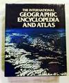
The International Geographic Encyclopedia and Atlas
by Vianna, Fernando de Mello (Editorial Director)
London: Macmillan Press Ltd. 1979. Quarto Size [approx 24cm x 30.5cm]. Very Good condition in Very Good Dustjacket. DJ protected in our purpose-made plastic sleeve. Light wear to dustjacket edges and corners. Colour and black & white maps. Robust, professional packaging and tracking provided for all parcels. . . Reprint. Hardback.
Item Price
$13.24

A NEW GENERAL ATLAS of THE WORLD Etc Etc
Title page has closed chips 43x 32, 38x17mm; & channel was carelessly folded. 47 double p maps in colour includes chart of Mountain Height and River Lengths. Please expect Mega EXTRA Postage.. Third Edition. Hard Cover Black Cloth.. Very Fine in Plastic./None. 385x51mm. The fascination in this ATLAS lies in the early record of railways through 4 continents including railways in the course of construction and must appeal to Steam buffs.
Item Price
$765.85

Westermanns Hausatlas
by Diercke, C, R. Dehmel und W. Tietze:
1961.. Westermann Vlg Braunschweig, 183 Kartenseiten, 56 S. Textseiten Leinen, gebundene Ausgabe 3. neubearbeitete Auflage Ecken/Kanten bestossen, Einband berieben, fleckig, Seiten gebräunt, Bindung locker, Karten: S.31-42 lose, S. 107-183 lose; Text:S.1-56 lose, Bindung gebrochen,schlechter Zustand Bücher
Item Price
$8.95

WORLD MAP in Equal Area Presentation: PETERS PROJECTION.
by UNDP (United Nations Development Program), produced with support of
Oxford: Oxford Cartographers, Ltd. (Friendship Press, New York), 1983. Stated First English Version edition. Copyright by Akademische Verlagsanstalt, FL-9490 Vaduz, Aeulestr. 56. One color map folded to 30x22cm. 90x132cm. Fine. Unopened condition. Seven illustrated maps with text explaining distortions under (72 x 113cm) map. Folded sides are pictured. Scarce and true first English Version of the controversial map (also featured on an episode of West Wing in 2001). ISBN: 0377730090..
Item Price
$150.00

Imagined Corners: Exploring the World's First Atlas
by Paul Binding
UK: Headline Review, 2003. Book. Near Fine. Hardcover. 1st Edition. 4to - over 9¾ - 12" tall. The ' Theatrum orbis terrarum was a watershed publication; it changed lives and altered perceptions for ever. Brainchild of Abraham Ortelius, the Theatrum reflected the vitality of the era Paul Binding views Ortelius's life - work against the stormy backdrop and often violent events of the period. A good, clean and tight copy..
Item Price
$22.80

GREAT WORLD ATLAS
by Heritage, Andrew (Editor)
Slip-case slightly rubbed. This huge book will incur extra postage even inside S Africa.
Item Price
$59.62

ELEMENTS OF MAP PROJECTION with Applications to map and chart construction: Special Publication No. 68
by Deetz, Charles H. and Oscar S. Adams
Washington, DC: GPO, 1921. Illustrated by 74 b/w map figures and 8 pull-out plates. First edition. Serial No. 146. Original wraps. Imperial 8vo. pp. 163, [1], 16 (plates). Very Good-. Top cover very chipped with several pen numbers, corner bump throughout, toning. Maps near fine..
Item Price
$30.00

Neuer illustrierter Weltatlas
1973.. Bayreuth, Gondrom Verlag, 119 Seiten, 64 mehrfarbige Kartenseiten, 155 mehrfarbige Illustrationen, 1500 Stichwörter großes Großformat, Ecken/Kanten bestossen, Einband etwas gewölbt, guter Zustand Bücher
Item Price
$12.21

Grosser Fackel-Universalatlas (in Zusammenarbeit mit dem Bibliographischen Institut Mannheim)
1970.. Brugg/Stutgart/Salzburg, Fackel Verlag, 119 Seiten, ca 25,5 x 37,5 cm Hardcover/Pappeinband, gebundene Ausgabe Lizenzausgabe übergroßes Format, Copyright 1970/oJ, ohne Schutzumschlag, Ecken/Kanten bestossen, Einband berieben, vergilbt und fleckig, Buchschnitt mit Lagerspuren, Seiten gebräunt, leicht schiefgelesen, sonst eher guter Zustand Bücher
Item Price
$45.57

Eye Of The Storm: A Civil War Odyssey
by Sneden, Robert Knox
New York: The Free Press. Near Fine in Near Fine dust jacket. 2000. First Edition; First Printing. Hardcover. 0684863650 . A near-fine volume in a near-fine DJ, dustjacket in Mylar, unclipped. Color illustrations and maps throughout. ; Large 8vo 9" - 10" tall; 329 pages; "A vividly illustrated chronicle of the Civil War, written by a Union mapmaker who witnessed the worst of the war firsthand, includes his experiences during a two-year stint at the notorious Andersonville prison....
Read more about this item
Item Price
$20.00

ATLAS ET GEOGRAPHIE DE LA REGION LYONNAISE Portrait de la France moderne
by Lebeau, Rene
France: Flammarion. Very Good+ in Very Good dust jacket. 1977. Hardcover. 2082013022 . TEXT IN FRENCH - A very good ++ hardcover in clean black faux leather boards with decorative stamped outline illustration of France without bumping or rubbing to the spine ends or corners, no writing or stamps, clean pages in a very good bright dustwrapper creased to the upper edge with several tiny closed tears supplied in a new removable archival sleeve. Carefully packaged and posted within 48 hours from our wee...
Read more about this item
Item Price
$47.50

Bartholomew's Road Atlas of Great Britain
Edinburgh: John Bartholomew & Son Ltd.. Very Good in Good dust jacket. 1966. Hardcover. DJ shows shelf wear, with soiling, tape-repaired tears. ; A tight solid book. Dust jacket in Mylar jacket protector. AA map of Great Britain laid in, in G- only condition ; Maps; Large 8vo 9" - 10" tall; 112 pages .
Item Price
$28.50

Maps, Mountains & Mosquitoes The McElhanney Story 1910-2010
by Gordon, Katherine
Vancouver BC: McElhanney Group, Limited, The. Very Good+ in Near Fine dust jacket. 2010. First Edition. Hardcover. 0981255612 . Gift inscription on FFEP has been pasted over with paper. ; A bright, solid book dustjacket in Mylar, unclipped. B&W and colour photos and maps throughout.; 9.6 X 6.9 X 1.0 inches; 303 pages .
Item Price
$25.00

Der grosse Welt-Atlas der deutschen Buch-Gemeinschaft
1935.. Berlin, deutsche Buch-Gemeinschaft, 31 Seiten Einleitung, 44 Karten, 45 Seiten Register Halbleder, Großformat, Goldprägung, Ecken/Kanten bestossen, Einband sehr abgerieben, stark fleckig, etwas gewölbt und stockfleckig, Schnitt fleckig, Seiten vergilbt, Seiten vergilbt und fleckig, am unteren Rand mit Feuchtigkeitsflecken, Karten etwas randlädiert, einige Seiten der Einleitung am Rand eingerissen, Zustand mäßig Bücher
Item Price
$81.38

EMPIRE d'ALLEMAGNE
by Vaugondy, Dirier Robert De
Paris: Vaugondy, 1778. The image is 9 3/8 inches by 11 inches on a folded sheet measuring 11 1/4 inches by 16 3/8 inches. Original hand-colored in outline map of the German Empire by Didier Robert de Vaugondy (circa 1723-1786). He and his father Gilles Robert de Vaugondy were the premier French cartographers of the 18th century. This map was published circa 1778 in Vaugondy's Atlas Portatif. The map is guaranteed to be more than 240 years old. It is in about very good condition: clean and bright,...
Read more about this item
Item Price
$100.00

WORLD MAP, The.
by Nitchi
Tokyo, Japan: Nitchi Map Publishing Co., Ltd, 1992. Illustrated by color. Later edition. c.1988. C0326 P1030E. Folded map in gloss pictorial folder. 28x40.5-inches. Fine. Unfolded for dimensions for the first time. English and Japanese. ISBN: 4527010239..
Item Price
$15.00

Neuer Taschenatlas
by Fischer , H.R. :
1961.. Südwest Verlag, 151 Textseiten, 39 Bildseiten Ledereinband, gebundene Ausgabe Sonderausgabe Kleinformat, Ecken/Kanten bestossen, Einband berieben, fleckig, Seiten gebräunt, mittlerer Zustand Bücher
Item Price
$8.95

Atlas of Framingham, Mass. From the Surveys of Barnes and Jenks, Pittsfield, Mass. (1895)
Pittsfield, Mass.: Jas. P. Beirne. Very Good-. 1895. Hardcover. An uncommon atlas of Framingham, Mass., this large-format atlas contains 8 numbered plates: 7 are double-page maps, and the first plate is a map of the Framingham which is printed on one page. The maps are black and white with color applied to streets, rivers, and other large areas (appears to be printed, not hand-colored). Lot lines are included as are many buildings, some with the current owners as of 1875. It was apparently...
Read more about this item
Item Price
$795.95

Mercator : the man who mapped the planet
by Crane, Nicholas
London : Phoenix, 2003. Second Edition. Hardcover. Fine copy in the original color printed boards. Particularly and uncommonly well-preserved; tight, bright, clean and especially sharp-cornered.
Physical description; xv, 397 p., [16] p. of plates : ill., maps ; 20 cm. Notes; Originally published: London : Weidenfeld & Nicolson, 2002.
Includes bibliographical references and index. Summary; Gerard Mercator (1512-1594) was born at the dawn of the Age of Discovery, when the world was beginning to be...
Read more about this item
Item Price
$30.00

People's Popular Atlas of the World. Descriptive, Geographical, Historical and Statistical
by TUNISON, Henry C
Chicago: Thompson and Thomas, 1903. Folio atlas, 320pp. Black cloth, with title on repaired spine, stains to cover corners bumped and gilt title faded, some foxing and toning but otherwise in good condition. Chicago: Thompson and Thomas 1903.<br/> <br/> Modern geography maps, with the world and its various political divisions. Illustrated by numerous views and charts; supplemented with statistics, diagrams and informational charts. Beautifully printed in color with a playful publishing...
Read more about this item
Item Price
$400.00

The Mapmakers
by Wilford, John Noble
Vintage Books, 2001. Paperback. New. revised subsequent edition. 507 pages. 8.00x5.25x1.15 inches.
Item Price
$27.16

Pathfinder sheet 1116 (SP 40/50)
by Ordnance Survey
Ordnance Survey, 1992. Scale 1:25,000. Folded map. V.g.. Trace of price sticker on cover.
Item Price
$10.13

Cartography of North America, 1500-1800
by Knirsch, Franco & Pierluigi Portinaro
New York, N.Y.: Facts on File, 1987. 1st. Hardcover. Very Good/Very Good. Hardcover, 320 pages, illustrated throughout in color and b&w. Light edgewear and rubbing to dust jacket. Faint foxing to top edge. Clean, tight copy. Record # 460193
Item Price
$20.00


