Surveying
From The Legal Elements Of Boundaries and Adjacent Properties to Surveying and Levelling, from Electronic Surveying and Navigation to Aerophotography and Aerosurveying, we can help you find the surveying books you are looking for. As the world's largest independent marketplace for new, used and rare books, you always get the best in service and value when you buy from Biblio.com, and all of your purchases are backed by our return guarantee.
Top Sellers in Surveying

Surveying Books & Ephemera


Thrust And Counterthrust: The Genesis Of The Canada-united States Boundary
by Classen, H. George
Rand Mcnally. Very Good with no dust jacket. 1965. Hardcover. Exlibrary with usual library markings. ; 386 pages .
Item Price
$16.00

Report And Journals Of Proceedings Of The Joint Commissioners To Adjust The Boundary Line Of The States Of Maryland And Virginia Authorized By The Act Of 1872, Chaper 210
by Various
S. S. Mills & L. F. Colton. Very Good with no dust jacket. 1874. Hardcover. 134016910X . Recently rebound. The original 1874 publication; X; 344 pages .
Item Price
$125.00

New Guinea and Polynesia Discoveries & Surveys in New Guinea and the D'Entrescasteaux Islands: A Cruise in Polynesia and Visits to the Peart-Shelling Stations in Torres Straits of H. M. S. Basilisk
by Morseby, John
London: John Murray, 1876. xviii, 327 [32] pp. First edition. Octavo. Bound in original blue cloth. Gilt lettering and illustrations on the spine and cover. Spine sunned. Boards have some shelf wear. Original Victorian red end papers. Previous owner's bookplates on the front end papers. Head and tail edges are trimmed, the fore edge is untrimmed. Edges are dust soiled. There is some staining and foxing inside the volume. Contains four plates and four maps, including a fold out chart. It also...
Read more about this item
Item Price
$370.75
![[Class Photograph] Photograph of the Yale School of Civil Engineering Class of 1916](https://d3525k1ryd2155.cloudfront.net/h/374/214/514214374.0.b.0.jpg)
[Class Photograph] Photograph of the Yale School of Civil Engineering Class of 1916
by Yale [ Sheffield ] School of Engineering
[ New Haven, Connecticut ]: Roger Sherman Studio, 1916. First Edition. Photograph. Near Fine. First Edition. An original silver print mounted on board. Image is 10 1/2 inches x 13 1/2 inches. Overall mount size 13 3/4 x 16 3/4 inches. Very nice tonality, presents nicely in person. Photograph. A photograph of what is no doubt the 1916 Civil Engineering class at Yale showing students, teachers, and the" tools of the trade". It was taken in front of Winchester Hall, then part of Yale's Sheffield School of...
Read more about this item
Item Price
$413.00
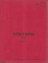
Platting in Minnesota
by Fant, Jesse E. Maner, William A
Univ. Minnesota. Very Good. 1971. Revised Edition. Paperback. 34 pages .
Item Price
$20.00

Principles Of Surveying
by Herubin, Charles A
Reston Publishing Company. Very Good in Very Good- dust jacket. 1974. Hardcover. 0879096187 . Some dust jacket wear. ; 288 pages .
Item Price
$10.00
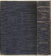
Surveying Theory And Practice
by Davis Raymond E. , Francis S. Foote
New York: McGraw Hill. Very Good with no dust jacket. 1953. Hardcover. Blue cloth boards with gilt titles to the spine. Wear to the spine ends and corners with scuffing to the covers. In very good condition with a solid binding, some notes written on the front free end paper, and sparse markings throuhg the book. Overall in Very Good condtion. ; B&W Illustrations; 8vo 8" - 9" tall; 1021 pages .
Item Price
$19.24
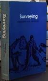
Surveying
by Bannister, A & Raymond, S
Pitman Publishing, London, 1974. Reprint. Softcover. Good Condition. Illustrator: photographic and illustrations. preface by authors, index and note on insert between pages 394 and 395. Black-and-white photographic frontispiece showing surveyors on South Georgia (Antarctica), 1955-1956. The Text is illustrated with numerous black-and-white photographs, formula, diagrams and the aforementioned insert showing a surveyors drawing of a British rail yard. Blue coloured illustrated card cover with black...
Read more about this item
Item Price
$8.43

Surveying and Mapping for Field Scientists
by Ritchie, William; Wood, Michael; Wright, Robert & Tait, David
Harlow, Essex, U.K.: Longman Scientific & Technical. 1988. Small Quarto Size [approx 17.5cm x 24cm]. Very Good condition. Illustrated with Colour and Black & White Photographs. B/W drawings. Robust, professional packaging and tracking provided for all parcels. 180 pages. . Reprint. Softcover.
Item Price
$23.17
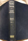
Elementary Surveying
by William Horace Rayner, C.E., M.S
D. Van Nostrand Co., 1943. 2nd Ed./Eleventh Printing. Hardcover. Surveying; The subject of land surveying is yearly becoming more important, and the treatment of the subject in the surveying textbooks has been inadequate. It is believed that Chapter 16 in this book supplies an improved presentation of this subject. (420 Pgs.)Blue cloth boards have slight fading. Sunning to cover pages. Illustrated. No marks or tears. BOOK VG.
Item Price
$29.95

A Manual of Field and Office Methods for the Use of Students in Surveying
by Pence, William D. & Ketchum, Milo S
New York: Engineering News Publishing. Good with no dust jacket. 1904. Third Edition. Hardcover. Packed with information, charts & diagrams, one folding chart. I noticed one sentence underlined, else a nice clean, tight and unmarked book with previous owner name. Red limp cloth covers with some wear, especially to edges and spine. ; B&W Illustrations; 8vo, 8"- 9" tall; 256 pages .
Item Price
$19.95

The Colorado River Survey: Robert B. Stanton and the Denver, Colorado Canyon and Pacific
by Stanton, Robert B.; Dwight L. Smith; C. Gregory Crampton
Salt Lake City: Howe Bros, 1987. Limited Edition. Quarto. Limited to 125 copies. The present copy is number 15 and signed by the editors Smith and Crampton. xix, 305 pages, illustrations, maps. Bibliographic references (pages 287-293), Index. Robert B. Stanton's work was the next important study after that of John Wesley Powell. His was an engineering survey for a projected railroad which would run from Grand Junction, Colorado to San Diego, which had it been followed would have had smoke-tracks in the...
Read more about this item
Item Price
$185.00
A Treatise of Practical Surveying; Which is Demonstrated from Its First Principles Wherein Every Thing That is Useful and Curious in That Art, is Fully Considered and Explained Particularly Three New and Very Concise Methods...
by Gibson, Robert
Philadelphia: For Joseph Cruikshank, 1796. Octavo. (title con't) for determining the areas of right-lined figures, arithmetically or by calculations, as well as the geometrical ones heretofore treated of. 7th edition, updated, eliminating parts being of little use to the American surveyor also, there are alterations and tables have also been incorporated into this edition. ` viii, 1-288pp, (2 title pages dated 1796).1-90pp., 1-60pp, illustrated with 13 folding plates showing diagrams. From the library...
Read more about this item
Item Price
$245.00
Report Of The Commissioners On The Survey Of The Boundaries Between The Provinces Of Ontario And Manitoba From The Twelfth Base Line Of The System Of Dominion Land Surveys
by Thistlethwaite, R
Ontario-Manitoba Boundary Commission. Very Good with no dust jacket. 1955. Hardcover. 92 pages .
Item Price
$35.00

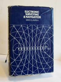
Electronic Surveying & Navigation
by Simo H. Laurila
John Wiley & Sons, 1976. Very Good book is clean, unmarked and tight. Not ex-library. Good dust jacket. 545pp, indexes, references, photos. Shipped in sturdy cardboard box. . First Edition. Hard Cover. Very Good/Good. 8vo - over 7¾" - 9¾" tall.
Item Price
$14.90

Surveying
by Kahmen (Heribert) & Wolfgang Faig
Berlin: Walter de Gruyter, 1988. Hardcover (Original Cloth). Very Good Condition/No Dust Jacket. Laminated boards, illustrated in black & white. Light discolouration to text block edges but otherwise an almost unread copy. Size: Small Quarto. 595 pages. Category: Geography & Maps; Surveying; Surveying; Science & Technology. ISBN: 3110083035. ISBN/EAN: 9783110083033. . 9783110083033
Item Price
$88.68
![[Printed on the first leaf]: Shashinjō 寫真帖 [Photo Album]](https://d3525k1ryd2155.cloudfront.net/h/469/021/1596021469.0.b.jpg)
[Printed on the first leaf]: Shashinjō 寫真帖 [Photo Album]
by MANCHUKUO AERIAL PHOTO ALBUM
23 black & white aerial photographs & one photograph of a map of the region (each ca. 97 x 142 mm.), all carefully mounted on 24 stiff leaves. Small 4to (274 x 227 mm.), orig. decorative boards, orig. stamp of the Manchuria Aviation Company on upper cover. [China]: [printed at the foot of the first leaf]: Manshū kōkū kabushiki gaisha 満洲航空株式会社, [1930s-40s]. An album containing a series of aerial photos taken by the Manchuria Aviation Company, or Manchukuo National Airways, which...
Read more about this item
Item Price
$1,950.00
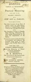
Hoppus's tables for measuring made easy to the meanest capacity, a new set of tables: which shew at sight, the solid content of any piece of timber...the superficial content of boards, glass painting...with some very curious observations concerning measuring...The fifteenth edition, greatly improved
by Hoppus, E
London: printed for J. Johnson, [et al.], 1809. Tall, narrow 12mo, pp. viii, lii, 214, [2]; engraved folding plate, tables throughout; a near fine copy in original full sheep, red morocco label on gilt-paneled spine.
Item Price
$143.75
This boke sheweth the maner of measurynge of all maner of lande, as well of woodlande, as of lande in the felde, and comptynge the true nombre of acres of the same. Newlye invented and compyled by..
by BENESE, Richard
Title within architectural woodcut border & many woodcuts in the text (many highlighted in red). Printed in black letter. [208] pp. Small 4to, modern calf (title with a few minor stains). London: "Prynted in Southwarke in Saynt Thomas Hospitall, by me James Nicolson," [1537].<br /> <P> First edition of the first English work on surveying in the modern sense: the measuring and plotting of land. In the 16th century, "surveying" could also mean giving instructions to...
Read more about this item
Item Price
$45,000.00

A History of the Western Boundary of the Louisiana Purchase, 1819-1841
by Marshall, Thomas Maitland
Univ. California. Very Good with no dust jacket. 1914. First Edition. Hardcover. 1017126399 . The original 1914 edition. Includes the 3 folding maps. ; 266 pages .
Item Price
$105.00
A COMPLETE KEY TO GUMMERE'S SURVEYING
by Samuel Alsop
Philadelphia: Published By Kimber & Sharpless. Very Good with no dust jacket. 1841. Hardcover. B&W Illustrations; A Complete Key to Gummere's Surveying; In Which the Operations of All the Examples, Not Solved in That Work, Are Exhibited at Large Principally Designed To Facilitate the Labour of Teachers, and To Assist Those Who Have Not the Opportunity of Their Instructions. Pagination: 84 pages plus 4 plates and 2 pages of advertisementsWidth: 6" Height: 9" Condition / Notes:...
Read more about this item
Item Price
$107.80

Hand-book and Illustrated Catalogue of the Engineers' and Surveyors' Instruments of Precision made by C. L. Berger & Sons, 1900
by Berger, C. L
Mendham, New Jersey: The Astragal Press, 1993. Revised Edition. Wraps. Near Fine. Revised Edition. vi, 210, [6] pages. A facsimile reprint of the original catalog from 1900. 8vo. Printed wrappers. A bright clean copy. Includes the large foldout at page 172. Wraps.
Item Price
$22.00
Surveying Manual
by Ripa, Louis C
Mcgraw Hill. Very Good in Very Good- dust jacket. 1964. Hardcover. Some dust jacket wear. ; 131 pages .
Item Price
$12.00
Aerophotography and Aerosurveying
by James W. Bagley
First Edition, Second Impression
Item Price
$50.00
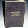
Surveyor's Diary, Lyon County, Kentucky, 189-(?)
Octavo. 98 unnumbered pages. Extensive surveying notes and handdrawn maps of areas at edge of the area under Lake Barkley from Kuttawa and edge of Eddyville, Kentucky. Laid in is folded notes of measurements on letterhead of W.H. Green, Rigg Hotel, Kuttawa, KY. 189(?). Stamped on Leather Cover: Receiving/Str. Tyrone. The first clues besides the inlay is the map that says road to Eddyville. Names and history at various points in the survey: e.g., McPhail's company, J.M. Boyd's Corner, Atkinson's Garden,...
Read more about this item
Item Price
$2,250.00
