Description:
Philadelphia: H.S. Tanner, 1823. Folio. (24 x 16 3/4 inches). Letterpress half-title, 1p. index and 18pp. text. Engraved title with vignette of the "First Landing of Columbus in the New World", 18 fine hand-coloured engraved maps (16 double-page, 2 folding). Expertly bound to style in half-calf over contemporary marbled paper-covered boards, the flat spine gilt and divided into seven compartments by fillets and roll tools, lettered in the second compartment, the others with repeat decoration in gilt, marbled endpapers A fine copy of the first collected edition of "the most distinguished atlas published in the United States during the engraving period" (Ristow). Tanner's New American Atlas contained the most accomplished series of maps of America that had yet appeared in an atlas. Of the greatest importance were the maps of American states. These maps were drawn up using a careful combination of original surveys and the best existing published sources. The evident high cost of production meant that…
Read More A Map of the British Empire in America with the French and Spanish settlements adjacent thereto by POPPLE, Henry (d.1743) - 1735
by POPPLE, Henry (d.1743)
Similar copies are shown below.
Similar copies are shown to the right.

A Map of the British Empire in America with the French and Spanish settlements adjacent thereto
by POPPLE, Henry (d.1743)
- Used
London: "Engrav'd by Willm. Henry Toms", 1735. Folio. (20 1/2 x 15 3/8 inches). Engraved map by William Henry Toms, with very fine full contemporary hand-colouring (with twenty-two integral inset views and plans) on 15 double-page and 5 single-page sheets, with full contemporary hand-colouring, mounted on guards throughout, with the double-page key map by Toms, with full hand-colouring. Expertly bound to style in half 18th-century russia over original 18th-century marbled paper-covered boards, spine gilt with red morocco spine label. Housed in a modern blue morocco-backed box. A monument to 18th-century American cartography: a highly attractive fully-coloured copy of the first large-scale map of North America, and the first printed map to show the thirteen colonies. Popple maps with full contemporary colour are exceedingly rare. Popple produced this map under the auspices of the Lord Commissioners of Trade and Plantations to help settle disputes arising from the rival expansion of English, Spanish and French colonies. "France claimed not only Canada, but also territories drained by the Mississippi and it's tributaries - in practical terms, an area of half a continent" (Goss The Mapping Of North America p.122.) The present copy of Popple's map, with its full contemporary hand-colouring, would have been particularly useful in these disputes. Mark Babinski in his masterly monograph on this map notes that 'The typical coloring of fully colored copies ... is described best by a contemporary manuscript legend on the end-paper affixing the Key map to the binding in the King George III copy at the British Library: "Green - Indian Countrys. Red - English. Yellow - Spanish. Blue - French. Purple - Dutch." The careful demarcation of the disputed areas by colour would have made the identification of whether a particular location was in one or another 'zone' a great deal easier. Thus the colouring adds a whole new dimension to a map that is usually only seen in its uncoloured state, and perhaps suggests that the copies with full hand-colouring were originally produced for some as-yet-unrediscovered official use to do with the international land disputes of the time. Benjamin Franklin, on May 22, 1746, ordered two copies of this map, "one bound the other in sheets," for the Pennsylvania Assembly. It was the only map of sufficient size and grandeur available - and the map is on a grand scale: if actually assembled it would result in a rectangle over eight feet square. Its coverage extends from the Grand Banks off Newfoundland to about ten degrees west of Lake Superior, and from the Great Lakes to the north coast of South America. Several of the sections are illustrated with handsome pictorial insets, including views of New York City, Niagara Falls, Mexico City, and Quebec, and inset maps of Boston, Charles-Town, Providence, Bermuda, and a number of others. "Little is known of Henry Popple except that he came from a family whose members had served the Board of Trade and Plantations for three generations, a connection that must have been a factor in his undertaking the map, his only known cartographic work" (McCorkle America Emergent 21.) Babinski has made a detailed study of the issues and states of the Popple map. This copy is in Babinski's state 6: the imprint on sheet 20 reads "London Engrav'd by Willm. Henry Toms 1733" (i.e. without R. W. Searle's name), sheet one includes the engraved figure "l" in the upper left corner just above the intersection of the two neat lines and engraved sheet numbers have been added to the upper right corners of each sheet. The key map is present here in the first state. Mark Babinski Henry Popple's 1733 map (New Jersey, 1998) (ref); Brown Early Maps of the Ohio Valley 14; cf. Cumming The Southeast in Early Maps 216, 217; Degrees of Latitude 24, state 4 (but with engraved number to sheet 1); E. McSherry Fowble Two Centuries of Prints in America 1680-1880 (1987), 6, 7; cf. John Goss The Mapping of North America (1990) 55 (key map only); Graff 3322; Howes P481, "b"; Lowery 337 & 338; McCorkle America Emergent 21; Phillips Maps p.569; Sabin 64140; Schwartz & Ehrenberg p.151; Streeter Sale 676; Stephenson & McKee Virginia in Maps , map II-18A-B.
-
Seller
Donald Heald Rare Books
 (US)
(US)
- Format/Binding Folio
- Book Condition Used
- Quantity Available 1
- Publisher "Engrav'd by Willm. Henry Toms"
- Place of Publication London
- Date Published 1735
- Keywords 18th century
We have 3 copies available starting at $165,000.00.

More Photos
A New American Atlas containing Maps of the Several States of the North American Union, projected and drawn on a uniform scale from documents found in public offices of the United States and State Governments, and other original and authentic information by Henry S. Tanner
by TANNER, H.[enry] S.[chenck] (1786-1858)
- Used
- Condition
- Used
- Binding
- Unknown
- Quantity Available
- 1
- Seller
-
New York, New York, United States
- Item Price
-
$60,000.00
Show Details
Item Price
$60,000.00
![[Hariot's Virginia] Admiranda narratio fida tamen, de commodis et incolarum ritibus Virginiae ......](https://d3525k1ryd2155.cloudfront.net/h/132/126/359126132.0.m.jpg)
More Photos
[Hariot's Virginia] Admiranda narratio fida tamen, de commodis et incolarum ritibus Virginiae ... Anglico scripta sermone, a Thoma Hariot
by HARIOT, Thomas, [and John WHITE]. - Theodor DE BRY and Johann Theodor DE BRY
- Used
- Condition
- Used
- Binding
- Unknown
- Quantity Available
- 1
- Seller
-
New York, New York, United States
- Item Price
-
$65,000.00
Show Details
Description:
Frankfurt: Typis Johannis Wecheli, Sumtibus vero Johannis-Theodori de Bry, 1608. Folio. (13 1/4 x 9 inches). Collation: a4, b6, c4, d6, *2, A6, B-C8, D6, E8, F5. Title page to text with two pasted on paper panels bearing the title and publishing details in Latin, all within an engraved surround (as issued), letterpress title to plates, engraved arms on dedication leaf, blank D6. 1 double-page engraved map of Virginia [Burden 76, state 2], 1 engraved plate of Adam and Eve (first state with inscription "Iodocus a Winghe in / / Theodore de Bry fe", 27 engraved plates after John White (including 5 plates of Picts), with blank D6 but without the final blank F6 (as in Church), various small neat expert repairs, three leaves misbound. Expertly bound to style in 18th-century blue/green morocco, covers with gilt roll tool border, the flat spine divided into six compartments with gilt roll tools and fillets, lettered in the second compartment, the others tooled with alternating neo-classical tools,…
Read More Item Price
$65,000.00

JOHN F KENNEDY LETTER
by John F Kennedy
- Used
- Fine
- Signed
- Condition
- Used - Fine
- Quantity Available
- 1
- Seller
-
Great Barrington, Massachusetts, United States
- Item Price
-
$3,500.00
Show Details
Description:
No Binding. Fine. 1 TLS, 1 page, signed "John" to William F. McConnor, United States Senate, Washington, 13 July 1953. The letter reads in part: I want to thank you very much indeed for talking with Jack Kearns for me. I have written directly to him and have told him that if he would take the initial step, insofar as municipal or city jobs are concerned and he is successful in uncovering a vacancy, I shall be happy to write in his interest. There isnt too much one can do when there is so much involved as in this particular case. Pencil and ink annotations across the bottom, light folding marks, o/w Fine
Item Price
$3,500.00

More Photos
DOCUMENTS ACCOMPANYING A BILL MAKING COMPENSATION TO MESSIEURS LEWIS AND CLARKE, AND THEIR COMPANIONS, PRESENTED THE 23RD JANUARY, 1807
- Used
- Condition
- Used
- Binding
- Unknown
- Quantity Available
- 1
- Seller
-
New Castle, Delaware, United States
- Item Price
-
$2,875.00
Show Details
Description:
Washington, DC: National Intelligencer and Washington Advertiser, Printed by Samuel Harrison Smith, Pennsylvania Avenue, Monday, February 2, 1807, 1807. self paper wrappers. Lewis & Clarke Expedition. folio. self paper wrappers. front page, column 3-5. First public printing, after having been published as a congressional/government document by A. & G. Way. (see, The Literature of the Lewis and Clark Expedition, A Bibliography and Essays (Lewis & Clark College2003), no. 2c.4 (containing letter from Willis Alston, January 12, 1807; letter from H. Dearborn, January 14, 1807; letter from Meriwether Lewis, January 15, 1807; and foldout chart titled "A Roll Of the men who accompanied captains Lewis and Clarke on their late tour to the Pacific ocean, through the interior of the continent of North America, shewing their rank, with some remarks on their respective merits and services." The Literature of the Lewis and Clark Expedition notes, "It is also the first printing of the expedition roster.")) Previous…
Read More Item Price
$2,875.00

More Photos
Bradford Bungalows
by Bradford Architectural Co.
- Used
- Hardcover
- Condition
- Used - Good+
- Binding
- Hardcover
- Quantity Available
- 1
- Seller
-
Lincoln, Nebraska, United States
- Item Price
-
$175.00
Show Details
Description:
A substantial arts and crafts trade catalog for 208 bungalow style homes. Home pictures have been cut from 15 pages presumably for sales. Plans cost from $8 to $15 . estimated construction from $758 to $4000.Near fine, bright copy= good +
Item Price
$175.00
More Photos
A New American Atlas containing Maps of the Several States of the North American Union, projected and drawn on a uniform scale from documents found in public offices of the United States and State Governments, and other original and authentic information by Henry S. Tanner
by TANNER, H.[enry] S.[chenck] (1786-1858)
- Used
- Condition
- Used
- Binding
- Unknown
- Quantity Available
- 1
- Seller
-
New York, New York, United States
- Item Price
-
$60,000.00
Show Details
Description:
Philadelphia: H.S. Tanner, 1823. Folio. (24 x 16 3/4 inches). Letterpress half-title, 1p. index and 18pp. text. Engraved title with vignette of the "First Landing of Columbus in the New World", 18 fine hand-coloured engraved maps (16 double-page, 2 folding). Expertly bound to style in half-calf over contemporary marbled paper-covered boards, the flat spine gilt and divided into seven compartments by fillets and roll tools, lettered in the second compartment, the others with repeat decoration in gilt, marbled endpapers A fine copy of the first collected edition of "the most distinguished atlas published in the United States during the engraving period" (Ristow). Tanner's New American Atlas contained the most accomplished series of maps of America that had yet appeared in an atlas. Of the greatest importance were the maps of American states. These maps were drawn up using a careful combination of original surveys and the best existing published sources. The evident high cost of production meant that…
Read More Item Price
$60,000.00
More Photos
[Hariot's Virginia] Admiranda narratio fida tamen, de commodis et incolarum ritibus Virginiae ... Anglico scripta sermone, a Thoma Hariot
by HARIOT, Thomas, [and John WHITE]. - Theodor DE BRY and Johann Theodor DE BRY
- Used
- Condition
- Used
- Binding
- Unknown
- Quantity Available
- 1
- Seller
-
New York, New York, United States
- Item Price
-
$65,000.00
Show Details
Description:
Frankfurt: Typis Johannis Wecheli, Sumtibus vero Johannis-Theodori de Bry, 1608. Folio. (13 1/4 x 9 inches). Collation: a4, b6, c4, d6, *2, A6, B-C8, D6, E8, F5. Title page to text with two pasted on paper panels bearing the title and publishing details in Latin, all within an engraved surround (as issued), letterpress title to plates, engraved arms on dedication leaf, blank D6. 1 double-page engraved map of Virginia [Burden 76, state 2], 1 engraved plate of Adam and Eve (first state with inscription "Iodocus a Winghe in / / Theodore de Bry fe", 27 engraved plates after John White (including 5 plates of Picts), with blank D6 but without the final blank F6 (as in Church), various small neat expert repairs, three leaves misbound. Expertly bound to style in 18th-century blue/green morocco, covers with gilt roll tool border, the flat spine divided into six compartments with gilt roll tools and fillets, lettered in the second compartment, the others tooled with alternating neo-classical tools,…
Read More Item Price
$65,000.00
JOHN F KENNEDY LETTER
by John F Kennedy
- Used
- Fine
- Signed
- Condition
- Used - Fine
- Quantity Available
- 1
- Seller
-
Great Barrington, Massachusetts, United States
- Item Price
-
$3,500.00
Show Details
Description:
No Binding. Fine. 1 TLS, 1 page, signed "John" to William F. McConnor, United States Senate, Washington, 13 July 1953. The letter reads in part: I want to thank you very much indeed for talking with Jack Kearns for me. I have written directly to him and have told him that if he would take the initial step, insofar as municipal or city jobs are concerned and he is successful in uncovering a vacancy, I shall be happy to write in his interest. There isnt too much one can do when there is so much involved as in this particular case. Pencil and ink annotations across the bottom, light folding marks, o/w Fine
Item Price
$3,500.00
More Photos
DOCUMENTS ACCOMPANYING A BILL MAKING COMPENSATION TO MESSIEURS LEWIS AND CLARKE, AND THEIR COMPANIONS, PRESENTED THE 23RD JANUARY, 1807
- Used
- Condition
- Used
- Binding
- Unknown
- Quantity Available
- 1
- Seller
-
New Castle, Delaware, United States
- Item Price
-
$2,875.00
Show Details
Description:
Washington, DC: National Intelligencer and Washington Advertiser, Printed by Samuel Harrison Smith, Pennsylvania Avenue, Monday, February 2, 1807, 1807. self paper wrappers. Lewis & Clarke Expedition. folio. self paper wrappers. front page, column 3-5. First public printing, after having been published as a congressional/government document by A. & G. Way. (see, The Literature of the Lewis and Clark Expedition, A Bibliography and Essays (Lewis & Clark College2003), no. 2c.4 (containing letter from Willis Alston, January 12, 1807; letter from H. Dearborn, January 14, 1807; letter from Meriwether Lewis, January 15, 1807; and foldout chart titled "A Roll Of the men who accompanied captains Lewis and Clarke on their late tour to the Pacific ocean, through the interior of the continent of North America, shewing their rank, with some remarks on their respective merits and services." The Literature of the Lewis and Clark Expedition notes, "It is also the first printing of the expedition roster.")) Previous…
Read More Item Price
$2,875.00
More Photos
Bradford Bungalows
by Bradford Architectural Co.
- Used
- Hardcover
- Condition
- Used - Good+
- Binding
- Hardcover
- Quantity Available
- 1
- Seller
-
Lincoln, Nebraska, United States
- Item Price
-
$175.00
Show Details
Description:
A substantial arts and crafts trade catalog for 208 bungalow style homes. Home pictures have been cut from 15 pages presumably for sales. Plans cost from $8 to $15 . estimated construction from $758 to $4000.Near fine, bright copy= good +
Item Price
$175.00

More Photos
A Map of the British Empire in America, with the French and Spanish Settlements Adjacent Thereto
by POPPLE, Henry (1695-1743, Cartographer). TOMS, William Henry (c.1700-1765, Engraver), BARON, Bernard (c.1700-1766, Engraver), SEARLE, Richard William (1732-1785, Engraver)
- Used
- Condition
- Used
- Quantity Available
- 1
- Seller
-
New York, New York, United States
- Item Price
-
$165,000.00
Show Details
Description:
London: Sold by the Proprietors S[amuel] Harding on the Pavement in St. Martins Lane, and W[illiam] H[enry] Toms, Engraver in Union Court near Hatton Garden Holborn, 1734. Folio. (21 x 15 inches). Engraved folding key map in Babinski State 4, showing the track line of Spanish Galleons. Large engraved wall map on 15 double-page and 5 full-page map sheets, numbered in plate and in contemporary ink manuscript, in Babinski State 7, with Harding and Toms's imprint on map sheet 17, on laid paper with Strasbourg Lily watermarks. Ink manuscript sheet key opposite key map, which also carries ink manuscript configuration guidance. Finely bound to style in period diced quarter calf with tips on marbled paper boards, six raised bands forming seven gilt-ruled compartments with gilt-titling in second. A bound example of the largest eighteenth-century wall map of the Thirteen Colonies, and the first to name all thirteen. Popple's was the first detailed map of British, French, and Spanish colonial possessions in…
Read More Item Price
$165,000.00

More Photos
A Map of the British Empire in America with the French and Spanish settlements adjacent thereto.
by POPPLE, Henry; and Clement LEMPRIERE
- Used
- Condition
- Used
- Quantity Available
- 1
- Seller
-
London, United Kingdom
- Item Price
-
$228,852.00
Show Details
Description:
A profound statement of England's designs for dominance of the North American continent; at a time when colonial control of North America was by no means certain.Large engraved wall map, with contemporary hand-colour in full, engraved on 20 printed mapsheets, 15 double-page maps and five single-page maps (the single-page maps comprise bird's eye views and harbour plans which appear on the right side of the map, from top to bottom, with 20 of the 22 views and plans appearing on these five sheets, the last two views appear on sheet 1, in the upper left corner of the map); plate 10 in Pritchard State 3, plate 20 in Pritchard State 4.
A magnificent example of Popple's twenty-sheet 'Map of the British Empire in America', with superb vibrant original hand-colour in full.
One of the two most important maps of North America published in the eighteenth century on a grand scale: along with John Mitchell's 'Map of the British & French Dominions in North America', Popple's map was a profound statement of… Read More
Item Price
$228,852.00

More Photos
A MAP OF THE BRITISH EMPIRE IN AMERICA WITH THE FRENCH AND SPANISH SETTLEMENTS ADJACENT THERETO
by Popple, Henry
- Used
- Hardcover
- Condition
- Used
- Binding
- Hardcover
- Quantity Available
- 1
- Seller
-
New Haven, Connecticut, United States
- Item Price
-
$250,000.00
Show Details
Description:
London: Engrav'd by Willm. Henry Toms, 1733 [but ca. 1735].. Engraved map by William Henry Toms on fifteen double-page and five single-page sheets, mounted on guards throughout, with the double- page key map by Toms, and the contents leaf tipped in as a fold-out from the rear free endpaper. Folio. Original half calf and marbled paper boards, raised bands. Boards with moderate wear and rubbing, loss to marbled paper in a few places, joints starting to separate but still strong, spine ends chipped. Bookplate and pencil notes on front pastedown (see below), light rumpling to endpapers. Minor worming at lower margin near gutter on the first few leaves (no text affected), one instance of slight staining, but overall very clean internally. Near fine. The Thomas W. Streeter copy of the first large-scale map of North America, and the first printed map to show the thirteen colonies, in original boards, complete with the separate key map and the contents leaf. Henry Popple produced this map under the…
Read More Item Price
$250,000.00

Attempt on Roosevelt Life
by nebraska state journal
- Used
- Condition
- Used
- Quantity Available
- 1
- Seller
-
Lincoln, Nebraska, United States
- Item Price
-
$10.00
Show Details
Description:
full
Item Price
$10.00

Cap'n Kid Goes To The South Pole
by Engle, Joanna
- Used
- good
- Paperback
- first
- Condition
- Used - Good
- Jacket Condition
- None Issued
- Edition
- First Edition
- Binding
- Paperback
- ISBN 10 / ISBN 13
- 9780394856438 / 0394856430
- Quantity Available
- 1
- Seller
-
Salem, Oregon, United States
- Item Price
-
$20.00$10.00Save $10.00!
Show Details
Description:
Engle, Joanna. Cap'n Kid Goes To The South Pole. A Seaworld Adventure featuring Shamu, the Killer Whale. RARE. Children's Book. Used. Good, clean Condition. Softcover. Stapled binding. Random House copyright 1983. 5 ½ X 5. ISBN 0394856430. Original cover price $1.25.
Item Price
$20.00$10.00
Save $10.00
!

The Treasure Of Sierra Madre
by Traven, B
- Used
- Hardcover
- first
- Condition
- Used - Good-
- Jacket Condition
- No DJ Included
- Edition
- Large-Print Edition
- Binding
- Hardcover
- ISBN 10 / ISBN 13
- 9780786201006 / 0786201002
- Quantity Available
- 1
- Seller
-
Salem, Oregon, United States
- Item Price
-
$33.89$16.95Save $16.94!
Show Details
Description:
Traven, B. : The Treasure Of Sierra Madre. 1994 THORNDIKE PRESS LARGE-PRINT EDITION. Thorndike, Maine. EXLIB. Good/ No DJ if issued. ISBN0786201002. 533 pages. 5 ¾ X 8 ¾. Summary: "The story of three American adventurers who search for a lost gold mine in the mountains of Mexico. A tale of 'gold fever' and desperate greed." Basis for the Humphrey Bogart, John Houston film of the same name.
Item Price
$33.89$16.95
Save $16.94
!
More Photos
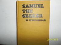
Samuel The Seeker
by Sinclair, Upton
- Used
- very good
- Hardcover
- first
- Condition
- Used - Very Good
- Jacket Condition
- No DJ Included
- Edition
- First Edition
- Binding
- Hardcover
- Quantity Available
- 1
- Seller
-
Salem, Oregon, United States
- Item Price
-
$40.00$20.00Save $20.00!
Show Details
Description:
Sinclair, Upton. Samuel, The Seeker Copyright 1910. Apparently published by author. No publisher stated. First Edition. States printed at Western Printing and Lithography, Racine, WI. Yellow Boards with black titling. Used. Very Good/ No Dj is Included. Rare/Scarce. A nice copy.
Item Price
$40.00$20.00
Save $20.00
!

Oregon; Or, a Short History of a Long Journey: Narrative of a Journey Across the Rocky Mountains, to the Columbia River
by John B. Wyeth
- Used
- very good
- Hardcover
- Condition
- Used - Very Good
- Edition
- Limited Edition
- Binding
- Hardcover
- Quantity Available
- 1
- Seller
-
Longmont, Colorado, United States
- Item Price
-
$20.00
Show Details
Description:
YE Gallon Press, 1970. Limited Edition. #499/605. VG. Interior is tight, clean, and free of ownership marks except for one penciled notation on the flyleaf. Cloth boards show shelf and handling wear with light soiling, edge, corner, and spine wear. Overall a solid copy showing minimal signs of use. Photo is of the copy we have here at Barbed Wire Books.
Item Price
$20.00
More Photos
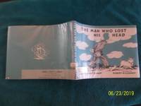
The Man Who Lost His Head
by Claire Huchet Bishop
- Used
- very good
- Hardcover
- Condition
- Used - Very Good
- Jacket Condition
- Very Good
- Edition
- Reprint Edition
- Binding
- Hardcover
- Quantity Available
- 1
- Seller
-
Salem, Oregon, United States
- Item Price
-
$44.89$22.45Save $22.44!
Show Details
Description:
The Man Who Lost His Head. By Claire Huchet Bishop. Viking Press, Copyright Renewed 1970. 16th Impression thus. Exlib. VG/VG unclipped DJ. Original cover price $3.56. Wrap-around blue and white endpapers show a headless man walking past farm animals on his way to the fair to look for his head there. Pages are bright. Now protected in a mylar wrap. A fantasy illustrated by Robert McCloskey, author and illustrator of "Make Way For Ducklings". Summary: "A man wakes up to find that he has no head, so he goes looking for it." Hard title to find.
Item Price
$44.89$22.45
Save $22.44
!

More Photos
Lucky You, What Science Has Done For Us
by Leaf, Munro
- Used
- good
- Hardcover
- first
- Condition
- Used - Good
- Jacket Condition
- Good
- Edition
- Stated First Edition
- Binding
- Hardcover
- Quantity Available
- 1
- Seller
-
Salem, Oregon, United States
- Item Price
-
$45.00$22.50Save $22.50!
Show Details
Description:
Lucky You: What Science Has Done For Us J.B. Lippincott Stated First Edition. SCIENCE. Artfully illustrated by MUNRO LEAF. Good EXLIB in a Good unclipped $2.25 orig. price dust jacket. Last page states: 152 4.
Item Price
$45.00$22.50
Save $22.50
!
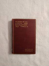
DOLLY MADISON: WOMEN OF COLONIAL AND REVOLUTIONARY TIMES
by Goodwin, Maud Wilder
- Used
- good
- Hardcover
- first
- Condition
- Used - Good
- Edition
- First Edition
- Binding
- Hardcover
- Quantity Available
- 1
- Seller
-
Buffalo, Wyoming, United States
- Item Price
-
$27.50
Show Details
Description:
New York: Charles Scribner's Sons, 1886. First Edition . Hardcover. Good. 12mo - over 6¾" - 7¾" tall. Book is in G condition with light rubbing to edges, cocked spine, bumping & fraying to spine ends, pencil marking to FFE, owner's name to title page, a couple of small tears to title page else still a bright and solid copy. SA 6/21
Item Price
$27.50

More Photos
Grant Wood and Marvin Cone : Artists of an Era
by Hazel E. Brown
- Used
- near fine
- Hardcover
- Signed
- first
- Condition
- Used - Near Fine
- Jacket Condition
- Very Good
- Edition
- First Edition
- Binding
- Hardcover
- ISBN 10 / ISBN 13
- 9780813817750 / 0813817757
- Quantity Available
- 1
- Seller
-
Arlington, Virginia, United States
- Item Price
-
$27.95
Show Details
Description:
Ames: Iowa State University Press, 1972. Hardcover. First Edition (stated). Flat signed and dated by author on FFEP and Inscribed by author to a friend on half-title page. Near Fine book in a Very Good jacket. Interior pristine except for author's inscription and signature. Spine straight and tight. Jacket shows light rubbing, light chipping at spine head, and light reading wear to edges. Not from a library. No remainder mark. Not clipped. xi + 150 pages. illus. A reflection of the relationships of two artists -- Grant Wood (1891-1942) and Marvin Cone (1891-1965) -- with the community of Cedar Rapids, Iowa. A loving biography by a woman who knew them both. Laid-in are two letters to the editor of the Cedar Rapids Gazette; one from Woods' sister, and another from a friend of Woods and the author.
Item Price
$27.95

More Photos
BOSTON ~ 150 VIEWS: One Hundred and Fifty Glimpses of Boston and Historical Surroundings
- Used
- very good
- Paperback
- Condition
- Used - Very Good
- Binding
- Paperback
- Quantity Available
- 1
- Seller
-
Surrey, British Columbia, Canada
- Item Price
-
$22.23
Show Details
Description:
Union News Company , New York and Boston, circa 1910, Very Good Stapled Softcover, 50 pages, 10" x 7", 150 photographs of Boston points of interest, landmarks, buildings, bridges, street views and more.
Item Price
$22.23