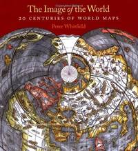
Stock Photo: Cover May Be Different
The Image of the World: 20 Centuries of World Maps Paperback - 2010
by Peter Whitfield
Details
- Title The Image of the World: 20 Centuries of World Maps
- Author Peter Whitfield
- Binding Paperback
- Pages 144
- Volumes 1
- Language ENG
- Publisher British Library, London
- Date 2010-07
- Illustrated Yes
- ISBN 9780712350891 / 0712350896
- Weight 2.07 lbs (0.94 kg)
- Dimensions 11 x 10.2 x 0.6 in (27.94 x 25.91 x 1.52 cm)
- Dewey Decimal Code 912.09
More Copies for Sale

The Image of the World: 20 Centuries of World Maps
by Peter Whitfield
- Used
- very good
- Paperback
- Condition
- Used - Very Good
- Binding
- Paperback
- ISBN 10 / ISBN 13
- 9780712350891 / 0712350896
- Quantity Available
- 1
- Seller
-
GORING BY SEA, West Sussex, United Kingdom
- Item Price
-
$11.02$10.86 shipping to USA
Show Details
Description:
Paperback. Very Good.
Item Price
$11.02
$10.86
shipping to USA

Stock Photo: Cover May Be Different
The Image of the World : 20 Centuries of World Maps / Updated Edition
by Whitfield, Peter
- Used
- Condition
- Used - Very Good
- ISBN 10 / ISBN 13
- 9780712350891 / 0712350896
- Quantity Available
- 1
- Seller
-
Dunfermline, Fife, United Kingdom
- Item Price
-
$14.37$10.00 shipping to USA
Show Details
Description:
British Library, The. Used - Very Good. Ships from the UK. Former library book; may include library markings. Used book that is in excellent condition. May show signs of wear or have minor defects.
Item Price
$14.37
$10.00
shipping to USA

The image of the world : 20 centuries of world maps / Peter Whitfield
by Whitfield, Peter, Dr.
- Used
- Paperback
- Condition
- Used
- Edition
- Reprint
- Binding
- Paperback
- ISBN 10 / ISBN 13
- 9780712350891 / 0712350896
- Quantity Available
- 1
- Seller
-
Galway, Ireland
- Item Price
-
$33.60$28.95 shipping to USA
Show Details
Description:
London : British Library, 2010. Reprint. Softcover. Fine paperback copy. Particularly and surprisingly well-preserved; tight, bright, clean and especially sharp-cornered. Physical description; viii, 144 p. : 70 col.ill. ; 29 cm. Subjects; Cartography History. Historical geography Maps. Cartography History; studies. World 1482-2008 ; Atlases. World maps. Maps; description and study.
Item Price
$33.60
$28.95
shipping to USA

Stock Photo: Cover May Be Different
The Image of the World : 20 Centuries of World Maps / Updated Edition
by Whitfield, Peter
- Used
- Condition
- Used - Very Good
- ISBN 10 / ISBN 13
- 9780712350891 / 0712350896
- Quantity Available
- 1
- Seller
-
Mishawaka, Indiana, United States
- Item Price
-
$47.42FREE shipping to USA
Show Details
Description:
British Library, The. Used - Very Good. Former library book; may include library markings. Used book that is in excellent condition. May show signs of wear or have minor defects.
Item Price
$47.42
FREE shipping to USA

The Image of the World 20 Centuries of World Maps
by Whitfield, Peter
- Used
- Paperback
- Condition
- Used - Very Good-
- Binding
- Paperback
- ISBN 10 / ISBN 13
- 9780712350891 / 0712350896
- Quantity Available
- 1
- Seller
-
Highland, New York, United States
- Item Price
-
$49.99FREE shipping to USA
Show Details
Description:
British Library. Very Good-. 2010. Paperback. 0712350896 . Light foxing to edge of pages. - Great overall condition. Minor cosmetic wear. No noteworthy blemishes. No writing.; 10.3 X 0.7 X 11.25 inches; 144 pages .
Item Price
$49.99
FREE shipping to USA