Add to Want List
Rare and Antiquarian Books

Maps and Atlases

Biblio is proud to not just sell rare and antique books, but to also sell rare and antique maps and atlases. You can find a diverse selection of rare maps and atlases in the Biblio Rare Book Room, and many of them include astounding illustrations and detailed notes. Be sure to browse the rare maps and atlases section of the Biblio Rare Book Room to find a special book or map that just might add considerable value to your rare and antique book collection.

Results 1 - 15 of 327
(Map / Chart- Ottoman, Turkish Empire): Estats De L'Empire Du Grand Seigneur Des Turcs, En...

(Map / Chart- Ottoman, Turkish Empire): Estats De L'Empire Du Grand Seigneur Des Turcs, En Europe, En Asie, et En Afrique, Divise En Touts Ses Beglerbeglicz, Ou Gouvernments

by Jaillot, Alexis-Hubert

  • Used
Condition
Used
Seller
Crozet, Virginia
Seller rating:
This seller has earned a 5 of 5 Stars rating from Biblio customers.
Item Price
$1,200.00
$8.50 shipping to USA

Show Details

Description:
Paris: H. Jaillot, 1695. VG, heavy paper, hand colored, decorative cartouche, inset of southern mediterranean / Algerian coast. A striking image, after Sanson and copied by several later cartographers. The above date is approximate, although clearly printed with the 5 scales indicated on the map.. Some browning and chipping of lower margin, not crossing neatline and easily covered by matting. This depicts the Ottoman (Turkish) Empire at the time, with its reaches through Asia, Europe and Africa. Includes environs of Mediterranean, Black, Red and Caspian Seas, with the "Golfe D'Ormus" at the western edge of the map. Includes details of Mediterranean with Cyprus, Rhodes, Candie, Sicily, Sardinia and Corsica, and much more. This is a very uncommon map, with the image measuring 18x25 inches (centerfold as issued)..
Item Price
$1,200.00
$8.50 shipping to USA
(Map of Holy Land- Canaan): Canaan

(Map of Holy Land- Canaan): Canaan

by Speed (Speede), John

  • Used
  • first
Condition
Used
Seller
Crozet, Virginia
Seller rating:
This seller has earned a 5 of 5 Stars rating from Biblio customers.
Item Price
$1,495.00
$8.50 shipping to USA

Show Details

Description:
London: Christopher Browne (at the Globe near the West End of St. Pauls Church), 1695. Good, hand colored outlines, This is the Christopher Browne imprint (see Roderick M. Barron's description in his catalogue 33 as to the recent discovery of this imprint, separate from the more commonly reported Bassett and Chiswell 1676 plate), which may be more common than initially thought. Browne published a bit later, and had purchased the Bassett and Chiswell plates, then changed the name on a few of those (of which this plate was one; very few survive), and the date here is approximate. This is a striking image with Jerusalem inset, newly updated and published in the 1676 edition (date approximate) of Speed's " A Prospect of the Most Famous Parts of the World". There is some general browning, with some professional restorations at folds (virtually no image loss), mild upper margin staining (mostly in blank areas) and backed with Japon paper. A custom case was made for this map, after… Read More
Item Price
$1,495.00
$8.50 shipping to USA
TOPOGRAPHICAL SURVEY OF THE GREAT ROAD FROM LONDON TO BATH AND BRISTOL. With historical and...

Show Details

Description:
London: For the author & William Faden (replaced by R.Faulder in vol.2), 1792. Hardcover. Very Good-. Aquatint plates (65 as listed) + 11 folding Maps. . 2 VOLUMES IN ONE 223x141mm green calf gilt key pattern border & spine gilt, gilt dent. & rev. (tips & hinges rubbed/spine darkened) All Edges Gilt Dedication to Prince of Wales the future George IV. TP + xvi =Dedic.+Introduction + contents & plate list +154pp Titlepage to Part II +viii=Contents & Plate list + 190pp+errata + 11 folding Maps. Coat of Arms bookplate James Forbes esq. & F.Fisher written in. Short tears to gutter edge - no loss - to first 3 leaves else a clean copy. Slight offset from plates to facing text but no foxing and great views with horses, coaches, people, boats etc. The maps without and misfold or tears -they look unused. A clean copy of a lovely aquatint book.
Item Price
$1,374.05
$25.75 shipping to USA
COMPENDIOUS GEOGRAPHICAL AND HISTORICAL GRAMMAR exhibiting a brief survey of the terraqueous...

Show Details

Description:
London: W.Peacock, 1795. Hardcover. Good. Hand colored in outline Folding Maps (12 + frontis) by Russell. Duodecimo red roan gilt (spine quite chipped down at head/foot & heavily rubbed/tips worn) All Edges Gilt xxii+404pp +(4p index) 2 leaves nearly loose but clean and square. Nice 19th century inscription on FEP. All folding maps crisp and untorn with outline coloring. Maps: Chart of the world - East Indies - Spain and Portugal - France - Italy - Netherlands - United Provinces - German Empire and Switzerland - Prussia and Poland - Dominions of Russia - Sweden, Denmark and Norway - Great Britain and Ireland - States of America.
Item Price
$325.43
$25.75 shipping to USA
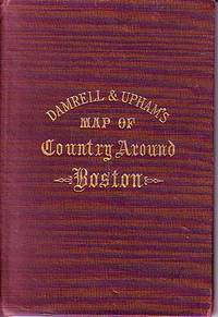
Damrell & Upham's Map of Country Around Boston

Damrell & Upham's Map of Country Around Boston

  • Used
  • good
  • Hardcover
Condition
Used - Good
Binding
Hardcover
Seller
Houlton, Maine
Seller rating:
This seller has earned a 5 of 5 Stars rating from Biblio customers.
Item Price
$125.00
$5.99 shipping to USA

Show Details

Description:
The Boston Map Store, 1889 IN GOOD CONDITION. Folds out to 32 inches by 22 inches. Hand coloured map of Boston and the Country Adjacent, from actual Surveys. Shows crease tears and stains.
Item Price
$125.00
$5.99 shipping to USA
[World Map, Bible]: A Map of all the Earth and how after the Flood it was divided among the Sons...

[World Map, Bible]: A Map of all the Earth and how after the Flood it was divided among the Sons of Noah

by Moxon, Joseph

  • Used
  • first
Condition
Used
Seller
Crozet, Virginia
Seller rating:
This seller has earned a 5 of 5 Stars rating from Biblio customers.
Item Price
$1,975.00
$8.50 shipping to USA

Show Details

Description:
Amsterdam: Visscher, Nicholas (Nicolaus), 1685. Very good, early color (perhaps some recent enhancement), few tiny worm holes, minor restoration at lower right (no image loss) and flattened center fold. Minmial browning margins. The date is approximate. Numerous biblical vignettes, some with Hebrew lettering. This was done for a Dutch bible, this one published by Visscher in Amsterday. Shirley's entry 457 is a similar map but without the Visscher imprint (and this issue does not have the tabular information in the lower central area. North America is labeled with "Japhet," and "Eden" is shown towards the cetner of the depiction of Asia. The vignettes are quite decorative. Moxon was a print and globe-maker, and he was the first tradesman to be elected to the Royal Society (online Dictionary of National Biography). The image measures 32 x 46 cm (18 x 12.5 inches), and has good margins..
Item Price
$1,975.00
$8.50 shipping to USA
MAP OF PHILADELPHIA, CAMDEN AND VICINITY Compiled from City Plans &  Personal Surveys
More Photos

MAP OF PHILADELPHIA, CAMDEN AND VICINITY Compiled from City Plans & Personal Surveys

by Smith, Elvino V.

  • Used
  • Hardcover
Condition
Used - Good+
Binding
Hardcover
Seller
Fairfield, New Jersey
Seller rating:
This seller has earned a 2 of 5 Stars rating from Biblio customers.
Item Price
$300.00
$4.00 shipping to USA

Show Details

Description:
Philadelphia: Elvino V. Smith. Good+. 1912. Hardcover. A very large folding map (56" x 43") mounted in a light blue, lightly faded, hardcover cloth folder with gilt lettering on front. Map in nice condition except for a few tears along the folds. Folder has paper tears along interior hinges. Condition--Folder: G+, Map: VG. Pennsylvania ; Fold out Map; Thin 12mo 7" - 7½" tall .
Item Price
$300.00
$4.00 shipping to USA
SMITH'S NEW MAP OF PHILADELPHIA AND VICINITY
More Photos

SMITH'S NEW MAP OF PHILADELPHIA AND VICINITY

by Smith, J. L.

  • Used
  • Hardcover
Condition
Used - Very Good+
Binding
Hardcover
Seller
Fairfield, New Jersey
Seller rating:
This seller has earned a 2 of 5 Stars rating from Biblio customers.
Item Price
$280.00
$4.00 shipping to USA
Show Details

Description:
Philadelphia: J. L. Smith. Very Good+. 1898. Hardcover. One large map Issued in two separate sheets; each 23" x 27 1/2". The folding maps are backed on linen. The maps are mounted in a green cloth hardcover folder with bright glit title on front. Pennsylvania; Thin 12mo 7" - 7½" tall .
Item Price
$280.00
$4.00 shipping to USA
A List of Geographical Atlases in the Library of Congress. Four Volumes. (1909-1920)
More Photos

A List of Geographical Atlases in the Library of Congress. Four Volumes. (1909-1920)

by Phillip Lee Phillips; Library of Congress

  • Used
  • Hardcover
  • first
Condition
Used - Very Good-
Edition
First
Binding
Hardcover
Seller
Tucson, Arizona
Seller rating:
This seller has earned a 5 of 5 Stars rating from Biblio customers.
Item Price
$100.00
$4.00 shipping to USA

Show Details

Description:
First edition, four volumes, 1909-1920, Washington. Overall very good condition in original bindings. Notable for the complete absence of library or ownership markings. The only marking I can find is an old pencil note on the front blank of volume 3. Includes bound in errata slips and a promotional leaf for the series laid in. The boards have some dings to the corners. Volume 3 has the most condition issues: shows the most outer wear with some stains on the edges and wear on spine and boards (see scans). Bindings are all sound, which I expect can be an issue with this heavy set. A quite decent usable set. Please see scans of the books you will receive.
Item Price
$100.00
$4.00 shipping to USA
The Cossacks: A Tale of the Caucasus in the Year 1852. UKRAINIA

The Cossacks: A Tale of the Caucasus in the Year 1852. UKRAINIA

by Tolstoi, Count Lyof N.

  • Used
  • Hardcover
  • first
Condition
Used - Good-
Edition
First English Edition
Binding
Hardcover
Seller
Salem, Oregon
Seller rating:
This seller has earned a 5 of 5 Stars rating from Biblio customers.
Item Price
$184.95$110.97
Save $73.98!
$5.00 shipping to USA

Show Details

Description:
UKRAINIA Tolstoi, Count Lyof N.: The Cossacks: A Tale of the Caucasus in the Year 1852. First English Edition, 1888 Walter Scott, 24 Warwick Lane, Paternoster Row, London. Translated from the Russian by Nathan Haskell Dole. Summary: A novel of the Caucasian War 1817-1864. Used. Good- Condition/ No DJ. Blue Boards gold titling and ornamentation. Imperial Russian crest stamped in gilt at center front. A solid copy. Light foxing to endpapers. Toning. Fabric at top of spine missing. RARE/SCARCE.
Item Price
$184.95$110.97
Save $73.98 !
$5.00 shipping to USA
Avalanche Safety
More Photos

Avalanche Safety: Rocky Mountains and Chamonix Alps 1934 - 1937 Book One

by [Set in Motion Press] Casey Gardner.

  • Used
  • Hardcover
Condition
Used
Edition
Edition of 39
Binding
Hardcover
Seller
Hoover, Alabama
Seller rating:
This seller has earned a 5 of 5 Stars rating from Biblio customers.
Item Price
$1,500.00
$14.35 shipping to USA

Show Details

Description:
Berkeley, California:: Set in Motion Press,, 2020.. Edition of 39. 7 x 14"; Accordion-bound folios with pamphlet-stitched interior booklets. Letterpress printed with photopolymer plates and carved linoleum. Digitally printed inserts. Paper, made of cottom and flax ,is Moulin due Gué. Other papers are Zerkall Book, German Etching, and Curious Metallic. Typefaces used are Cheltenham, Kabel, Gill Sans, Futura and Bodoni. Drawings by the artist. Animal wildlife is vintage line art. The "Atlas Biographic" folio features images from the Library of Congress: "1877 Geological and Geographical Atlas of Colorado" surveyed by F. V. Hayden and photograph of a 19th century silver mine on Aspen Moutain. Bound in Iris bookcloth at corners with letterpress printed papers over boards. Numbered. Set in Motion Press: "Set in the precarious time of the 1920s, living on the brink of human-triggered catastrophe, two young people explore their relationship with naure amid hidden and… Read More
Item Price
$1,500.00
$14.35 shipping to USA
Lithograph Wall Chart] Structural Differential
More Photos

Lithograph Wall Chart] Structural Differential

by Korzybski, Alfred (1879-1950)

  • Used
  • near fine
  • first
Condition
Used - Near Fine
Edition
First Printing
Seller
Bloomington, Indiana
Seller rating:
This seller has earned a 5 of 5 Stars rating from Biblio customers.
Item Price
$1,750.00
FREE shipping to USA

Show Details

Description:
New York: Rand McNally & Co. , 1949. RARE lithograph wall chart for the device called the "Structural Differential" which Alfred Korzybski patented in 1925 as a means to aid in visualizing the process he called "abstracting". This was to be used as a training device in general semantics, a field of study Korzybski is credited with founding. The chart is Near Fine, rubbed lower right, mounted on two stained wooden dowels with ribbon hanger 18" wide by 38" high. Korzybski's work in semantics heavily influenced science fiction authors such as A.E. Van Vogt, Robert A. Heinlein, Poul Anderson, and H. Beam Piper, as well as L. Ron Hubbard and Joseph W. Campbell. His most famous quote "The map is not the territory" comes from this longer quote "A map is not the territory it represents, but, if correct, it has a similar structure to the territory, which accounts for its usefulness."( Science and Sanity, Korzybski, 1931). OCLC locates no copies; no… Read More
Item Price
$1,750.00
FREE shipping to USA
Published by the Milwaukee Sentinel Commemorating Its One Hundredth Anniversary June 27, 1937

Show Details

Description:
Map Details and Condition:
color lithograph by Litho in U.S.A.
dimensions: 24" x 28.5 " print, 26 1/4" x 30" sheet size
condition: professionally removed from wood backing and restored, deeply toned paper, some surface damage to paper, repaired vertical tear through sheet, backed with Japanese Mulberry tissue, some chipping at edges Map Description:
This scarce Wisconsin pictorial map was created by the artist Nina S. Bahlman (b1886-___) whose art work other than this map may exist in collections but is not readily identified. The copyright is held by Erwin F. Bahlmann (b.1886-__) a family member or spouse. The Library of Congress cites its copy of this map as Historical Map of Wisconsin and cites a 1995 copyright registration. WorldCat confirms that there is a 1995 reprint of this map. A further note corrects the spelling of the artist's name to read "Bahlmann". The example of the map on offer gives every appearance of being the 1932 edition.
The map was published… Read More
Item Price
$650.00
$11.00 shipping to USA
Map of Mining Claims Butte and Vicinity Montana (1907)

Map of Mining Claims Butte and Vicinity Montana (1907)

by Harper, Macdonald & Co., J.H. Harper, A.B. Hobart, R.H. Lindsay, Jr., Mineral & Land Attorneys & U.S. Mineral Land Surveyors

  • Used
  • Signed
Condition
Used
Seller
FRAMINGHAM, Massachusetts
Seller rating:
This seller has earned a 5 of 5 Stars rating from Biblio customers.
Item Price
$800.00
$11.00 shipping to USA

Show Details

Description:
Map Details:Scale 1"=1,200' (manuscript pencil above printed scale)color lithograph
dimensions: 37 1/2" x 49" sheet size
maroon pocket covers: 8 7/8" x 5 1/8" x 3/4"
condition: professional conservation to reattach lifted paper at original folds. Some paper loss at folds, bright colors with some fading. Paper shows wear from actual use, including pencil notations on map's color key of claimants.
provenance: manuscript inside pocket cover identifying two prior owners, W.B. Brinker (Butte) and C.A. Lemmon, Anaconda, MontanaDescription:
Harper, Macdonald & Co. published maps of Butte, Montana mining claims as early as 1901. This 1907 map edition of Mining Clams Butte and Vicinity Montana is referred to in certain literature as the first edition of its series. The 1907 copyright date of this map and its 1907 publication date therefore identify this map is the first edition of its series. The series was published until at least 1913. The Harper, Macdonald firm… Read More
Item Price
$800.00
$11.00 shipping to USA
Gall and Inglis’ School Atlas of Modern Geography
More Photos

Gall and Inglis’ School Atlas of Modern Geography

by Gall and Inglis

  • Used
  • near fine
  • Hardcover
Condition
Used - Near Fine
Binding
Hardcover
Seller
COLUMBIA, Missouri
Seller rating:
This seller has earned a 4 of 5 Stars rating from Biblio customers.
Item Price
$750.00
FREE shipping to USA

Show Details

Description:
1861 RARE Gall Inglis ATLAS Geography China America Australia 31 COLOR MAPS

Gall and Inglis' "School Atlas of Modern Geography" is a civil war compilation of 31 royal quarto maps. This 1861 edition includes maps of Europe, England and Wales, Ireland, Scotland, North America, South America, Switzerland, Turkey, Hindostan, and much more!
Item number: #13467
Price: $750
Gall and Inglis
Gall and Inglis' School Atlas of Modern Geography
Edinburgh: Gall & Inglis, 1861.

Details:
·
Collation: Complete with all pages
o 31 color maps
· Language: English
· Binding: Hardcover; tight & secure
o
Cloth
· Size: ~12.5in X 9.75in (31.5cm x 25cm)

Our Guarantee:
Very Fast. Very Safe. Free Shipping Worldwide.
Customer satisfaction is our priority! Notify us with 7 days of receiving, and we will offer a full refund without reservation!

13467Photos available upon request.
Item Price
$750.00
FREE shipping to USA