Rare and Antiquarian Books
Maps and Atlases
Biblio is proud to not just sell rare and antique books, but to also sell rare and antique maps and atlases. You can find a diverse selection of rare maps and atlases in the Biblio Rare Book Room, and many of them include astounding illustrations and detailed notes. Be sure to browse the rare maps and atlases section of the Biblio Rare Book Room to find a special book or map that just might add considerable value to your rare and antique book collection.
Results 1 - 15 of 309

(Map / Chart- Ottoman, Turkish Empire): Estats De L'Empire Du Grand Seigneur Des Turcs, En Europe, En Asie, et En Afrique, Divise En Touts Ses Beglerbeglicz, Ou Gouvernments
by Jaillot, Alexis-Hubert
- Used
- Condition
- Used
- Seller
-
Crozet, Virginia
- Item Price
-
$1,200.00$8.50 shipping to USA
Show Details
Item Price
$1,200.00
$8.50
shipping to USA

(Map of Holy Land- Canaan): Canaan
by Speed (Speede), John
- Used
- first
- Condition
- Used
- Seller
-
Crozet, Virginia
- Item Price
-
$1,495.00$8.50 shipping to USA
Show Details
Item Price
$1,495.00
$8.50
shipping to USA

TOPOGRAPHICAL SURVEY OF THE GREAT ROAD FROM LONDON TO BATH AND BRISTOL. With historical and descriptive accounts of the country, towns, villages, and gentlemen's seats on and adjacent to it; illustrated by perspective views of the most select and picturesque scenery. To which is added a correct map of the country three miles on each side of the road, planned from a scale of one inch to a mile.
by Robertson,Archibald
- Used
- Hardcover
- Condition
- Used - Very Good-
- Binding
- Hardcover
- Seller
-
Blockley, Gloucestershire
- Item Price
-
$1,348.09$25.75 shipping to USA
Show Details
Item Price
$1,348.09
$25.75
shipping to USA

COMPENDIOUS GEOGRAPHICAL AND HISTORICAL GRAMMAR exhibiting a brief survey of the terraqueous globe : and shewing, the situation, extent, boundaries, and divisions of the various countries, their chief towns, mountains, rivers, climates, and productions; their governments, revenues, commerce, and their sea and land forces; likewise, the religion, language, literature, customs, and manners of the respective inhabitants of the different nations: and also, a concise view of the political history of the several empires, kingdoms, and states. Embellished with maps.
- Used
- good
- Hardcover
- Condition
- Used - Good
- Binding
- Hardcover
- Seller
-
Blockley, Gloucestershire
- Item Price
-
$319.28$25.75 shipping to USA
Show Details
Item Price
$319.28
$25.75
shipping to USA
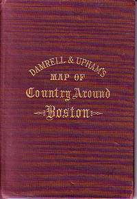
Damrell & Upham's Map of Country Around Boston
- Used
- good
- Hardcover
- Condition
- Used - Good
- Binding
- Hardcover
- Seller
-
Houlton, Maine
- Item Price
-
$125.00$5.99 shipping to USA
Show Details
Item Price
$125.00
$5.99
shipping to USA

(Satirical political map of Franco-Prussian War): Karte von Europa im Jahre 1870 nach einem französischen Holzschnitte
by Hadol (Paul)
- Used
- first
- Condition
- Used
- Edition
- First Edition Thus
- Seller
-
Crozet, Virginia
- Item Price
-
$1,875.00$8.50 shipping to USA
Show Details
Item Price
$1,875.00
$8.50
shipping to USA
![[World Map, Bible]: A Map of all the Earth and how after the Flood it was divided among the Sons...](https://d3525k1ryd2155.cloudfront.net/h/880/450/438450880.0.m.jpg)
[World Map, Bible]: A Map of all the Earth and how after the Flood it was divided among the Sons of Noah
by Moxon, Joseph
- Used
- first
- Condition
- Used
- Seller
-
Crozet, Virginia
- Item Price
-
$1,975.00$8.50 shipping to USA
Show Details
Item Price
$1,975.00
$8.50
shipping to USA

More Photos
MAP OF PHILADELPHIA, CAMDEN AND VICINITY Compiled from City Plans & Personal Surveys
by Smith, Elvino V.
- Used
- Hardcover
- Condition
- Used - Good+
- Binding
- Hardcover
- Seller
-
Fairfield, New Jersey
- Item Price
-
$300.00$4.00 shipping to USA
Show Details
Item Price
$300.00
$4.00
shipping to USA

More Photos
SMITH'S NEW MAP OF PHILADELPHIA AND VICINITY
by Smith, J. L.
- Used
- Hardcover
- Condition
- Used - Very Good+
- Binding
- Hardcover
- Seller
-
Fairfield, New Jersey
- Item Price
-
$280.00$4.00 shipping to USA
Show Details
Item Price
$280.00
$4.00
shipping to USA
More Photos
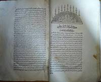
cihannuma or Jihannuma (Mirror of the world)
by KATIB CELEBI (Mustafa ibn Abd Allah, aka Haci Halife, 1609-1657)
- Used
- Fine
- Hardcover
- Condition
- Used - Fine
- Edition
- 1st Edition
- Binding
- Hardcover
- Seller
-
Riyadh, Saudi Arabia
- Item Price
-
$85,000.00$15.50 shipping to USA
Show Details
Item Price
$85,000.00
$15.50
shipping to USA

More Photos
A List of Geographical Atlases in the Library of Congress. Four Volumes. (1909-1920)
by Phillip Lee Phillips; Library of Congress
- Used
- Hardcover
- first
- Condition
- Used - Very Good-
- Edition
- First
- Binding
- Hardcover
- Seller
-
Tucson, Arizona
- Item Price
-
$100.00$4.00 shipping to USA
Show Details
Item Price
$100.00
$4.00
shipping to USA

More Photos
Avalanche Safety: Rocky Mountains and Chamonix Alps 1934 - 1937 Book One
by [Set in Motion Press] Casey Gardner.
- Used
- Hardcover
- Condition
- Used
- Edition
- Edition of 39
- Binding
- Hardcover
- Seller
-
Hoover, Alabama
- Item Price
-
$1,500.00$14.35 shipping to USA
Show Details
Item Price
$1,500.00
$14.35
shipping to USA

Published by the Milwaukee Sentinel Commemorating Its One Hundredth Anniversary June 27, 1937: Approved by the Wisconsin Conservation Commission, Checked and Approved by Dr. Joseph Schafer, Superintendent of the Historical Society of Wisconsin and Dr. Louise Phelps Kellogg, Senior Research Associate Endorsed by the Wisconsin State Chamber of Commer
by Copyright 1932 by Erwin F. Bahlmann and Artist Nina S. Bahlman
- Used
- Condition
- Used
- Seller
-
FRAMINGHAM, Massachusetts
- Item Price
-
$650.00$11.00 shipping to USA
Show Details
Item Price
$650.00
$11.00
shipping to USA

Map of Mining Claims Butte and Vicinity Montana (1907)
by Harper, Macdonald & Co., J.H. Harper, A.B. Hobart, R.H. Lindsay, Jr., Mineral & Land Attorneys & U.S. Mineral Land Surveyors
- Used
- Signed
- Condition
- Used
- Seller
-
FRAMINGHAM, Massachusetts
- Item Price
-
$800.00$11.00 shipping to USA
Show Details
Item Price
$800.00
$11.00
shipping to USA

More Photos
Gall and Inglis’ School Atlas of Modern Geography
by Gall and Inglis
- Used
- near fine
- Hardcover
- Condition
- Used - Near Fine
- Binding
- Hardcover
- Seller
-
COLUMBIA, Missouri
- Item Price
-
$750.00FREE shipping to USA
Show Details
Item Price
$750.00
FREE shipping to USA
