Description:
Collins, Greenville : Chart of Milford Haven, from Great Britain's Coasting Pilot, ca.1760. Copper engraved chart. Map size approx 560mm x 440mm. Wide margins, hand coloured, good impression on heavy paper, showing the Welsh coast at Milford Haven. Compass rose, rhumb lines, scale. Cartouche with cherub, dedicated to Sir Hugh Owen. Light water stain to top margin just touching printed area, otherwise a very good, bright and attractive chart.
Hydraulics of Great Rivers, the Parana, the Uruguay and the la Plata Estuary by J.J. Révy - 1874
by J.J. Révy

Hydraulics of Great Rivers, the Parana, the Uruguay and the la Plata Estuary
by J.J. Révy
- Used
- good
- Hardcover
- first
London: E.and F.N. Spon, 1874. First Edition. Hardback. Good/No Jacket. 2339 Folio. With charts and tables, all as called for. In original black cloth-covered boards, blind stamped, gilt titles. An account of the surveying of three of the largest rivers in the world, undertaken under considerable pressure of time, to enable proposed engineering works. The work included development of an improved current meter, based on one that was just being offered to market as the expedition was being planned. Of the device offered to him, which had been simplified from a sound design in order to make it "easier" to use, the author wrote "all these attempts at making things very easy is a mistake, for they tend to make things very useless" - a sentiment which is likely to ring true for many of us today. Condition notes: Boards bumped and rubbed, title page just starting to pull away from its binding, and some foxing to the prelims. Apart from the early foxing, the pages are clean and bright. The volume has been owned by K u k Plonnier-Cadettenschule zu Hainburg, and has their ownership stamp to the title page and occasionally to text pages. The charts and tables are clean, bright and sound, although the chart of the Delta of the Parana has separated into two sheets along the centrefold.
-
Bookseller
Independent bookstores
 (GB)
(GB)
- Format/Binding Hardback
- Book Condition Used - Good
- Jacket Condition No Jacket
- Edition First Edition
- Binding Hardcover
- Publisher E.and F.N. Spon
- Place of Publication London
- Date Published 1874
- Keywords history of science, history of technology, history of surveying

Sea Chart of Milford Haven,
by Greenville Collins
- Used
- very good
- Condition
- Used - Very Good
- Edition
- Original 18th Century, Hand Coloured Sea Chart
- Quantity Available
- 1
- Seller
-
Plymouth, Devon, United Kingdom
- Item Price
-
$127.14
Show Details
Item Price
$127.14

Reynolds Map of the Environs of London Geologically Coloured
by James Reynolds
- Used
- Hardcover
- Condition
- Used - Good Plus
- Jacket Condition
- No Jacket
- Binding
- Hardcover
- Quantity Available
- 1
- Seller
-
West Molesey, Surrey, United Kingdom
- Item Price
-
$178.00
Show Details
Description:
London: James Reynolds Hand coloured map of London and environs from Essex down to Surrey laid on cloth backing, not dated but looks around late 1800s possibly a bit earlier. Map size from edge to edge is 30 ½ x 20 Inches in overall clean condition just a few light stains to back which do not come through onto map, on points of a few folds there are small holes of wear but when map is laid out they cannot be seen and all wording is readable, scale is ½ inch to one mile. Folds into a hard cover 7 x 4 ¼ inches, which is worn on edges and on surface, opens onto marbled endpaper and a cutting advertising the maps of James Reynolds, this has been pasted to the inside of front board and is a two page fold out which is torn in the middle but is not original to the map but is a cutting from a newspaper.A pleasing clean copy of an old map SEE IMAGE. DETAILED IMAGES AVAILABLE ON REQUEST. Boards and Cloth Backed Map. Good Plus/No Jacket. 30 ½ x 20 Inches. Hardcover.
Item Price
$178.00

Circa 1950 Fairchild Aerial Camera Panoramic View Of Palm Springs, California, Two Palm Springs Airports
by Fairchild Aerial Surveys
- Used
- Condition
- Used
- Binding
- Unknown
- Quantity Available
- 1
- Seller
-
Van Nuys, California, United States
- Item Price
-
$175.00
Show Details
Description:
Fairchild Aerial Surveys, Los Angeles, 1950; Large circa 1950 Fairchild Surveys aerial photo of Palm Springs, California, from a time when it was a much cherished rural outpost, and long before today’s ghastly urban sprawl. Of special interest is the inclusion of both of Palm Springs’ historic airports, each clearly visible in the photo: the original Palm Springs Air Port (Stevens Airfield), built in the early twenties, and the subsequent airfield, constructed approximately 1 mile to the east, which began construction in 1939 as the Palm Springs Army Airfield and gradually evolved into the present day Palm Springs Airport. Image size 20" long by 10" high, covering a land area of approximately 9 miles by 5 miles. Fairchild imprint and North indicator at upper right corner. From the office of Culver Nichols, legendary Palm Springs realtor who was instrumental in the movement to incorporate the city in 1936, and a significant figure in the Palm Springs area real estate boom. Archivally…
Read More Item Price
$175.00

More Photos
Circa 1950 Fairchild Aerial Camera Panoramic View Cathedral City, Rancho Mirage, Palm Desert, Palm Desert Air Park, California
by Fairchild Aerial Surveys
- Used
- Condition
- Used
- Binding
- Unknown
- Quantity Available
- 1
- Seller
-
Van Nuys, California, United States
- Item Price
-
$175.00
Show Details
Description:
Fairchild Aerial Surveys, Los Angeles, 1950; Large circa 1950 Fairchild Aerial Surveys photo showing Cathedral City, Rancho Mirage, and Palm Desert, California. Shows Tamarisk Country Club, Thunderbird Country Club, and the bygone Palm Desert Air Park, famed "Airport Of The Stars," frequent destination of celebrity aviators such as Dwight Eisenhower, Bob Cummings, Robert Taylor, and Edgar Bergen. Large image size of 20" long by 10" high corresponds to a land area of approximately 9 miles by 4 miles. Fairchild imprint and North indicator at upper right corner. From the office of Culver Nichols, legendary realtor who was instrumental in the movement to incorporate the city of Palm Springs in 1936, and who was a significant figure in the Palm Springs area real estate boom. Archivally hinged and matted with 100% rag acid-free museum board, ready for framing. Outside matte dimensions 24" x 14". Excellent condition, no chips or tears. Scarce.
Item Price
$175.00

Maps and Mapmakers of the Aegean
by Sphyroeras, Vasilis Avramea, Anna Ashdrahas, Spyros
- Used
- as new
- Hardcover
- first
- Condition
- As New
- Jacket Condition
- as new
- Edition
- First English language edition
- Binding
- Hardcover
- Quantity Available
- 1
- Seller
-
Thessaloniki, Greece
- Item Price
-
$108.80
Show Details
Description:
Athens: Olkos, 1985. First English language edition. Hardcover. As New/as new. As new hardcover with DJ. 1st english ed. 263pages, 29X21,8cm.Translated by G. Cox, J. Solman. The charting of the Aegean Sea, or the Greek Archipelago, from the 15th up to the 19th century. Map Index; General Index. 166 color and black & white maps.
Item Price
$108.80
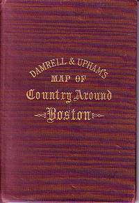
Damrell & Upham's Map of Country Around Boston
- Used
- good
- Hardcover
- Condition
- Used - Good
- Binding
- Hardcover
- Quantity Available
- 1
- Seller
-
Houlton, Maine, United States
- Item Price
-
$125.00
Show Details
Description:
The Boston Map Store, 1889 IN GOOD CONDITION. Folds out to 32 inches by 22 inches. Hand coloured map of Boston and the Country Adjacent, from actual Surveys. Shows crease tears and stains.
Item Price
$125.00

Amerique Septrionale [ Original Map From The Atlas Universal Illustre, By Levasseur, V. / Laguillermie]
by Levasseur, V. / Laguillermie
- Used
- Condition
- Used - Very Good +
- Edition
- Original Antique Map
- Binding
- Unknown
- Quantity Available
- 1
- Seller
-
Pasadena, California, United States
- Item Price
-
$135.00
Show Details
Description:
Paris Circa 1840: A. Combette, 1840. Original Antique Map . Single Sheet. Very Good +. 21" x 14 1/4. Large Color Views By Raimond Bonheur. Original Decorative Map 21" X 14 1/4" Of North America Showing The United States As Claiming Much Of British Colombia, With The West Coast Of The Usa Continuing Well Into Present-Day Canada; Texas As A Republic; Guatemala Encompassing All Of Central America South Of Chiapas And Belize And North Of Panama. Large Panels At Sides With Detailed, Attractive And Well Colored Views Of People, Wildlife, Vegetation, High Mountains, Etc.Colors Very Bright And Well-Placed.
Item Price
$135.00

More Photos
SMITH'S MAP OF PHILADELPHIA AND VICINITY
by Gannett, Henry; Chief Topographer, U. S. Geological Survey
- Used
- Hardcover
- first
- Condition
- Used - Good+
- Edition
- First Edition Thus; Second Printing
- Binding
- Hardcover
- Quantity Available
- 1
- Seller
-
Fairfield, New Jersey, United States
- Item Price
-
$175.00
Show Details
Description:
Philadelphia: J. L. Smith. Good+. 1904. First Edition Thus; Second Printing. Hardcover. U. S. Geological Survey, surveyed in 1894, edition of 1902, printed in 1904. This is a 30 1/2" x 38 1/2" USGS map that J. L. Smith of Philadelphia, sometime after issue, sectioned (4 sections x 6 sections) and mounted on linen to create a folding pocket map. It is mounted in a 10 x 5.5 inch dark brown embossed and gilded hardcover folder that bears the title "Smith's Map of Philadelphia and Vicinity". The map covers the area north and west well past Norristown and south into Delaware, as well as a good part of New Jersey beyond Camden. It shows the local road network and was made for local travel. The inside cover has original owner's signature. Cover graded G+ due to rubbing along the spine edges & corners. The map is in VG condition. ; Fold out cloth Map; Small 4to 9" - 11" tall .
Item Price
$175.00

GEZICHT VAN DEN BERG ARARAT VAN DEN KANT DER DREI KERKEN (Ansicht des Berges Ararat mit den drei Kirchen - View of Mount Ararat with the Three Churches)
by MOUNT ARARAT - Kupferstich - Original Antique Etching
- Used
- very good
- Condition
- Used - Very Good
- Binding
- Unknown
- Quantity Available
- 1
- Seller
-
Tel-Aviv, Israel
- Item Price
-
$150.00
Show Details
Description:
1727. No Binding. Very Good. ORIGINAL-KUPFERSTICH ( holländische Ausgabe) von 1727 . Ansicht nach der Beschreibung von de Tournefort. 44 x 27,5. Gesamtansicht beider Gipfel. Frisches festes Papier. - ORIGINAL COPPER ETCHING , depicting MOUNT ARARAT - view following the description of Tournefort. Strong and fresh paper quality. -
Item Price
$150.00

More Photos
Britannicae Insulae: Antique map of Great Britain
by Robert de Vaugondy
- Used
- very good
- Condition
- Used - Very Good
- Quantity Available
- 1
- Seller
-
Providence, Seychelles
- Item Price
-
$175.00
Show Details
Description:
FULL TITLE: Britannicae, Insulae in quibus Albion Seu Britannia Major, et Ivernia seu Britannia Minor juxta Ptolemaei mentem divisae tùm in suas majores partes, tùm in populos exhibentur, à Nicolao sanson Christ, Regis Geographo, Revisae, et ad observationes astronomicas redactae, accurante Robert de Vaugondy filio, gum Privilegio Regis'DATE PRINTED: 1750 IMAGE SIZE: Approx 50.0 x 55.0cm, 19.5 x 21.5 inches (Large); Please note that this is a folding map.TYPE: Large antique 18th-century atlas map, printed on thick, good quality paper. partially hand-colored.CONDITION: Good; suitable for framing. Please check the scan for any blemishes prior to making your purchase. Virtually all antiquarian maps and prints are subject to some normal aging due to use and time which is not obtrusive unless otherwise stated. We offer a no-questions-asked return policy.AUTHENTICITY: This is an authentic historic map, published at the date stated above. It is not a modern copy.VERSO: Short map title printed on the…
Read More Item Price
$175.00

More Photos
The Sky and the Forest
by Forester, C.S
- Used
- very good
- Hardcover
- first
- Condition
- Used - Very Good
- Jacket Condition
- Very Good
- Edition
- First Edition
- Binding
- Hardcover
- Quantity Available
- 1
- Seller
-
Salem, Oregon, United States
- Item Price
-
$34.89$17.45Save $17.44!
Show Details
Description:
C.S. Forester: The Sky and the Forest. Little, Brown and Company, Boston. Stated First Edition First Printing Thus August, 1948. Cover price $2.75. Used. VG BOOK/VG UNCLIPPED DUST JACKET. A story of a central Africa. By C.S. Forester, author of the Admiral Hornblower series.
Item Price
$34.89$17.45
Save $17.44
!
![Alaska and Klondike Region; [With inset of Klondike Region on the Upper Yukon detail] [From an...](https://d3525k1ryd2155.cloudfront.net/h/062/537/1339537062.0.m.jpg)
Alaska and Klondike Region; [With inset of Klondike Region on the Upper Yukon detail] [From an atlas, "Gazetteer of Alaska and Yukon Region " pp. 105 and 106]
by Miller, J. Martin
- Used
- very good
- Condition
- Used - Very Good
- Edition
- Unknown
- Quantity Available
- 1
- Seller
-
Sebastopol, California, United States
- Item Price
-
$39.00
Show Details
Description:
Chicago: J. Martin Miller, 1899. Unknown. Map. Very Good. [Map copyright 1899, printing date of Atlas later] [19.875x15.125in]; Colored map of Alaska with steamer routes from Portland and Seattle, insets of the Klondike Region on the Upper Yukon and Western portion of Aleutian Islands; On verso index of places and names with two large black and white images; Age toning to all edges, water stain marks on bottom, slight printing offset of colors, small chips and closed tears to lower edge;.
Item Price
$39.00

Zemepis Sveta - Monsunova Asie
by De La Blache, P. Vidal; Gallois, L
- Used
- Hardcover
- Condition
- Used - Very Good Condition
- Jacket Condition
- No Dust Jacket
- Binding
- Hardcover
- Quantity Available
- 1
- Seller
-
Oak Point, Texas, United States
- Item Price
-
$60.00
Show Details
Description:
Aventinum, Prague, Czechoslovakia, 1930. Hardcover. Very Good Condition/No Dust Jacket. Text entirely in Czech. Geography book on Asia with numerous photographs and maps. 1931 edition also available. Size: 4mo - over 9 3/4" - 12" tall. 400 pp. Pages are yellowed, but are tight and clean. Moderate shelfwear along the spine. Corners are lightly bumped. Quantity Available: 1. Shipped Weight: 3-5 pounds. Category: Travel & Places; Non-English Language::Czech; Pictures of this item not already displayed here available upon request. Inventory No: 001227. . Additional shipping charges may apply.
Item Price
$60.00

Last Tales
by Dinesen, Isak
- Used
- very good
- Hardcover
- first
- Condition
- Used - Very Good
- Jacket Condition
- Good+
- Edition
- First Edition
- Binding
- Hardcover
- Quantity Available
- 1
- Seller
-
Salem, Oregon, United States
- Item Price
-
$120.00$60.00Save $60.00!
Show Details
Description:
Dinesen, Isak: Last Tales, A Collection of Twelve New Tales of Compelling Beauty 1957, Random House. First Edition. Stated First Printing Thus. Used. Very Good/Good+ original red dust jacket, price-clipped. Jacket states 11/57 on front flap. 5 3/4 X
Item Price
$120.00$60.00
Save $60.00
!

Zemepis Sveta - Monsunova Asie
by De La Blache, P. Vidal; Gallois, L
- Used
- Hardcover
- Condition
- Used - Very Good Condition
- Jacket Condition
- No Dust Jacket
- Binding
- Hardcover
- Quantity Available
- 1
- Seller
-
Oak Point, Texas, United States
- Item Price
-
$60.00
Show Details
Description:
Aventinum, Prague, Czechoslovakia, 1931. Hardcover. Very Good Condition/No Dust Jacket. Text entirely in Czech. Geography book on Asia with numerous photographs and maps. 1930 edition also available. Size: 4mo - over 9 3/4" - 12" tall. 400 pp. Pages are yellowed, but are tight and clean. Moderate shelfwear along the spine. Corners are lightly bumped. Quantity Available: 1. Shipped Weight: 3-5 pounds. Category: Travel & Places; Non-English Language::Czech; Pictures of this item not already displayed here available upon request. Inventory No: 001228. . Additional shipping charges may apply.
Item Price
$60.00

The Adventure of Wrangel Island
by Vilhjalmur Stefansson
- Used
- good
- Hardcover
- first
- Condition
- Used - Good
- Jacket Condition
- No DJ Included
- Edition
- First Edition
- Binding
- Hardcover
- Quantity Available
- 1
- Seller
-
Salem, Oregon, United States
- Item Price
-
$124.89$62.45Save $62.44!
Show Details
Description:
The Adventure of Wrangel Island, Alaska (1925 Macmillan 1st Edition) HISTORY OF ALASKA. EXLIB. Good Condition/ No DJ included. Fold-out map affixed to binding at the back of the book has never been opened. The story of the (unsuccessful) attempted colonization of Wrangel Island Alaska. 413 pages plus appendix, Index. Titling is still bright. A clean, solid copy. Scarce.
Item Price
$124.89$62.45
Save $62.44
!

Seven Pillars Of Wisdom, A Triumph
by Lawrence, T.E
- Used
- good
- Hardcover
- first
- Condition
- Used - Good
- Jacket Condition
- No DJ Included
- Edition
- First American Edition
- Binding
- Hardcover
- Quantity Available
- 1
- Seller
-
Salem, Oregon, United States
- Item Price
-
$124.95$62.48Save $62.47!
Show Details
Description:
T.E. Lawrence. SEVEN PILLARS OF WISDOM, A TRIUMPH. AUTOBIOGRAPHY. Privately Printed, 1926. First Published for general circulation 1935. First American Edition. States MCMXXXVI on the title page. Doubleday, Doran & Company, Inc. Garden City, NY. GOOD CONDITION/ NO DUST JACKET IS INCLUDED. 672 pages, indexed. Beige buckram boards. Spine has darkened a bit. 6 7/8 X 9 ½.
Item Price
$124.95$62.48
Save $62.47
!

Asia from the Best Authorities, Russell, ca.1800
by Russell
- Used
- Condition
- Used
- Quantity Available
- 1
- Seller
-
Plymouth, Devon, United Kingdom
- Item Price
-
$25.43
Show Details
Description:
Russell, J. : Asia from the Best Authorities. Nd but ca.1800. From "A New Geographical, Historical and Commercial Grammar and Present State of Several Kingdoms of the World". Copper engraving. Size approx 200 x 230mm. Two neat folds. Some age colouring to edges, otherwise clean and bright. Includes Arabia, India, Borneo, Japan, China and eastern Russia.
Item Price
$25.43

North America from the Best Authorities, Russell, ca.1800
by Russell
- Used
- Condition
- Used
- Quantity Available
- 1
- Seller
-
Plymouth, Devon, United Kingdom
- Item Price
-
$25.43
Show Details
Description:
Russell, J. : A General Map of North America from the Best Authorities. Nd but ca.1800. From "A New Geographical, Historical and Commercial Grammar and Present State of Several Kingdoms of the World." Copper engraving. Size approx 200 x 230mm. Two neat folds. Some age colouring to edges, otherwise very clean and bright.
Item Price
$25.43
![MAP OF UTAH [Territory]](https://d3525k1ryd2155.cloudfront.net/h/836/461/1485461836.0.m.jpg)
More Photos
MAP OF UTAH [Territory]
- Used
- Condition
- Used - Very Good-
- Edition
- Original
- Quantity Available
- 1
- Seller
-
Williamsburg, Virginia, United States
- Item Price
-
$65.00
Show Details
Description:
New York, Richmond, Chicago, & Toledo: H. H. Hardesty, 1885. Original color lithographed map printed by Rand, McNally & Company, Engravers and published in HARDESTY'S HISTORICAL AND GEOGRAPHICAL ENCYCLOPEDIA: SPECIAL VIRGINIA EDITION. 19 3/8 inches by 13 1/4 inches on a 21" X 14 1/2" sheet. The map depicts the Territory of Utah in its final form--large areas had been removed and ceded to Nevada, Colorado, Wyoming, and Nebraska since Utah became a U. S. Territory in 1850. The issue of polygamy prevented statehood until it was finally granted in 1896. This map features railroads and topography and uses color to set off counties from each other. Unlike most atlas maps of the period, this map identifies most small towns. The map is guaranteed to be moe than 135 years old. The map is in about very good condition: generally clean and bright, with slight toning of paper and one faint water stain near the center-left edge of the map.. Original. Single Sheet. Very Good-. Elephant…
Read More Item Price
$65.00