Description:
Paris: C.N.R.S., 1959. Livre. Bon. En Feuilles. Grand In-folio. Paris, Centre national de la recherche scientifique (CNRS), Editions géographiques de France, sd [1959]. 50 x 32 cm, grand in-folio, 4 ff. + 80 cartes à doubles page réhaussées de couleurs légendées au recto, en feuilles sous portefeuille vert de l'éditeur. Nouvelle et meilleure édition de ce rare atlas, fruit de 30 années de recherches scientifiques. Déchirures au portefeuille, dont le premier plat est détaché, tampons de la bibliothèque d'un lycée sur la page de titre et au recto de chaque planche, sinon un bon exemplaire..
Atlas-i Cedid (the modern Atlas) with the text, Ucalet ul Cografiya. 2 vols. by Mahmud Raif Pasha - 1802
by Mahmud Raif Pasha
Atlas-i Cedid (the modern Atlas) with the text, Ucalet ul Cografiya. 2 vols.
by Mahmud Raif Pasha
- Used
- very good
- Hardcover
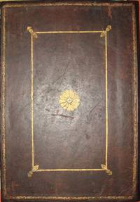
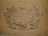
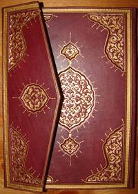
The Text volume printed in 1218 H-1803 AD by Abd ur Rahman el Muderris in Uskudar. 79 ff in hard cover binding with gilt Tughra of the Sultan Abdul Hamid II. and the second volume in full leather binding tooled in gold, contains 24 maps (of 25) lacking the celestial chart. otherwise, complete fine set in a contemporary fine binding for the Atlas volume. limited to 50 copies. Cedid Atlas (or Atlas-ı Cedid) is the first published atlas in the Muslim world, printed and published in 1803 in Istanbul, then the capital of the Ottoman Empire. The full title name of the atlas reads as Cedid Atlas Tercümesi (meaning, literally, "A Translation of a New Atlas") and in most libraries outside Turkey, it is recorded and referenced accordingly. Although manuscripts and hand-drawn maps were widely available throughout the Muslim world, due mainly to religious reasons, the printing of books started only in 1729 by Ibrahim Muteferrika and the Cedid Atlas could only be published in 1803 by Müderris Abdurrahman Efendi in a style based on European geographical knowledge as well as European map-making methods of the day. The Cedid Atlas includes a monochrome celestial chart (missed from our copy) and 24 hand-colored copper engraved maps of various parts of the world; all the maps are actually adaptations of William Faden's General Atlas. The maps are preceded by a (1+79) page-long treatise of geography, "Ucalet-ül Coğrafiye" (separated in our copy) by Mahmud Raif Efendi and a title page. The "Ucalet-ül Coğrafiye" of Mahmud Raif Efendi was printed one year later, in 1804, and bound together with the atlas in many copies. From a point of view of art, the atlas is notable for the color of the maps as well as the beauty of the script on the maps. The Cedid Atlas was published in parallel with the developments of the Ottoman Empire's Nizam-ı Cedid, the "New-Order" or the "New System" ("Cedid" means "new" and "Nizam" means "system", "regime", or "order") and its title-name reflects this clearly. The atlas was new in terms of cartographical knowledge and well suited to the new system which tried to introduce new institutions into the Ottoman Empire while trying to replace existing ones with contemporary counterparts from the West. Introduced by the ruling padishah (the sultan) of the Ottoman Empire, Selim III, the "New-Order" included a series of reforms which mainly modernized and changed the structure of the then existing Ottoman army and changed the administrative structure of the Empire. It was an effort to catch up with technical, military, economic, and administrative achievements of the West against which the Ottoman Empire was losing grounds since the 17th century. New military and engineering schools were established and governmental units related with the foreign relations and affairs were re-organized to align with the new system. For these schools, governmental units, and the wholly re-organized army reformed according to the European practice, a new understanding and applications of geography of the standards of the West were necessary and the Cedid Atlas was translated and printed for this purpose. Only 50 copies of this atlas were printed at the press. A copy was presented to Selim III; several copies were also presented to the high-ranking officials of the Empire, some were reserved for the library of Muhendishane (military engineering school of the time), and the remaining were reserved for sale. However, during the "Alemdar Vakası", an uprising of the janissaries in Istanbul during November 15–18, 1808, a fire at the warehouse of the press destroyed an unknown (unaccounted) number of the copies reserved for sale. Based on several estimates and accounting for the single maps (torn-out from bound volumes of the atlas) sold or being sold worldwide, it is believed that a maximum of 20 complete examples could be present in libraries or in private collections whereas some sources suggest that there exist only 10 complete and intact copies in the world. As such, it's one of the rarest printed atlases of historical value. A few sources outside Turkey and the Muslim world also refer to this atlas as the New Great Atlas. In Turkey, since the printing press of the book was located in the historical Üsküdar (Scutari) region (now a municipality) of Istanbul, the atlas sometimes is referred to as the Üsküdar Atlası.
-
Bookseller
Archive
 (SA)
(SA)
- Book Condition Used - Very Good
- Quantity Available 1
- Edition first and only ed.
- Binding Hardcover
- Publisher Dar ut Tiba'aa and Tab' Hane-i Humayun, Uskudar
- Place of Publication Istanbul
- Date Published 1802
- Size Elephant folio
- Keywords Ottoman; Arabic; Arabe; manuscript; unique; autograph; Islamic; Islam; sultan; Mustafa; Mustapha; arrow; bow; military; history; dedication; imperial; humayun; atlas; cedid; ottoman; raif; mahmoud; mahmud; pasha; pacha; dar; tiba'aa; muderris; mudarris;
- Size Elephant folio

More Photos
Atlas de France (métropole)
by Comité national de géographie ; Margerie, Emmanuel de (préf.) ; Perret, Robert (dir.)
- Used
- Paperback
- Condition
- Used - Bon
- Binding
- Paperback
- Quantity Available
- 1
- Seller
-
Paris, France
- Item Price
-
$162.75
Show Details
Item Price
$162.75
More Photos
OTTOMAN ATLAS CONTAINS THIRTY NINE HAND COLORED MAPS PREPARED AND PRINTED IN THE MUHENDISHANE I BERRI HUMAYUN (THE ROYAL SCHOOL OF MILITARY ENGNEERING) IN ISTANBUL. POSSIBLY THE FIRST ADMINISTRATIVE ATLAS TO BE PRINTED IN USKUDAR AFTER THE ESTABLISHMENT OF THE TELEGRAPH LINES IN THE OTTOMAN WILAYAS (STATES)
by THE OTTOMAN AUTHORITY
- Used
- very good
- Hardcover
- Signed
- Condition
- Used - Very Good
- Binding
- Hardcover
- Quantity Available
- 1
- Seller
-
Riyadh, Saudi Arabia
- Item Price
-
$50,000.00
Show Details
Description:
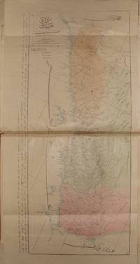
Uskudar: MuhendisHane-i Berr-i Humatun (The Royal school of military engneering) Atlas. Illus. by YUMNI. Very Good. Hardcover. Folio - over 12" - 15" tall. 1860's THIRTY NINE HAND COLORED MAPS MOSTLY SIGNED BY (YUMNI). MOST OF THEM ARE DESCRIBED IN THE OTTOMAN TURKISH. ALL MAPS ON DOUBLE PAGES, TITLED AND WITH PRINTING DETAILS. LATER HARD COVER. FOLIO 40 X 28 CM. SCARCE. the maps are the followings: (1)Arabistan (Arabian peninsula) 56 x 47 cm. (2)Tarablus Gharb wa tunus (Libya and Tunisia) 56 x 39 cm. (3)Tarablus Gharb (Libya) 56 x 40 cm. (4)Misir ayalet I mumtaza si (territory of Egypt) 56 x 46 cm. (5)Yemen 69 x 33 cm. (6)Hejaz, 56 x 39 cm. (7)Ankara . (8)Sivas . (9)Ma'muat ul Aziz. (10)Diyar Bekir. (11)Bitlis. (12)Erzurum . (13)Van. (14)Mosul 56 x 39 cm. (15)Bagdad 56 x 39 cm. (16)Basra 55 x 39 cm. (17)Zor mutasarrifligi (Part of Mesopotamia. (18)Halep (Aleppo). (19)Adana. (20)Konya. (21)Kibris (Cyprus). (22)Caza'ir I Bahr I Sefid (the Wilaya of the Mediterranean sea islands). (23)Aydin. (24)Pega…
Read More Item Price
$50,000.00
More Photos
RARE OTTOMAN MILITARY MAP OF KARA DAG (MONT NEGRO)
by Ottoman General Staff Section
- Used
- very good
- Condition
- Used - Very Good
- Quantity Available
- 1
- Seller
-
Riyadh, Saudi Arabia
- Item Price
-
$5,000.00
Show Details
Description:
Istanbul: The general staff section, 1875 Map. Very Good. No Binding. Military map of Kara Dag (Mont Negro), Ottoman General staff section in 1291 (1875) after the map which made by the Austrian military geographical section in 1869 about Kara Dag and environs after the war and military movements of 1861-1862. Officially linen in colors by contemporary hands, 105 x 105 cm. Very rare..
Item Price
$5,000.00
More Photos
Tuhfet ul Kibar fi Esfar il Bihar, complete with the all maps contemporarly hand colored
by katib Celebi, Haci Halife
- Used
- Condition
- Used - Very Good+
- Quantity Available
- 1
- Seller
-
Riyadh, Saudi Arabia
- Item Price
-
$60,000.00
Show Details
Description:
complete fine copy with the 5 maps of which 4 are colored in contemporary hands.In modern fine Ottoman style binding. on The naval expeditions, printed by Ibrahim Muteferrika in 1141 H. (1728-1729).
Item Price
$60,000.00

More Photos
Avrupa-i Osmani Haritasi (Wall map of the Ottoman Europe), extra ordinary copy of an Ottoman lieutenant
- Used
- very good
- Condition
- Used - Very Good
- Quantity Available
- 1
- Seller
-
Riyadh, Saudi Arabia
- Item Price
-
$7,000.00
Show Details
Description:
205 x 137 cm. extra ordinary Ottoman wall map of the Ottoman Europe prınted ın colors, folding paper on cloth. Signatures by the first lieutenant M. İhsan.
Item Price
$7,000.00
More Photos
OTTOMAN ATLAS CONTAINS THIRTY NINE HAND COLORED MAPS PREPARED AND PRINTED IN THE MUHENDISHANE I BERRI HUMAYUN (THE ROYAL SCHOOL OF MILITARY ENGNEERING) IN ISTANBUL. POSSIBLY THE FIRST ADMINISTRATIVE ATLAS TO BE PRINTED IN USKUDAR AFTER THE ESTABLISHMENT OF THE TELEGRAPH LINES IN THE OTTOMAN WILAYAS (STATES)
by THE OTTOMAN AUTHORITY
- Used
- very good
- Hardcover
- Signed
- Condition
- Used - Very Good
- Binding
- Hardcover
- Quantity Available
- 1
- Seller
-
Riyadh, Saudi Arabia
- Item Price
-
$50,000.00
Show Details
Description:
Uskudar: MuhendisHane-i Berr-i Humatun (The Royal school of military engneering) Atlas. Illus. by YUMNI. Very Good. Hardcover. Folio - over 12" - 15" tall. 1860's THIRTY NINE HAND COLORED MAPS MOSTLY SIGNED BY (YUMNI). MOST OF THEM ARE DESCRIBED IN THE OTTOMAN TURKISH. ALL MAPS ON DOUBLE PAGES, TITLED AND WITH PRINTING DETAILS. LATER HARD COVER. FOLIO 40 X 28 CM. SCARCE. the maps are the followings: (1)Arabistan (Arabian peninsula) 56 x 47 cm. (2)Tarablus Gharb wa tunus (Libya and Tunisia) 56 x 39 cm. (3)Tarablus Gharb (Libya) 56 x 40 cm. (4)Misir ayalet I mumtaza si (territory of Egypt) 56 x 46 cm. (5)Yemen 69 x 33 cm. (6)Hejaz, 56 x 39 cm. (7)Ankara . (8)Sivas . (9)Ma'muat ul Aziz. (10)Diyar Bekir. (11)Bitlis. (12)Erzurum . (13)Van. (14)Mosul 56 x 39 cm. (15)Bagdad 56 x 39 cm. (16)Basra 55 x 39 cm. (17)Zor mutasarrifligi (Part of Mesopotamia. (18)Halep (Aleppo). (19)Adana. (20)Konya. (21)Kibris (Cyprus). (22)Caza'ir I Bahr I Sefid (the Wilaya of the Mediterranean sea islands). (23)Aydin. (24)Pega…
Read More Item Price
$50,000.00
More Photos
RARE OTTOMAN MILITARY MAP OF KARA DAG (MONT NEGRO)
by Ottoman General Staff Section
- Used
- very good
- Condition
- Used - Very Good
- Quantity Available
- 1
- Seller
-
Riyadh, Saudi Arabia
- Item Price
-
$5,000.00
Show Details
Description:
Istanbul: The general staff section, 1875 Map. Very Good. No Binding. Military map of Kara Dag (Mont Negro), Ottoman General staff section in 1291 (1875) after the map which made by the Austrian military geographical section in 1869 about Kara Dag and environs after the war and military movements of 1861-1862. Officially linen in colors by contemporary hands, 105 x 105 cm. Very rare..
Item Price
$5,000.00
More Photos
Tuhfet ul Kibar fi Esfar il Bihar, complete with the all maps contemporarly hand colored
by katib Celebi, Haci Halife
- Used
- Condition
- Used - Very Good+
- Quantity Available
- 1
- Seller
-
Riyadh, Saudi Arabia
- Item Price
-
$60,000.00
Show Details
Description:
complete fine copy with the 5 maps of which 4 are colored in contemporary hands.In modern fine Ottoman style binding. on The naval expeditions, printed by Ibrahim Muteferrika in 1141 H. (1728-1729).
Item Price
$60,000.00
More Photos
Avrupa-i Osmani Haritasi (Wall map of the Ottoman Europe), extra ordinary copy of an Ottoman lieutenant
- Used
- very good
- Condition
- Used - Very Good
- Quantity Available
- 1
- Seller
-
Riyadh, Saudi Arabia
- Item Price
-
$7,000.00
Show Details
Description:
205 x 137 cm. extra ordinary Ottoman wall map of the Ottoman Europe prınted ın colors, folding paper on cloth. Signatures by the first lieutenant M. İhsan.
Item Price
$7,000.00
More Photos
cihannuma or Jihannuma (Mirror of the world)
by KATIB CELEBI (Mustafa ibn Abd Allah, aka Haci Halife, 1609-1657)
- Used
- Fine
- Hardcover
- Condition
- Used - Fine
- Edition
- 1st Edition
- Binding
- Hardcover
- Quantity Available
- 1
- Seller
-
Riyadh, Saudi Arabia
- Item Price
-
$85,000.00
Show Details
Description:
FIrst page of the preface and last page of the index are facsimiles, else; complete with 39 original maps and shapes, mint condition and wide complete margins. 698pp of Ottoman Turkish text, printed by Ibrahim Muteferrika in 1145 AH. - 1732 AD. In contemporary hard covers binding. FIRST AND ONLY EDITION OF THE JIHANNUMA. Planned as a great cosmosgraphy, the work was never completed, although Katib Celebi wrote two versions. The text contained here is the second version, rewritten after the author had acquired a Mercator-Hondius Atlas minor (Koemans mistakenly considered the Jihannuma a translation into Turkish of that Atlas). It covers the world from Japan to the Ottoman borders and is well-illustrated with engraved maps, including: the World in twin hemispheres, the World in oval projection, Europe, Africa, Asia, America, the North and South Poles, Arabia, Japan and various other parts of Asia and Asia Minor. Several of the maps and diagrams had appeared in earlier books printed by Mteferrika.The…
Read More Item Price
$85,000.00

More Photos
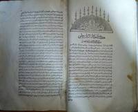
Ujalat ul Jografiya (the Geographic brief - عجالة الجغرافيا) The first atlas geographic work to be printed by Muslims, the text volume of Atlas-i Cedid
by Mahmoud Rayf Efendi, Mahmud Raif Pasha
- Used
- first
- Condition
- Used - Good+
- Edition
- first and only
- Quantity Available
- 1
- Seller
-
Riyadh, Saudi Arabia
- Item Price
-
$40,000.00
Show Details
Description:
45 x 38 cm. Ottoman Turkish text. printed by Abdurrahman el Muderris in 1219 AH, 1804 AD.
Item Price
$40,000.00

More Photos
The Sky and the Forest
by Forester, C.S
- Used
- very good
- Hardcover
- first
- Condition
- Used - Very Good
- Jacket Condition
- Very Good
- Edition
- First Edition
- Binding
- Hardcover
- Quantity Available
- 1
- Seller
-
Salem, Oregon, United States
- Item Price
-
$34.89$20.93Save $13.96!
Show Details
Description:
C.S. Forester: The Sky and the Forest. Little, Brown and Company, Boston. Stated First Edition First Printing Thus August, 1948. Cover price $2.75. Used. VG BOOK/VG UNCLIPPED DUST JACKET. A story of a central Africa. By C.S. Forester, author of the Admiral Hornblower series.
Item Price
$34.89$20.93
Save $13.96
!
![Alaska and Klondike Region; [With inset of Klondike Region on the Upper Yukon detail] [From an...](https://d3525k1ryd2155.cloudfront.net/h/062/537/1339537062.0.m.jpg)
Alaska and Klondike Region; [With inset of Klondike Region on the Upper Yukon detail] [From an atlas, "Gazetteer of Alaska and Yukon Region " pp. 105 and 106]
by Miller, J. Martin
- Used
- very good
- Condition
- Used - Very Good
- Edition
- Unknown
- Quantity Available
- 1
- Seller
-
Sebastopol, California, United States
- Item Price
-
$39.00
Show Details
Description:
Chicago: J. Martin Miller, 1899. Unknown. Map. Very Good. [Map copyright 1899, printing date of Atlas later] [19.875x15.125in]; Colored map of Alaska with steamer routes from Portland and Seattle, insets of the Klondike Region on the Upper Yukon and Western portion of Aleutian Islands; On verso index of places and names with two large black and white images; Age toning to all edges, water stain marks on bottom, slight printing offset of colors, small chips and closed tears to lower edge;.
Item Price
$39.00

Zemepis Sveta - Monsunova Asie
by De La Blache, P. Vidal; Gallois, L
- Used
- Hardcover
- Condition
- Used - Very Good Condition
- Jacket Condition
- No Dust Jacket
- Binding
- Hardcover
- Quantity Available
- 1
- Seller
-
Oak Point, Texas, United States
- Item Price
-
$60.00
Show Details
Description:
Aventinum, Prague, Czechoslovakia, 1930. Hardcover. Very Good Condition/No Dust Jacket. Text entirely in Czech. Geography book on Asia with numerous photographs and maps. 1931 edition also available. Size: 4mo - over 9 3/4" - 12" tall. 400 pp. Pages are yellowed, but are tight and clean. Moderate shelfwear along the spine. Corners are lightly bumped. Quantity Available: 1. Shipped Weight: 3-5 pounds. Category: Travel & Places; Non-English Language::Czech; Pictures of this item not already displayed here available upon request. Inventory No: 001227. . Additional shipping charges may apply.
Item Price
$60.00

Zemepis Sveta - Monsunova Asie
by De La Blache, P. Vidal; Gallois, L
- Used
- Hardcover
- Condition
- Used - Very Good Condition
- Jacket Condition
- No Dust Jacket
- Binding
- Hardcover
- Quantity Available
- 1
- Seller
-
Oak Point, Texas, United States
- Item Price
-
$60.00
Show Details
Description:
Aventinum, Prague, Czechoslovakia, 1931. Hardcover. Very Good Condition/No Dust Jacket. Text entirely in Czech. Geography book on Asia with numerous photographs and maps. 1930 edition also available. Size: 4mo - over 9 3/4" - 12" tall. 400 pp. Pages are yellowed, but are tight and clean. Moderate shelfwear along the spine. Corners are lightly bumped. Quantity Available: 1. Shipped Weight: 3-5 pounds. Category: Travel & Places; Non-English Language::Czech; Pictures of this item not already displayed here available upon request. Inventory No: 001228. . Additional shipping charges may apply.
Item Price
$60.00

Asia from the Best Authorities, Russell, ca.1800
by Russell
- Used
- Condition
- Used
- Quantity Available
- 1
- Seller
-
Plymouth, Devon, United Kingdom
- Item Price
-
$25.34
Show Details
Description:
Russell, J. : Asia from the Best Authorities. Nd but ca.1800. From "A New Geographical, Historical and Commercial Grammar and Present State of Several Kingdoms of the World". Copper engraving. Size approx 200 x 230mm. Two neat folds. Some age colouring to edges, otherwise clean and bright. Includes Arabia, India, Borneo, Japan, China and eastern Russia.
Item Price
$25.34

North America from the Best Authorities, Russell, ca.1800
by Russell
- Used
- Condition
- Used
- Quantity Available
- 1
- Seller
-
Plymouth, Devon, United Kingdom
- Item Price
-
$25.34
Show Details
Description:
Russell, J. : A General Map of North America from the Best Authorities. Nd but ca.1800. From "A New Geographical, Historical and Commercial Grammar and Present State of Several Kingdoms of the World." Copper engraving. Size approx 200 x 230mm. Two neat folds. Some age colouring to edges, otherwise very clean and bright.
Item Price
$25.34
![MAP OF UTAH [Territory]](https://d3525k1ryd2155.cloudfront.net/h/836/461/1485461836.0.m.jpg)
More Photos
MAP OF UTAH [Territory]
- Used
- Condition
- Used - Very Good-
- Edition
- Original
- Quantity Available
- 1
- Seller
-
Williamsburg, Virginia, United States
- Item Price
-
$65.00
Show Details
Description:
New York, Richmond, Chicago, & Toledo: H. H. Hardesty, 1885. Original color lithographed map printed by Rand, McNally & Company, Engravers and published in HARDESTY'S HISTORICAL AND GEOGRAPHICAL ENCYCLOPEDIA: SPECIAL VIRGINIA EDITION. 19 3/8 inches by 13 1/4 inches on a 21" X 14 1/2" sheet. The map depicts the Territory of Utah in its final form--large areas had been removed and ceded to Nevada, Colorado, Wyoming, and Nebraska since Utah became a U. S. Territory in 1850. The issue of polygamy prevented statehood until it was finally granted in 1896. This map features railroads and topography and uses color to set off counties from each other. Unlike most atlas maps of the period, this map identifies most small towns. The map is guaranteed to be moe than 135 years old. The map is in about very good condition: generally clean and bright, with slight toning of paper and one faint water stain near the center-left edge of the map.. Original. Single Sheet. Very Good-. Elephant…
Read More Item Price
$65.00

Philips Special Map of the Nile, The Advance on Khartum and the Environs of Omdurman. Cc1900
by George Philips and Son,
- Used
- Condition
- Used
- Quantity Available
- 1
- Seller
-
Plymouth, Devon, United Kingdom
- Item Price
-
$32.94
Show Details
Description:
Philips Special map of the Nile illustrating the Advance on Khartum [Khartoum] with an enlargement of the environs of Omdurman [Omdur]. George Philips and Son, London and Liverpool Ca 1900. 580mm x 900mm folded map. Front title wrapper has come loose, not affecting map area. Three maps are displayed within the sheet. Map1. Map of the Nile Valley 520mm x 300mm showing the approaches of Khartum. Scale 1inch to 100 Geographical miles. Coloured indicating Possessions and Protectorates of European Powers. Map 2. Special map of the Nile from Dongola to Khartum. Scale 16 miles to the inch. Coloured. In set in this map is Map3. Environs of Omdurman, Scale 5 statute miles to the inch. Some small breaks at some folds, not affecting imagery or use of map. Title label is damaged, the map is clean and bright, probably unused. A very interesting record.
Item Price
$32.94

Last Tales
by Dinesen, Isak
- Used
- very good
- Hardcover
- first
- Condition
- Used - Very Good
- Jacket Condition
- Good+
- Edition
- First Edition
- Binding
- Hardcover
- Quantity Available
- 1
- Seller
-
Salem, Oregon, United States
- Item Price
-
$120.00$72.00Save $48.00!
Show Details
Description:
Dinesen, Isak: Last Tales, A Collection of Twelve New Tales of Compelling Beauty 1957, Random House. First Edition. Stated First Printing Thus. Used. Very Good/Good+ original red dust jacket, price-clipped. Jacket states 11/57 on front flap. 5 3/4 X
Item Price
$120.00$72.00
Save $48.00
!

The Adventure of Wrangel Island
by Vilhjalmur Stefansson
- Used
- good
- Hardcover
- first
- Condition
- Used - Good
- Jacket Condition
- No DJ Included
- Edition
- First Edition
- Binding
- Hardcover
- Quantity Available
- 1
- Seller
-
Salem, Oregon, United States
- Item Price
-
$124.89$74.93Save $49.96!
Show Details
Description:
The Adventure of Wrangel Island, Alaska (1925 Macmillan 1st Edition) HISTORY OF ALASKA. EXLIB. Good Condition/ No DJ included. Fold-out map affixed to binding at the back of the book has never been opened. The story of the (unsuccessful) attempted colonization of Wrangel Island Alaska. 413 pages plus appendix, Index. Titling is still bright. A clean, solid copy. Scarce.
Item Price
$124.89$74.93
Save $49.96
!